Exe catchment river levels today
Are the rivers and lakes in the Exe catchment unusually low or high?
We follow 40 water level gauges in the Exe catchment. None read below their normal range for the date and 2 gauges above it.
How many gauges do we follow in the Exe catchment?
40 gauges of the 2,373 we follow in the United Kingdom, as of 26 October 2026.
How many waters in the Exe catchment have a level gauge?
21 waters with a level gauge, of the 1,149 waters we follow in the United Kingdom, as of 26 October 2026.
How many gauges read below normal for the date?
0 gauges below their normal range, of the 2 gauges with a current reading and a normal range for the date, as of 26 October 2026.
How many gauges read above normal for the date?
2 gauges above their normal range, of the 2 gauges with a current reading and a normal range for the date, as of 26 October 2026.
How the places stand today
0 places below normal and 2 places above
Which places are furthest above normal?
Which gauges do we follow in Exe?
| Place | Reading | Against normal for the date | Change in a day |
|---|---|---|---|
| Alphin Brook | |||
| Exeter Alphington Mill Lane | 0.048 m | -0.007 m | |
| Cole Brook | |||
| Cullompton Swallow Way | 0.337 m | +0.02 m | |
| Crow Green Stream | |||
| Cullompton Langlands | 0.075 m | ||
| Dawlish Water | |||
| Dawlish | 0.176 m | -0.006 m | |
| Exminster Marshes | |||
| Swans Nest | 0.004 m | -0.018 m | |
| Ford Stream | |||
| Rockbeare Bridge | 0.484 m | +0.034 m | |
| Marsh Water | |||
| Dulverton Town Marsh | 0.677 m | -0.004 m | |
| Northbrook | |||
| Exeter Heavitree Sweetbriar Lane | 0.036 m | +0.007 m | |
| River Barle | |||
| Brushford | 1.12 m | in the highest 5 percent for the date | -0.019 m |
| Simonsbath | 0.683 m | +0.089 m | |
| River Batherm | |||
| Bampton Bridge | 0.262 m | +0.024 m | |
| River Clyst | |||
| Ashclyst | 0.167 m | -0.011 m | |
| Clyst Honiton | 0.876 m | -0.055 m | |
| Withy Bridge | 0.156 m | -0.074 m | |
| River Clyst Tributary | |||
| Clyst St Mary Millstream Footbridge | 2.233 m | -0.14 m | |
| Clyst St Mary Millstream Outfall | 1.85 m | -0.256 m | |
| River Creedy | |||
| Cowley Bridge | 0.319 m | -0.086 m | |
| Upton Hellions | 0.338 m | +0.009 m | |
| River Culm | |||
| Bradninch Hele Station Road | 1.23 m | -0.048 m | |
| Culmstock | 0.236 m | +0.03 m | |
| Rewe | 0.378 m | -0.324 m | |
| Woodmill | 0.622 m | +0.12 m | |
| River Exe | |||
| Exebridge | 0.914 m | -0.028 m | |
| Exeter Pynes Stafford Bridge | 2.723 m | -0.347 m | |
| Exford | 0.742 m | -0.036 m | |
| Pixton | 0.726 m | -0.004 m | |
| Stoodleigh | 2.124 m | +0.001 m | |
| Thorverton | 1.152 m | in the highest 10 percent for the date | -0.094 m |
| Tiverton | 1.378 m | -0.01 m | |
| Topsham | 2.645 m | +0.575 m | |
| Trews Weir | 3.634 m | -0.204 m | |
| River Haddeo | |||
| Upton | 0.21 m | +0.006 m | |
| Upton Tributary | 0.108 m | +0.001 m | |
| Wimbleball | 0.112 m | 0 m | |
| Wimbleball Footbridge | 0.10 m | 0 m | |
| River Kenn Tributary | |||
| Kennford | 0.025 m | 0 m | |
| River Yeo (Yeoford) | |||
| Yeoford | 0.202 m | -0.041 m | |
| Spratford Stream | |||
| Tiverton Parkway | 0.287 m | +0.017 m | |
| Withycombe Brook | |||
| Exmouth Phear Park | 0.061 m | -0.001 m | |
| Wotton Brook (Lympstone) | |||
| Lympstone Longbrook Lane | 0.141 m | +0.006 m | |
Keep exploring
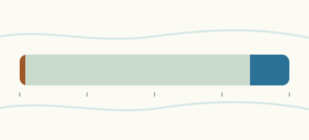 Country, United Kingdom Are the rivers and lakes in the United Kingdom unusually low or high? Every river and lake we follow here, against normal for the date.
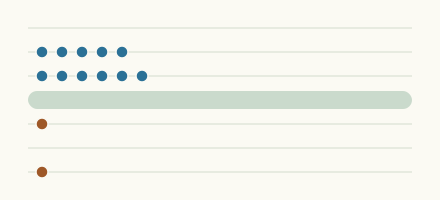 Today's list, United Kingdom Which places in the United Kingdom are furthest from normal today? The places in the United Kingdom furthest below and above normal today.
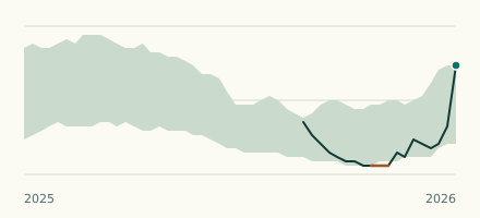 River gauge, United Kingdom Is the River Barle unusually high at Brushford? Level now, history, the same date in past years and each year's range.
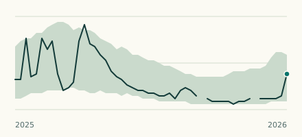 River gauge, United Kingdom Is the River Exe unusually high at Thorverton? Level now, history, the same date in past years and each year's range.