Low and high river levels today: furthest from normal
Which places are furthest from normal today?
On 21 November 2026 the Perhonjoki at Kaitfors read furthest below its normal range for the date and the Veyre at Bagnac-sur-Célé furthest above it.
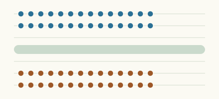
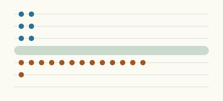
How far the furthest places stand from normal
One mark for each place in the lists below, against the normal range for the date.
Furthest below normal
More places
Furthest above normal
More places
How the ranking works
Only places with at least 10 years of daily data (weekly values for a reservoir of Spain) and a current reading are ranked. A place ranks first by where its newest reading sits for the date: below every year, in the lowest 5 percent, in the lowest 10 percent; then by how far it lies beyond the 10th (or 90th) percentile, measured in widths of the normal range.
More lists
Keep exploring
 Today's list, Germany Which places in Germany are furthest from normal today? The places in Germany furthest below and above normal today.
 Today's list, Netherlands Which places in the Netherlands are furthest from normal today? The places in the Netherlands furthest below and above normal today.
 Today's list, United Kingdom Which places in the United Kingdom are furthest from normal today? The places in the United Kingdom furthest below and above normal today.
 Today's list, United States Which places in the United States are furthest from normal today? The places in the United States furthest below and above normal today.
Sources
- This uses Environment Agency flood and river level data from the real-time data API (Beta) (source). Licence: Open Government Licence v3.0
- Contains public sector information licensed under the Open Government Licence v3.0 (source). Licence: Open Government Licence v3.0
- Data Source: Environment and Climate Change Canada (Water Survey of Canada) (source). Licence: ECCC Data Services End-use Licence v2.1.1
- Source : Hub'Eau / SCV, données PHyC (Licence Ouverte Etalab) (source). Licence: Licence Ouverte / Open Licence version 2.0
- Landesamt für Landwirtschaft, Umwelt und ländliche Räume Schleswig-Holstein (LLUR-SH), names and waters edited (source). Licence: Data licence Germany, attribution, version 2.0
- Source: Lietuvos hidrometeorologijos tarnyba prie Aplinkos ministerijos (Lithuanian Hydrometeorological Service, LHMT), Meteo LT API, values changed (source). Licence: CC BY-SA 4.0
- Fuente: MITECO, Boletín Hidrológico (source). Licence: Reuse of public sector information under Spain's Ley 37/2007, with the source cited
- Danmarks Miljøportal (VanDa): Indeholder data, som benyttes i henhold til vilkår for brug af danske offentlige data (source). Licence: Danmarks Miljøportal terms for the use of Danish public data: free reuse, credit text required