World Water LevelsWater, in perspective

Low and high river levels today in Australia

Which places in Australia are furthest from normal today?

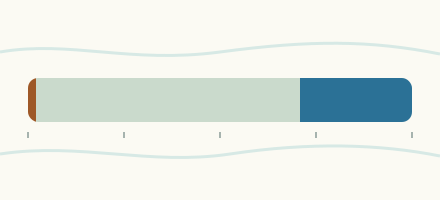
On 20 November 2026 the Saxby River at Punchbowl Road read furthest below its normal range for the date and the Flinders River at Punchbowl furthest above it.

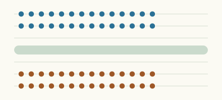
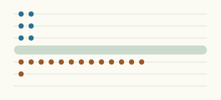
How far the furthest places stand from normal

One mark for each place in the lists below, against the normal range for the date.

Furthest below normal

  1. Punchbowl RoadSaxby River

    0.595 m

    lower than any day of these dates in 12 years

  2. Upper MonalMonal Creek

    0.188 m

    in the lowest 5 percent for the date

  3. Channel RoadRocky Creek

    0.898 m

    in the lowest 5 percent for the date

  4. EaglefieldSuttor River

    1.396 m

    in the lowest 5 percent for the date

  5. Folding HillsGrevillea Creek

    0.315 m

    in the lowest 5 percent for the date

  6. Spring BluffMurphys Creek

    1.056 m

    in the lowest 10 percent for the date

  7. KingsboroughDon River (Fitzroy)

    -0.064 m

    in the lowest 10 percent for the date

  8. GlendaleHaughton River

    -0.426 m

    in the lowest 10 percent for the date

Furthest above normal

  1. PunchbowlFlinders River

    1.64 m

    in the highest 5 percent for the date

  2. Mount RoyJolimont Creek

    1.674 m

    in the highest 5 percent for the date

  3. Stafford's CrossingO'Connell River

    1.606 m

    in the highest 5 percent for the date

  4. HomebushSandy Creek (Plane)

    1.631 m

    in the highest 5 percent for the date

  5. Higham's BridgeCattle Creek

    1.535 m

    in the highest 5 percent for the date

  6. Forbes RoadO'Connell River

    2.313 m

    in the highest 5 percent for the date

  7. Bauple EastTinana Creek

    1.616 m

    in the highest 5 percent for the date

  8. ChinchillaCondamine River

    4.407 m

    in the highest 5 percent for the date

  9. GargettCattle Creek

    1.903 m

    in the highest 5 percent for the date

  10. The LakeComet River

    3.255 m

    in the highest 5 percent for the date

More places
  1. LeesonsGregory River (Burrum)

    2.427 m

    in the highest 5 percent for the date

  2. Mirani Weir TailwaterPioneer River

    2.089 m

    in the highest 5 percent for the date

  3. Bruce HighwayIsis River

    1.444 m

    in the highest 5 percent for the date

  4. TaroomDawson River

    4.032 m

    in the highest 5 percent for the date

  5. Loudouns BridgeCondamine River

    3.232 m

    in the highest 5 percent for the date

  6. MarodianMunna Creek

    1.385 m

    in the highest 5 percent for the date

  7. Isis HighwayGregory River (Burrum)

    2.154 m

    in the highest 5 percent for the date

  8. UrannahBroken River

    1.50 m

    in the highest 5 percent for the date

  9. CooranSix Mile Creek (Queensland)

    2.389 m

    in the highest 5 percent for the date

  10. Gorge RoadFinch Hatton Creek

    1.623 m

    in the highest 5 percent for the date

  11. Springsure Creek JunctionComet River

    2.72 m

    in the highest 5 percent for the date

  12. MitchellMaranoa River

    1.263 m

    in the highest 5 percent for the date

  13. Violet GroveNative Companion Creek

    2.322 m

    in the highest 5 percent for the date

  14. BrigalowCondamine River

    6.251 m

    in the highest 5 percent for the date

  15. Cecil WeirCondamine River

    4.568 m

    in the highest 5 percent for the date

  16. CotswoldCondamine River

    5.76 m

    in the highest 5 percent for the date

  17. Old RacecourseBroken River

    0.917 m

    in the highest 5 percent for the date

  18. Dirranbandi-Hebel RoadNarran River

    2.354 m

    in the highest 5 percent for the date

  19. Kalpowar CrossingNormanby River

    1.66 m

    in the highest 5 percent for the date

  20. Sarich'sPioneer River

    1.883 m

    in the highest 5 percent for the date

  21. JochheimsAndromache River

    1.773 m

    in the highest 5 percent for the date

  22. Booba SandsMacintyre Brook

    2.064 m

    in the highest 5 percent for the date

  23. Hensley DriveCloncurry River

    0.926 m

    in the highest 5 percent for the date

  24. Pump StationSouth Kariboe Creek

    0.962 m

    in the highest 5 percent for the date

  25. CalenSt Helens Creek

    2.022 m

    in the highest 5 percent for the date

  26. BeechmontBack Creek

    0.235 m

    in the highest 5 percent for the date

  27. Emu ValeEmu Creek (Balonne-Condamine)

    1.80 m

    in the highest 5 percent for the date

  28. Figtree CreekBurnett River

    2.122 m

    in the highest 5 percent for the date

  29. InglewoodMacintyre Brook

    2.133 m

    in the highest 5 percent for the date

  30. Taromeo CreekCooyar Creek

    1.151 m

    in the highest 5 percent for the date

  31. Gregors CreekBrisbane River

    1.54 m

    in the highest 5 percent for the date

  32. PowerlineHaughton River

    0.931 m

    in the highest 5 percent for the date

  33. SuratBalonne River

    3.886 m

    in the highest 10 percent for the date

  34. WeriboneBalonne River

    5.302 m

    in the highest 10 percent for the date

  35. StanthorpeQuart Pot Creek

    0.713 m

    in the highest 10 percent for the date

  36. Glendower CrossingFlinders River

    0.294 m

    in the highest 10 percent for the date

  37. CraigmoreNogoa River

    2.23 m

    in the highest 10 percent for the date

  38. WhyenbahCulgoa River

    3.35 m

    in the highest 10 percent for the date

  39. WoodleighDawson River

    2.807 m

    in the highest 10 percent for the date

  40. YandinaSouth Maroochy River

    0.73 m

    in the highest 10 percent for the date

How the ranking works

Only places with at least 10 years of daily data and a current reading are ranked. A place ranks first by where its newest reading sits for the date: below every year, in the lowest 5 percent, in the lowest 10 percent; then by how far it lies beyond the 10th (or 90th) percentile, measured in widths of the normal range.

More lists

Keep exploring