World Water LevelsWater, in perspective

Low and high river levels today in the United States

Which places in the United States are furthest from normal today?

On 21 November 2026 the places furthest below and above their normal range for the date are listed below.

How far the furthest places stand from normal

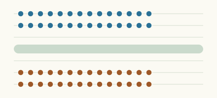
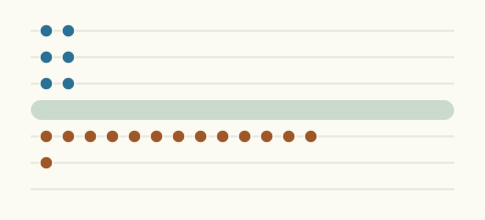
One mark for each place in the lists below, against the normal range for the date.

Furthest below normal

  1. GardinerKennebec River

    -1.32 ft

    lower than any day of these dates in 25 years

  2. FoxholmDes Lacs River

    3.15 ft

    lower than any day of these dates in 25 years

  3. AugustaKennebec River

    -1.94 ft

    lower than any day of these dates in 28 years

  4. BangorPenobscot River

    0.40 ft

    lower than any day of these dates in 14 years

  5. McKinneyEast Fork Trinity River

    2.42 ft

    lower than any day of these dates in 14 years

  6. Georgia Ave at CedartownBig Cedar Creek

    2.57 ft

    lower than any day of these dates in 16 years

  7. Philadelphia near 30th StreetSchuylkill River

    -2.32 ft

    lower than any day of these dates in 10 years

  8. Village DriveBolin Creek

    1.00 ft

    lower than any day of these dates in 14 years

  9. GreensboroNorth Buffalo Creek

    0.86 ft

    lower than any day of these dates in 28 years

  10. GormanEllerbe Creek

    0.75 ft

    lower than any day of these dates in 20 years

More places
  1. GuayanillaRio Guayanilla

    4.78 ft

    lower than any day of these dates in 35 years

  2. McFarland-Lk. WaubesaYahara River

    3.64 ft

    lower than any day of these dates in 23 years

  3. MurdockNinnescah River

    3.20 ft

    lower than any day of these dates in 35 years

  4. BethelWest Fork Pigeon River

    0.12 ft

    lower than any day of these dates in 31 years

  5. LorenzoKankakee River

    504.49 ft

    lower than any day of these dates in 13 years

  6. FredericktownLittle St. Francis River

    0.77 ft

    lower than any day of these dates in 43 years

  7. Orange FactoryLittle River

    0.02 ft

    lower than any day of these dates in 38 years

  8. Newborn Road near NewbornLittle River

    3.07 ft

    lower than any day of these dates in 16 years

  9. Bevill Lock and DamTombigbee River

    108.45 ft

    lower than any day of these dates in 27 years

  10. White CrossMorgan Creek

    1.92 ft

    lower than any day of these dates in 34 years

  11. SuwaneeSuwanee Creek

    -0.46 ft

    lower than any day of these dates in 26 years

  12. PinevilleLittle Sugar Creek

    1.96 ft

    lower than any day of these dates in 22 years

  13. SplendoraPeach Creek

    3.23 ft

    lower than any day of these dates in 27 years

  14. Greenbelt LakeGreenbelt Lake

    2,606.17 ft

    lower than any day of these dates in 27 years

  15. North CedarvillleNooksack River

    138.03 ft

    lower than any day of these dates in 24 years

  16. Greenbelt LakeSalt Fork of the Red River

    2,606.16 ft

    lower than any day of these dates in 29 years

  17. NewportLake Memphremagog

    679.49 ft

    lower than any day of these dates in 95 years

  18. SpillwayWahiawa Reservoir

    58.29 ft

    lower than any day of these dates in 21 years

  19. LaurinburgBig Shoe Heel Creek

    0.78 ft

    lower than any day of these dates in 38 years

  20. Little RockSardine Branch

    0.85 ft

    lower than any day of these dates in 25 years

  21. Monticello ReservoirMonticello Reservoir

    334.19 ft

    lower than any day of these dates in 27 years

  22. Paper Mill Rd near LawrencevilleShoal Creek

    1.09 ft

    lower than any day of these dates in 17 years

  23. CarrolltonWakenda Creek

    2.45 ft

    lower than any day of these dates in 17 years

  24. Diversion MonserrateRio Yauco

    1.34 ft

    lower than any day of these dates in 22 years

  25. US 441 near IrwintonBig Sandy Creek

    2.93 ft

    lower than any day of these dates in 17 years

  26. MarmarthLittle Missouri River

    0.81 ft

    lower than any day of these dates in 24 years

  27. VeronaPeckman River

    -0.51 ft

    lower than any day of these dates in 13 years

  28. US Highway 78 and 278 near MabletonNickajack Creek

    1.02 ft

    lower than any day of these dates in 27 years

  29. KentwoodTangipahoa River

    1.64 ft

    lower than any day of these dates in 26 years

  30. WhitesburgSnake Creek downstream Snake Creek Reservoir

    2.88 ft

    lower than any day of these dates in 18 years

  31. Quebrada MargaritaRio Piedras

    2.68 ft

    lower than any day of these dates in 13 years

  32. Walnut ShadeBull Creek

    0.89 ft

    lower than any day of these dates in 27 years

  33. Saxon BridgeSouth Fork Nooksack River

    0.82 ft

    lower than any day of these dates in 18 years

  34. Ball GroundSettingdown Creek

    0.39 ft

    lower than any day of these dates in 21 years

  35. Lake MeadLake Mead

    1,041.27 ft

    lower than any day of these dates in 85 years

  36. SedgwickLittle Arkansas River

    1.78 ft

    lower than any day of these dates in 31 years

  37. GlenwoodThorn Creek

    2.50 ft

    lower than any day of these dates in 32 years

  38. ColliervilleWolf River

    3.18 ft

    lower than any day of these dates in 13 years

  39. GreerGreer Spring

    0.44 ft

    lower than any day of these dates in 21 years

  40. IvernessFlat Creek

    0.64 ft

    lower than any day of these dates in 30 years

Furthest above normal

  1. Hazelbrand Road near CovingtonCornish Creek

    7.59 ft

    higher than any day of these dates in 16 years

  2. SR1300 near CrutchfieldRocky River NC

    3.55 ft

    higher than any day of these dates in 30 years

  3. SalinaMulberry Creek

    5.73 ft

    higher than any day of these dates in 24 years

  4. Lake HarneySt. Johns River

    12.05 ft

    higher than any day of these dates in 84 years

  5. CocoaSt. Johns River

    18.76 ft

    higher than any day of these dates in 73 years

  6. MiddleburgBlack Creek

    14.35 ft

    higher than any day of these dates in 45 years

  7. SanfordSt. Johns River

    6.91 ft

    higher than any day of these dates in 33 years

  8. HaiglerArikaree River

    6.21 ft

    higher than any day of these dates in 15 years

  9. AstorSt. Johns River

    3.99 ft

    higher than any day of these dates in 35 years

  10. TarpleyHondo Creek

    2.94 ft

    higher than any day of these dates in 29 years

More places
  1. ParksRock Creek

    2.71 ft

    higher than any day of these dates in 27 years

  2. 8WNW Haigler, NebraskaNorth Fork Republican River

    1.70 ft

    higher than any day of these dates in 27 years

  3. GoodwellBeaver River

    7.01 ft

    higher than any day of these dates in 10 years

  4. Penney FarmsSouth Fork Black Creek

    7.98 ft

    in the highest 5 percent for the date

  5. MiddleburgNorth Fork Black Creek

    7.28 ft

    in the highest 5 percent for the date

  6. LincolnStevens Creek

    10.04 ft

    in the highest 5 percent for the date

  7. Club Blvd in DurhamEllerbe Creek

    1.01 ft

    in the highest 5 percent for the date

  8. FredericksburgPedernales River

    7.79 ft

    in the highest 5 percent for the date

  9. AustinColorado River

    16.09 ft

    in the highest 5 percent for the date

  10. SabanaRio Mameyes

    3.84 ft

    in the highest 5 percent for the date

  11. SabanaRio Sabana

    9.22 ft

    in the highest 5 percent for the date

  12. Downers GroveEast Branch Du Page River

    11.79 ft

    in the highest 5 percent for the date

  13. Altamonte Springs 2NLittle Wekiva River

    27.66 ft

    in the highest 5 percent for the date

  14. DelandSt. Johns River

    5.02 ft

    in the highest 5 percent for the date

  15. County Road 95 near OxfordLittle Cornish Creek

    0.93 ft

    in the highest 5 percent for the date

  16. MasonLlano River

    8.06 ft

    in the highest 5 percent for the date

  17. OakleySmoky Hill River

    4.79 ft

    in the highest 5 percent for the date

  18. ClevelandSouth Saluda River

    3.33 ft

    in the highest 5 percent for the date

  19. Foley (US 27)Fenholloway River

    4.60 ft

    in the highest 5 percent for the date

  20. Minot 4NWSouris River

    5.27 ft

    in the highest 5 percent for the date

  21. MarysvilleBig Blue River

    14.29 ft

    in the highest 5 percent for the date

  22. CreteBig Blue River

    9.11 ft

    in the highest 5 percent for the date

  23. ParaisoRio Fajardo

    6.20 ft

    in the highest 5 percent for the date

  24. Blue RapidsBig Blue River

    17.07 ft

    in the highest 5 percent for the date

  25. CampbellShingle Creek

    56.04 ft

    in the highest 5 percent for the date

  26. Saltwater BarrierNeches River

    3.46 ft

    in the highest 5 percent for the date

  27. Silver CreekSilver Creek

    4.93 ft

    in the highest 5 percent for the date

  28. JusticeburgBrazos River

    6.64 ft

    in the highest 5 percent for the date

  29. Fort MeadePeace River

    76.06 ft

    in the highest 5 percent for the date

  30. JolietDes Plaines River

    539.24 ft

    in the highest 5 percent for the date

  31. Lake Marble FallsLake Marble Falls

    736.73 ft

    in the highest 5 percent for the date

  32. Old Atlanta Road near SuwaneeDick Creek

    6.36 ft

    in the highest 5 percent for the date

  33. PingreePipestem Creek

    5.98 ft

    in the highest 5 percent for the date

  34. Levee - 15Kawainui Marsh

    5.76 ft

    in the highest 5 percent for the date

  35. Emsworth L/d PoolOhio River

    17.32 ft

    in the highest 5 percent for the date

  36. Newport on Old Magnolia Rd (in stage datum)St. Marks River

    6.44 ft

    in the highest 5 percent for the date

  37. FoxholmSouris River

    6.98 ft

    in the highest 5 percent for the date

  38. B. A. Steinhagen LakeB. A. Steinhagen Lake

    82.99 ft

    in the highest 5 percent for the date

  39. LipscombWolf Creek

    5.69 ft

    in the highest 5 percent for the date

  40. OcalaOcklawaha River

    36.85 ft

    in the highest 5 percent for the date

How the ranking works

Only places with at least 10 years of daily data and a current reading are ranked. A place ranks first by where its newest reading sits for the date: below every year, in the lowest 5 percent, in the lowest 10 percent; then by how far it lies beyond the 10th (or 90th) percentile, measured in widths of the normal range.

More lists

Keep exploring