Teign Torbay and South Hams catchment river levels today
Are the rivers and lakes in the Teign Torbay and South Hams catchment unusually low or high?
We follow 34 water level gauges in the Teign Torbay and South Hams catchment. None read below their normal range for the date and 2 gauges above it.
How many gauges do we follow in the Teign Torbay and South Hams catchment?
34 gauges of the 2,373 we follow in the United Kingdom, as of 26 October 2026.
How many waters in the Teign Torbay and South Hams catchment have a level gauge?
21 waters with a level gauge, of the 1,149 waters we follow in the United Kingdom, as of 26 October 2026.
How many gauges read below normal for the date?
0 gauges below their normal range, of the 2 gauges with a current reading and a normal range for the date, as of 26 October 2026.
How many gauges read above normal for the date?
2 gauges above their normal range, of the 2 gauges with a current reading and a normal range for the date, as of 26 October 2026.
How the places stand today
0 places below normal and 2 places above
Which places are furthest above normal?
Which gauges do we follow in Teign Torbay and South Hams?
| Place | Reading | Against normal for the date | Change in a day |
|---|---|---|---|
| Aller Brook | |||
| Kingskerswell | 0.41 m | +0.005 m | |
| Clennon Valley Watercourse | |||
| Paignton Kings Ash Road | 0.157 m | +0.009 m | |
| Dean Burn | |||
| Buckfastleigh Kingcombe Court | 0.775 m | +0.024 m | |
| East Dart River | |||
| Bellever | 0.813 m | +0.118 m | |
| Higher Brixham Watercourse | |||
| Higher Brixham Horsepool Street | 0.071 m | -0.002 m | |
| Kingsbridge North Watercourse | |||
| Kingsbridge Duncombe Street | 0.048 m | +0.003 m | |
| Occombe Brook | |||
| Occombe Valley Road | 0.05 m | +0.006 m | |
| River Ashburn | |||
| Ashburton Lower | 0.167 m | +0.02 m | |
| Ashburton Upper | -2.568 m | -0.001 m | |
| River Avon (Devon) | |||
| Didworthy | 0.824 m | +0.173 m | |
| Loddiswell | 0.92 m | +0.215 m | |
| River Bovey | |||
| Bovey Parke | 0.524 m | +0.014 m | |
| North Bovey | 0.195 m | +0.023 m | |
| River Bovey Tributary | |||
| Bovey Tracey Wifford Footbridge | 0.454 m | +0.011 m | |
| River Dart | |||
| Austins Bridge | 0.945 m | +0.13 m | |
| River Erme | |||
| Ermington | 0.692 m | in the highest 5 percent for the date | +0.196 m |
| Harford | 0.409 m | ||
| River Harbourne | |||
| Harbertonford Bridge | 0.526 m | +0.042 m | |
| Palmers Dam | 0.35 m | +0.077 m | |
| Rolster Bridge | 0.158 m | +0.062 m | |
| River Harbourne Tributary | |||
| Harbertonford Church | 0.26 m | +0.014 m | |
| River Lemon | |||
| Bickington | 0.491 m | +0.02 m | |
| Holbeam Dam | 0.238 m | +0.036 m | |
| Holbeam Dam Downstream | 0.216 m | +0.043 m | |
| Templers Road | 2.005 m | higher than any day of these dates in 16 years | +0.486 m |
| Union Bridge | 0.067 m | +0.022 m | |
| River Mardle | |||
| Buckfastleigh Higher Town Bridge | 0.745 m | +0.056 m | |
| River Teign | |||
| Chagford Drogo Iron Bridge | 1.376 m | +0.007 m | |
| Chudleigh Bridge | 0.602 m | -0.125 m | |
| Clifford Bridge | 0.671 m | +0.013 m | |
| Coombe Cellars | 2.597 m | +0.524 m | |
| Shutterton Brook | |||
| Dawlish Warren Secmaton Lane | 0.45 m | +0.004 m | |
| West Dart River | |||
| Dunnabridge | 0.936 m | +0.207 m | |
| Yeolands Stream | |||
| Harbertonford Yeolands | 0.017 m | +0.003 m | |
Keep exploring
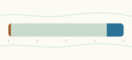 Country, United Kingdom Are the rivers and lakes in the United Kingdom unusually low or high? Every river and lake we follow here, against normal for the date.
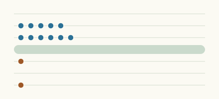 Today's list, United Kingdom Which places in the United Kingdom are furthest from normal today? The places in the United Kingdom furthest below and above normal today.
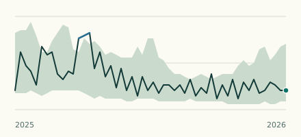 River gauge, United Kingdom Is the River Lemon unusually high at Templers Road? Level now, history, the same date in past years and each year's range.
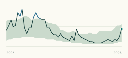 River gauge, United Kingdom Is the River Erme unusually high at Ermington? Level now, history, the same date in past years and each year's range.