Texas river levels today
Are the rivers and lakes in Texas unusually low or high?
We follow 550 water level places in Texas. 78 places read below their normal range for the date and 22 places above it, not counting the 19 tide stations.
How many places do we follow in Texas?
550 places of the 7,007 we follow in the United States, as of 21 November 2026.
How many waters in Texas have a level gauge?
329 waters with a level gauge, of the 3,733 waters we follow in the United States, as of 21 November 2026.
How many places read below normal for the date?
78 places below their normal range, of the 387 places with a current reading and a normal range for the date, not counting the 19 tide stations, as of 21 November 2026.
How many places read above normal for the date?
22 places above their normal range, of the 387 places with a current reading and a normal range for the date, not counting the 19 tide stations, as of 21 November 2026.
How the places stand today
78 places below normal and 22 places above
Which places are furthest below normal?
More places
Which places are furthest above normal?
More places
Which gauges do we follow in Texas?
| Place | Reading | Against normal for the date | Change in a day |
|---|---|---|---|
| Adams Bayou | |||
| FM 3247 | 1.63 ft | +0.06 ft | |
| SH 87 | 1.84 ft | +0.03 ft | |
| Addicks Reservoir | |||
| Addicks Reservoir | 76.38 ft | within the normal range for the date | 0 ft |
| Amistad Reservoir | |||
| Amistad Reservoir | 1,070.17 ft | in the lowest 10 percent for the date | +0.05 ft |
| Angelina River | |||
| Alto | 11.02 ft | within the normal range for the date | +0.14 ft |
| Lufkin | 155.06 ft | +0.16 ft | |
| Aquilla Lake | |||
| Aquilla Lake | 534.40 ft | within the normal range for the date | +0.32 ft |
| Aransas River | |||
| Skidmore | 0.42 ft | in the lowest 10 percent for the date | 0 ft |
| Atascosa River | |||
| Whitsett | 1.41 ft | within the normal range for the date | -0.02 ft |
| Attoyac Bayou | |||
| Chireno | 2.24 ft | -0.13 ft | |
| Austin Bayou | |||
| SH 35 near Liverpool | 9.39 ft | -0.13 ft | |
| Ayish Bayou | |||
| San Augustine | 2.96 ft | ||
| B. A. Steinhagen Lake | |||
| B. A. Steinhagen Lake | 82.99 ft | in the highest 5 percent for the date | +0.04 ft |
| Bardwell Lake | |||
| Bardwell Lake | 418.61 ft | within the normal range for the date | 0 ft |
| Barker Reservoir | |||
| Barker Reservoir | 70.62 ft | within the normal range for the date | -0.52 ft |
| Barton Creek | |||
| Hwy 71 near Oak Hill | 2.24 ft | within the normal range for the date | -0.02 ft |
| Loop 360 | 1.66 ft | lower than any day of these dates in 25 years | 0 ft |
| Bear Creek | |||
| Barker | 96.72 ft | in the lowest 5 percent for the date | -0.05 ft |
| Beaver Creek | |||
| Electra | 10.33 ft | -0.07 ft | |
| Beaver Creek (Llano River Basin) | |||
| Mason | 6.74 ft | in the highest 5 percent for the date | -0.04 ft |
| Bedias Creek | |||
| Madisonville | 1.89 ft | in the lowest 10 percent for the date | -0.08 ft |
| Belton Lake | |||
| Belton Lake | 592.46 ft | within the normal range for the date | -0.01 ft |
| Benbrook Lake | |||
| Benbrook Lake | 687.33 ft | within the normal range for the date | -0.07 ft |
| Big Cow Creek | |||
| FM1416 | 41.02 ft | -0.10 ft | |
| Newton | 5.81 ft | in the lowest 10 percent for the date | -0.02 ft |
| Big Creek | |||
| Needville | 2.05 ft | in the lowest 10 percent for the date | -0.06 ft |
| TX 150 near Shepherd | 132.87 ft | +0.06 ft | |
| Big Cypress Creek | |||
| Jefferson | 3.35 ft | lower than any day of these dates in 38 years | +0.03 ft |
| Pittsburg | 4.41 ft | in the lowest 5 percent for the date | -0.01 ft |
| Big Sandy Creek | |||
| Big Sandy | 3.94 ft | in the lowest 5 percent for the date | -0.02 ft |
| Elgin | 0.54 ft | 0 ft | |
| Big Sandy Creek (Brazos River Basin) | |||
| Breckenridge | 5.91 ft | within the normal range for the date | 0 ft |
| Big Sandy Creek (Trinity River Basin) | |||
| Bridgeport | 0.83 ft | in the lowest 5 percent for the date | +0.13 ft |
| Black Creek | |||
| Highway 326 | 43.02 ft | ||
| Black Cypress Bayou | |||
| Jefferson | 3.79 ft | within the normal range for the date | +0.01 ft |
| Blanco River | |||
| Blanco | 12.55 ft | 0 ft | |
| Crabapple Road | 0.65 ft | 0 ft | |
| Fischer Store Rd near Fischer | 3.61 ft | +0.02 ft | |
| San Marcos | 7.96 ft | -0.04 ft | |
| Wimberley | 3.57 ft | within the normal range for the date | +0.02 ft |
| Boggy Creek (E TX) | |||
| Park Road | 0.37 ft | +0.10 ft | |
| Bois d'Arc Lake | |||
| Bois d'Arc Lake | 530.55 ft | -0.05 ft | |
| Brady Creek | |||
| Brady | 6.80 ft | in the highest 10 percent for the date | -0.01 ft |
| Brady Creek Reservoir | |||
| Brady Creek Reservoir | 1,740.78 ft | within the normal range for the date | 0 ft |
| Brays Bayou | |||
| Gessner Drive | 38.68 ft | within the normal range for the date | -0.03 ft |
| Houston | 16.70 ft | within the normal range for the date | -0.06 ft |
| Brazos River | |||
| Aquilla | 6.44 ft | within the normal range for the date | -0.26 ft |
| Aspermont 10S | 4.67 ft | within the normal range for the date | -0.10 ft |
| Bryan | 8.44 ft | within the normal range for the date | -0.06 ft |
| Dennis | 2.30 ft | within the normal range for the date | -0.03 ft |
| Glen Rose | 3.98 ft | lower than any day of these dates in 37 years | -0.07 ft |
| Hempstead | 11.23 ft | within the normal range for the date | -0.12 ft |
| Highbank | 2.27 ft | within the normal range for the date | +0.02 ft |
| Justiceburg | 6.64 ft | in the highest 5 percent for the date | 0 ft |
| Lubbock 4ESE | 6.52 ft | within the normal range for the date | -0.01 ft |
| Palo Pinto | 1.54 ft | within the normal range for the date | +0.04 ft |
| Richmond | 9.24 ft | within the normal range for the date | +0.09 ft |
| Rosharon | 5.47 ft | within the normal range for the date | +0.02 ft |
| San Felipe | 93.83 ft | within the normal range for the date | +0.27 ft |
| Seymour | 1.74 ft | within the normal range for the date | -0.08 ft |
| South Bend | 4.15 ft | within the normal range for the date | +0.06 ft |
| US 59 | 28.61 ft | +0.10 ft | |
| Waco | 1.29 ft | within the normal range for the date | -0.47 ft |
| West Columbia | 2.48 ft | -0.20 ft | |
| Bridgeport Reservoir | |||
| Bridgeport Reservoir | 826.18 ft | within the normal range for the date | 0 ft |
| Buffalo Bayou | |||
| Barker Reservoir | 70.45 ft | -0.83 ft | |
| Piney Point Village | 28.65 ft | within the normal range for the date | -0.14 ft |
| Shepherd Drive | 2.82 ft | within the normal range for the date | -0.11 ft |
| West Belt Drive | 35.64 ft | in the lowest 10 percent for the date | -0.18 ft |
| Bull Creek | |||
| Loop 360 | 1.55 ft | in the lowest 10 percent for the date | -0.01 ft |
| Caddo Lake | |||
| Caddo Lake | 167.25 ft | ||
| California Creek (Clear Fk Brazos) | |||
| Stamford | 6.89 ft | within the normal range for the date | -0.04 ft |
| Canadian River | |||
| Amarillo | 1.36 ft | within the normal range for the date | +0.01 ft |
| Canadian | 1.40 ft | within the normal range for the date | 0 ft |
| Lake Meredith | 2,892.60 ft | in the highest 10 percent for the date | 0 ft |
| Caney Creek | |||
| Hwy 21 near Madisonville | 218.89 ft | -0.01 ft | |
| Splendora | 2.85 ft | within the normal range for the date | 0 ft |
| Canyon Lake | |||
| Canyon Lake | 907.69 ft | within the normal range for the date | +0.03 ft |
| Carters Creek | |||
| FM 60 near College Station | 240.48 ft | -0.01 ft | |
| Cedar Bayou | |||
| Crosby | 36.54 ft | within the normal range for the date | -0.02 ft |
| I-10 near Mont Belvieu | 2.37 ft | -0.21 ft | |
| Cedar Creek Reservoir | |||
| Cedar Creek Reservoir | 315.33 ft | in the lowest 10 percent for the date | -0.01 ft |
| Chambers Creek | |||
| Rice | 4.61 ft | within the normal range for the date | +0.08 ft |
| Champion Creek Reservoir | |||
| Champion Creek Reservoir | 2,063.83 ft | within the normal range for the date | -0.01 ft |
| Cherokee Bayou | |||
| Lake Cherokee | 276.95 ft | -0.01 ft | |
| Choke Canyon Reservoir | |||
| Choke Canyon Reservoir | 190.43 ft | in the lowest 5 percent for the date | -0.01 ft |
| Cibolo Creek | |||
| Falls City | 1.03 ft | within the normal range for the date | -0.08 ft |
| Selma | 1.73 ft | within the normal range for the date | 0 ft |
| Sutherland Springs | 6.78 ft | within the normal range for the date | -0.07 ft |
| Clear Creek | |||
| Friendswood | 2.17 ft | within the normal range for the date | -0.10 ft |
| Sanger | 6.58 ft | within the normal range for the date | -0.04 ft |
| Telephone Road | 31.30 ft | within the normal range for the date | -0.06 ft |
| Clear Fork Brazos River | |||
| Fort Griffin | 6.40 ft | within the normal range for the date | -0.36 ft |
| Hawley | 1.42 ft | within the normal range for the date | -0.15 ft |
| Nugent | 1.83 ft | within the normal range for the date | -0.11 ft |
| Roby | 3.53 ft | within the normal range for the date | 0 ft |
| Clear Fork Trinity River | |||
| Fort Worth | 8.39 ft | within the normal range for the date | +0.04 ft |
| Weatherford | 4.41 ft | in the lowest 5 percent for the date | +0.05 ft |
| Cole Creek | |||
| I-10 | 1.55 ft | +0.07 ft | |
| Coleto Creek | |||
| Arnold Road Crossing | 1.93 ft | in the lowest 5 percent for the date | -0.02 ft |
| Highway 59 | 3.95 ft | within the normal range for the date | -0.01 ft |
| Coleto Creek Reservoir | |||
| Coleto Creek Reservoir | 95.23 ft | within the normal range for the date | -0.01 ft |
| Colorado River | |||
| Austin | 16.09 ft | in the highest 5 percent for the date | -0.05 ft |
| Ballinger | 4.13 ft | within the normal range for the date | 0 ft |
| Bastrop | 5.74 ft | in the highest 10 percent for the date | -0.01 ft |
| Bay City | 7.15 ft | within the normal range for the date | -0.15 ft |
| Columbus | 12.22 ft | -0.43 ft | |
| La Grange | 6.36 ft | within the normal range for the date | +0.16 ft |
| Matagorda | 2.54 ft | -0.16 ft | |
| Robert Lee | 1.01 ft | within the normal range for the date | -0.02 ft |
| San Saba | 2.68 ft | within the normal range for the date | -0.05 ft |
| Silver | 2.08 ft | within the normal range for the date | -0.04 ft |
| Smithville | 3.76 ft | within the normal range for the date | +0.04 ft |
| Stacy | 3.67 ft | within the normal range for the date | -0.04 ft |
| Wharton | 12.42 ft | within the normal range for the date | -0.66 ft |
| Winchell | 2.65 ft | -0.09 ft | |
| Comal River | |||
| New Braunfels | 3.71 ft | 0 ft | |
| Comanche Creek Reservoir | |||
| Comanche Creek Reservoir | 775.51 ft | in the highest 5 percent for the date | 0 ft |
| Concho River | |||
| Paint Rock | 12.76 ft | within the normal range for the date | -0.02 ft |
| San Angelo | 1.55 ft | within the normal range for the date | +0.01 ft |
| Coon Bayou | |||
| Lane of the Oaks | 1.38 ft | +0.10 ft | |
| Copano Creek | |||
| Refugio | 3.29 ft | within the normal range for the date | -0.07 ft |
| Cow Bayou | |||
| FM 1442 | 1.60 ft | +0.09 ft | |
| I-10 | 1.70 ft | +0.11 ft | |
| Mauriceville | 3.80 ft | -0.01 ft | |
| SH 87 | 1.57 ft | +0.06 ft | |
| Cowhouse Creek | |||
| Pidcoke | 1.93 ft | in the lowest 5 percent for the date | -0.01 ft |
| Cowleech Fork Sabine River | |||
| Greenville | 4.61 ft | within the normal range for the date | +0.02 ft |
| Crystal Creek | |||
| FM 1314 near Conroe | 98.08 ft | 0 ft | |
| Cummins Creek | |||
| Frelsburg | 5.47 ft | -0.08 ft | |
| Cypress Creek | |||
| Cypress | 102.39 ft | within the normal range for the date | -0.05 ft |
| Hockley | 145.40 ft | within the normal range for the date | -0.12 ft |
| Westfield | 64.22 ft | within the normal range for the date | -0.04 ft |
| Cypress Creek (E TX) | |||
| CR 725 | 1.07 ft | -0.03 ft | |
| Davidson Creek | |||
| Lyons | 2.18 ft | within the normal range for the date | -0.01 ft |
| Denton Creek | |||
| Justin | 2.23 ft | within the normal range for the date | -0.06 ft |
| Devils River | |||
| Bakers Crossing near Juno | 3.05 ft | -0.03 ft | |
| Cauthorn Ranch near Juno | 4.58 ft | 0 ft | |
| Pafford Crossing near Comstock | 2.77 ft | -0.01 ft | |
| Dickinson Bayou | |||
| SH 517 near Alvin | 12.29 ft | ||
| Dove Creek (Concho River Basin) | |||
| Knickerbocker | 2.28 ft | in the lowest 5 percent for the date | 0 ft |
| Dry Devils River | |||
| Comstock | 0.83 ft | 0 ft | |
| Dry Frio River | |||
| Reagan Wells near Uvalde 23N | 2.49 ft | in the highest 10 percent for the date | -0.01 ft |
| E. V. Spence Reservoir | |||
| E. V. Spence Reservoir | 1,842.00 ft | within the normal range for the date | -0.01 ft |
| Eagle Mountain Reservoir | |||
| Eagle Mountain Reservoir | 642.91 ft | within the normal range for the date | 0 ft |
| East Fork Angelina River | |||
| Cushing | 7.09 ft | within the normal range for the date | -0.06 ft |
| East Fork San Jacinto River | |||
| Cleveland | 4.38 ft | within the normal range for the date | -0.04 ft |
| New Caney | 46.13 ft | within the normal range for the date | -0.06 ft |
| East Fork Trinity River | |||
| Crandall | 0.28 ft | -0.06 ft | |
| McKinney | 2.42 ft | lower than any day of these dates in 14 years | -0.06 ft |
| East Mustang Creek | |||
| Louise | 3.31 ft | within the normal range for the date | -0.14 ft |
| East Yegua Creek | |||
| Dime Box | 1.36 ft | in the lowest 10 percent for the date | +0.02 ft |
| Elm Creek (Colorado Basin WCTX) | |||
| Ballinger | 3.42 ft | within the normal range for the date | -0.01 ft |
| Elm Fork Trinity River | |||
| Carrollton | 3.57 ft | within the normal range for the date | +0.08 ft |
| Gainesville | 1.12 ft | within the normal range for the date | -0.01 ft |
| Falcon Reservoir | |||
| Falcon Reservoir | 262.37 ft | within the normal range for the date | +0.04 ft |
| Fort Phantom Hill Reservoir | |||
| Fort Phantom Hill Reservoir | 1,629.03 ft | within the normal range for the date | -0.01 ft |
| Frio River | |||
| Concan | 4.01 ft | -0.01 ft | |
| Derby | -0.82 ft | in the lowest 10 percent for the date | 0 ft |
| Dry Frio near Uvalde | 0.94 ft | in the lowest 5 percent for the date | 0 ft |
| Tilden | 1.05 ft | lower than any day of these dates in 35 years | -0.23 ft |
| Gail Creek | |||
| FM 1280 near Lovelady | 183.20 ft | -0.07 ft | |
| Garcitas Creek | |||
| Inez | 6.15 ft | within the normal range for the date | +0.01 ft |
| Gibbons Creek Reservoir | |||
| Gibbons Creek Reservoir | 245.38 ft | -0.02 ft | |
| Goode Branch | |||
| CR 773 | 1.42 ft | ||
| Goose Creek | |||
| McNair | 15.27 ft | +0.01 ft | |
| Granger Lake | |||
| Granger Lake | 504.46 ft | within the normal range for the date | +0.01 ft |
| Grapevine Lake | |||
| Grapevine Lake | 532.30 ft | within the normal range for the date | -0.06 ft |
| Grassy Creek | |||
| TX 105 near Navasota | 218.31 ft | -0.02 ft | |
| Greenbelt Lake | |||
| Greenbelt Lake | 2,606.17 ft | lower than any day of these dates in 27 years | -0.02 ft |
| Greens Bayou | |||
| Houston | 39.06 ft | within the normal range for the date | +0.03 ft |
| Ley Rd, Houston | 2.50 ft | within the normal range for the date | -0.09 ft |
| US Hwy 75 nr Houston | 65.73 ft | within the normal range for the date | +0.03 ft |
| Guadalupe River | |||
| Bloomington | 11.82 ft | within the normal range for the date | -0.20 ft |
| Canyon Lake | 907.69 ft | within the normal range for the date | +0.03 ft |
| Comal | 9.54 ft | within the normal range for the date | 0 ft |
| Comal River at New Braunfels | 2.06 ft | within the normal range for the date | -0.01 ft |
| Comfort | 3.50 ft | within the normal range for the date | -0.07 ft |
| Cuero | 7.67 ft | within the normal range for the date | -0.22 ft |
| Gonzales | 11.44 ft | within the normal range for the date | -0.03 ft |
| Hunt | 7.91 ft | within the normal range for the date | -0.01 ft |
| Hwy 183 near Hochheim | 6.41 ft | -0.13 ft | |
| Kerrville | 1.57 ft | within the normal range for the date | -0.01 ft |
| Sattler | 4.46 ft | within the normal range for the date | +0.01 ft |
| Seguin | -1.66 ft | ||
| Spring Branch | 2.88 ft | within the normal range for the date | -0.02 ft |
| Victoria | 6.09 ft | within the normal range for the date | -0.48 ft |
| Halbert Lake | |||
| Halbert Lake | 365.07 ft | within the normal range for the date | +0.02 ft |
| Hickory Slough | |||
| FM 865 near Pearland | 45.39 ft | -0.08 ft | |
| Highland Bayou | |||
| FM 646 near Santa Fe | 10.10 ft | 0 ft | |
| Hillebrandt Bayou | |||
| Highway 124 | 1.97 ft | +0.04 ft | |
| Hillebrandt Road | 1.91 ft | +0.03 ft | |
| Hog Creek | |||
| Crawford | 0.72 ft | in the lowest 5 percent for the date | 0 ft |
| Hondo Creek | |||
| SH 173 near Hondo | 0.69 ft | within the normal range for the date | 0 ft |
| Tarpley | 2.94 ft | higher than any day of these dates in 29 years | -0.02 ft |
| Hords Creek Lake | |||
| Hords Creek Lake | 1,888.29 ft | within the normal range for the date | -0.01 ft |
| Houston County Lake | |||
| Houston County Lake | 259.49 ft | within the normal range for the date | 0 ft |
| Houston Ship Channel | |||
| Manchester | 0.386 m above the tide table | in the highest 5 percent for the date | |
| Hubbard Creek | |||
| Albany | 3.56 ft | within the normal range for the date | -0.02 ft |
| Hubbard Creek Reservoir | |||
| Hubbard Creek Reservoir | 1,165.82 ft | within the normal range for the date | -0.01 ft |
| Hurricane Bayou | |||
| US 287 near Crockett | 255.97 ft | +0.02 ft | |
| Inks Lake | |||
| Inks Lake | 887.16 ft | within the normal range for the date | +0.01 ft |
| Jim Chapman Lake | |||
| Jim Chapman Lake | 433.45 ft | within the normal range for the date | -0.03 ft |
| Joe Pool Lake | |||
| Joe Pool Lake | 519.57 ft | within the normal range for the date | -0.01 ft |
| Juanita Creek | |||
| SH 71 near Midfield | 32.99 ft | -0.09 ft | |
| La Nana Creek | |||
| Nacogdoches | 3.83 ft | -0.03 ft | |
| Lake Abilene | |||
| Lake Abilene | 1,990.57 ft | within the normal range for the date | -0.02 ft |
| Lake Alan Henry | |||
| Lake Alan Henry | 2,209.76 ft | in the lowest 5 percent for the date | -0.02 ft |
| Lake Amon G Carter | |||
| Lake Amon G Carter | 917.19 ft | within the normal range for the date | 0 ft |
| Lake Arlington | |||
| Lake Arlington | 545.36 ft | within the normal range for the date | 0 ft |
| Lake Arrowhead | |||
| Lake Arrowhead | 920.77 ft | within the normal range for the date | 0 ft |
| Lake Athens | |||
| Lake Athens | 439.44 ft | within the normal range for the date | 0 ft |
| Lake Austin | |||
| Lake Austin | 492.16 ft | within the normal range for the date | -0.08 ft |
| Lake Bob Sandlin | |||
| Lake Bob Sandlin | 334.35 ft | within the normal range for the date | 0 ft |
| Lake Bonham | |||
| Lake Bonham | 561.95 ft | within the normal range for the date | -0.01 ft |
| Lake Brownwood | |||
| Lake Brownwood | 1,422.73 ft | -0.01 ft | |
| Lake Buchanan | |||
| Lake Buchanan | 1,018.58 ft | in the highest 10 percent for the date | +0.02 ft |
| Lake Cherokee | |||
| Lake Cherokee | 276.95 ft | 0 ft | |
| Lake Cisco | |||
| Lake Cisco | 1,502.41 ft | within the normal range for the date | 0 ft |
| Lake Coleman | |||
| Lake Coleman | 1,712.52 ft | within the normal range for the date | -0.01 ft |
| Lake Colorado City | |||
| Lake Colorado City | 2,058.83 ft | within the normal range for the date | 0 ft |
| Lake Conroe | |||
| Lake Conroe | 199.21 ft | within the normal range for the date | -0.01 ft |
| Lake Corpus Christi | |||
| Lake Corpus Christi | 92.12 ft | within the normal range for the date | +0.02 ft |
| Lake Creek | |||
| The Woodlands | 121.08 ft | lower than any day of these dates in 11 years | +0.01 ft |
| Lake Crook | |||
| Lake Crook | 474.25 ft | within the normal range for the date | -0.01 ft |
| Lake Cypress Springs | |||
| Lake Cypress Springs | 375.06 ft | in the lowest 10 percent for the date | -0.03 ft |
| Lake Fork Creek | |||
| Quitman | 4.47 ft | within the normal range for the date | 0 ft |
| Lake Fork Reservoir | |||
| Lake Fork Reservoir | 397.52 ft | within the normal range for the date | -0.01 ft |
| Lake Georgetown | |||
| Lake Georgetown | 785.16 ft | within the normal range for the date | +0.03 ft |
| Lake Graham | |||
| Lake Graham | 1,067.82 ft | within the normal range for the date | +0.02 ft |
| Lake Granbury | |||
| Lake Granbury | 691.01 ft | within the normal range for the date | 0 ft |
| Lake Houston | |||
| Lake Houston | 42.50 ft | within the normal range for the date | -0.02 ft |
| Lake J. B. Thomas | |||
| Lake J. B. Thomas | 2,226.42 ft | within the normal range for the date | -0.02 ft |
| Lake Jacksonville | |||
| Lake Jacksonville | 421.09 ft | within the normal range for the date | -0.01 ft |
| Lake Kemp | |||
| Lake Kemp | 1,140.35 ft | within the normal range for the date | +0.02 ft |
| Lake Kickapoo | |||
| Lake Kickapoo | 1,041.83 ft | within the normal range for the date | 0 ft |
| Lake L. B. Johnson | |||
| Lake L. B. Johnson | 824.71 ft | within the normal range for the date | +0.08 ft |
| Lake Limestone | |||
| Lake Limestone | 359.62 ft | within the normal range for the date | -0.02 ft |
| Lake Marble Falls | |||
| Lake Marble Falls | 736.73 ft | in the highest 5 percent for the date | +0.08 ft |
| Lake Meredith | |||
| Lake Meredith | 2,892.62 ft | within the normal range for the date | +0.02 ft |
| Lake Mineral Wells | |||
| Lake Mineral Wells | 861.15 ft | within the normal range for the date | -0.01 ft |
| Lake Nacogdoches | |||
| Lake Nacogdoches | 275.37 ft | within the normal range for the date | -0.02 ft |
| Lake Nasworthy | |||
| Lake Nasworthy | 1,871.88 ft | 0 ft | |
| Lake Nocona | |||
| Lake Nocona | 822.84 ft | within the normal range for the date | -0.01 ft |
| Lake O' the Pines | |||
| Lake O' the Pines | 226.84 ft | within the normal range for the date | -0.01 ft |
| Lake Palestine | |||
| Lake Palestine | 342.62 ft | within the normal range for the date | -0.02 ft |
| Lake Palo Pinto | |||
| Lake Palo Pinto | 863.41 ft | within the normal range for the date | -0.01 ft |
| Lake Pat Cleburne | |||
| Lake Pat Cleburne | 731.19 ft | within the normal range for the date | 0 ft |
| Lake Ray Hubbard | |||
| Lake Ray Hubbard | 431.40 ft | within the normal range for the date | -0.02 ft |
| Lake Stamford | |||
| Lake Stamford | 1,413.91 ft | within the normal range for the date | -0.01 ft |
| Lake Striker | |||
| Lake Striker | 290.53 ft | 0 ft | |
| Lake Sulphur Springs | |||
| Lake Sulphur Springs | 457.04 ft | within the normal range for the date | -0.01 ft |
| Lake Sweetwater | |||
| Lake Sweetwater | 2,090.25 ft | within the normal range for the date | 0 ft |
| Lake Tawakoni | |||
| Lake Tawakoni | 434.29 ft | within the normal range for the date | -0.02 ft |
| Lake Texana | |||
| Lake Texana | 42.79 ft | within the normal range for the date | -0.01 ft |
| Lake Texoma | |||
| Lake Texoma | 617.39 ft | within the normal range for the date | +0.02 ft |
| Lake Travis | |||
| Lake Travis | 681.37 ft | in the highest 10 percent for the date | -0.14 ft |
| Lake Tyler | |||
| Lake Tyler | 372.34 ft | within the normal range for the date | -0.01 ft |
| Lake Waxahachie | |||
| Lake Waxahachie | 526.71 ft | within the normal range for the date | +0.03 ft |
| Lake Weatherford | |||
| Lake Weatherford | 888.20 ft | within the normal range for the date | -0.02 ft |
| Lake Worth | |||
| Lake Worth | 591.86 ft | within the normal range for the date | -0.01 ft |
| Lampasas River | |||
| Kempner | 1.31 ft | within the normal range for the date | +0.02 ft |
| Langham Creek | |||
| Addicks | 96.50 ft | within the normal range for the date | -0.03 ft |
| Addicks Reservoir | 69.03 ft | +0.19 ft | |
| Larrison Creek | |||
| FM 1428 near Midway | 157.34 ft | +0.14 ft | |
| Lavaca River | |||
| Edna | 4.56 ft | within the normal range for the date | +0.03 ft |
| Hallettsville | 2.94 ft | -0.01 ft | |
| Lavon Lake | |||
| Lavon Lake | 487.41 ft | within the normal range for the date | -0.01 ft |
| Lelia Lake Creek | |||
| Hedley | 2.47 ft | lower than any day of these dates in 27 years | 0 ft |
| Leon Creek | |||
| I-35S near San Antonio | 2.41 ft | within the normal range for the date | -0.02 ft |
| Leon Reservoir | |||
| Leon Reservoir | 1,370.41 ft | within the normal range for the date | -0.01 ft |
| Leon River | |||
| Belton | 3.59 ft | within the normal range for the date | 0 ft |
| DeLeon | -0.09 ft | lower than any day of these dates in 15 years | 0 ft |
| Gatesville | 2.75 ft | within the normal range for the date | 0 ft |
| Hamilton | 3.95 ft | in the lowest 10 percent for the date | -0.02 ft |
| Lewisville Lake | |||
| Lewisville Lake | 517.78 ft | within the normal range for the date | -0.02 ft |
| Linnville Bayou | |||
| FM 521 near Cedar Lane | 2.72 ft | -0.21 ft | |
| Little Bernard Creek | |||
| I-10 near Sealy | 180.91 ft | 0 ft | |
| Little Blanco River | |||
| FM32 near Fischer | 2.77 ft | within the normal range for the date | +0.01 ft |
| Little Cypress Creek | |||
| Jefferson | 1.93 ft | in the lowest 5 percent for the date | -0.01 ft |
| Ore City | 1.51 ft | in the lowest 5 percent for the date | -0.01 ft |
| Little Cypress Creek (SE TX) | |||
| County Road 3114 | 0.00 ft | 0 ft | |
| Little Pine Island Bayou | |||
| Pine Wood Estates | 0.00 ft | ||
| Little River | |||
| Cameron | 1.39 ft | within the normal range for the date | -0.12 ft |
| Little River | 1.55 ft | within the normal range for the date | -0.02 ft |
| Rockdale | 4.57 ft | within the normal range for the date | -0.10 ft |
| Livingston Reservoir | |||
| Livingston Reservoir | 128.62 ft | in the lowest 5 percent for the date | 0 ft |
| Llano River | |||
| Junction | 2.31 ft | within the normal range for the date | -0.06 ft |
| Llano | 3.61 ft | in the highest 10 percent for the date | -0.10 ft |
| Mason | 8.06 ft | in the highest 5 percent for the date | -0.07 ft |
| Long King Creek | |||
| Livingston | 2.45 ft | in the lowest 10 percent for the date | -0.04 ft |
| Los Olmos Creek | |||
| Falfurrias | 1.54 ft | within the normal range for the date | -0.05 ft |
| Lost Creek Reservoir | |||
| Lost Creek Reservoir | 1,005.17 ft | within the normal range for the date | -0.01 ft |
| Luce Bayou | |||
| Huffman | 54.81 ft | -0.04 ft | |
| Mackenzie Reservoir | |||
| Mackenzie Reservoir | 3,018.22 ft | within the normal range for the date | -0.01 ft |
| Martin Lake | |||
| Martin Lake | 301.52 ft | within the normal range for the date | -0.01 ft |
| Marys Creek | |||
| Benbrook | 1.14 ft | within the normal range for the date | 0 ft |
| Mathis Creek | |||
| US 190 near Kurten | 274.92 ft | -0.23 ft | |
| Mayhaw Bayou | |||
| McCall Road | 0.00 ft | 0 ft | |
| Medina Lake | |||
| Medina Lake | 1,019.74 ft | within the normal range for the date | +0.03 ft |
| Medina River | |||
| Bandera | 4.61 ft | within the normal range for the date | -0.03 ft |
| La Coste | 6.70 ft | -0.03 ft | |
| Medina Lake | 1,019.74 ft | within the normal range for the date | +0.04 ft |
| San Antonio US 281S | 3.08 ft | within the normal range for the date | +0.06 ft |
| Somerset | 4.16 ft | within the normal range for the date | -0.01 ft |
| Menard Creek | |||
| Rye | 9.01 ft | within the normal range for the date | -0.06 ft |
| Middle Bosque River | |||
| McGregor | 2.60 ft | within the normal range for the date | -0.04 ft |
| Middle Concho River | |||
| Tankersley | 5.03 ft | within the normal range for the date | -0.01 ft |
| Middle Wichita River | |||
| Guthrie 19NE | 7.80 ft | 0 ft | |
| Middle Yegua Creek | |||
| Dime Box | 0.35 ft | in the lowest 5 percent for the date | 0 ft |
| Mill Creek | |||
| Bellville | 2.98 ft | within the normal range for the date | 0 ft |
| Mill Creek (E TX) | |||
| Brownlea Road | 0.00 ft | 0 ft | |
| Millers Creek Reservoir | |||
| Millers Creek Reservoir | 1,328.28 ft | in the lowest 10 percent for the date | 0 ft |
| Mission River | |||
| Refugio | 2.11 ft | within the normal range for the date | -0.02 ft |
| Monticello Reservoir | |||
| Monticello Reservoir | 334.19 ft | lower than any day of these dates in 27 years | 0 ft |
| Moss Lake | |||
| Moss Lake | 714.71 ft | within the normal range for the date | 0 ft |
| Mountain Creek Lake | |||
| Mountain Creek Lake | 457.77 ft | within the normal range for the date | +0.01 ft |
| Mud Creek | |||
| Jacksonville | 1.54 ft | in the lowest 5 percent for the date | -0.06 ft |
| Murvaul Bayou | |||
| Lake Murvaul | 263.71 ft | within the normal range for the date | 0 ft |
| Murvaul Lake | |||
| Murvaul Lake | 263.71 ft | within the normal range for the date | 0 ft |
| Mustang Bayou | |||
| SH 6 near Alvin | 32.20 ft | -0.10 ft | |
| Navarro Mills Lake | |||
| Navarro Mills Lake | 422.04 ft | within the normal range for the date | 0 ft |
| Navasota River | |||
| Easterly | 2.83 ft | in the lowest 5 percent for the date | 0 ft |
| Groesbeck | 1.14 ft | within the normal range for the date | -0.03 ft |
| Normangee | 1.09 ft | in the lowest 10 percent for the date | -0.19 ft |
| SH 6 near Navasota | 151.35 ft | +0.01 ft | |
| Navidad River | |||
| Morales | 6.61 ft | within the normal range for the date | +0.02 ft |
| Speaks | 2.88 ft | within the normal range for the date | -0.05 ft |
| Strane Park | 5.32 ft | within the normal range for the date | -0.06 ft |
| Sublime | 5.12 ft | within the normal range for the date | +0.04 ft |
| Neches River | |||
| Alto | 4.40 ft | -0.25 ft | |
| Diboll | 2.57 ft | within the normal range for the date | +0.13 ft |
| Downtown Beaumont | 2.28 ft | 0 ft | |
| Evadale | 3.86 ft | in the lowest 5 percent for the date | -0.01 ft |
| Lake Palestine | 342.61 ft | within the normal range for the date | -0.02 ft |
| Lee Avenue | 1.48 ft | -0.02 ft | |
| Neches | 3.83 ft | within the normal range for the date | -0.05 ft |
| Rainbow Bridge | 0.39 m above the tide table | in the highest 10 percent for the date | |
| Rockland | 3.37 ft | within the normal range for the date | -0.01 ft |
| Saltwater Barrier | 3.46 ft | in the highest 5 percent for the date | -0.02 ft |
| Town Bluff | 46.11 ft | in the lowest 5 percent for the date | 0 ft |
| Nelson Creek | |||
| FM 247 near Huntsville | 182.12 ft | ||
| New Terrell City Lake | |||
| New Terrell City Lake | 493.10 ft | in the lowest 10 percent for the date | 0 ft |
| New Year Creek | |||
| TX 105 near Brenham | 200.20 ft | 0 ft | |
| Nolan River | |||
| Blum | 1.39 ft | in the lowest 5 percent for the date | 0 ft |
| North Bosque River | |||
| Clifton | 1.76 ft | within the normal range for the date | +0.14 ft |
| Hico | 5.46 ft | within the normal range for the date | -0.05 ft |
| Valley Mills | 4.67 ft | within the normal range for the date | 0 ft |
| North Concho River | |||
| Carlsbad | 1.99 ft | lower than any day of these dates in 24 years | 0 ft |
| Sterling City | 3.41 ft | within the normal range for the date | 0 ft |
| North Fork Buffalo Creek Reservoir | |||
| North Fork Buffalo Creek Reservoir | 1,045.81 ft | within the normal range for the date | 0 ft |
| North Fork of the Red River | |||
| Shamrock | 4.93 ft | 0 ft | |
| North Fork Taylor Bayou | |||
| F.M. 1406 | 21.91 ft | 0 ft | |
| North Llano River | |||
| Junction | 9.06 ft | in the highest 10 percent for the date | -0.02 ft |
| North Sulphur River | |||
| Cooper | 0.56 ft | in the lowest 5 percent for the date | 0 ft |
| North Wichita River | |||
| Paducah 14SE | 3.64 ft | +0.08 ft | |
| Nueces River | |||
| Asherton | 7.08 ft | in the highest 10 percent for the date | -0.36 ft |
| Bluntzer | 6.70 ft | within the normal range for the date | -0.06 ft |
| Calallen | 4.53 ft | within the normal range for the date | -0.15 ft |
| Cotulla | 9.95 ft | in the highest 10 percent for the date | -0.83 ft |
| Laguna | 2.45 ft | within the normal range for the date | -0.05 ft |
| Mathis | 0.33 ft | in the lowest 5 percent for the date | -0.02 ft |
| Three Rivers | 6.40 ft | within the normal range for the date | -0.43 ft |
| Tilden | 10.39 ft | within the normal range for the date | +0.83 ft |
| Uvalde | 2.05 ft | within the normal range for the date | -0.04 ft |
| O. C. Fisher Lake | |||
| O. C. Fisher Lake | 1,871.98 ft | within the normal range for the date | 0 ft |
| O. H. Ivie Reservoir | |||
| O. H. Ivie Reservoir | 1,529.10 ft | within the normal range for the date | -0.01 ft |
| Oak Creek Reservoir | |||
| Oak Creek Reservoir | 1,973.64 ft | in the lowest 10 percent for the date | 0 ft |
| Olmos Creek | |||
| Dresden Drive | 1.87 ft | within the normal range for the date | 0 ft |
| Onion Creek | |||
| Buda | 2.61 ft | -0.07 ft | |
| Driftwood | 1.69 ft | within the normal range for the date | +0.02 ft |
| US 183 | 4.79 ft | within the normal range for the date | -0.07 ft |
| Oso Creek | |||
| Corpus Christi | 5.96 ft | within the normal range for the date | -0.04 ft |
| Palo Duro Creek | |||
| Palo Duro Reservoir | 2,826.21 ft | in the lowest 10 percent for the date | +0.01 ft |
| Spearman | 4.01 ft | within the normal range for the date | 0 ft |
| Palo Duro Reservoir | |||
| Palo Duro Reservoir | 2,826.21 ft | in the lowest 5 percent for the date | 0 ft |
| Paluxy River | |||
| Glen Rose | 1.72 ft | in the lowest 10 percent for the date | -0.01 ft |
| Pat Mayse Lake | |||
| Pat Mayse Lake | 448.18 ft | within the normal range for the date | -0.01 ft |
| Peach Creek | |||
| Splendora | 3.23 ft | lower than any day of these dates in 27 years | -0.01 ft |
| Pease River | |||
| Vernon | 4.46 ft | within the normal range for the date | -0.01 ft |
| Pecan Bayou | |||
| Brownwood | 4.97 ft | -0.01 ft | |
| Cross Cut | 3.08 ft | within the normal range for the date | -0.02 ft |
| Lake Brownwood | 1,421.04 ft | ||
| Mullin | 5.69 ft | -0.03 ft | |
| Pecan Creek (Concho River Basin) | |||
| San Angelo | -0.04 ft | in the lowest 5 percent for the date | 0 ft |
| Pecos River | |||
| Langtry | 2.16 ft | -0.01 ft | |
| Pandale Crossing | 1.74 ft | -0.01 ft | |
| Pedernales River | |||
| Fredericksburg | 7.79 ft | in the highest 5 percent for the date | 0 ft |
| Johnson City | 10.39 ft | within the normal range for the date | -0.01 ft |
| Pin Oak Creek | |||
| S. Elizabeth Ave. Kirbyville | 0.00 ft | 0 ft | |
| Pine Island Bayou | |||
| B.I. Pump Plant | 4.36 ft | -0.02 ft | |
| Batson | 54.14 ft | -0.02 ft | |
| Bevil Oaks | 3.73 ft | -0.10 ft | |
| Highway 326 | 18.40 ft | ||
| Sour Lake | 12.29 ft | within the normal range for the date | +0.53 ft |
| Plum Creek | |||
| Lockhart | 2.30 ft | within the normal range for the date | -0.07 ft |
| Luling | 4.69 ft | within the normal range for the date | -0.05 ft |
| Possum Kingdom Lake | |||
| Possum Kingdom Lake | 996.31 ft | within the normal range for the date | -0.01 ft |
| Prairie Dog Town Fork of the Red River | |||
| Childress 10N | 7.16 ft | within the normal range for the date | 0 ft |
| Wayside | 5.54 ft | within the normal range for the date | +0.01 ft |
| Proctor Lake | |||
| Proctor Lake | 1,155.82 ft | within the normal range for the date | -0.01 ft |
| Rabbit Creek | |||
| Kilgore | 3.52 ft | -0.01 ft | |
| Ray Roberts Lake | |||
| Ray Roberts Lake | 630.41 ft | within the normal range for the date | -0.01 ft |
| Red Bluff Reservoir | |||
| Red Bluff Reservoir | 2,813.87 ft | +0.01 ft | |
| Red River | |||
| Burkburnett | 3.07 ft | within the normal range for the date | -0.02 ft |
| Dekalb - Pecan Point | 9.56 ft | +2.44 ft | |
| Redgate Creek | |||
| Frelsburg | 10.44 ft | within the normal range for the date | 0 ft |
| Rhodair Gully | |||
| Wellspring Dr. | 0.00 ft | 0 ft | |
| Richland-Chambers Reservoir | |||
| Richland-Chambers Reservoir | 312.05 ft | within the normal range for the date | +0.01 ft |
| Rio Grande | |||
| Anzalduas Reservior | 101.76 ft | -0.12 ft | |
| Boquillas Crossing | 3.05 ft | within the normal range for the date | -0.01 ft |
| Castolon | 2.43 ft | within the normal range for the date | -0.01 ft |
| Columbia Bridge | 7.12 ft | -0.06 ft | |
| Del Rio | 1.99 ft | 0 ft | |
| Eagle Pass | 3.71 ft | -0.17 ft | |
| El Paso (Courchesne Bridge) | 2.21 ft | +0.01 ft | |
| Falcon Lake | 262.41 ft | +0.05 ft | |
| Foster Ranch | 1.63 ft | -0.01 ft | |
| Johnson Ranch | 4.84 ft | -0.02 ft | |
| Lake Amistad | 1,070.26 ft | +0.06 ft | |
| Laredo | 2.04 ft | 0 ft | |
| Lower Brownsville | 3.11 ft | -0.23 ft | |
| Presidio International Bridge | 4.27 ft | -0.01 ft | |
| Rio Grande City | 24.96 ft | -0.09 ft | |
| San Benito | 34.78 ft | +0.15 ft | |
| Rowlette Creek | |||
| Sachse | 4.68 ft | -0.01 ft | |
| Sabana River | |||
| DeLeon | 1.87 ft | within the normal range for the date | +0.20 ft |
| Sabinal River | |||
| Sabinal | 3.95 ft | within the normal range for the date | 0 ft |
| Sabine River | |||
| Beckville | 6.86 ft | within the normal range for the date | -0.03 ft |
| Bon Wier | 11.65 ft | lower than any day of these dates in 28 years | -0.02 ft |
| Burkeville | 10.87 ft | lower than any day of these dates in 30 years | 0 ft |
| CR 2082 | 71.21 ft | ||
| Deweyville | 13.49 ft | in the lowest 5 percent for the date | +0.08 ft |
| Gladewater | 5.53 ft | within the normal range for the date | -0.01 ft |
| Hawkins | 5.17 ft | -0.02 ft | |
| I-10 | 1.80 ft | +0.08 ft | |
| International Paper | 2.03 ft | ||
| Logansport | 19.92 ft | within the normal range for the date | +0.01 ft |
| Longview | 2.96 ft | within the normal range for the date | +0.07 ft |
| Mineola | 0.74 ft | in the lowest 5 percent for the date | +0.01 ft |
| Orange | 1.60 ft | within the normal range for the date | +0.04 ft |
| Salado Creek | |||
| Loop 13 | 5.19 ft | within the normal range for the date | 0 ft |
| Salt Fork - Brazos River | |||
| Aspermont 13N | 3.17 ft | within the normal range for the date | -0.04 ft |
| Plainview | 0.64 ft | within the normal range for the date | -0.06 ft |
| Salt Fork of the Red River | |||
| Greenbelt Lake | 2,606.16 ft | lower than any day of these dates in 29 years | -0.02 ft |
| Wellington | 2.42 ft | ||
| Sam Rayburn Reservoir | |||
| Sam Rayburn Reservoir | 152.51 ft | in the lowest 10 percent for the date | -0.01 ft |
| San Antonio River | |||
| Elmendorf | 9.84 ft | within the normal range for the date | -0.04 ft |
| Falls City | 0.96 ft | in the lowest 10 percent for the date | -0.15 ft |
| Floresville | 3.97 ft | in the lowest 10 percent for the date | -0.14 ft |
| Goliad | 4.44 ft | within the normal range for the date | -0.39 ft |
| Loop 410 | 3.71 ft | within the normal range for the date | 0 ft |
| Mitchell Street | 4.30 ft | within the normal range for the date | -0.01 ft |
| SH 72 near Runge | 10.83 ft | within the normal range for the date | -0.28 ft |
| San Bernard River | |||
| Boling | 4.96 ft | within the normal range for the date | -0.55 ft |
| East Bernard | 7.64 ft | -0.46 ft | |
| Old Ocean | 2.44 ft | -0.09 ft | |
| San Diego Creek | |||
| Alice | 7.08 ft | 0 ft | |
| San Fernando Creek | |||
| Alice | 0.70 ft | within the normal range for the date | +0.01 ft |
| San Gabriel River | |||
| Georgetown South Fork | 2.13 ft | within the normal range for the date | 0 ft |
| San Jacinto River | |||
| Sheldon | 2.52 ft | within the normal range for the date | -0.17 ft |
| San Marcos River | |||
| Luling | 3.86 ft | in the lowest 10 percent for the date | -0.03 ft |
| San Miguel Creek | |||
| Tilden | 1.50 ft | within the normal range for the date | -0.02 ft |
| San Saba River | |||
| Brady | 2.51 ft | -0.04 ft | |
| Menard | 2.94 ft | within the normal range for the date | -0.01 ft |
| San Saba | 3.35 ft | within the normal range for the date | -0.11 ft |
| Sandies Creek | |||
| Westhoff | 2.61 ft | within the normal range for the date | -0.22 ft |
| Sandy Creek | |||
| Cordele | 5.53 ft | within the normal range for the date | -0.21 ft |
| Kingsland | 5.85 ft | in the highest 10 percent for the date | -0.17 ft |
| Willow City | 2.84 ft | -0.06 ft | |
| Sandy Creek (E TX) | |||
| Jasper | 0.86 ft | +0.08 ft | |
| Seco Creek | |||
| Miller Ranch near Utopia | 1.17 ft | within the normal range for the date | 0 ft |
| Rowe Ranch near D'Hanis | 5.05 ft | within the normal range for the date | 0 ft |
| Shoal Creek | |||
| West 12th Street | 1.84 ft | within the normal range for the date | -0.02 ft |
| Sims Bayou | |||
| Houston | 2.41 ft | within the normal range for the date | -0.04 ft |
| Sister Grove Creek | |||
| Blue Ridge | 11.71 ft | within the normal range for the date | +0.02 ft |
| Slaughter Creek | |||
| FM 1826 near Austin | 3.27 ft | in the lowest 10 percent for the date | 0 ft |
| Somerville Lake | |||
| Somerville Lake | 236.05 ft | within the normal range for the date | -0.01 ft |
| South Concho River | |||
| Christoval | 1.97 ft | +0.03 ft | |
| South Fork Sabine River | |||
| Quinlan | 5.51 ft | within the normal range for the date | +0.15 ft |
| South Sulphur River | |||
| Cooper | 1.42 ft | within the normal range for the date | -0.02 ft |
| South Wichita River | |||
| Guthrie 6E | 3.39 ft | -0.01 ft | |
| Spring Branch | |||
| SH 242 near Splendora | 96.28 ft | -0.01 ft | |
| Spring Creek | |||
| Spring | 73.39 ft | -0.12 ft | |
| Tomball | 138.96 ft | -0.04 ft | |
| Spring Creek (Concho River Basin) | |||
| Tankersley | 2.27 ft | lower than any day of these dates in 29 years | 0 ft |
| Stillhouse Hollow Lake | |||
| Stillhouse Hollow Lake | 620.47 ft | within the normal range for the date | 0 ft |
| Sulphur River | |||
| Talco | 1.25 ft | 0 ft | |
| Sweetwater Creek | |||
| Kelton | 7.90 ft | 0 ft | |
| Taylor Bayou | |||
| Craigen Road | 2.04 ft | +0.03 ft | |
| Labelle Road | 2.17 ft | +0.03 ft | |
| Terry Gully | |||
| FM 1442 | 3.36 ft | +0.09 ft | |
| Texas Coast | |||
| Aransas Wildlife Refuge | 0.383 m above the tide table | in the highest 5 percent for the date | |
| Eagle Point | 0.472 m above the tide table | in the highest 5 percent for the date | |
| Galveston Bay Entrance, North Jetty | 0.404 m above the tide table | in the highest 5 percent for the date | |
| Galveston Pier 21 | 0.401 m above the tide table | in the highest 5 percent for the date | |
| Matagorda City | 0.406 m above the tide table | in the highest 5 percent for the date | |
| Morgans Point, Barbours Cut | 0.349 m above the tide table | in the highest 10 percent for the date | |
| Packery Channel | 0.393 m above the tide table | in the highest 5 percent for the date | |
| Port Aransas | 0.418 m above the tide table | higher than any day of these dates in 10 years | |
| Port Arthur | 0.404 m above the tide table | in the highest 5 percent for the date | |
| Port Isabel | 0.435 m above the tide table | in the highest 5 percent for the date | |
| Port Lavaca | 0.418 m above the tide table | in the highest 5 percent for the date | |
| Rockport | 0.402 m above the tide table | in the highest 5 percent for the date | |
| San Luis Pass | 0.437 m above the tide table | in the highest 5 percent for the date | |
| Sargent | 0.402 m above the tide table | in the highest 5 percent for the date | |
| South Padre Island CG Station | 0.411 m above the tide table | higher than any day of these dates in 10 years | |
| Texas Point | 0.426 m above the tide table | in the highest 5 percent for the date | |
| USS Lexington | 0.377 m above the tide table | in the highest 5 percent for the date | |
| Toledo Bend Reservoir | |||
| Toledo Bend Reservoir | 167.51 ft | within the normal range for the date | -0.01 ft |
| Tres Palacios River | |||
| Midfield | 3.48 ft | within the normal range for the date | -0.18 ft |
| Trinity River | |||
| Crockett | 3.62 ft | lower than any day of these dates in 38 years | -0.76 ft |
| Dallas | 11.79 ft | 0 ft | |
| Goodrich | 4.44 ft | in the lowest 5 percent for the date | -0.01 ft |
| Liberty | 6.93 ft | within the normal range for the date | -0.03 ft |
| Long Lake (Oakwood) | 4.48 ft | in the lowest 5 percent for the date | -1.02 ft |
| Moss Bluff | 3.04 ft | within the normal range for the date | -0.03 ft |
| Riverside | 128.49 ft | in the lowest 10 percent for the date | +0.11 ft |
| Romayor | 10.49 ft | in the lowest 10 percent for the date | 0 ft |
| Rosser | 2.95 ft | in the lowest 5 percent for the date | -0.05 ft |
| Trinidad | 7.55 ft | -0.28 ft | |
| Twin Buttes Reservoir | |||
| Twin Buttes Reservoir | 1,894.02 ft | within the normal range for the date | -0.01 ft |
| Village Creek | |||
| Everman | 2.78 ft | within the normal range for the date | 0 ft |
| Kountze | 3.45 ft | within the normal range for the date | -0.27 ft |
| Village Mills | 62.79 ft | -0.28 ft | |
| Waco Lake | |||
| Waco Lake | 458.93 ft | within the normal range for the date | -0.01 ft |
| Walnut Creek | |||
| Mansfield | 6.67 ft | within the normal range for the date | 0 ft |
| West Fork San Jacinto River | |||
| Conroe | 93.75 ft | within the normal range for the date | -0.02 ft |
| Humble | 42.81 ft | within the normal range for the date | -0.02 ft |
| Lake Conroe | 199.20 ft | within the normal range for the date | -0.02 ft |
| Porter | 56.61 ft | -0.04 ft | |
| West Fork Trinity River | |||
| Boyd | 4.35 ft | in the lowest 10 percent for the date | +0.86 ft |
| Fort Worth | 0.71 ft | within the normal range for the date | -0.02 ft |
| Grand Prairie | 2.54 ft | in the lowest 5 percent for the date | -0.06 ft |
| Jacksboro | 3.71 ft | within the normal range for the date | +0.01 ft |
| West Mustang Creek | |||
| Ganado | 4.83 ft | within the normal range for the date | -0.26 ft |
| West Nueces River | |||
| Brackettville | 1.54 ft | within the normal range for the date | -0.05 ft |
| White Oak Bayou | |||
| Houston | 7.88 ft | within the normal range for the date | +0.04 ft |
| White Oak Creek | |||
| Talco | 1.34 ft | within the normal range for the date | +0.01 ft |
| White River Reservoir | |||
| White River Reservoir | 2,352.17 ft | within the normal range for the date | -0.01 ft |
| White Rock Creek | |||
| Dallas | 70.13 ft | lower than any day of these dates in 32 years | +0.02 ft |
| Whitney Lake | |||
| Whitney Lake | 530.11 ft | within the normal range for the date | -0.01 ft |
| Wichita River | |||
| Wichita Falls | 2.61 ft | within the normal range for the date | -0.03 ft |
| Wilbarger Creek | |||
| Elgin | 5.43 ft | -0.10 ft | |
| Williamson Creek | |||
| Manchaca Road at Austin | 1.90 ft | lower than any day of these dates in 23 years | 0 ft |
| Oak Hill | 1.62 ft | 0 ft | |
| Willow Creek | |||
| Tomball | 111.45 ft | in the lowest 5 percent for the date | -0.14 ft |
| Wolf Creek | |||
| Lipscomb | 5.69 ft | in the highest 5 percent for the date | 0 ft |
| Wright Patman Lake | |||
| Wright Patman Lake | 224.54 ft | within the normal range for the date | -0.02 ft |
| Yellow Bayou | |||
| St. John Road | 0.03 ft | 0 ft | |
Keep exploring
 Country, United States Are the rivers and lakes in the United States unusually low or high? Every river and lake we follow here, against normal for the date.
 Today's list, United States Which places in the United States are furthest from normal today? The places in the United States furthest below and above normal today.
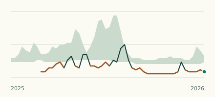 River gauge, United States Is the East Fork Trinity River unusually low at McKinney? Level now, history, the same date in past years and each year's range.
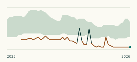 River gauge, United States Is the Peach Creek unusually low at Splendora? Level now, history, the same date in past years and each year's range.