Alberta river levels today
Are the rivers and lakes in Alberta unusually low or high?
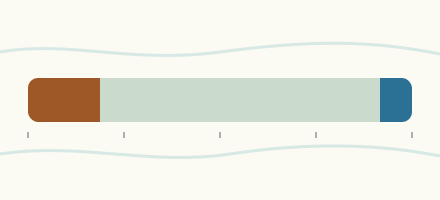
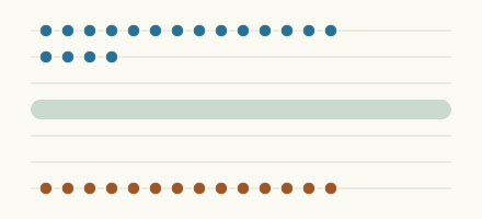
We follow 402 water level places in Alberta. 17 places read below their normal range for the date and 60 places above it.
How many places do we follow in Alberta?
402 Water Survey of Canada level gauges of the 2,148 we follow in Canada, as of 26 October 2026.
How many waters in Alberta have a level gauge?
310 waters with a level gauge, of the 1,635 waters we follow in Canada, as of 26 October 2026.
How many places read below normal for the date?
17 places below their normal range, of the 279 places with a current reading and a normal range for the date, as of 26 October 2026.
How many places read above normal for the date?
60 places above their normal range, of the 279 places with a current reading and a normal range for the date, as of 26 October 2026.
How the places stand today
17 places below normal and 60 places above
Which places are furthest below normal?
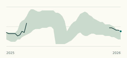
Burnt Timber Creek (downstream)Red Deer River (Alberta)
0.716 m
lower than any day of these dates in 13 years
More places
Which places are furthest above normal?
More places
Which gauges do we follow in Alberta?
| Place | Reading | Against normal for the date | Change in a day |
|---|---|---|---|
| Alkali Creek | |||
| Mouth | 1.836 m | ||
| Amisk River | |||
| Highway No. 36 | 1.064 m | -0.009 m | |
| Athabasca River | |||
| Athabasca | 1.21 m | within the normal range for the date | -0.048 m |
| Embarras Airport | 213.426 m | ||
| Fort McMurray (downstream) | 2.142 m | within the normal range for the date | -0.013 m |
| Hinton | 26.957 m | within the normal range for the date | -0.011 m |
| Jackfish Creek (upstream) | 6.079 m | within the normal range for the date | -0.122 m |
| Jasper | 1.026 m | within the normal range for the date | -0.036 m |
| Old Fort | 7.836 m | within the normal range for the date | -0.018 m |
| Atim Creek | |||
| Century Road | 8.589 m | within the normal range for the date | -0.011 m |
| Atimoswe Creek | |||
| Elk Point | 1.673 m | within the normal range for the date | -0.004 m |
| Babette Creek | |||
| Colinton | 1.747 m | -0.003 m | |
| Bare Creek Reservoir | |||
| Elkwater | 1,135.47 m | within the normal range for the date | +0.001 m |
| Battle Creek | |||
| Alberta Boundary | 0.677 m | within the normal range for the date | +0.005 m |
| Battle River | |||
| Duhamel | 12.642 m | within the normal range for the date | +0.062 m |
| Forestburg | 1.163 m | higher than any day of these dates in 12 years | -0.011 m |
| Highway No. 872 | 4.322 m | higher than any day of these dates in 12 years | +0.047 m |
| Ponoka | 0.421 m | in the lowest 10 percent for the date | -0.005 m |
| Saskatchewan Boundary | 0.587 m | within the normal range for the date | +0.003 m |
| Bear River (Alberta) | |||
| Valhalla Centre | 1.995 m | ||
| Bearberry Creek | |||
| Sundre | 2.053 m | within the normal range for the date | +0.002 m |
| Beaver Creek (Alberta) | |||
| Brocket | 0.543 m | within the normal range for the date | -0.008 m |
| Beaver River (Alberta and Saskatchewan) | |||
| Cold Lake Reserve | 7.225 m | higher than any day of these dates in 14 years | -0.014 m |
| Goodridge | 0.45 m | within the normal range for the date | 0 m |
| Beaver River (Syncrude) | |||
| Syncrude (upstream) | 2.875 m | higher than any day of these dates in 13 years | -0.037 m |
| Beaverlodge River | |||
| Beaverlodge | 1.002 m | within the normal range for the date | -0.006 m |
| Belly - St. Mary Diversion Canal | |||
| Belly - St. Mary Diversion Canal | 0.424 m | ||
| Belly River | |||
| Glenwood | 0.725 m | within the normal range for the date | -0.004 m |
| Highway No. 511 | 90.76 m | -0.005 m | |
| Mountain View | 1.139 m | within the normal range for the date | -0.005 m |
| Berland River | |||
| Mouth | 1.619 m | within the normal range for the date | -0.047 m |
| Berry Creek | |||
| Mouth | 0.873 m | 0 m | |
| Rose Lynn | 0.533 m | -0.004 m | |
| Berry Creek Reservoir | |||
| Outlet | 0.765 m | 0 m | |
| Sunnynook | 733.467 m | within the normal range for the date | -0.003 m |
| Big Creek (Alberta) | |||
| Mouth | 98.707 m | +0.061 m | |
| Big Mountain Creek | |||
| Big Mountain Creek Provincial Recreational Area | 93.753 m | +0.077 m | |
| Birch River (Alberta) | |||
| Alice Creek (downstream) | 5.486 m | in the highest 5 percent for the date | +0.069 m |
| Blackmud Creek | |||
| Ellerslie | 0.671 m | -0.11 m | |
| Blindman River | |||
| Blackfalds | 1.07 m | within the normal range for the date | -0.01 m |
| Block Creek | |||
| Leedale | 1.562 m | -0.005 m | |
| Blood Indian Creek | |||
| Mouth | 0.719 m | within the normal range for the date | -0.012 m |
| Bountiful Coulee Inflow | |||
| Cranford | 1.888 m | 0 m | |
| Bow River | |||
| Banff | 1.96 m | within the normal range for the date | -0.004 m |
| Bassano Dam (downstream) | 1.347 m | within the normal range for the date | -0.034 m |
| Calgary | 0.882 m | within the normal range for the date | +0.092 m |
| Carseland Dam (downstream) | 2.544 m | within the normal range for the date | +0.009 m |
| Cochrane | 16.261 m | within the normal range for the date | +0.019 m |
| Lake Louise | 1.105 m | ||
| Mouth | 5.469 m | within the normal range for the date | +0.08 m |
| Bow River Development Drain D | |||
| Vauxhall | 0.183 m | ||
| Bow River Development Main Canal | |||
| Headgates (downstream) | 905.41 m | ||
| Boyer River | |||
| Fort Vermilion | 1.186 m | in the highest 10 percent for the date | 0 m |
| Paddle Prairie | 0.826 m | within the normal range for the date | +0.003 m |
| Brazeau River | |||
| Cardinal River (downstream) | 4.336 m | within the normal range for the date | -0.015 m |
| Brown Creek | |||
| Forestry Road | 0.329 m | lower than any day of these dates in 13 years | -0.023 m |
| Buchanan Creek | |||
| Manning | 2.505 m | within the normal range for the date | -0.011 m |
| Buffalo Creek (Alberta) | |||
| Highway No. 41 | 1.059 m | -0.044 m | |
| Bullpound Creek | |||
| Watts | 0.497 m | -0.003 m | |
| Bullshead Reservoir | |||
| Elkwater | 1,074.139 m | within the normal range for the date | -0.006 m |
| Calling Lake | |||
| Ranger Station | 594.281 m | in the highest 5 percent for the date | -0.006 m |
| Calumet River | |||
| Mouth | 96.535 m | -0.008 m | |
| Camrose Creek | |||
| Camrose | 17.429 m | within the normal range for the date | +0.002 m |
| Canadian St. Mary Canal | |||
| Spring Coulee | 0.357 m | -0.001 m | |
| Carrot Creek | |||
| Mouth | 8.313 m | +0.013 m | |
| Castle River | |||
| Beaver Mines | 0.657 m | within the normal range for the date | -0.005 m |
| Ranger Station | 1.606 m | within the normal range for the date | -0.001 m |
| Cataract Creek | |||
| Forestry Road | 0.937 m | lower than any day of these dates in 14 years | -0.02 m |
| Cavan Lake | |||
| Dunmore | 805.325 m | within the normal range for the date | -0.002 m |
| Chain Lakes Reservoir | |||
| Nanton | 1,296.952 m | within the normal range for the date | +0.001 m |
| Chinchaga River | |||
| High Level | 0.676 m | within the normal range for the date | 0 m |
| Christina River | |||
| Chard | 5.586 m | within the normal range for the date | -0.023 m |
| Mouth | 96.774 m | -0.03 m | |
| Statoil Leismer (upstream) | 97.116 m | +0.066 m | |
| Christmas Creek | |||
| Blue Ridge | 0.589 m | within the normal range for the date | +0.009 m |
| Clear River | |||
| Bear Canyon | 1.021 m | in the lowest 10 percent for the date | +0.027 m |
| Clearwater River (Dovercourt) | |||
| Dovercourt | 0.846 m | within the normal range for the date | +0.001 m |
| Clearwater River (Draper) | |||
| Christina River (upstream) | 3.53 m | within the normal range for the date | +0.025 m |
| Draper | 2.433 m | ||
| Coal Lake Reservoir | |||
| Wetaskiwin | 702.714 m | within the normal range for the date | -0.008 m |
| Cold Lake | |||
| Cold Lake | 534.996 m | within the normal range for the date | +0.008 m |
| Coyote Creek | |||
| Cherhill | 0.703 m | within the normal range for the date | +0.003 m |
| Cressday Reservoir | |||
| Cressday | 963.26 m | within the normal range for the date | -0.003 m |
| Crowfoot Creek | |||
| Cluny | 0.759 m | within the normal range for the date | -0.002 m |
| Crowsnest River | |||
| Frank | 1.339 m | within the normal range for the date | -0.005 m |
| Cutbank River | |||
| Grande Prairie | 1.109 m | within the normal range for the date | -0.012 m |
| Cypress View Reservoir | |||
| Elkwater | 979.12 m | in the highest 10 percent for the date | -0.014 m |
| Dapp Creek | |||
| Highway No. 44 | 0.835 m | +0.009 m | |
| Deep Valley Creek | |||
| Valleyview | 4.837 m | within the normal range for the date | -0.007 m |
| Dickson Dam Tunnel Outlet | |||
| Dickson Dam Tunnel Outlet | 1.315 m | in the lowest 10 percent for the date | -0.001 m |
| Dover River | |||
| Mouth | 97.655 m | +0.032 m | |
| Driftpile River | |||
| Driftpile | 1.656 m | in the highest 5 percent for the date | -0.138 m |
| Driftwood River (Alberta) | |||
| Mouth | 0.97 m | within the normal range for the date | -0.081 m |
| Drywood Creek | |||
| Mouth | 0.79 m | in the highest 10 percent for the date | +0.001 m |
| Dunkirk River | |||
| Fort Mackay | 97.754 m | -0.007 m | |
| East Jackpine Creek | |||
| 1300 Ft Contour | 100.162 m | +0.009 m | |
| East Prairie River | |||
| Enilda | 2.889 m | higher than any day of these dates in 11 years | -0.049 m |
| Eastern Irrigation District Main Branch Canal | |||
| Headgate | 92.47 m | ||
| Elbow River | |||
| Bragg Creek | 0.902 m | within the normal range for the date | -0.002 m |
| Glenmore Dam (downstream) | 0.642 m | within the normal range for the date | -0.001 m |
| Sarcee Bridge | 3.669 m | -0.005 m | |
| Elkwater Lake | |||
| Elkwater | 1,226.31 m | within the normal range for the date | -0.009 m |
| Ells River | |||
| Canadian Natural Resources Limited Bridge | 98.16 m | -0.011 m | |
| Joslyn Creek Diversion (upstream) | 97.663 m | -0.061 m | |
| Embarras River (Athabasca delta) | |||
| Breakthrough to Mamawi Lake | 6.959 m | ||
| Divergence (downstream) | 7.69 m | -0.01 m | |
| Embarras River (Weald) | |||
| Weald | 0.867 m | +0.075 m | |
| Ethel Lake | |||
| Cold Lake | 541.239 m | within the normal range for the date | -0.001 m |
| Expanse Coulee | |||
| Mouth | 0.684 m | +0.003 m | |
| Eymundson Creek | |||
| Mouth | 98.016 m | +0.043 m | |
| Fallentimber Creek | |||
| Sundre | 1.012 m | within the normal range for the date | -0.004 m |
| Fawcett Lake | |||
| Smith | 611.49 m | within the normal range for the date | +0.001 m |
| Firebag River | |||
| Mouth | 1.043 m | within the normal range for the date | -0.086 m |
| Suncor Firebag (upstream) | 98.894 m | -0.01 m | |
| Fish Creek (Little Fish Lake) | |||
| Little Fish Lake (upstream) | 1.186 m | +0.001 m | |
| Fish Creek (Priddis) | |||
| Priddis | 2.237 m | within the normal range for the date | -0.007 m |
| Forster Reservoir | |||
| Cessford | 705.432 m | higher than any day of these dates in 40 years | -0.002 m |
| Freeman River | |||
| Fort Assiniboine | 1.29 m | higher than any day of these dates in 14 years | -0.015 m |
| Ghost River | |||
| Waiparous Creek (upstream) | 0.723 m | within the normal range for the date | 0 m |
| Ghostpine Creek | |||
| Huxley | 17.594 m | within the normal range for the date | 0 m |
| Gleniffer Reservoir | |||
| Dickson | 947.755 m | within the normal range for the date | -0.017 m |
| Gold Creek | |||
| Frank | 1.12 m | within the normal range for the date | +0.001 m |
| Grande Prairie Creek | |||
| Sexsmith | 0.98 m | in the highest 10 percent for the date | -0.014 m |
| Greasewood Reservoir | |||
| Elkwater | 29.361 m | in the highest 10 percent for the date | +0.002 m |
| Gregg River | |||
| Mouth | 1.153 m | -0.01 m | |
| Gregoire Lake | |||
| Fort McMurray | 475.789 m | in the highest 5 percent for the date | +0.014 m |
| Gregoire River | |||
| Mouth | 97.055 m | -0.321 m | |
| Groat Creek | |||
| Whitecourt | 0.302 m | within the normal range for the date | +0.007 m |
| Gull Lake | |||
| Rv Heaven Marina | 897.983 m | lower than any day of these dates in 25 years | +0.025 m |
| Hangingstone River | |||
| Fort McMurray | 2.245 m | within the normal range for the date | -0.013 m |
| North Star Road | 99.319 m | -0.015 m | |
| Hay River | |||
| Meander River | 3.794 m | within the normal range for the date | +0.01 m |
| Heart River | |||
| Nampa | 1.329 m | in the highest 10 percent for the date | -0.031 m |
| High Hill River | |||
| Mouth | 98.448 m | -0.042 m | |
| Highwood River | |||
| Diebel's Ranch | 0.786 m | within the normal range for the date | -0.008 m |
| Little Bow Canal (downstream) | 1.165 m | within the normal range for the date | -0.004 m |
| Mouth | 2.313 m | within the normal range for the date | -0.005 m |
| Hilda Lake | |||
| Cold Lake | 547.777 m | higher than any day of these dates in 26 years | 0 m |
| Hines Creek | |||
| Gerry Lake (upstream) | 1.978 m | within the normal range for the date | -0.007 m |
| House River | |||
| Highway No. 63 | 7.679 m | in the highest 5 percent for the date | +0.225 m |
| Iosegun River | |||
| Little Smoky | 1.037 m | within the normal range for the date | -0.002 m |
| Iron Creek | |||
| Hardisty | 0.594 m | ||
| Isle Lake | |||
| Silver Sands | 729.767 m | within the normal range for the date | -0.004 m |
| Iyinimin Creek | |||
| Kearl Lake (upstream) | 359.303 m | -0.019 m | |
| Jackfish River | |||
| Christina Lake (downstream) | 98.688 m | +0.005 m | |
| Jackpine Creek (Alberta) | |||
| Highway No. 88 | 2.032 m | within the normal range for the date | -0.007 m |
| Jackpine Creek (Canterra Road) | |||
| Canterra Road | 296.69 m | +0.001 m | |
| James River | |||
| Sundre | 3.767 m | in the highest 10 percent for the date | +0.005 m |
| Jumpingpound Creek | |||
| Cox Hill | 0.284 m | within the normal range for the date | -0.001 m |
| Township Road No. 252 | 2.434 m | within the normal range for the date | -0.003 m |
| Kakwa River | |||
| Highway No. 40 | 1.385 m | within the normal range for the date | -0.031 m |
| Kearl Lake | |||
| Canterra Road | 99.42 m | +0.001 m | |
| Outlet | 329.184 m | -0.003 m | |
| Keg River | |||
| Highway No. 35 | 0.704 m | within the normal range for the date | -0.03 m |
| Kettles Creek | |||
| Pincher Creek | 7.911 m | ||
| Killarney Lake Tributary | |||
| Chauvin | 0.847 m | -0.021 m | |
| Kleskun Hills Main Drain | |||
| Grande Prairie | 0.538 m | -0.001 m | |
| Kneehills Creek | |||
| Drumheller | 1.996 m | -0.003 m | |
| Lac La Biche | |||
| Lac La Biche | 544.012 m | in the highest 10 percent for the date | -0.024 m |
| Lac La Nonne | |||
| Lac La Nonne | 663.75 m | in the highest 10 percent for the date | -0.006 m |
| Lac Ste. Anne | |||
| Alberta Beach | 723.034 m | within the normal range for the date | -0.006 m |
| Lafond Creek | |||
| Red Earth Creek | 1.547 m | within the normal range for the date | -0.008 m |
| Lake Athabasca | |||
| Fort Chipewyan | 5.225 m | within the normal range for the date | |
| Lake Claire | |||
| Outlet to Prairie River | 5.918 m | ||
| Lasthill Creek | |||
| Eckville | 24.445 m | within the normal range for the date | +0.005 m |
| Lee Creek | |||
| Cardston | 1.381 m | within the normal range for the date | 0 m |
| Lesser Slave Lake | |||
| Slave Lake | 576.562 m | within the normal range for the date | -0.081 m |
| Lesser Slave River | |||
| Slave Lake | 576.389 m | within the normal range for the date | -0.079 m |
| Lethbridge Northern Irrigation District Canal | |||
| Oldman Flume (upstream) | 0.045 m | ||
| Lily Creek | |||
| Slave Lake | 92.345 m | ||
| Little Berland River | |||
| Highway No. 40 | 0.594 m | within the normal range for the date | +0.024 m |
| Little Bow Canal | |||
| High River | 1.264 m | within the normal range for the date | -0.001 m |
| Little Bow River | |||
| Carmangay | 0.238 m | within the normal range for the date | +0.001 m |
| Mouth | 0.386 m | -0.002 m | |
| Travers Dam (downstream) | 7.924 m | within the normal range for the date | -0.005 m |
| Little Paddle River | |||
| Mayerthorpe | 1.709 m | within the normal range for the date | -0.019 m |
| Little Red Deer River | |||
| Mouth | 0.944 m | within the normal range for the date | -0.001 m |
| Water Valley | 0.571 m | within the normal range for the date | +0.051 m |
| Little Smoky River | |||
| Guy | 3.095 m | within the normal range for the date | -0.003 m |
| Little Smoky | 1.409 m | within the normal range for the date | -0.039 m |
| Lloyd Creek | |||
| Bluffton | 1.12 m | -0.002 m | |
| Logan River | |||
| Mouth | 6.778 m | within the normal range for the date | -0.054 m |
| Lomond Lateral | |||
| Headgate | 0.00 m | ||
| Loon River (Alberta) | |||
| Mouth | 30.408 m | higher than any day of these dates in 13 years | -0.02 m |
| Lovett River | |||
| Mouth | 0.415 m | ||
| Lutose Creek | |||
| Steen River | 0.95 m | within the normal range for the date | 0 m |
| Mackay Creek Reservoir | |||
| Elkwater | 1,185.347 m | within the normal range for the date | -0.002 m |
| Mackay River | |||
| Fort Mackay | 1.911 m | within the normal range for the date | +0.013 m |
| Petro-Canada Bridge | 96.665 m | 0 m | |
| Magrath Irrigation District Canal | |||
| Spring Coulee | 0.364 m | -0.01 m | |
| Mamawi Lake Channel | |||
| Old Dog Camp | 5.624 m | ||
| Marie Lake | |||
| Cold Lake | 573.792 m | within the normal range for the date | +0.003 m |
| Maskwa Creek No. 1 | |||
| Bearhills Lake (upstream) | 1.075 m | -0.006 m | |
| Massy Reservoir | |||
| Elkwater | 28.012 m | within the normal range for the date | -0.003 m |
| Matzhiwin Creek | |||
| Ware Coulee (downstream) | 0.961 m | within the normal range for the date | -0.004 m |
| McAlpine Creek Reservoir | |||
| Elkwater | 1,220.066 m | within the normal range for the date | +0.015 m |
| McClelland Lake | |||
| East End | 294.778 m | 0 m | |
| McClelland Lake Outlet | |||
| Firebag River (upstream) | 96.684 m | -0.059 m | |
| McLeod River | |||
| Cadomin | 0.708 m | within the normal range for the date | -0.013 m |
| Embarras River (upstream) | 1.381 m | within the normal range for the date | -0.04 m |
| Rosevear | 1.46 m | within the normal range for the date | -0.025 m |
| Whitecourt | 1.739 m | within the normal range for the date | -0.01 m |
| Medicine River | |||
| Eckville | 1.824 m | in the highest 5 percent for the date | +0.008 m |
| Michel Reservoir | |||
| Elkwater | 1,102.082 m | within the normal range for the date | -0.003 m |
| Michichi Creek | |||
| Drumheller | 1.909 m | within the normal range for the date | -0.01 m |
| Middle Creek | |||
| Saskatchewan Boundary | 1.107 m | within the normal range for the date | +0.011 m |
| Miette River | |||
| Jasper | 0.727 m | within the normal range for the date | -0.006 m |
| Milk River | |||
| Milk River | 0.285 m | within the normal range for the date | -0.001 m |
| Western Crossing of International Boundary | 0.745 m | within the normal range for the date | +0.001 m |
| Milk River Ridge Reservoir | |||
| Milk River Ridge Reservoir | 1,032.069 m | in the highest 5 percent for the date | -0.001 m |
| Mill Creek (Alberta) | |||
| Mouth | 0.641 m | within the normal range for the date | -0.003 m |
| Mistaya River | |||
| Saskatchewan Crossing | 0.922 m | within the normal range for the date | -0.007 m |
| Mitchell Reservoir | |||
| Elkwater | 32.633 m | within the normal range for the date | -0.003 m |
| Monitor Creek | |||
| Monitor | 0.381 m | -0.001 m | |
| Moore Lake | |||
| Cold Lake | 549.42 m | in the highest 5 percent for the date | 0 m |
| Mosquito Creek (Alberta) | |||
| Mouth | 0.306 m | +0.006 m | |
| Mountain View Irrigation District Canal | |||
| Mountain View Irrigation District Canal | 1.092 m | higher than any day of these dates in 11 years | 0 m |
| Muriel Lake | |||
| Gurneyville | 555.802 m | within the normal range for the date | +0.003 m |
| Muskeg Creek | |||
| Mouth | 98.397 m | +0.033 m | |
| Muskeg River (Fort Mackay) | |||
| Fort Mackay | 1.591 m | within the normal range for the date | +0.006 m |
| Muskeg Creek (upstream) | 281.39 m | -0.056 m | |
| Stanley Creek (upstream) | 98.333 m | -0.003 m | |
| Upland | 99.109 m | -0.082 m | |
| Muskeg River (Grande Cache) | |||
| Grande Cache | 3.222 m | within the normal range for the date | 0 m |
| Namur Lake | |||
| Outlet | 97.869 m | +0.001 m | |
| New West Coulee | |||
| Mouth | 0.159 m | -0.003 m | |
| Nordegg River | |||
| Sunchild Road | 0.992 m | within the normal range for the date | +0.007 m |
| North Milk River | |||
| International Boundary | 0.331 m | within the normal range for the date | -0.001 m |
| North Ram River | |||
| Forestry Road | 0.746 m | in the lowest 5 percent for the date | -0.001 m |
| North Saskatchewan River | |||
| Edmonton | 2.955 m | in the lowest 10 percent for the date | -0.039 m |
| Highway No. 22 | 92.583 m | -0.003 m | |
| Highway No. 759 | 87.406 m | in the lowest 10 percent for the date | -0.013 m |
| Rocky Mountain House | 1.735 m | in the lowest 10 percent for the date | -0.002 m |
| Whirlpool Point | 0.485 m | within the normal range for the date | -0.012 m |
| Nose Creek | |||
| Airdrie (upstream) | 8.595 m | -0.002 m | |
| Notikewin River | |||
| Manning | 0.784 m | in the highest 10 percent for the date | -0.055 m |
| Oldman Reservoir | |||
| Pincher Creek | 1,111.489 m | within the normal range for the date | -0.014 m |
| Oldman River | |||
| Brocket | 1.153 m | within the normal range for the date | +0.003 m |
| Lethbridge | 0.387 m | within the normal range for the date | +0.006 m |
| Mouth | 2.393 m | within the normal range for the date | -0.005 m |
| Range Road No. 13A | 5.832 m | within the normal range for the date | -0.01 m |
| Onetree Creek | |||
| Patricia | 0.477 m | within the normal range for the date | 0 m |
| Owl River | |||
| Piche River (downstream) | 7.601 m | in the highest 5 percent for the date | -0.004 m |
| Paddle River | |||
| Anselmo | 0.744 m | within the normal range for the date | -0.008 m |
| Barrhead | 0.741 m | within the normal range for the date | -0.012 m |
| Rochfort Bridge | 1.194 m | ||
| Paintearth Creek | |||
| Halkirk | 1.242 m | ||
| Parflesh Creek | |||
| Chancellor | 0.946 m | -0.003 m | |
| Parlby Creek | |||
| Alix | 0.131 m | ||
| Peace River | |||
| Carcajou | 5.749 m | in the highest 5 percent for the date | -0.284 m |
| Chenal Des Quatre Fourches (downstream) | 4.435 m | within the normal range for the date | -0.063 m |
| Dunvegan Bridge | 3.965 m | within the normal range for the date | -0.002 m |
| Elk Island Park | 329.896 m | within the normal range for the date | -0.029 m |
| Fort Vermilion | 4.833 m | in the highest 5 percent for the date | -0.109 m |
| Peace Point | 5.719 m | in the highest 5 percent for the date | +0.042 m |
| Peace River | 7.173 m | within the normal range for the date | -0.025 m |
| Smoky River Confluence (upstream) | 316.612 m | in the highest 10 percent for the date | -0.023 m |
| Peavine Creek | |||
| Falher | 3.931 m | higher than any day of these dates in 13 years | +0.001 m |
| Peigan Creek | |||
| Pakowki Road | 0.28 m | +0.014 m | |
| Pekisko Creek | |||
| Longview | 0.637 m | within the normal range for the date | -0.002 m |
| Pembina River (Alberta) | |||
| Entwistle | 1.949 m | in the highest 5 percent for the date | -0.009 m |
| Jarvie | 1.068 m | within the normal range for the date | -0.012 m |
| Paddy Creek (downstream) | 0.711 m | within the normal range for the date | -0.009 m |
| Pigeon Lake | |||
| Pigeon Lake Provincial Park | 849.723 m | within the normal range for the date | +0.004 m |
| Pincher Creek | |||
| Front Range Road | 7.79 m | within the normal range for the date | -0.002 m |
| Pincher Creek | 0.237 m | within the normal range for the date | -0.017 m |
| Pine Coulee Outflow | |||
| Reservoir (downstream) | 7.505 m | ||
| Pine Coulee Reservoir | |||
| Stavely | 1,050.993 m | within the normal range for the date | -0.004 m |
| Pine Creek (Alberta) | |||
| Grassland | 0.844 m | +0.019 m | |
| Pipestone Creek (Alberta) | |||
| Wetaskiwin | 0.944 m | within the normal range for the date | -0.005 m |
| Pipestone River (Alberta) | |||
| Lake Louise | 0.454 m | within the normal range for the date | -0.07 m |
| Piyami Drain | |||
| Picture Butte | 0.51 m | +0.001 m | |
| Ponton River | |||
| Boyer River (upstream) | 1.869 m | within the normal range for the date | -0.023 m |
| Pony Creek | |||
| Chard | 8.861 m | within the normal range for the date | +0.097 m |
| Poplar Creek | |||
| Fort McMurray | 97.119 m | -0.018 m | |
| Porter Creek | |||
| Baptiste Lake (upstream) | 6.682 m | -0.004 m | |
| Pothole Creek | |||
| Russell's Ranch | 0.581 m | within the normal range for the date | -0.003 m |
| Prairie Blood Coulee | |||
| Lethbridge | 0.624 m | +0.003 m | |
| Prairie Creek (Alberta) | |||
| Lick Creek (downstream) | 1.214 m | within the normal range for the date | -0.004 m |
| Rocky Mountain House | 0.29 m | in the lowest 10 percent for the date | -0.001 m |
| Racehorse Creek | |||
| Mouth | 0.398 m | in the lowest 10 percent for the date | -0.01 m |
| Rat Creek (Alberta) | |||
| Cynthia | 1.299 m | within the normal range for the date | -0.034 m |
| Raven River | |||
| Raven | 0.565 m | within the normal range for the date | -0.003 m |
| Red Clay Creek | |||
| Mouth | 98.096 m | +0.012 m | |
| Red Deer River (Alberta) | |||
| Bindloss | 1.34 m | within the normal range for the date | -0.001 m |
| Burnt Timber Creek (downstream) | 0.716 m | lower than any day of these dates in 13 years | -0.023 m |
| Drumheller | 0.663 m | within the normal range for the date | +0.004 m |
| Red Deer | 2.552 m | within the normal range for the date | -0.001 m |
| Redearth Creek | |||
| Red Earth Creek | 1.434 m | higher than any day of these dates in 13 years | +0.022 m |
| Redwater River | |||
| Mouth | 2.121 m | -0.006 m | |
| Redwillow River | |||
| Rio Grande | 3.519 m | higher than any day of these dates in 12 years | +0.131 m |
| Reesor Reservoir | |||
| Elkwater | 1,226.411 m | within the normal range for the date | 0 m |
| Renwick Creek | |||
| Three Hills | 0.627 m | within the normal range for the date | -0.023 m |
| Ribstone Creek | |||
| Edgerton | 2.675 m | -0.001 m | |
| Richardson River | |||
| Mouth | 1.79 m | within the normal range for the date | 0 m |
| Riviere Des Rochers | |||
| Little Rapids (east) | 5.007 m | ||
| Little Rapids (west) | 4.011 m | within the normal range for the date | -0.113 m |
| Slave River (upstream) | 3.813 m | within the normal range for the date | -0.105 m |
| Rolph Creek | |||
| Kimball | 0.497 m | +0.001 m | |
| Rose Creek | |||
| Alder Flats | 1.353 m | within the normal range for the date | +0.003 m |
| Rosebud River | |||
| Carstairs Creek (downstream) | 0.991 m | in the highest 10 percent for the date | -0.011 m |
| Redland | 0.307 m | +0.03 m | |
| Ross Creek | |||
| Highway No. 41 | 2.129 m | higher than any day of these dates in 14 years | -0.002 m |
| Saddle River | |||
| Woking | 1.022 m | within the normal range for the date | -0.02 m |
| Sage Creek | |||
| Q Ranch near Wildhorse | 1.492 m | ||
| Sakwatamau River | |||
| Whitecourt | 0.456 m | within the normal range for the date | -0.023 m |
| Salt Creek (Alberta) | |||
| Grouard | 2.136 m | higher than any day of these dates in 12 years | -0.023 m |
| Sam Lake Tributary | |||
| Schuler | 0.766 m | 0 m | |
| Sand River | |||
| Mouth | 1.21 m | in the highest 5 percent for the date | -0.017 m |
| Saulteaux River | |||
| Spurfield | 1.502 m | within the normal range for the date | -0.026 m |
| Sawridge Creek | |||
| Slave Lake | 1.613 m | within the normal range for the date | -0.027 m |
| Seven Persons Creek | |||
| Medicine Hat | 0.418 m | within the normal range for the date | -0.028 m |
| Sheep River | |||
| Black Diamond | 1.28 m | in the highest 10 percent for the date | -0.002 m |
| Okotoks | 26.052 m | within the normal range for the date | -0.008 m |
| Shorncliffe Lake | |||
| Czar | 673.08 m | ||
| Silverhorn Creek | |||
| Mouth | 7.277 m | in the highest 10 percent for the date | +0.001 m |
| Simonette River | |||
| Goodwin | 1.643 m | in the highest 5 percent for the date | -0.038 m |
| Slave River | |||
| Fitzgerald | 3.884 m | in the highest 5 percent for the date | -0.065 m |
| Smoky River | |||
| Hells Creek (upstream) | 1.362 m | within the normal range for the date | -0.019 m |
| Watino | 2.245 m | within the normal range for the date | -0.058 m |
| Snake Creek | |||
| Vulcan | 0.52 m | -0.001 m | |
| Sounding Creek | |||
| Chinook | 0.844 m | +0.003 m | |
| Oyen | 0.56 m | 0 m | |
| Sousa Creek | |||
| High Level | 3.24 m | higher than any day of these dates in 13 years | +0.003 m |
| South Heart Reservoir | |||
| McLennan | 625.771 m | within the normal range for the date | -0.021 m |
| South Heart River | |||
| Big Prairie Settlement | 25.039 m | higher than any day of these dates in 13 years | -0.016 m |
| Peavine | 5.006 m | higher than any day of these dates in 14 years | -0.071 m |
| South Saskatchewan River | |||
| Medicine Hat | 2.141 m | within the normal range for the date | -0.046 m |
| South Wabasca Lake | |||
| Desmarais | 545.106 m | in the highest 10 percent for the date | -0.005 m |
| Spray River | |||
| Banff | 0.991 m | in the highest 5 percent for the date | -0.002 m |
| Spruce Coulee Reservoir | |||
| Elkwater | 1,304.742 m | within the normal range for the date | -0.004 m |
| St. Mary Reservoir | |||
| Spring Coulee | 1,095.548 m | within the normal range for the date | -0.025 m |
| St. Mary River (Alberta) | |||
| Lethbridge | 1.301 m | within the normal range for the date | +0.001 m |
| Steen River | |||
| Steen River | 3.662 m | within the normal range for the date | -0.083 m |
| Steepbank River | |||
| Fort McMurray | 97.724 m | higher than any day of these dates in 12 years | |
| North Steepbank River (downstream) | 97.76 m | -0.009 m | |
| Stimson Creek | |||
| Pekisko | 1.628 m | -0.009 m | |
| Stony Creek (Alberta) | |||
| Tawatinaw | 0.471 m | ||
| Strawberry Creek | |||
| Mouth | 0.315 m | within the normal range for the date | -0.013 m |
| Stretton Creek | |||
| Marwayne | 0.869 m | within the normal range for the date | -0.023 m |
| Sturgeon Lake (Alberta) | |||
| Valleyview | 676.90 m | within the normal range for the date | +0.002 m |
| Sturgeon River (Alberta) | |||
| Fort Saskatchewan | 3.791 m | -0.023 m | |
| Magnolia Bridge | 0.935 m | -0.001 m | |
| St. Albert | 0.652 m | within the normal range for the date | +0.007 m |
| Villeneuve | 0.867 m | within the normal range for the date | 0 m |
| Sundance Creek | |||
| Bickerdike | 0.954 m | ||
| Sunday Creek | |||
| Christina Lake (upstream) | 98.321 m | +0.152 m | |
| Sunwapta River | |||
| Athabasca Glacier | 0.471 m | in the lowest 10 percent for the date | -0.003 m |
| Swan River (Alberta) | |||
| Kinuso | 583.387 m | within the normal range for the date | -0.161 m |
| Swan Hills | 96.147 m | higher than any day of these dates in 13 years | +0.061 m |
| Sylvan Lake | |||
| Sylvan Lake | 935.997 m | lower than any day of these dates in 29 years | -0.007 m |
| Tar River | |||
| Canadian Natural Resources Limited Lake (upstream) | 97.33 m | +0.007 m | |
| Mouth | 97.613 m | -0.007 m | |
| Teepee Creek | |||
| La Crete | 0.942 m | within the normal range for the date | +0.001 m |
| Threehills Creek | |||
| Carbon | 1.448 m | +0.006 m | |
| Ray Creek (downstream) | 0.317 m | lower than any day of these dates in 10 years | +0.002 m |
| Threepoint Creek | |||
| Millarville | 1.547 m | within the normal range for the date | -0.005 m |
| Tomahawk Creek | |||
| Tomahawk | 1.343 m | within the normal range for the date | -0.009 m |
| Trap Creek | |||
| Longview | 1.946 m | within the normal range for the date | -0.007 m |
| Trout Creek (Alberta) | |||
| Granum | 0.471 m | within the normal range for the date | -0.004 m |
| Twelve Mile Creek (Alberta) | |||
| Cecil | 28.332 m | -0.035 m | |
| United Irrigation District Canal | |||
| Hill Spring | 0.888 m | ||
| Vermilion Lakes | |||
| Morecambe | 599.067 m | within the normal range for the date | -0.043 m |
| Vermilion Park Lake | |||
| Vermilion | 575.865 m | within the normal range for the date | +0.009 m |
| Vermilion River (Alberta) | |||
| Marwayne | 0.555 m | higher than any day of these dates in 11 years | +0.01 m |
| Range Road No. 105 | 16.902 m | within the normal range for the date | -0.046 m |
| Vegreville | 1.284 m | within the normal range for the date | -0.005 m |
| Vermilion River Tributary | |||
| Bruce | 0.589 m | -0.004 m | |
| Wabamun Lake | |||
| Sundance Power Station | 724.21 m | within the normal range for the date | -0.004 m |
| Wabasca River | |||
| Highway No. 88 | 2.268 m | higher than any day of these dates in 11 years | 0 m |
| Wabash Creek | |||
| Pibroch | 3.833 m | -0.009 m | |
| Waiparous Creek | |||
| Mouth | 0.734 m | within the normal range for the date | -0.004 m |
| Wampus Creek | |||
| Hinton | 0.706 m | +0.034 m | |
| Wandering River | |||
| Wandering River | 0.867 m | within the normal range for the date | +0.002 m |
| Wapiti River | |||
| Grande Prairie | 95.239 m | higher than any day of these dates in 11 years | -0.062 m |
| Waskahigan River | |||
| Mouth | 1.144 m | in the highest 5 percent for the date | +0.055 m |
| Waskasoo Creek | |||
| Red Deer | 1.09 m | in the highest 5 percent for the date | -0.016 m |
| Waterton - Belly Diversion Canal | |||
| Waterton - Belly Diversion Canal | 0.135 m | +0.001 m | |
| Waterton Lake | |||
| Waterton Park | 1,278.184 m | within the normal range for the date | +0.006 m |
| Waterton Reservoir | |||
| Waterton Reservoir | 1,178.675 m | within the normal range for the date | +0.042 m |
| Waterton River | |||
| Glenwood | 0.867 m | within the normal range for the date | -0.001 m |
| Waterton Park | 0.396 m | within the normal range for the date | +0.002 m |
| Weed Creek | |||
| Thorsby | 5.605 m | within the normal range for the date | +0.001 m |
| Weiller Creek | |||
| Wetaskiwin | 1.734 m | higher than any day of these dates in 10 years | -0.008 m |
| West Arrowwood Creek | |||
| Arrowwood | 0.272 m | +0.001 m | |
| Ensign | 0.724 m | -0.013 m | |
| West Nose Creek | |||
| Calgary | 5.419 m | within the normal range for the date | -0.007 m |
| West Prairie River | |||
| High Prairie | 2.716 m | within the normal range for the date | +0.064 m |
| West Whitemud Creek | |||
| Ireton | 0.516 m | ||
| Whitemud Creek | |||
| Edmonton | 5.372 m | within the normal range for the date | -0.026 m |
| Ellerslie | 1.266 m | -0.006 m | |
| Whitemud River (Alberta) | |||
| Dixonville | 1.358 m | higher than any day of these dates in 13 years | -0.223 m |
| Wildhay River | |||
| Hinton | 1.458 m | -0.005 m | |
| Willow Creek (Alberta) | |||
| Claresholm | 0.562 m | within the normal range for the date | -0.013 m |
| Oxly Ranch | 1.179 m | within the normal range for the date | -0.007 m |
| Secondary No. 532 | 1.233 m | in the lowest 10 percent for the date | -0.005 m |
| Willow River | |||
| Wabasca | 2.028 m | within the normal range for the date | -0.053 m |
| Winagami Lake | |||
| Provincial Park | 621.919 m | higher than any day of these dates in 23 years | +0.002 m |
| Wolf Creek | |||
| Highway No. 16A | 1.17 m | within the normal range for the date | -0.064 m |
| Wolf River (Alberta) | |||
| Outlet of Wolf Lake | 597.395 m | within the normal range for the date | +0.002 m |
| Yarrow Creek | |||
| Spread Eagle Road | 6.32 m | within the normal range for the date | -0.001 m |
| Young Creek (Alberta) | |||
| Castor | 0.618 m | -0.002 m | |
Keep exploring
 Country, Canada Are the rivers and lakes in Canada unusually low or high? Every river and lake we follow in Canada, against normal for the date.
 Today's list, Canada Which places in Canada are furthest from normal today? The places in Canada furthest below and above normal today.
 River gauge, Canada Is the Red Deer River (Alberta) unusually low at Burnt Timber Creek (downstream)? Level now, history, the same date in past years and each year's range.
 Lake gauge, Canada Is the Sylvan Lake unusually low at Sylvan Lake? Level now, history, the same date in past years and each year's range.
Sources
- Data Source: Environment and Climate Change Canada (Water Survey of Canada) (source). Licence: ECCC Data Services End-use Licence v2.1.1