Louisiana river levels today
Are the rivers and lakes in Louisiana unusually low or high?
We follow 151 water level gauges in Louisiana. 16 gauges read below their normal range for the date and 4 gauges above it, not counting the 13 tide stations.
How many gauges do we follow in Louisiana?
151 gauges of the 7,007 we follow in the United States, as of 21 November 2026.
How many waters in Louisiana have a level gauge?
68 waters with a level gauge, of the 3,733 waters we follow in the United States, as of 21 November 2026.
How many gauges read below normal for the date?
16 gauges below their normal range, of the 56 gauges with a current reading and a normal range for the date, not counting the 13 tide stations, as of 21 November 2026.
How many gauges read above normal for the date?
4 gauges above their normal range, of the 56 gauges with a current reading and a normal range for the date, not counting the 13 tide stations, as of 21 November 2026.
How the places stand today
16 places below normal and 4 places above
Which places are furthest below normal?
More places
Which places are furthest above normal?
Which gauges do we follow in Louisiana?
| Place | Reading | Against normal for the date | Change in a day |
|---|---|---|---|
| Amite River | |||
| Darlington | -1.35 ft | lower than any day of these dates in 30 years | -0.01 ft |
| Denham Springs | 9.62 ft | in the lowest 5 percent for the date | -0.01 ft |
| French Settlement | 2.36 ft | in the highest 10 percent for the date | -0.27 ft |
| Grangeville | 17.54 ft | within the normal range for the date | -0.01 ft |
| Hwy 22 near Maurepas | 3.01 ft | in the highest 10 percent for the date | -0.37 ft |
| Magnolia | 26.87 ft | within the normal range for the date | +0.01 ft |
| Port Vincent | 2.97 ft | -0.27 ft | |
| Amite River Basin | |||
| Bayou Manchac near Little Prairie | 3.00 ft | within the normal range for the date | -0.26 ft |
| Atchafalaya River | |||
| Bayou Sorrel Landside | 3.30 ft | +0.20 ft | |
| Bayou Sorrel Lock | 3.30 ft | 0 ft | |
| Berwick | 0.087 m above the tide table | within the normal range for the date | |
| Butte La Rose | 4.07 ft | within the normal range for the date | +0.09 ft |
| Krotz Springs | 3.90 ft | +0.08 ft | |
| Melville | 5.16 ft | +0.07 ft | |
| Morgan City | 2.97 ft | +0.09 ft | |
| Simmesport | 7.43 ft | within the normal range for the date | +0.08 ft |
| Barnes Creek | |||
| Topsy Bel Road | 2.32 ft | ||
| Bayou Anacoco | |||
| Rosepine | 3.06 ft | within the normal range for the date | -0.02 ft |
| Bayou Bodcau | |||
| Bayou Bodcau Lake | 158.95 ft | +0.02 ft | |
| Bayou Bonfouca | |||
| Slidell | 1.83 ft | -0.29 ft | |
| Bayou Cocodrie | |||
| Clearwater | 5.31 ft | within the normal range for the date | -0.37 ft |
| Whiteville | 18.12 ft | +0.18 ft | |
| Bayou Courtableau | |||
| Courtableau | 17.77 ft | +0.18 ft | |
| Drainage Structure | 18.03 ft | +0.19 ft | |
| Washington | 18.45 ft | within the normal range for the date | +0.18 ft |
| Bayou D'Arbonne | |||
| Lake Claiborne | 7.57 ft | within the normal range for the date | -0.02 ft |
| Lake D'Arbonne | 38.41 ft | within the normal range for the date | 0 ft |
| Bayou Des Cannes | |||
| Eunice | 0.11 ft | lower than any day of these dates in 30 years | -0.04 ft |
| Bayou Des Glaises Diversion Ch | |||
| Moreauville (near) | 3.02 ft | 0 ft | |
| Bayou Des Glaises Diversion Ch. | |||
| Moreauville | 2.74 ft | within the normal range for the date | +0.01 ft |
| Bayou Dorcheat | |||
| Dixie Inn | 0.40 ft | lower than any day of these dates in 29 years | 0 ft |
| Lake Bistineau | 3.22 ft | in the lowest 5 percent for the date | -0.01 ft |
| Springhill | 3.85 ft | lower than any day of these dates in 29 years | +0.01 ft |
| Bayou Lacassine | |||
| Lorrain Park | -0.55 ft | 0 ft | |
| Bayou Lafourche (NE LA) | |||
| Alto | 35.12 ft | within the normal range for the date | -0.09 ft |
| Bayou Liberty | |||
| Slidell | 2.25 ft | in the highest 10 percent for the date | -0.27 ft |
| Bayou Macon | |||
| Como | 36.10 ft | 0 ft | |
| Bayou Mallet | |||
| HWY 91 north of Iota | 2.79 ft | -0.11 ft | |
| Bayou Millhome | |||
| Stephensville | 1.26 ft | +0.05 ft | |
| Bayou Nezpique | |||
| Basile | 2.12 ft | within the normal range for the date | -0.16 ft |
| Bayou Plaquemine Brule | |||
| Estherwood | 7.79 ft | +0.01 ft | |
| Bayou Queue De Tortue | |||
| Riceville | 4.98 ft | ||
| Bayou Rouge | |||
| Palmetto | 17.63 ft | +0.22 ft | |
| Bayou Teche | |||
| Port Barre | 17.42 ft | +0.19 ft | |
| Bayou Vermilion | |||
| Carencro | 6.01 ft | within the normal range for the date | -0.02 ft |
| Bess Branch | |||
| Alligator Park | 10.38 ft | 0 ft | |
| Big Colewa Bayou | |||
| Oak Grove | 84.01 ft | -0.01 ft | |
| Big Cypress Creek | |||
| Mooringsport (Caddo Lake) | 167.40 ft | +0.90 ft | |
| Black River | |||
| Acme | 7.48 ft | +0.07 ft | |
| Jonesville L&D | 34.42 ft | -0.11 ft | |
| Boeuf River | |||
| Alto | 12.09 ft | 0 ft | |
| Fort Necessity | 33.95 ft | -0.09 ft | |
| Bogue Chitto River | |||
| Bush | 2.64 ft | in the lowest 5 percent for the date | -0.01 ft |
| Franklinton | 0.32 ft | within the normal range for the date | +0.01 ft |
| Bogue Falaya River | |||
| Boston Street | 2.13 ft | in the highest 10 percent for the date | -0.41 ft |
| Camp Covington | 34.56 ft | within the normal range for the date | 0 ft |
| Bundick Creek | |||
| Bundick Lake | 6.03 ft | within the normal range for the date | 0 ft |
| DeRidder | 2.39 ft | in the lowest 5 percent for the date | -0.02 ft |
| Hwy 113 | 3.17 ft | ||
| Buxton Creek | |||
| HWY 27 near DeQuincy | 1.92 ft | ||
| Calcasieu River | |||
| Glenmora | 4.60 ft | within the normal range for the date | 0 ft |
| Goos Ferry Road | 1.53 ft | +0.09 ft | |
| Kinder | 1.63 ft | ||
| Lake Charles | 0.372 m above the tide table | in the highest 10 percent for the date | |
| Oakdale | 8.03 ft | 0 ft | |
| Oberlin | 1.05 ft | in the lowest 10 percent for the date | -0.01 ft |
| Saltwater Barrier | 3.90 ft | ||
| White Oak Park | 1.69 ft | +0.11 ft | |
| Choupique Bayou | |||
| Highway 108 | 1.60 ft | +0.09 ft | |
| Comite River | |||
| Comite Joor Rd. | 0.25 ft | within the normal range for the date | 0 ft |
| Olive Branch | -1.61 ft | lower than any day of these dates in 40 years | -0.02 ft |
| Contraband Bayou | |||
| Common Street | 2.24 ft | +0.11 ft | |
| Cross Lake | |||
| Shreveport | 170.06 ft | within the normal range for the date | -0.02 ft |
| Cypress Bayou Lake | |||
| Benton | 7.66 ft | within the normal range for the date | -0.01 ft |
| French Branch | |||
| Slidell | 2.90 ft | -0.16 ft | |
| Houston River | |||
| Anthony Ferry Road | 1.44 ft | +0.06 ft | |
| Indian Bayou | |||
| Coffey Road | 1.59 ft | +0.08 ft | |
| Lake Palourde | |||
| Morgan City | 3.66 ft | +0.08 ft | |
| Lake Pontchartrain | |||
| New Canal Station | 0.417 m above the tide table | in the highest 10 percent for the date | |
| Little Bayou D'Inde | |||
| Wright Road | 1.59 ft | -0.01 ft | |
| Little River | |||
| Boggy Bayou Road | 39.53 ft | 0 ft | |
| Little River of Louisiana | |||
| Rochelle | 3.94 ft | lower than any day of these dates in 26 years | -0.01 ft |
| Louisiana Coast | |||
| Bulk Terminal | 0.377 m above the tide table | in the highest 10 percent for the date | |
| Calcasieu Pass | 0.39 m above the tide table | in the highest 5 percent for the date | |
| Eugene Island | 0.497 m above the tide table | in the highest 5 percent for the date | |
| Freshwater Canal Locks | 0.411 m above the tide table | in the highest 5 percent for the date | |
| Grand Isle | 0.232 m above the tide table | in the highest 5 percent for the date | |
| LAWMA Amerada Pass | 0.423 m above the tide table | in the highest 5 percent for the date | |
| Port Fourchon | 0.243 m above the tide table | in the highest 5 percent for the date | |
| Shell Beach | 0.366 m above the tide table | in the highest 10 percent for the date | |
| Mermentau River | |||
| Catfish Point Lock | 14.80 ft | ||
| Lake Arthur | 22.53 ft | +0.01 ft | |
| Mermentau | 2.21 ft | 0 ft | |
| Mississippi River | |||
| Algiers Lock | 2.66 ft | -0.20 ft | |
| Alliance Refinery | 2.12 ft | -0.69 ft | |
| Baton Rouge | 8.34 ft | -0.07 ft | |
| Baton Rouge (USGS) | 8.46 ft | within the normal range for the date | -0.12 ft |
| Belle Chasse | 8.81 ft | within the normal range for the date | -0.71 ft |
| Bonnel Carre near Norco | 3.93 ft | -0.69 ft | |
| Bonnet Carre North near Montz | 3.96 ft | -0.53 ft | |
| Donaldsonville | 5.10 ft | -0.36 ft | |
| Empire | 1.85 ft | -0.66 ft | |
| Harvey Lock | 3.46 ft | -0.65 ft | |
| Head of Passes | 1.33 ft | -0.58 ft | |
| Knox Landing | 22.33 ft | -0.06 ft | |
| Lake Providence | 1.42 ft | +0.04 ft | |
| New Orleans | 3.50 ft | -0.59 ft | |
| Old River Low Sill Structure | 22.57 ft | +0.04 ft | |
| Pilots Station East | 0.552 m above the tide table | in the highest 5 percent for the date | |
| Pilottown | 0.235 m above the tide table | in the highest 10 percent for the date | |
| Port Eads | 1.17 ft | -0.38 ft | |
| Red River Landing | 20.30 ft | +0.08 ft | |
| Reserve | 4.26 ft | -0.51 ft | |
| Southwest Pass at East Jetty | 1.52 ft | -0.56 ft | |
| Southwest Pass Mile 7.5 near Burrwood | 1.69 ft | -0.45 ft | |
| St. Francisville | 11.77 ft | +0.05 ft | |
| Venice | 1.20 ft | -0.47 ft | |
| West Bay | 1.06 ft | -0.61 ft | |
| West Pointe a la Hache | 1.77 ft | -0.64 ft | |
| Natalbany River | |||
| Baptist | 3.68 ft | within the normal range for the date | -0.01 ft |
| Ouachita River | |||
| Columbia Lock and Dam | 49.00 ft | 0 ft | |
| Monroe | 18.09 ft | in the lowest 5 percent for the date | +0.05 ft |
| Pearl River | |||
| Bogalusa | 5.91 ft | lower than any day of these dates in 55 years | 0 ft |
| Pearl River | 5.03 ft | within the normal range for the date | -0.07 ft |
| Slidell (above) | 2.87 ft | within the normal range for the date | -0.13 ft |
| Red Chute Bayou | |||
| Sligo | 16.06 ft | within the normal range for the date | -0.01 ft |
| Red River | |||
| Alexandria | 19.97 ft | +0.01 ft | |
| Coushatta | 25.13 ft | +0.02 ft | |
| Grand Ecore | 20.21 ft | -0.03 ft | |
| Red River Lock 1 | 40.23 ft | -0.21 ft | |
| Shreveport | 13.58 ft | +0.07 ft | |
| Sabine River | |||
| Toledo Bend Reservoir | 167.51 ft | within the normal range for the date | -0.02 ft |
| Tangipahoa River | |||
| Amite | 5.12 ft | within the normal range for the date | -0.01 ft |
| Kentwood | 1.64 ft | lower than any day of these dates in 26 years | 0 ft |
| Robert | 6.45 ft | within the normal range for the date | -0.01 ft |
| Tchefuncte River | |||
| Covington | 9.06 ft | in the lowest 5 percent for the date | -0.01 ft |
| Folsom | 4.79 ft | in the lowest 5 percent for the date | 0 ft |
| Tensas Bayou | |||
| Transylvania | 3.20 ft | -0.01 ft | |
| Tensas River | |||
| Clayton | 34.57 ft | ||
| Newlight | 34.02 ft | -0.14 ft | |
| Tendal | 5.60 ft | within the normal range for the date | 0 ft |
| Tickfaw River | |||
| Holden | 0.52 ft | within the normal range for the date | 0 ft |
| Liverpool | 1.61 ft | within the normal range for the date | 0 ft |
| Montpelier | 2.47 ft | within the normal range for the date | 0 ft |
| Vermilion River | |||
| I-10 at Lafayette | 5.46 ft | +0.02 ft | |
| Lafayette - Surrey Street | 6.11 ft | +0.04 ft | |
| Lake Martin Road | 3.79 ft | within the normal range for the date | +0.04 ft |
| West Fork Calcasieu River | |||
| Dunn Ferry Road | 1.61 ft | +0.01 ft | |
| Gahgan Boat Launch | 1.42 ft | +0.06 ft | |
| Whiskey Chitto Creek | |||
| Hwy 399 | 1.98 ft | -0.03 ft | |
| Whisky Chitto Creek | |||
| Mittie | 2.53 ft | within the normal range for the date | -0.03 ft |
Keep exploring
 Country, United States Are the rivers and lakes in the United States unusually low or high? Every river and lake we follow here, against normal for the date.
 Today's list, United States Which places in the United States are furthest from normal today? The places in the United States furthest below and above normal today.
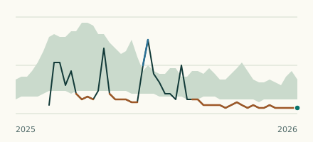 River gauge, United States Is the Tangipahoa River unusually low at Kentwood? Level now, history, the same date in past years and each year's range.
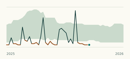 River gauge, United States Is the Comite River unusually low at Olive Branch? Level now, history, the same date in past years and each year's range.