LKN Itzehoe river levels today
Are the rivers and lakes in the LKN Itzehoe unusually low or high?
We follow 81 water level places in the LKN Itzehoe. None read below their normal range for the date and 1 place above it.
Last updated . This page normally updates every day; the latest update is late.
How many places do we follow in the LKN Itzehoe?
81 places of the 1,158 we follow in Germany, as of 17 November 2026.
How many waters in the LKN Itzehoe have a level gauge?
53 waters with a level gauge, of the 363 waters we follow in Germany, as of 17 November 2026.
How many places read below normal for the date?
0 places below their normal range, of the 48 places with a current reading and a normal range for the date, as of 17 November 2026.
How many places read above normal for the date?
1 place above its normal range, of the 48 places with a current reading and a normal range for the date, as of 17 November 2026.
How the places stand today
0 places below normal and 1 place above
Which places are furthest above normal?
Which gauges do we follow in LKN Itzehoe?
| Place | Reading | Against normal for the date | Change in a day |
|---|---|---|---|
| Alster | |||
| Naherfurth | 31 cm | within the normal range for the date | +8 cm |
| Wulksfelde | 107 cm | within the normal range for the date | +11 cm |
| Ammersbek | |||
| Ammersbek | 192 cm | within the normal range for the date | +4 cm |
| Barnitz | |||
| Quellenthal | 672 cm | within the normal range for the date | +7 cm |
| Behlendorfer See | |||
| Behlendorfer See | 144 cm | ||
| Bekau | |||
| Dragerborn | 244 cm | within the normal range for the date | +8 cm |
| Beste | |||
| Oldesloe 3 Stadtpark | 63 cm | within the normal range for the date | +7 cm |
| Quellenthal/Beste | 636 cm | within the normal range for the date | +6 cm |
| Bille | |||
| Mühlenteich | 699 cm | ||
| Reinbek | 36 cm | within the normal range for the date | +4 cm |
| Sachsenwaldau | 1,274 cm | within the normal range for the date | +2 cm |
| Bilsbek | |||
| Rantzel | 29 cm | within the normal range for the date | +3 cm |
| Bißnitz | |||
| Geschendorf | 146 cm | +15 cm | |
| Blankensee | |||
| Blankensee | 81 cm | ||
| Bornhöveder See | |||
| Bornhöveder See | 2,929 cm | ||
| Bramau | |||
| Föhrden-Barl | 204 cm | within the normal range for the date | +11 cm |
| Wrist | 160 cm | within the normal range for the date | +8 cm |
| Brokstedter Au | |||
| Brokstedt | 559 cm | within the normal range for the date | +5 cm |
| Dellbrückau | |||
| Dellbrück | 719 cm | within the normal range for the date | +5 cm |
| Drüsensee | |||
| Drüsensee | 1,441 cm | ||
| Düpenau | |||
| Halstenbek | 34 cm | within the normal range for the date | +1 cm |
| Ekholter Au | |||
| Ekholt | 29 cm | ||
| Kölln | 25 cm | within the normal range for the date | +3 cm |
| Garrensee | |||
| Garrensee | 3,960 cm | ||
| Gieselau | |||
| Wennbüttel | 897 cm | within the normal range for the date | +3 cm |
| Großensee | |||
| Großensee | 3,841 cm | ||
| Gudower See | |||
| Gudower See | 155 cm | ||
| Holmau | |||
| Holm/Aue | 12 cm | within the normal range for the date | +1 cm |
| Hunnau | |||
| Bünningstedt | 2,816 cm | within the normal range for the date | +2 cm |
| Ihlsee | |||
| Ihlsee | 2,758 cm | ||
| Krückau | |||
| Bokholtermühle | 62 cm | ||
| Kölln-Reisiek A23 | 93 cm | within the normal range for the date | +6 cm |
| Langeln | 28 cm | within the normal range for the date | +3 cm |
| Langeln OP | 44 cm | ||
| Mözener See | |||
| Mözener See | 1,827 cm | ||
| Mühlenau (Rellingen) | |||
| Rellingen | 41 cm | within the normal range for the date | +7 cm |
| Mühlenbach (Schafstedt) | |||
| Schafstedt | 779 cm | in the highest 10 percent for the date | +5 cm |
| Neversdorfer See | |||
| Neversdorfer See | 2,216 cm | ||
| Offenau | |||
| Groß Offenseht | 47 cm | ||
| Ohlau | |||
| Bad Bramstedt/Ohlau | 87 cm | within the normal range for the date | +6 cm |
| Osterau | |||
| Bad Bramstedt/Osterau | 72 cm | within the normal range for the date | +7 cm |
| Panzergraben | |||
| Spersdiek | 707 cm | ||
| Pinnau | |||
| Hohenhorst | 62 cm | ||
| Renzel | 116 cm | within the normal range for the date | +6 cm |
| Pinnsee | |||
| Pinnsee | 65 cm | ||
| Rantzau | |||
| Ridders | 1,123 cm | within the normal range for the date | +4 cm |
| Winseldorf | 136 cm | within the normal range for the date | +1 cm |
| Ratzeburger See | |||
| Ratzeburger See | 339 cm | within the normal range for the date | 0 cm |
| Rugenwedelsau | |||
| Wendlohe | 114 cm | ||
| Sarnekower See | |||
| Sarnekower See | 126 cm | ||
| Schaalsee | |||
| Schaalsee | 3,492 cm | within the normal range for the date | 0 cm |
| Schmalfelder Au | |||
| Bad Bramstedt/Schmalfelder Au | 748 cm | within the normal range for the date | +5 cm |
| Schmalsee | |||
| Schmalsee | 1,445 cm | ||
| Schwarze Au | |||
| Friedrichsruh | 21 cm | within the normal range for the date | +3 cm |
| Segeberger See | |||
| Segeberger See | 2,890 cm | ||
| Stegau | |||
| Mehlbek | 71 cm | within the normal range for the date | +6 cm |
| Stocksee | |||
| Stocksee | 2,797 cm | ||
| Stör | |||
| Kellinghusen-Parkplatz | 162 cm | within the normal range for the date | 0 cm |
| Willenscharen | 161 cm | within the normal range for the date | +8 cm |
| Störbek | |||
| Bokel/Störbek | 29 cm | ||
| Süderau | |||
| Süderrade | 902 cm | within the normal range for the date | +5 cm |
| Trave | |||
| Herrenmühle OP | 1,523 cm | within the normal range for the date | +2 cm |
| Herrenmühle UP | 1,256 cm | within the normal range for the date | +2 cm |
| Lübeck-Moisling | 522 cm | within the normal range for the date | +19 cm |
| Nütschau | 646 cm | within the normal range for the date | +3 cm |
| Oldesloe | 271 cm | ||
| Oldesloe 4 Mühlenarm | 50 cm | ||
| Oldesloe B75 | 35 cm | ||
| Oldesloe OP | 632 cm | within the normal range for the date | +1 cm |
| Oldesloe Stadtarm OP | 633 cm | ||
| Schackendorf | 146 cm | within the normal range for the date | +1 cm |
| Sehmsdorf | 686 cm | within the normal range for the date | +6 cm |
| Sühlen | 729 cm | within the normal range for the date | +3 cm |
| Traventhal | 84 cm | ||
| Wardersee (SE) | 2,434 cm | ||
| Wensin-Rote Kate | 2,498 cm | within the normal range for the date | +2 cm |
| Wolkenwehe | 101 cm | within the normal range for the date | +2 cm |
| Wakenitz | |||
| Lübeck-Strecknitz | 47 cm | within the normal range for the date | +1 cm |
| Wedeler Au | |||
| Wedel | 34 cm | ||
| Wilsterau | |||
| Averfleth | 438 cm | ||
| Kasenort-Binnen | 438 cm | within the normal range for the date | -6 cm |
Keep exploring
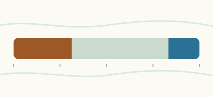 Country, Germany Are the rivers and lakes in Germany unusually low or high? Every river and lake we follow in Germany, against normal for the date.
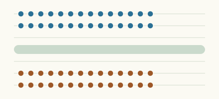 Today's list, Germany Which places in Germany are furthest from normal today? The places in Germany furthest below and above normal today.
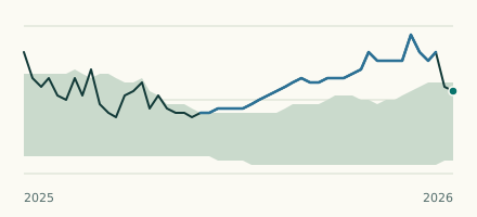 River gauge, Germany Is the Mühlenbach (Schafstedt) unusually high at Schafstedt? Level now, history, the same date in past years and each year's range.
 Records, world Which places have set a new record low or high? Record lows and highs in our data, and the newest set.
Sources
- Landesamt für Landwirtschaft, Umwelt und ländliche Räume Schleswig-Holstein (LLUR-SH), names and waters edited (source). Licence: Data licence Germany, attribution, version 2.0