British Columbia river levels today
Are the rivers and lakes in British Columbia unusually low or high?
We follow 425 water level gauges in British Columbia. 105 gauges read below their normal range for the date and 15 gauges above it.
How many gauges do we follow in British Columbia?
425 Water Survey of Canada level gauges of the 2,148 we follow in Canada, as of 26 October 2026.
How many waters in British Columbia have a level gauge?
340 waters with a level gauge, of the 1,635 waters we follow in Canada, as of 26 October 2026.
How many gauges read below normal for the date?
105 gauges below their normal range, of the 359 gauges with a current reading and a normal range for the date, as of 26 October 2026.
How many gauges read above normal for the date?
15 gauges above their normal range, of the 359 gauges with a current reading and a normal range for the date, as of 26 October 2026.
How the places stand today
105 places below normal and 15 places above
Which places are furthest below normal?
More places
Which places are furthest above normal?
More places
Which gauges do we follow in British Columbia?
| Place | Reading | Against normal for the date | Change in a day |
|---|---|---|---|
| Adams Lake (British Columbia) | |||
| Squilax | 1.702 m | within the normal range for the date | +0.003 m |
| Akie River | |||
| 760 M Contour | 7.395 m | within the normal range for the date | +0.01 m |
| Alouette River | |||
| Haney | 0.757 m | within the normal range for the date | -0.011 m |
| Anderson Creek | |||
| Nelson | 0.028 m | ||
| Ansedagan Creek | |||
| New Aiyansh | 4.439 m | within the normal range for the date | -0.007 m |
| Arrow Creek | |||
| Erickson | 0.296 m | within the normal range for the date | 0 m |
| Arrow Reservoir | |||
| Fauquier | 436.225 m | within the normal range for the date | +0.087 m |
| Nakusp | 436.16 m | within the normal range for the date | +0.076 m |
| Arrowstone Creek | |||
| Mouth | 1.74 m | within the normal range for the date | +0.004 m |
| Ash River | |||
| Moran Creek (downstream) | 0.596 m | in the lowest 5 percent for the date | -0.006 m |
| Ashnola River | |||
| Keremeos | 1.06 m | within the normal range for the date | +0.008 m |
| Atlin Lake | |||
| Atlin | 2.098 m | within the normal range for the date | -0.02 m |
| Atnarko River | |||
| Mouth | 1.023 m | within the normal range for the date | -0.008 m |
| B.x. Creek | |||
| B.x. Ranch Park | 4.882 m | -0.018 m | |
| Swan Lake Control Dam (downstream) | 4.047 m | -0.006 m | |
| Babine Lake | |||
| Topley Landing | 0.913 m | within the normal range for the date | -0.001 m |
| Babine River | |||
| Babine | 0.678 m | within the normal range for the date | +0.003 m |
| Outlet of Nilkitkwa Lake | 0.215 m | in the lowest 10 percent for the date | -0.006 m |
| Baker Creek (British Columbia) | |||
| Quesnel | 1.58 m | within the normal range for the date | +0.008 m |
| Barriere River | |||
| Mouth | 2.552 m | within the normal range for the date | -0.006 m |
| Sprague Creek (downstream) | 0.065 m | in the lowest 10 percent for the date | -0.004 m |
| Beatton River | |||
| Fort St. John | 2.102 m | within the normal range for the date | -0.037 m |
| Tommy Lakes Road | 95.219 m | +0.013 m | |
| Beaver River (British Columbia) | |||
| Cupola Creek (upstream) | 1.777 m | -0.001 m | |
| Belgo Creek | |||
| Hilda Creek (downstream) | 1.142 m | within the normal range for the date | -0.001 m |
| Bella Coola River | |||
| Hammer Creek (upstream) | 2.034 m | within the normal range for the date | -0.044 m |
| Thorsen Creek (downstream) | 7.481 m | -0.041 m | |
| Bessette Creek | |||
| Beaverjack Creek (upstream) | 0.401 m | lower than any day of these dates in 14 years | 0 m |
| Lumby Lagoon Outfall (upstream) | 0.154 m | in the lowest 5 percent for the date | -0.002 m |
| Big Creek (British Columbia) | |||
| Graveyard Creek (downstream) | 0.75 m | within the normal range for the date | -0.016 m |
| Groundhog Creek (upstream) | 0.712 m | within the normal range for the date | +0.006 m |
| Big Sheep Creek | |||
| Rossland | 0.399 m | within the normal range for the date | +0.001 m |
| Bings Creek | |||
| Mouth | 1.383 m | in the lowest 5 percent for the date | -0.035 m |
| Blaeberry River | |||
| Willowbank Creek (upstream) | 0.877 m | within the normal range for the date | -0.003 m |
| Blue River | |||
| Blue River | 0.734 m | in the lowest 10 percent for the date | -0.007 m |
| Blueberry River | |||
| Aitken Creek (downstream) | 2.111 m | within the normal range for the date | -0.006 m |
| Bonaparte River | |||
| Cache Creek (downstream) | 1.338 m | in the lowest 10 percent for the date | -0.002 m |
| Bougie Creek | |||
| Kilometre 368 Alaska Highway | 1.642 m | within the normal range for the date | -0.044 m |
| Boundary Creek | |||
| Boundary Falls | 1.318 m | -0.001 m | |
| Bowron River | |||
| Box Canyon (downstream) | 3.786 m | within the normal range for the date | -0.017 m |
| Bridge Creek | |||
| Deka Creek (downstream) | 3.499 m | lower than any day of these dates in 14 years | -0.004 m |
| Bridge River | |||
| Downton Lake (upstream) | 0.776 m | within the normal range for the date | -0.013 m |
| Lajoie Dam (downstream) | 2.172 m | +0.008 m | |
| Bridge River (South Branch) | |||
| Bridge Glacier (downstream) | 0.845 m | within the normal range for the date | -0.017 m |
| Browns River | |||
| Courtenay | 6.242 m | within the normal range for the date | +0.197 m |
| Buck Creek | |||
| Mouth | 0.364 m | within the normal range for the date | -0.088 m |
| Bulkley River | |||
| Houston | 0.514 m | within the normal range for the date | -0.001 m |
| Quick | 0.452 m | within the normal range for the date | -0.023 m |
| Smithers | 3.026 m | within the normal range for the date | -0.033 m |
| Bull River | |||
| Wardner | 1.153 m | within the normal range for the date | -0.007 m |
| Burrell Creek | |||
| Gloucester Creek (upstream) | 1.366 m | within the normal range for the date | +0.002 m |
| Buttle Lake | |||
| Upper Campbell Lake (upstream) | 214.233 m | lower than any day of these dates in 14 years | +0.038 m |
| Cameron River (British Columbia) | |||
| Upper Halfway Road | 44.601 m | -0.001 m | |
| Camp Creek (British Columbia) | |||
| Mouth near Thirsk | 0.836 m | in the lowest 5 percent for the date | +0.005 m |
| Campbell River | |||
| Argonaut Wharf | 3.671 m | +0.496 m | |
| Campbell River Cableway | 4.243 m | +0.001 m | |
| Campbell River Lodge | 0.809 m | in the highest 10 percent for the date | +0.406 m |
| Canoe River (British Columbia) | |||
| Kimmel Creek (downstream) | 1.713 m | within the normal range for the date | -0.01 m |
| Capilano River | |||
| Canyon | 0.529 m | +0.007 m | |
| Eastcap Creek (upstream) | 1.785 m | +0.075 m | |
| Intake (upstream) | 1.049 m | within the normal range for the date | +0.102 m |
| Carbon Creek | |||
| Mouth | 4.258 m | within the normal range for the date | -0.02 m |
| Carnation Creek | |||
| Mouth | 0.129 m | within the normal range for the date | +0.02 m |
| Cayoosh Creek | |||
| Lillooet | 1.089 m | in the highest 10 percent for the date | +0.002 m |
| Cedar Creek (British Columbia) | |||
| Mouth (upstream) | 1.466 m | in the lowest 10 percent for the date | +0.007 m |
| Chase Creek | |||
| Mouth (upstream) | 0.504 m | in the lowest 5 percent for the date | +0.005 m |
| Cheakamus River | |||
| Brackendale | 0.792 m | in the lowest 5 percent for the date | -0.01 m |
| Millar Creek (upstream) | 1.783 m | lower than any day of these dates in 15 years | -0.016 m |
| Chehalis River | |||
| Harrison Mills | 8.929 m | within the normal range for the date | +0.054 m |
| Chemainus River | |||
| Westholme | 0.656 m | within the normal range for the date | +0.013 m |
| Cheslatta Lake | |||
| West End | 2.763 m | within the normal range for the date | +0.01 m |
| Chilcotin River | |||
| Hanceville | 2.523 m | -0.015 m | |
| Chilko River | |||
| Outlet of Chilko Lake | 1.005 m | within the normal range for the date | +0.01 m |
| Redstone | 1.005 m | within the normal range for the date | -0.017 m |
| Chilliwack River | |||
| Outlet of Chilliwack Lake | 0.297 m | in the lowest 5 percent for the date | +0.006 m |
| Slesse Creek (upstream) | 0.382 m | in the lowest 5 percent for the date | +0.011 m |
| Vedder Crossing | 1.397 m | in the lowest 5 percent for the date | +0.003 m |
| Chuchinka Creek | |||
| Mouth | 3.067 m | within the normal range for the date | -0.019 m |
| Clarence Creek | |||
| Rosswood | 2.173 m | in the lowest 10 percent for the date | -0.009 m |
| Clark Creek | |||
| Winfield | 0.81 m | in the lowest 10 percent for the date | +0.001 m |
| Clearwater River (British Columbia) | |||
| Clearwater Station | 2.353 m | within the normal range for the date | -0.02 m |
| Clowhom River | |||
| Clowhom Lake | 2.627 m | lower than any day of these dates in 15 years | 0 m |
| Coldstream Creek | |||
| Coldstream Creek Road | 4.201 m | 0 m | |
| Coldwater River (British Columbia) | |||
| Brookmere | 2.395 m | within the normal range for the date | +0.001 m |
| Merritt | 1.087 m | within the normal range for the date | +0.01 m |
| Columbia River | |||
| Birchbank | 2.873 m | within the normal range for the date | +0.001 m |
| Donald | 0.891 m | within the normal range for the date | -0.009 m |
| Nicholson | 0.516 m | within the normal range for the date | -0.007 m |
| Comox Harbour | |||
| Goose Spit | 5.922 m | +0.44 m | |
| Comox Lake | |||
| Courtenay | 131.136 m | in the lowest 10 percent for the date | -0.002 m |
| Coquihalla River | |||
| Alexander Creek (upstream) | 1.342 m | in the lowest 10 percent for the date | +0.011 m |
| Needle Creek (downstream) | 1.803 m | lower than any day of these dates in 14 years | +0.002 m |
| Coquitlam Lake | |||
| Forebay | 44.579 m | within the normal range for the date | -0.056 m |
| Coquitlam River | |||
| Coquitlam Lake (upstream) | 1.724 m | within the normal range for the date | +0.037 m |
| Port Coquitlam | 7.986 m | within the normal range for the date | +0.004 m |
| Corning Creek | |||
| Squilax | 0.892 m | within the normal range for the date | -0.015 m |
| Cottonwood Creek (British Columbia) | |||
| Headwaters | 0.732 m | within the normal range for the date | +0.028 m |
| Cottonwood River | |||
| Bass Creek (upstream) | 0.747 m | within the normal range for the date | +0.046 m |
| Courtenay River | |||
| 5TH Street Bridge | 2.811 m | +0.415 m | |
| Cowichan Lake | |||
| Lake Cowichan | 0.50 m | within the normal range for the date | +0.026 m |
| Cowichan River | |||
| Duncan | 0.327 m | in the lowest 5 percent for the date | -0.013 m |
| Lake Cowichan | 0.306 m | lower than any day of these dates in 14 years | 0 m |
| Cranberry Creek | |||
| B.c. Hydro Intake (upstream) | 24.198 m | in the lowest 10 percent for the date | -0.007 m |
| Cranberry River | |||
| Cranberry Junction | 2.516 m | -0.023 m | |
| Crest Lake | |||
| Highway 28 | 1.091 m | within the normal range for the date | -0.044 m |
| Criss Creek | |||
| Savona | -0.33 m | lower than any day of these dates in 14 years | -0.004 m |
| Cruickshank River | |||
| Mouth | 4.152 m | within the normal range for the date | +0.051 m |
| Dairy Creek | |||
| Tsotin Lake (upstream) | 0.249 m | within the normal range for the date | -0.001 m |
| Dash Creek | |||
| Churn Creek (upstream) | 3.312 m | within the normal range for the date | -0.008 m |
| Deadman River | |||
| Criss Creek (upstream) | 4.262 m | higher than any day of these dates in 14 years | -0.004 m |
| Dean River | |||
| Tanswanket Creek (downstream) | 1.016 m | within the normal range for the date | -0.005 m |
| Deer Creek | |||
| Deer Park | 0.133 m | within the normal range for the date | 0 m |
| Dickebusch Creek | |||
| Mouth | 1.217 m | in the highest 5 percent for the date | +0.024 m |
| Dore River (British Columbia) | |||
| McBride | 1.145 m | within the normal range for the date | +0.014 m |
| Douglas Lake | |||
| Spaxomin | 1.348 m | -0.004 m | |
| Dove Creek | |||
| Mouth | 1.323 m | within the normal range for the date | +0.072 m |
| Driftwood River (British Columbia) | |||
| Kastberg Creek (upstream) | 1.556 m | within the normal range for the date | -0.026 m |
| Duhamel Creek | |||
| Diversions (upstream) | 0.625 m | within the normal range for the date | -0.001 m |
| Duncan Reservoir | |||
| Duncan Dam | 571.903 m | within the normal range for the date | -0.081 m |
| Duncan River | |||
| B.b. Creek (downstream) | 1.309 m | in the lowest 10 percent for the date | -0.011 m |
| Lardeau River (downstream) | 1.937 m | within the normal range for the date | -0.003 m |
| Eagle River (British Columbia) | |||
| Malakwa | 1.112 m | in the lowest 5 percent for the date | 0 m |
| East Canoe Creek | |||
| Dam (upstream) | 0.027 m | within the normal range for the date | -0.001 m |
| Elaho River | |||
| Mouth | 2.843 m | in the lowest 5 percent for the date | -0.023 m |
| Elk River (Fernie) | |||
| Elko Dam Diversion (downstream) | 1.718 m | within the normal range for the date | -0.01 m |
| Elko Dam Forebay | 8.865 m | -0.01 m | |
| Fernie | 1.628 m | within the normal range for the date | -0.003 m |
| Natal | 0.484 m | in the highest 5 percent for the date | -0.008 m |
| Elk River (Vancouver Island) | |||
| Campbell Lake (upstream) | 4.535 m | within the normal range for the date | +0.051 m |
| Englishman River | |||
| Parksville | 1.01 m | in the lowest 10 percent for the date | +0.056 m |
| Eve River | |||
| Kunnum Creek (downstream) | 3.228 m | -0.059 m | |
| Ewart Creek | |||
| Cathedral Park | 0.903 m | within the normal range for the date | -0.007 m |
| Finlay River | |||
| Akie River (upstream) | 0.507 m | within the normal range for the date | -0.054 m |
| Fishtrap Creek (British Columbia) | |||
| International Boundary | 3.546 m | in the highest 10 percent for the date | +0.021 m |
| Fishtrap Creek (McLure) | |||
| McLure | 1.96 m | in the highest 10 percent for the date | -0.008 m |
| Fitzsimmons Creek | |||
| Blackcomb Creek (downstream) | 5.55 m | within the normal range for the date | -0.004 m |
| Flatbed Creek | |||
| Kilometre 110 Heritage Highway | 8.151 m | within the normal range for the date | -0.038 m |
| Fording River | |||
| Mouth | 1.902 m | in the highest 10 percent for the date | -0.004 m |
| Fraser River | |||
| Albion | 3.851 m | -0.072 m | |
| Big Bar Creek | 4.952 m | -0.072 m | |
| Deas Island Tunnel | 1.929 m | +0.42 m | |
| Hansard | 2.468 m | within the normal range for the date | -0.057 m |
| Hope | 3.664 m | in the lowest 10 percent for the date | -0.04 m |
| Marguerite | 2.605 m | within the normal range for the date | -0.047 m |
| McBride | 3.681 m | within the normal range for the date | -0.032 m |
| Mission | 0.979 m | within the normal range for the date | -0.218 m |
| Port Mann Pumping Station | 3.988 m | higher than any day of these dates in 10 years | +0.16 m |
| Red Pass | 2.178 m | within the normal range for the date | -0.023 m |
| Shelley | 1.976 m | within the normal range for the date | -0.083 m |
| South Fort George | 4.297 m | ||
| Steveston | 4.257 m | +0.391 m | |
| Texas Creek (upstream) | 1.285 m | within the normal range for the date | -0.048 m |
| Garbage Creek | |||
| Mouth | 0.325 m | in the lowest 10 percent for the date | -0.013 m |
| Goathorn Creek | |||
| Telkwa | 1.225 m | within the normal range for the date | -0.013 m |
| Gold River (Columbia) | |||
| Palmer Creek (upstream) | 1.294 m | ||
| Gold River (Vancouver Island) | |||
| Ucona River (downstream) | 1.169 m | within the normal range for the date | -0.136 m |
| Goldstream River | |||
| Old Camp Creek (downstream) | 1.405 m | in the lowest 5 percent for the date | -0.004 m |
| Graham River | |||
| Colt Creek (upstream) | -0.139 m | within the normal range for the date | -0.045 m |
| Granby River | |||
| Grand Forks | 0.846 m | within the normal range for the date | 0 m |
| Greata Creek | |||
| Mouth | 1.052 m | within the normal range for the date | -0.005 m |
| Greeley Creek | |||
| Diversion (upstream) | 4.452 m | -0.002 m | |
| Guichon Creek | |||
| Outlet of Mamit Lake | 2.234 m | in the lowest 10 percent for the date | -0.005 m |
| Tunkwa Lake Diversion (upstream) | 0.196 m | in the lowest 5 percent for the date | -0.001 m |
| Gun Creek | |||
| Carpenter Lake (upstream) | 4.134 m | 0 m | |
| Halfway River | |||
| Farrell Creek | 0.063 m | within the normal range for the date | -0.037 m |
| Graham River (upstream) | 3.726 m | within the normal range for the date | -0.026 m |
| Harper Creek | |||
| Mouth | 0.90 m | lower than any day of these dates in 15 years | -0.003 m |
| Harris Creek | |||
| Lake Cowichan | 1.421 m | within the normal range for the date | +0.011 m |
| Harrison Lake | |||
| Harrison Hot Springs | 8.833 m | in the lowest 10 percent for the date | -0.014 m |
| Harrison River | |||
| Harrison Mills | 6.192 m | -0.046 m | |
| Morris Creek (downstream) | 8.673 m | within the normal range for the date | -0.016 m |
| Hedley Creek | |||
| Mouth | 2.057 m | within the normal range for the date | -0.032 m |
| Hidden Creek | |||
| Mouth | 0.224 m | in the lowest 5 percent for the date | -0.002 m |
| Hirsch Creek | |||
| Mouth | 0.827 m | within the normal range for the date | -0.03 m |
| Homathko River | |||
| Inlet to Tatlayoko Lake | 2.045 m | within the normal range for the date | +0.002 m |
| Mouth | 13.893 m | within the normal range for the date | -0.034 m |
| Honna River | |||
| Mouth | 1.413 m | -0.095 m | |
| Horsefly River | |||
| McKinley Creek (upstream) | 0.282 m | within the normal range for the date | -0.01 m |
| Quesnel Lake (upstream) | 4.52 m | within the normal range for the date | -0.017 m |
| Horseshoe River | |||
| Lois Lake (upstream) | 2.245 m | within the normal range for the date | +0.002 m |
| Hosmer Creek | |||
| Diversions (upstream) | 2.103 m | in the highest 5 percent for the date | -0.002 m |
| Hurley River | |||
| Lone Goat Creek (downstream) | 5.817 m | within the normal range for the date | +0.001 m |
| Icy Creek | |||
| Mouth | 2.704 m | in the lowest 5 percent for the date | -0.029 m |
| Illecillewaet River | |||
| Greeley | 1.096 m | in the lowest 5 percent for the date | -0.003 m |
| Ingenika River | |||
| Swannell River (upstream) | 2.293 m | within the normal range for the date | -0.138 m |
| Inkaneep Creek | |||
| Mouth | 1.195 m | lower than any day of these dates in 14 years | +0.002 m |
| Inonoaklin Creek | |||
| Valley Creek (upstream) | 1.342 m | within the normal range for the date | +0.001 m |
| Iskut River | |||
| Johnson River (downstream) | 0.946 m | ||
| Joe Ross Creek | |||
| Mouth | 2.321 m | within the normal range for the date | +0.001 m |
| Jump Creek | |||
| Mouth | 0.823 m | within the normal range for the date | -0.005 m |
| Kalamalka Lake | |||
| Vernon Pumphouse | 4.611 m | lower than any day of these dates in 54 years | -0.015 m |
| Kanaka Creek | |||
| Webster Corners | 0.903 m | within the normal range for the date | +0.013 m |
| Kaslo River | |||
| Kemp Creek (downstream) | 1.933 m | within the normal range for the date | -0.006 m |
| Keen Creek | |||
| Kyawats Creek (downstream) | 1.071 m | within the normal range for the date | -0.004 m |
| Kemano River | |||
| Powerhouse Tailrace (upstream) | 1.942 m | within the normal range for the date | -0.038 m |
| Keogh River | |||
| Port Hardy | 4.713 m | -0.057 m | |
| Keremeos Creek | |||
| Willis Intake (downstream) | 0.585 m | lower than any day of these dates in 14 years | -0.001 m |
| Kettle River (British Columbia) | |||
| Westbridge | 0.749 m | within the normal range for the date | -0.002 m |
| Kicking Horse River | |||
| Golden | 3.201 m | within the normal range for the date | -0.008 m |
| Kinbasket Lake | |||
| Garrett Creek (downstream) | 749.188 m | within the normal range for the date | -0.189 m |
| Kingcome River | |||
| Atlatzi River (downstream) | 3.706 m | in the lowest 10 percent for the date | -0.159 m |
| Kiskatinaw River | |||
| Borden Creek (downstream) | 8.075 m | -0.041 m | |
| Kispiox River | |||
| Hazelton | 1.023 m | within the normal range for the date | -0.041 m |
| Kitimat River | |||
| Hirsch Creek (downstream) | 0.816 m | within the normal range for the date | -0.043 m |
| Kitsumkalum River | |||
| Alice Creek (downstream) | 3.325 m | -0.078 m | |
| Kitwanga River | |||
| Kitwanga | 1.851 m | -0.02 m | |
| Klaskish River | |||
| Klaskino Inlet | 3.891 m | within the normal range for the date | -0.289 m |
| Klinaklini River East Channel (Main) | |||
| Mouth | 3.916 m | in the lowest 5 percent for the date | -0.061 m |
| Koksilah River | |||
| Cowichan Station | 0.52 m | lower than any day of these dates in 15 years | +0.012 m |
| Kootenay Lake | |||
| Kuskonook | 531.407 m | within the normal range for the date | -0.001 m |
| Queens Bay | 531.245 m | within the normal range for the date | -0.017 m |
| Kootenay River | |||
| Fort Steele | 0.599 m | within the normal range for the date | -0.01 m |
| Kootenay Crossing | 0.218 m | within the normal range for the date | -0.002 m |
| Kuskanax Creek | |||
| Nakusp | 0.337 m | within the normal range for the date | -0.008 m |
| Lambly Creek | |||
| Terrace Creek (upstream) | 1.343 m | +0.003 m | |
| Lardeau River | |||
| Marblehead | 0.839 m | within the normal range for the date | -0.009 m |
| Lemieux Creek | |||
| Mouth | 0.855 m | within the normal range for the date | -0.001 m |
| Lemon Creek | |||
| South Lemon Creek (upstream) | 0.731 m | within the normal range for the date | -0.001 m |
| Liard River | |||
| Lower Crossing | 9.375 m | within the normal range for the date | -0.078 m |
| Lillooet Lake | |||
| Pemberton | 25.066 m | in the lowest 10 percent for the date | -0.035 m |
| Lillooet River | |||
| Pemberton | 1.803 m | within the normal range for the date | -0.012 m |
| Tenas Narrows | 8.292 m | lower than any day of these dates in 10 years | -0.03 m |
| Line Creek | |||
| Mouth | 0.631 m | within the normal range for the date | -0.003 m |
| Lingfield Creek | |||
| Mouth | 0.309 m | within the normal range for the date | +0.012 m |
| Little Oyster River | |||
| Yorke Road | 0.761 m | within the normal range for the date | -0.056 m |
| Little Qualicum River | |||
| Qualicum Beach | 4.938 m | within the normal range for the date | +0.027 m |
| Little Swift River | |||
| Mouth | 1.17 m | within the normal range for the date | -0.008 m |
| Little Wedeene River | |||
| Bowbyes Creek (downstream) | 0.86 m | within the normal range for the date | -0.015 m |
| Louis Creek | |||
| Mouth | 3.595 m | 0 m | |
| M3 Creek | |||
| Smithers | 3.055 m | within the normal range for the date | -0.002 m |
| Mackay Creek | |||
| Montroyal Boulevard | 0.532 m | in the lowest 5 percent for the date | -0.053 m |
| Mamquam River | |||
| Ring Creek (upstream) | 1.223 m | in the lowest 5 percent for the date | +0.05 m |
| Marble River | |||
| Outlet of Alice Lake | 3.237 m | +0.027 m | |
| Mather Creek | |||
| Houle Creek (downstream) | 2.194 m | within the normal range for the date | -0.004 m |
| McGregor River | |||
| Lower Canyon | 1.262 m | within the normal range for the date | -0.091 m |
| McKinley Creek | |||
| Outlet of McKinley Lake (downstream) | 0.816 m | within the normal range for the date | 0 m |
| Mesilinka River | |||
| Gopherhole Creek (upstream) | 2.10 m | within the normal range for the date | -0.013 m |
| Meziadin River | |||
| Lax an Zok (upstream) | 3.292 m | -0.03 m | |
| Millstone River | |||
| Nanaimo | 1.305 m | within the normal range for the date | -0.05 m |
| Mission Creek | |||
| East Kelowna | 0.461 m | in the lowest 10 percent for the date | +0.005 m |
| Moberly River | |||
| Fort St. John | 1.977 m | higher than any day of these dates in 15 years | -0.001 m |
| Moffat Creek | |||
| Horsefly | 2.234 m | higher than any day of these dates in 14 years | -0.001 m |
| Morice River | |||
| Houston | 0.996 m | within the normal range for the date | -0.019 m |
| Morkill River | |||
| Hellroaring Creek (downstream) | 1.588 m | within the normal range for the date | +0.008 m |
| Moyie River | |||
| Noke Creek (upstream) | 1.792 m | -0.006 m | |
| Murray River | |||
| Mouth | 7.818 m | within the normal range for the date | -0.037 m |
| Wolverine River (upstream) | 1.362 m | within the normal range for the date | -0.041 m |
| Muskwa River | |||
| Fort Nelson | -0.532 m | in the lowest 10 percent for the date | -0.113 m |
| Nadina Lake | |||
| Noralee | 0.62 m | within the normal range for the date | -0.012 m |
| Nadina River | |||
| Outlet of Nadina Lake | 1.012 m | within the normal range for the date | -0.008 m |
| Nahatlatch River | |||
| Tachewana Creek (downstream) | 0.748 m | in the lowest 5 percent for the date | -0.004 m |
| Nanaimo River | |||
| Cassidy | 0.795 m | within the normal range for the date | +0.046 m |
| Nanika River | |||
| Outlet of Kidprice Lake | 3.467 m | within the normal range for the date | -0.03 m |
| Nass River | |||
| Shumal Creek (upstream) | 3.759 m | within the normal range for the date | -0.109 m |
| Nation River | |||
| Fort St. James | 0.978 m | -0.015 m | |
| Mouth | 0.446 m | within the normal range for the date | -0.02 m |
| Nautley River | |||
| Fort Fraser | 1.249 m | within the normal range for the date | +0.002 m |
| Nazko River | |||
| Michelle Creek (upstream) | 0.273 m | -0.002 m | |
| Nechako Reservoir | |||
| Skins Lake Spillway | 11.599 m | within the normal range for the date | +0.004 m |
| Nechako River | |||
| Cheslatta Falls (downstream) | 0.654 m | within the normal range for the date | -0.001 m |
| Isle Pierre | 1.319 m | within the normal range for the date | -0.018 m |
| Vanderhoof | 1.659 m | within the normal range for the date | -0.004 m |
| Nicola Lake | |||
| Quilchena | 1.891 m | in the lowest 10 percent for the date | +0.001 m |
| Nicola River | |||
| Outlet of Nicola Lake | 0.964 m | lower than any day of these dates in 15 years | -0.003 m |
| Shackan (south) | 2.957 m | +0.012 m | |
| Nicomekl River | |||
| 203 Street, Langley | 0.933 m | within the normal range for the date | -0.111 m |
| Nile Creek | |||
| Bowser | 1.346 m | ||
| Nimpkish River | |||
| Woss River (upstream) | 0.707 m | within the normal range for the date | -0.002 m |
| Nordic Creek | |||
| Outlet of Nordic Glacier | 3.003 m | within the normal range for the date | -0.003 m |
| North Alouette River | |||
| 232ND Street, Maple Ridge | 0.221 m | within the normal range for the date | +0.039 m |
| North Arm Fraser River | |||
| Vancouver | 4.266 m | +0.362 m | |
| North Thompson River | |||
| Birch Island | 0.444 m | in the lowest 10 percent for the date | -0.027 m |
| McLure | 0.886 m | within the normal range for the date | -0.023 m |
| Okanagan Lake | |||
| Kelowna | 1.11 m | lower than any day of these dates in 82 years | +0.007 m |
| Okanagan River | |||
| McIntyre Dam (downstream) | 1.176 m | in the lowest 5 percent for the date | -0.001 m |
| Okanagan Falls | 1.37 m | in the lowest 5 percent for the date | -0.002 m |
| Oliver | 0.628 m | in the lowest 10 percent for the date | +0.002 m |
| Penticton | 1.613 m | within the normal range for the date | +0.001 m |
| Omineca River | |||
| Osilinka River (upstream) | 1.96 m | within the normal range for the date | -0.042 m |
| Or Creek | |||
| Coquitlam | 3.265 m | in the lowest 5 percent for the date | -0.067 m |
| Osilinka River | |||
| End Lake | 2.298 m | within the normal range for the date | -0.031 m |
| Ospika River | |||
| Aley Creek (upstream) | 1.365 m | within the normal range for the date | -0.013 m |
| Owikeno Lake | |||
| Rivers Inlet | 1.956 m | within the normal range for the date | -0.064 m |
| Oyster River | |||
| Woodhus Creek (downstream) | 0.779 m | lower than any day of these dates in 14 years | +0.085 m |
| Pack River | |||
| Outlet of McLeod Lake | 0.804 m | within the normal range for the date | -0.016 m |
| Pallant Creek | |||
| Daajing Giids | 1.715 m | within the normal range for the date | -0.031 m |
| Parsnip River | |||
| Misinchinka River (upstream) | 1.367 m | within the normal range for the date | -0.043 m |
| Pasayten River | |||
| Calcite Creek (upstream) | 0.849 m | lower than any day of these dates in 14 years | +0.004 m |
| Peace River | |||
| Alces River (upstream) | 3.476 m | within the normal range for the date | -0.03 m |
| Pine River (upstream) | 1.822 m | in the highest 10 percent for the date | +0.008 m |
| Taylor | 3.168 m | in the highest 10 percent for the date | -0.015 m |
| Pearson Creek | |||
| Mouth | 1.286 m | -0.001 m | |
| Pemberton Creek | |||
| Pemberton | 1.809 m | lower than any day of these dates in 13 years | +0.004 m |
| Pennask Creek | |||
| Quilchena | 0.377 m | in the lowest 5 percent for the date | -0.003 m |
| Pepin Creek | |||
| International Boundary | 1.199 m | in the lowest 10 percent for the date | +0.001 m |
| Petitot River | |||
| Highway No. 77 (downstream) | 5.635 m | within the normal range for the date | -0.041 m |
| Pine River (British Columbia) | |||
| East Pine | 2.287 m | within the normal range for the date | -0.081 m |
| Pinkut Creek | |||
| Tintagel | 0.846 m | in the lowest 10 percent for the date | -0.007 m |
| Pitt River | |||
| Port Coquitlam | 3.636 m | +0.024 m | |
| Pouce Coupe River | |||
| Henderson Creek (downstream) | 10.10 m | within the normal range for the date | -0.061 m |
| Pugh Creek | |||
| Nahwitti Lake | 4.353 m | within the normal range for the date | -0.239 m |
| Puntledge River | |||
| Courtenay | 19.93 m | in the lowest 10 percent for the date | +0.079 m |
| Diversion (downstream) | 120.455 m | in the lowest 10 percent for the date | -0.017 m |
| Quesnel Lake | |||
| Likely | 0.463 m | within the normal range for the date | -0.009 m |
| Quesnel River | |||
| Quesnel | 1.819 m | within the normal range for the date | -0.022 m |
| Quilchena Creek | |||
| Quilchena | 2.129 m | +0.004 m | |
| Quinsam Diversion | |||
| Campbell River | 1.008 m | in the lowest 10 percent for the date | -0.006 m |
| Quinsam River | |||
| Argonaut Bridge | 0.457 m | lower than any day of these dates in 15 years | 0 m |
| Campbell River | 0.756 m | in the lowest 10 percent for the date | -0.006 m |
| Diversion Headpond | 302.658 m | +0.082 m | |
| Lower Quinsam Lake (downstream) | 2.238 m | in the lowest 10 percent for the date | +0.031 m |
| Redfish Creek | |||
| Harrop | 4.651 m | within the normal range for the date | 0 m |
| Renegade Creek | |||
| Kitimat | 2.371 m | within the normal range for the date | -0.008 m |
| Renfrew Creek | |||
| Port Renfrew | 1.383 m | within the normal range for the date | +0.074 m |
| Revelstoke Reservoir | |||
| Martha Creek | 26.865 m | +0.016 m | |
| Roberts Creek | |||
| Roberts Creek | 0.457 m | within the normal range for the date | -0.042 m |
| Ryan River | |||
| Pemberton Meadows | 17.70 m | -0.007 m | |
| Salloomt River | |||
| Hagensborg | 0.039 m | within the normal range for the date | -0.016 m |
| Salmo River | |||
| Salmo | 0.478 m | in the lowest 5 percent for the date | -0.003 m |
| Salmon River (Falkland) | |||
| Falkland | 0.562 m | within the normal range for the date | -0.001 m |
| Salmon Arm | -0.201 m | lower than any day of these dates in 15 years | -0.003 m |
| Salmon River (Langley) | |||
| 72 Avenue, Langley | 1.653 m | within the normal range for the date | -0.003 m |
| Salmon River (Prince George) | |||
| Prince George | 1.138 m | within the normal range for the date | -0.011 m |
| Salmon River (Sayward) | |||
| Memekay River (upstream) | 0.729 m | within the normal range for the date | -0.013 m |
| Sayward | 1.75 m | lower than any day of these dates in 13 years | -0.018 m |
| San Jose River | |||
| Borland Creek (upstream) | 1.873 m | in the lowest 10 percent for the date | 0 m |
| San Josef River | |||
| Sharp Creek (downstream) | 2.775 m | within the normal range for the date | -0.441 m |
| San Juan River | |||
| Port Renfrew | 2.332 m | within the normal range for the date | +0.122 m |
| Sarita River | |||
| Bamfield | 1.603 m | within the normal range for the date | +0.056 m |
| Seton River | |||
| Lillooet | 0.999 m | within the normal range for the date | +0.006 m |
| Seymour River (North Vancouver) | |||
| Lakehead (upstream) | 9.089 m | in the lowest 10 percent for the date | +0.081 m |
| North Vancouver | 0.899 m | within the normal range for the date | -0.03 m |
| Orchid Creek (downstream) | 1.795 m | within the normal range for the date | +0.018 m |
| Seymour River (Seymour Arm) | |||
| Seymour Arm | 0.543 m | in the lowest 5 percent for the date | -0.004 m |
| Shatford Creek | |||
| Penticton | 1.06 m | in the lowest 5 percent for the date | +0.004 m |
| Sheridan Creek | |||
| McLeese Lake (upstream) | 0.12 m | lower than any day of these dates in 14 years | 0 m |
| Shuswap Lake | |||
| Blind Bay | 344.992 m | -0.015 m | |
| Shuswap River | |||
| Enderby | 1.862 m | within the normal range for the date | -0.006 m |
| Lumby | 3.525 m | within the normal range for the date | -0.005 m |
| Outlet of Sugar Lake Reservoir | 1.88 m | within the normal range for the date | -0.002 m |
| Sikanni Chief River | |||
| Fort Nelson | 0.962 m | within the normal range for the date | -0.051 m |
| Similkameen River | |||
| Goodfellow Creek (upstream) | 0.552 m | in the lowest 5 percent for the date | +0.006 m |
| Hedley | 0.634 m | lower than any day of these dates in 13 years | +0.008 m |
| Princeton | 0.491 m | lower than any day of these dates in 14 years | +0.003 m |
| Simpson Creek (British Columbia) | |||
| Mouth | 0.356 m | within the normal range for the date | -0.002 m |
| Simpson Creek (Koprino Harbour) | |||
| Koprino Harbour | 0.676 m | within the normal range for the date | -0.077 m |
| Siwash Creek | |||
| Princeton | 0.693 m | ||
| Skagit River | |||
| Klesilkwa River (upstream) | 5.411 m | +0.002 m | |
| Skaha Lake | |||
| Okanagan Falls | 2.412 m | within the normal range for the date | -0.002 m |
| Skeena River | |||
| Babine River (upstream) | 6.671 m | within the normal range for the date | -0.113 m |
| Glen Vowell | 1.153 m | within the normal range for the date | -0.131 m |
| Usk | 5.218 m | in the highest 5 percent for the date | -0.122 m |
| Slesse Creek | |||
| Vedder Crossing | 0.251 m | in the lowest 5 percent for the date | +0.019 m |
| Slocan River | |||
| Crescent Valley | 0.709 m | within the normal range for the date | -0.011 m |
| Smith River | |||
| Mouth | 1.064 m | within the normal range for the date | -0.012 m |
| Somass River | |||
| Alberni | 1.539 m | +0.006 m | |
| South Nanaimo River | |||
| Junction | 2.362 m | within the normal range for the date | +0.061 m |
| South Thompson River | |||
| Chase | 1.285 m | within the normal range for the date | 0 m |
| Southgate River | |||
| Elliot Creek (upstream) | 8.374 m | -0.038 m | |
| Spillimacheen River | |||
| Spillimacheen | 0.384 m | within the normal range for the date | +0.004 m |
| Spius Creek | |||
| Canford | 0.762 m | lower than any day of these dates in 12 years | +0.006 m |
| Sproat River | |||
| Alberni | 0.902 m | in the lowest 10 percent for the date | +0.018 m |
| Squamish River | |||
| Brackendale | 1.808 m | in the lowest 5 percent for the date | -0.01 m |
| St. Mary River (British Columbia) | |||
| Morris Creek (downstream) | 1.367 m | within the normal range for the date | -0.006 m |
| Stave River | |||
| Stave Lake (upstream) | 1.966 m | in the lowest 5 percent for the date | +0.01 m |
| Stawamus River | |||
| Highway No. 99 | 1.71 m | within the normal range for the date | +0.075 m |
| Stellako River | |||
| Glenannan | 1.64 m | within the normal range for the date | -0.026 m |
| Stikine River | |||
| Telegraph Creek | 1.336 m | within the normal range for the date | -0.192 m |
| Stuart River | |||
| Fort St. James | 0.867 m | within the normal range for the date | -0.007 m |
| Sugar Lake Reservoir | |||
| Outlet | 7.506 m | in the lowest 10 percent for the date | -0.04 m |
| Sukunka River | |||
| Mouth | 2.472 m | -0.044 m | |
| Sumas River | |||
| Huntingdon | 1.269 m | within the normal range for the date | +0.009 m |
| Surprise Creek | |||
| Mouth | 0.95 m | within the normal range for the date | -0.018 m |
| Swift River | |||
| Swift River | 0.568 m | within the normal range for the date | -0.051 m |
| Tahltan River | |||
| Mouth | 3.797 m | -0.037 m | |
| Tarundl Creek | |||
| Daajing Giids | 1.018 m | -0.053 m | |
| Taseko River | |||
| Outlet of Taseko Lakes | 1.524 m | within the normal range for the date | -0.011 m |
| Teeter Creek | |||
| Mouth | 7.629 m | within the normal range for the date | +0.007 m |
| Telkwa River | |||
| Tsai Creek (downstream) | 0.535 m | within the normal range for the date | -0.022 m |
| Thautil Corner Creek | |||
| Morice Lake | 1.224 m | within the normal range for the date | -0.002 m |
| Theodosia River | |||
| Diversion Bypass | 6.799 m | within the normal range for the date | -0.007 m |
| Olsen Lake Diversion (downstream) | 3.745 m | within the normal range for the date | +0.002 m |
| Scotty Creek (upstream) | 3.382 m | within the normal range for the date | +0.011 m |
| Theodosia River Diversion | |||
| Olsen Lake (upstream) | 9.542 m | within the normal range for the date | -0.018 m |
| Thompson River | |||
| Kamloops | 2.279 m | in the lowest 5 percent for the date | -0.023 m |
| Savona | 10.316 m | -0.017 m | |
| Spences Bridge | 1.059 m | within the normal range for the date | -0.03 m |
| Toad River | |||
| Nonda Creek (upstream) | 1.302 m | within the normal range for the date | -0.036 m |
| Tofino Creek | |||
| Mouth | 1.524 m | within the normal range for the date | -0.003 m |
| Trapping Creek | |||
| Mouth | 0.667 m | in the lowest 10 percent for the date | +0.002 m |
| Trout Creek (British Columbia) | |||
| Mouth | 3.142 m | +0.001 m | |
| Trout River (British Columbia) | |||
| Kilometre 783.7 Alaska Highway | 2.13 m | in the lowest 5 percent for the date | -0.003 m |
| Tsilcoh River | |||
| Mouth | 3.224 m | within the normal range for the date | -0.004 m |
| Tsitika River | |||
| Catherine Creek (downstream) | 1.678 m | within the normal range for the date | -0.165 m |
| Tsolum River | |||
| Courtenay | 1.011 m | within the normal range for the date | +0.356 m |
| Tulameen River | |||
| Princeton | 0.182 m | in the lowest 10 percent for the date | +0.011 m |
| Vuich Creek (downstream) | 0.70 m | within the normal range for the date | +0.004 m |
| Tutshi River | |||
| Outlet of Tutshi Lake | 11.02 m | within the normal range for the date | -0.007 m |
| Tuya River | |||
| Telegraph Creek | 0.71 m | within the normal range for the date | -0.045 m |
| Twain Creek Tributary | |||
| Babine Lake | 1.927 m | within the normal range for the date | -0.012 m |
| Two Mile Creek | |||
| District Lot 4834 | 0.306 m | in the lowest 10 percent for the date | 0 m |
| Upper Campbell Lake | |||
| Strathcona Dam | 214.289 m | lower than any day of these dates in 15 years | +0.021 m |
| Vance Creek | |||
| Deafies Creek (downstream) | 0.146 m | within the normal range for the date | -0.002 m |
| Vaseux Creek | |||
| Solco Creek (upstream) | 0.924 m | lower than any day of these dates in 11 years | +0.001 m |
| Vaseux Lake | |||
| Outlet | 7.86 m | within the normal range for the date | 0 m |
| Vernon Creek | |||
| Mouth | 0.059 m | -0.012 m | |
| Outlet of Kalamalka Lake | 0.30 m | lower than any day of these dates in 14 years | -0.019 m |
| Swalwell Park | 2.801 m | +0.002 m | |
| Wakeman River | |||
| Atwaykellesse River (downstream) | 3.223 m | within the normal range for the date | -0.148 m |
| West Creek | |||
| Fort Langley | 1.905 m | within the normal range for the date | +0.025 m |
| West Kettle River | |||
| McCulloch | 1.169 m | in the lowest 10 percent for the date | +0.012 m |
| Westbridge | 0.608 m | in the lowest 5 percent for the date | -0.001 m |
| West Road River | |||
| Cinema | -0.659 m | within the normal range for the date | -0.004 m |
| Whatshan River | |||
| Barnes Creek (downstream) | 3.293 m | -0.001 m | |
| Whiteman Creek | |||
| Bouleau Creek (upstream) | 0.627 m | lower than any day of these dates in 13 years | +0.001 m |
| Whitesail Middle Creek | |||
| Tahtsa Reach | 1.94 m | within the normal range for the date | -0.003 m |
| Williston Lake | |||
| Lost Cabin Creek | 39.522 m | within the normal range for the date | -0.056 m |
| Schooler Creek | 39.525 m | within the normal range for the date | -0.019 m |
| Witches Brook | |||
| Merritt | 1.014 m | -0.001 m | |
| Wokas Lake | |||
| Campbell River | 2.352 m | in the lowest 10 percent for the date | +0.009 m |
| Yakoun River | |||
| Port Clements | 1.245 m | within the normal range for the date | -0.205 m |
| Yalakom River | |||
| Ore Creek (upstream) | 1.16 m | within the normal range for the date | -0.003 m |
| Zeballos River | |||
| Mook Peak | 1.634 m | within the normal range for the date | -0.118 m |
| Zeballos | 1.773 m | within the normal range for the date | -0.112 m |
| Zymoetz River | |||
| O.k. Creek (upstream) | 0.647 m | in the lowest 5 percent for the date | -0.047 m |
Keep exploring
 Country, Canada Are the rivers and lakes in Canada unusually low or high? Every river and lake we follow in Canada, against normal for the date.
 Today's list, Canada Which places in Canada are furthest from normal today? The places in Canada furthest below and above normal today.
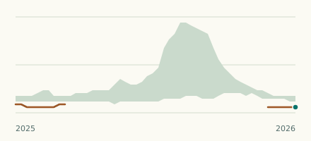 River gauge, Canada Is the Nicola River unusually low at Outlet of Nicola Lake? Level now, history, the same date in past years and each year's range.
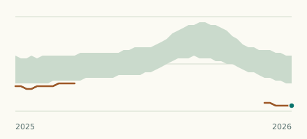 Lake gauge, Canada Is the Kalamalka Lake unusually low at Vernon Pumphouse? Level now, history, the same date in past years and each year's range.
Sources
- Data Source: Environment and Climate Change Canada (Water Survey of Canada) (source). Licence: ECCC Data Services End-use Licence v2.1.1