Vermont river levels today
Are the rivers and lakes in Vermont unusually low or high?
We follow 44 water level gauges in Vermont. 1 gauge reads below its normal range for the date and none above it.
How many gauges do we follow in Vermont?
44 gauges of the 7,007 we follow in the United States, as of 21 November 2026.
How many waters in Vermont have a level gauge?
34 waters with a level gauge, of the 3,733 waters we follow in the United States, as of 21 November 2026.
How many gauges read below normal for the date?
1 gauge below its normal range, of the 2 gauges with a current reading and a normal range for the date, as of 21 November 2026.
How many gauges read above normal for the date?
0 gauges above their normal range, of the 2 gauges with a current reading and a normal range for the date, as of 21 November 2026.
How the places stand today
1 place below normal and 0 places above
Which places are furthest below normal?
Which gauges do we follow in Vermont?
| Place | Reading | Against normal for the date | Change in a day |
|---|---|---|---|
| Ayers Brook | |||
| Randolph | 2.28 ft | -0.01 ft | |
| Barton River | |||
| Coventry | 0.94 ft | -0.02 ft | |
| Black River | |||
| North Springfield | 2.02 ft | -0.01 ft | |
| Black River (Northern VT) | |||
| Coventry | 1.53 ft | -0.01 ft | |
| Clyde River | |||
| Newport | 3.21 ft | +0.03 ft | |
| Connecticut River | |||
| Wells River | 2.08 ft | -0.07 ft | |
| Dog River | |||
| Northfield Falls | 0.70 ft | 0 ft | |
| East Branch of the Passumpsic River | |||
| East Haven | 2.07 ft | -0.02 ft | |
| East Orange Branch | |||
| East Orange | 1.48 ft | 0 ft | |
| Lake Champlain | |||
| Burlington | 93.74 ft | within the normal range for the date | +0.02 ft |
| Lake Memphremagog | |||
| Newport | 679.49 ft | lower than any day of these dates in 95 years | -0.02 ft |
| Lamoille River | |||
| East Georgia | 2.90 ft | -0.05 ft | |
| Jeffersonville | 441.48 ft | -0.03 ft | |
| Johnson | 2.09 ft | -0.01 ft | |
| Lewis Creek | |||
| North Ferrisburg | 1.82 ft | -0.01 ft | |
| Little Otter Creek | |||
| Ferrisburg | 0.70 ft | -0.01 ft | |
| Mad River | |||
| Moretown | 2.55 ft | 0 ft | |
| Missisquoi River | |||
| East Berkshire | 2.48 ft | -0.04 ft | |
| North Troy | 1.49 ft | -0.07 ft | |
| Swanton | 1.16 ft | -0.05 ft | |
| Moose River | |||
| Victory | 3.10 ft | -0.03 ft | |
| New Haven River | |||
| Brooksville | 2.87 ft | -0.01 ft | |
| North Branch Winooski River | |||
| Montpelier Langdon St.Bridge | 508.84 ft | -0.02 ft | |
| Wrightsville | 1.38 ft | 0 ft | |
| North Springfield Dam | |||
| North Springfield | 15.54 ft | -0.01 ft | |
| Ompompanoosuc River | |||
| Union Village Dam | 6.33 ft | +0.01 ft | |
| Ottauquechee River | |||
| North Hartland | 2.21 ft | +0.10 ft | |
| West Bridgewater | 3.11 ft | -0.01 ft | |
| Otter Creek | |||
| Center Rutland | 1.92 ft | -0.03 ft | |
| Middlebury | 1.78 ft | +0.07 ft | |
| Passumpsic River | |||
| Passumpsic | 2.08 ft | -0.01 ft | |
| Pike River | |||
| East Franklin | 1.80 ft | -0.01 ft | |
| Pope Brook | |||
| North Danville | 0.38 ft | 0 ft | |
| Poultney River | |||
| Fair Haven | 2.06 ft | 0 ft | |
| Ranch Brook | |||
| Ranch Camp near Stowe 5NW | 1.11 ft | -0.02 ft | |
| Sleepers River | |||
| St. Johnsbury | 0.45 ft | 0 ft | |
| Walloomsac River | |||
| North Bennington | 1.78 ft | -0.04 ft | |
| Wells River | |||
| Wells River | 1.59 ft | -0.01 ft | |
| White River | |||
| West Hartford | 3.16 ft | 0 ft | |
| Williams River | |||
| Rockingham | 2.31 ft | -0.03 ft | |
| Winooski River | |||
| Essex Junction | 1.88 ft | -0.04 ft | |
| Lower Cabot | 1.18 ft | -0.01 ft | |
| Montpelier | 3.15 ft | +0.07 ft | |
| Waterbury | 408.22 ft | 0 ft | |
Keep exploring
 Country, United States Are the rivers and lakes in the United States unusually low or high? Every river and lake we follow here, against normal for the date.
 Today's list, United States Which places in the United States are furthest from normal today? The places in the United States furthest below and above normal today.
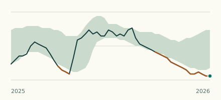 Lake gauge, United States Is Lake Memphremagog unusually low at Newport? Level now, history, the same date in past years and each year's range.
 Records, world Which places have set a new record low or high? Record lows and highs in our data, and the newest set.