Tennessee river levels today
Are the rivers and lakes in Tennessee unusually low or high?
We follow 109 water level gauges in Tennessee. 16 gauges read below their normal range for the date and none above it.
How many gauges do we follow in Tennessee?
109 gauges of the 7,007 we follow in the United States, as of 21 November 2026.
How many waters in Tennessee have a level gauge?
54 waters with a level gauge, of the 3,733 waters we follow in the United States, as of 21 November 2026.
How many gauges read below normal for the date?
16 gauges below their normal range, of the 24 gauges with a current reading and a normal range for the date, as of 21 November 2026.
How many gauges read above normal for the date?
0 gauges above their normal range, of the 24 gauges with a current reading and a normal range for the date, as of 21 November 2026.
How the places stand today
16 places below normal and 0 places above
Which places are furthest below normal?
More places
Which gauges do we follow in Tennessee?
| Place | Reading | Against normal for the date | Change in a day |
|---|---|---|---|
| Beaver Creek | |||
| Powell | 4.07 ft | -0.01 ft | |
| Big Creek | |||
| Millington | 9.45 ft | 0 ft | |
| Rogersville | 1.50 ft | 0 ft | |
| Rosemark | 10.93 ft | 0 ft | |
| Browns Creek | |||
| Glendale Lane | 3.48 ft | within the normal range for the date | -0.01 ft |
| State Fairgrounds in Nashville | 1.71 ft | -0.01 ft | |
| Buffalo River | |||
| Flat Woods | 2.23 ft | in the lowest 5 percent for the date | 0 ft |
| Lobelville | 3.07 ft | +0.01 ft | |
| Bullrun Creek | |||
| Halls Crossroads | 1.60 ft | -0.02 ft | |
| Clinch River | |||
| Melton Hill Dam | 737.71 ft | -0.19 ft | |
| Norris Dam | 821.31 ft | -0.12 ft | |
| Tazewell | 0.95 ft | -0.02 ft | |
| Crockett Creek | |||
| Rogersville | 0.56 ft | 0 ft | |
| Cumberland River | |||
| Ashland City | 17.82 ft | +0.23 ft | |
| Bordeaux | 15.59 ft | in the lowest 10 percent for the date | -0.04 ft |
| Carthage | 4.58 ft | +0.25 ft | |
| Celina | 11.92 ft | -0.21 ft | |
| Clarksville | 23.74 ft | +0.06 ft | |
| Cockrill Bend | 15.55 ft | ||
| Dover | 54.31 ft | -0.05 ft | |
| Edenwold | 15.69 ft | ||
| Hermitage | 18.00 ft | lower than any day of these dates in 14 years | -0.16 ft |
| Hunters Point | 43.12 ft | +0.22 ft | |
| Nashville | 16.97 ft | -0.11 ft | |
| Omohundro | 19.28 ft | in the lowest 5 percent for the date | -0.10 ft |
| Penitentiary Branch in Jackson County | 11.79 ft | -0.20 ft | |
| Dry Creek | |||
| Edenwold | 4.95 ft | -0.01 ft | |
| Duck River | |||
| Centerville | 3.09 ft | -0.02 ft | |
| Columbia | 1.54 ft | in the lowest 5 percent for the date | -0.07 ft |
| Hurricane Mills | 0.82 ft | -0.03 ft | |
| Milltown | 10.96 ft | 0 ft | |
| Shelbyville | 2.53 ft | in the lowest 5 percent for the date | 0 ft |
| Elk River | |||
| Fayetteville | 3.87 ft | +0.73 ft | |
| Pelham | 3.46 ft | within the normal range for the date | -0.01 ft |
| Prospect | 2.80 ft | +0.11 ft | |
| Emory River | |||
| Oakdale | 1.80 ft | -0.01 ft | |
| French Broad River | |||
| Douglas Dam | 868.88 ft | +0.35 ft | |
| Newport | 2.14 ft | -0.05 ft | |
| Harpeth River | |||
| Bellevue | 1.37 ft | within the normal range for the date | 0 ft |
| Franklin | 3.44 ft | -0.03 ft | |
| Franklin (below) | 1.96 ft | -0.02 ft | |
| Kingston Springs | 0.78 ft | -0.03 ft | |
| Hatchie River | |||
| Bolivar | 6.01 ft | in the lowest 5 percent for the date | -0.05 ft |
| Rialto | 3.28 ft | -0.05 ft | |
| Holston River | |||
| Cherokee Dam | 920.26 ft | 0 ft | |
| Horse Creek | |||
| Savannah 2SE | 0.56 ft | 0 ft | |
| Little Pigeon River | |||
| Cherokee Hills (New Riverside) | 0.07 ft | 0 ft | |
| Richardson Cove (Maples Branch) | 2.39 ft | 0 ft | |
| Sevierville | 1.27 ft | +0.04 ft | |
| Little River | |||
| Maryville | 5.15 ft | 0 ft | |
| Townsend | 1.29 ft | 0 ft | |
| Loosahatchie River | |||
| Arlington | 0.86 ft | within the normal range for the date | -0.03 ft |
| Brunswick | 3.66 ft | 0 ft | |
| Frayser | 5.31 ft | 0 ft | |
| Mansker Creek | |||
| Millersville | 2.12 ft | within the normal range for the date | 0 ft |
| Middle Creek | |||
| Pigeon Forge (Dollywood) | 0.61 ft | 0 ft | |
| Mill Creek | |||
| Antioch | 3.08 ft | +0.04 ft | |
| Nolensville | 3.49 ft | lower than any day of these dates in 15 years | -0.01 ft |
| Woodbine | 2.45 ft | -0.01 ft | |
| Mississippi River | |||
| Memphis | -1.70 ft | -0.78 ft | |
| Mountain Creek | |||
| Red Bank | 1.67 ft | 0 ft | |
| Nolichucky River | |||
| Embreeville | 1.17 ft | -0.03 ft | |
| Nonconnah Creek | |||
| Farrisview Boulevard | 6.69 ft | in the lowest 10 percent for the date | +0.01 ft |
| Winchester Rd | 6.51 ft | in the lowest 5 percent for the date | 0 ft |
| North Chickamauga Creek | |||
| Mile Straight | 1.16 ft | -0.04 ft | |
| North Fork Forked Deer River | |||
| Dyersburg | 2.16 ft | +0.01 ft | |
| Obion River | |||
| Bogota | -1.43 ft | +0.01 ft | |
| Martin | 5.28 ft | within the normal range for the date | +0.01 ft |
| Obion | 19.19 ft | within the normal range for the date | +0.01 ft |
| Ocoee Dam #1 Tailwater | |||
| Parksville | 713.77 ft | +0.20 ft | |
| Oostanaula Creek | |||
| Sanford 1SE | 2.22 ft | 0 ft | |
| Pigeon River | |||
| Newport | 2.69 ft | -0.01 ft | |
| Piney River | |||
| Vernon | 3.06 ft | within the normal range for the date | 0 ft |
| Powell River | |||
| Arthur | 2.02 ft | -0.02 ft | |
| Red River | |||
| Port Royal | 3.76 ft | +0.01 ft | |
| Richland Creek | |||
| Belle Meade | 2.51 ft | in the lowest 5 percent for the date | 0 ft |
| Charlotte Avenue in Nashville | 0.75 ft | -0.02 ft | |
| Pulaski | 5.66 ft | -0.01 ft | |
| S. Chickamauga Creek | |||
| Chickamauga | 3.95 ft | -0.03 ft | |
| Sequatchie River | |||
| Whitwell | 0.70 ft | 0 ft | |
| Sevenmile Creek | |||
| Blackman Road | 1.75 ft | in the lowest 5 percent for the date | -0.01 ft |
| Sewee Creek | |||
| Decatur 5NE | 0.28 ft | 0 ft | |
| Shoal Creek | |||
| Iron City | 1.94 ft | -0.01 ft | |
| South Fork Forked Deer River | |||
| Halls | -3.80 ft | +0.07 ft | |
| Jackson | 22.86 ft | +0.01 ft | |
| Stones River | |||
| Donelson | 2.59 ft | -0.10 ft | |
| Sycamore Creek | |||
| Ashland City | 1.56 ft | 0 ft | |
| Tellico River | |||
| Tellico Plains | 0.64 ft | -0.01 ft | |
| Tennessee River | |||
| Chattanooga | 632.90 ft | -0.14 ft | |
| Ft. Loudoun Dam (Lenoir City 1E) | 737.77 ft | -0.20 ft | |
| Johnsonville | 354.28 ft | -0.06 ft | |
| Knoxville | 809.57 ft | +0.01 ft | |
| Nickajack Dam (Jasper 5S) | 594.34 ft | -1.07 ft | |
| Perryville | 354.43 ft | -0.03 ft | |
| Savannah | 354.60 ft | -0.14 ft | |
| Watts Bar Dam | 677.39 ft | -0.27 ft | |
| Toccoa River (GA) / Ocoee River | |||
| Copperhill | 2.55 ft | -0.01 ft | |
| Wartrace Creek | |||
| Wartrace | 2.03 ft | +0.01 ft | |
| Watauga River | |||
| Elizabethton | 2.94 ft | +0.01 ft | |
| West Prong Little Pigeon River | |||
| Chimney Picnic Area | -0.02 ft | +0.01 ft | |
| Gatlinburg | 2.67 ft | +0.01 ft | |
| Gatlinburg (Aquarium Bridge) | 0.80 ft | +0.01 ft | |
| Whites Creek | |||
| Bordeaux | 4.36 ft | -0.01 ft | |
| Whites Creek | 2.71 ft | in the lowest 5 percent for the date | 0 ft |
| Wolf River | |||
| Collierville | 3.18 ft | lower than any day of these dates in 13 years | 0 ft |
| Germantown | 3.06 ft | in the lowest 10 percent for the date | 0 ft |
| Raleigh | -2.62 ft | -0.01 ft | |
| Rossville | 1.94 ft | lower than any day of these dates in 25 years | +0.01 ft |
| Wolftever Creek | |||
| Ooltewah | 2.53 ft | 0 ft | |
Keep exploring
 Country, United States Are the rivers and lakes in the United States unusually low or high? Every river and lake we follow here, against normal for the date.
 Today's list, United States Which places in the United States are furthest from normal today? The places in the United States furthest below and above normal today.
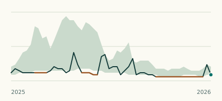 River gauge, United States Is the Wolf River unusually low at Collierville? Level now, history, the same date in past years and each year's range.
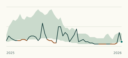 River gauge, United States Is the Wolf River unusually low at Rossville? Level now, history, the same date in past years and each year's range.