Puerto Rico river levels today
Are the rivers and lakes in Puerto Rico unusually low or high?
We follow 84 water level gauges in Puerto Rico. 22 gauges read below their normal range for the date and 9 gauges above it, not counting the 5 tide stations.
How many gauges do we follow in Puerto Rico?
84 gauges of the 7,007 we follow in the United States, as of 21 November 2026.
How many waters in Puerto Rico have a level gauge?
59 waters with a level gauge, of the 3,733 waters we follow in the United States, as of 21 November 2026.
How many gauges read below normal for the date?
22 gauges below their normal range, of the 67 gauges with a current reading and a normal range for the date, not counting the 5 tide stations, as of 21 November 2026.
How many gauges read above normal for the date?
9 gauges above their normal range, of the 67 gauges with a current reading and a normal range for the date, not counting the 5 tide stations, as of 21 November 2026.
How the places stand today
22 places below normal and 9 places above
Which places are furthest below normal?
More places
Which places are furthest above normal?
More places
Which gauges do we follow in Puerto Rico?
| Place | Reading | Against normal for the date | Change in a day |
|---|---|---|---|
| Canal de Patillas | |||
| Guayama Filtration Plant | 2.62 ft | within the normal range for the date | -0.02 ft |
| Intake 113 | 1.30 ft | -0.05 ft | |
| Canal de Riego de Lajas | |||
| Bo. Betances | 1.68 ft | +0.11 ft | |
| Bo. Palmarejo | 1.74 ft | in the highest 10 percent for the date | +0.11 ft |
| Majinas Filtration Plant | 2.99 ft | in the highest 10 percent for the date | -0.06 ft |
| Lago Dos Bocas | |||
| Arecibo | 294.78 ft | +0.64 ft | |
| Lago Guajataca | |||
| Damsite | 642.43 ft | +0.07 ft | |
| Lago Loco | |||
| Damsite nr Yauco | 230.25 ft | +0.02 ft | |
| Lago Luccheti | |||
| Damsite nr Yauco | 565.13 ft | -0.43 ft | |
| Puerto Rico Coast | |||
| Culebra | 0.17 m above the tide table | in the highest 5 percent for the date | |
| Esperanza, Vieques Island | 0.224 m above the tide table | higher than any day of these dates in 12 years | |
| Mayaguez | 0.219 m above the tide table | higher than any day of these dates in 14 years | |
| Mona Island | 0.207 m above the tide table | in the highest 5 percent for the date | |
| San Juan | 0.224 m above the tide table | higher than any day of these dates in 15 years | |
| Quebrada Grande | |||
| Bo. Dos Bocas | 3.91 ft | lower than any day of these dates in 24 years | -0.01 ft |
| Rio Bairoa | |||
| Bairoa | 4.17 ft | ||
| Rio Bauta | |||
| Orocovis | 3.61 ft | lower than any day of these dates in 33 years | -0.02 ft |
| Rio Bayamon | |||
| Bayamon | 1.82 ft | within the normal range for the date | 0 ft |
| Lago de Cidra Dam | 5.53 ft | lower than any day of these dates in 21 years | -0.03 ft |
| Rio Blanco | |||
| Florida | 4.51 ft | +0.73 ft | |
| Rio Caguitas | |||
| Villa Blanca | 7.95 ft | within the normal range for the date | -0.03 ft |
| Rio Camuy | |||
| Bayaney | 5.05 ft | within the normal range for the date | -0.06 ft |
| Rio Canas | |||
| Rio Canas | 8.99 ft | in the lowest 5 percent for the date | +0.01 ft |
| Rio Canovanas | |||
| Campo Rico | 2.46 ft | within the normal range for the date | -0.01 ft |
| Rio Caonillas | |||
| Paso Palma | 3.82 ft | within the normal range for the date | -0.04 ft |
| Rio Cayaguas | |||
| at Cerro Gordo | 6.50 ft | within the normal range for the date | +0.48 ft |
| Rio Cerrillos | |||
| Lago Cerrillos | 0.91 ft | within the normal range for the date | 0 ft |
| Rio Cibuco | |||
| Vega Baja | 4.36 ft | in the lowest 10 percent for the date | -0.03 ft |
| Rio Coamo | |||
| Coamo | 4.29 ft | within the normal range for the date | +0.02 ft |
| Rio Corozal | |||
| Corozal | 4.52 ft | -0.01 ft | |
| Rio Culebrinas | |||
| HWY 404 nr Moca | 9.65 ft | within the normal range for the date | -0.15 ft |
| Margarita Damsite nr Aguada | 10.05 ft | in the highest 10 percent for the date | -0.34 ft |
| Rio De La Plata | |||
| Comerio | 5.12 ft | within the normal range for the date | -0.05 ft |
| La Plata Dam | 6.86 ft | in the lowest 10 percent for the date | 0 ft |
| Proyecto La Plata | 10.03 ft | within the normal range for the date | +0.02 ft |
| Toa Alta | 3.38 ft | within the normal range for the date | 0 ft |
| Rio Espiritu Santo | |||
| Rio Grande | 4.35 ft | in the highest 10 percent for the date | +0.98 ft |
| Rio Fajardo | |||
| Fajardo | 4.17 ft | within the normal range for the date | +1.45 ft |
| Paraiso | 6.20 ft | in the highest 5 percent for the date | +1.79 ft |
| Rio Grande | |||
| Verde at Rio Grande | 5.45 ft | in the highest 10 percent for the date | +0.25 ft |
| Rio Grande De Anasco | |||
| San Sebastian | 2.63 ft | within the normal range for the date | -0.06 ft |
| Rio Grande De Arecibo | |||
| San Pedro | 6.47 ft | within the normal range for the date | -0.10 ft |
| Utuado (above) | 3.91 ft | within the normal range for the date | 0 ft |
| Utuado (below) | 4.30 ft | in the lowest 10 percent for the date | -0.04 ft |
| Rio Grande De Loiza | |||
| Caguas | 4.42 ft | in the lowest 5 percent for the date | -0.17 ft |
| Dam | 2.57 ft | in the lowest 5 percent for the date | 0 ft |
| Hwy 183 | 7.43 ft | within the normal range for the date | -0.13 ft |
| Quebrada Arenas | 5.21 ft | within the normal range for the date | +0.06 ft |
| Rio Grande De Manati | |||
| Ciales | 2.29 ft | within the normal range for the date | 0 ft |
| HWY 115 nr Morovis | 2.89 ft | -0.05 ft | |
| Manati | 10.66 ft | +0.03 ft | |
| Rio Guadiana | |||
| Guadiana | 1.63 ft | in the lowest 5 percent for the date | -0.01 ft |
| Rio Guajataca | |||
| Lares | 8.09 ft | in the highest 10 percent for the date | 0 ft |
| Rio Guanajibo | |||
| Hormigueros | 10.03 ft | within the normal range for the date | -0.09 ft |
| Rio Guayanes | |||
| Central Roig | 12.70 ft | within the normal range for the date | -0.47 ft |
| Yabucoa | 10.24 ft | within the normal range for the date | -0.36 ft |
| Rio Guayanilla | |||
| Guayanilla | 4.78 ft | lower than any day of these dates in 35 years | -0.02 ft |
| Rio Gurabo | |||
| El Mango | 8.24 ft | within the normal range for the date | -0.21 ft |
| Gurabo | 4.63 ft | within the normal range for the date | -0.53 ft |
| Rio Humacao | |||
| Las Piedras | 0.50 ft | in the lowest 5 percent for the date | -0.05 ft |
| Rio Inabon | |||
| Real Abajo | 1.69 ft | within the normal range for the date | -0.01 ft |
| Rio Jacaguas | |||
| Juana Diaz | 4.99 ft | in the lowest 5 percent for the date | -0.02 ft |
| Rio Lapa | |||
| Rabo del Buey | 5.37 ft | within the normal range for the date | -0.01 ft |
| Rio Limon | |||
| Lago Dos Bocas | 7.59 ft | within the normal range for the date | -0.01 ft |
| Rio Loco | |||
| Las Latas | 2.62 ft | within the normal range for the date | +0.03 ft |
| Rio Majada | |||
| La Plena | 2.77 ft | within the normal range for the date | +0.02 ft |
| Rio Mameyes | |||
| Sabana | 3.84 ft | in the highest 5 percent for the date | +1.85 ft |
| Rio Marin | |||
| Patillas | 6.64 ft | within the normal range for the date | -0.01 ft |
| Rio Maunabo | |||
| Lizas | 3.60 ft | within the normal range for the date | -0.04 ft |
| Rio Patillas | |||
| Patillas | 4.65 ft | within the normal range for the date | -0.07 ft |
| Rio Piedras | |||
| Hato Rey | 3.59 ft | lower than any day of these dates in 27 years | 0 ft |
| Quebrada Josefina | 1.48 ft | -0.03 ft | |
| Quebrada Margarita | 2.68 ft | lower than any day of these dates in 13 years | +0.01 ft |
| Rio Portugues | |||
| Tibes | 4.46 ft | lower than any day of these dates in 24 years | +0.07 ft |
| Rio Rosario | |||
| Hormigueros | 1.71 ft | within the normal range for the date | -0.04 ft |
| Rio Sabana | |||
| Sabana | 9.22 ft | in the highest 5 percent for the date | +1.61 ft |
| Rio Saliente | |||
| Coabey | 3.14 ft | within the normal range for the date | -0.01 ft |
| Rio Tanama | |||
| Charco Hondo | 3.37 ft | in the lowest 5 percent for the date | -0.13 ft |
| Utuado | 3.16 ft | lower than any day of these dates in 25 years | -0.04 ft |
| Rio Toa Vaca | |||
| Lago Toa Vaca | 1.85 ft | in the lowest 5 percent for the date | -0.01 ft |
| Rio Turabo | |||
| Borinquen | 3.68 ft | lower than any day of these dates in 32 years | +0.05 ft |
| Rio Usabon | |||
| HWY 162 nr Barranquitas | 2.87 ft | lower than any day of these dates in 18 years | -0.02 ft |
| Rio Valenciano | |||
| Juncos | 3.01 ft | within the normal range for the date | -0.13 ft |
| Rio Yauco | |||
| Diversion Monserrate | 1.34 ft | lower than any day of these dates in 22 years | +0.01 ft |
Keep exploring
 Country, United States Are the rivers and lakes in the United States unusually low or high? Every river and lake we follow here, against normal for the date.
 Today's list, United States Which places in the United States are furthest from normal today? The places in the United States furthest below and above normal today.
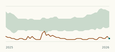 River gauge, United States Is the Rio Guayanilla unusually low at Guayanilla? Level now, history, the same date in past years and each year's range.
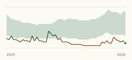 River gauge, United States Is the Rio Yauco unusually low at Diversion Monserrate? Level now, history, the same date in past years and each year's range.