Pennsylvania river levels today
Are the rivers and lakes in Pennsylvania unusually low or high?
We follow 201 water level gauges in Pennsylvania. 4 gauges read below their normal range for the date and 1 gauge above it, not counting the 4 tide stations.
How many gauges do we follow in Pennsylvania?
201 gauges of the 7,007 we follow in the United States, as of 21 November 2026.
How many waters in Pennsylvania have a level gauge?
100 waters with a level gauge, of the 3,733 waters we follow in the United States, as of 21 November 2026.
How many gauges read below normal for the date?
4 gauges below their normal range, of the 22 gauges with a current reading and a normal range for the date, not counting the 4 tide stations, as of 21 November 2026.
How many gauges read above normal for the date?
1 gauge above its normal range, of the 22 gauges with a current reading and a normal range for the date, not counting the 4 tide stations, as of 21 November 2026.
How the places stand today
4 places below normal and 1 place above
Which places are furthest below normal?
Which places are furthest above normal?
Which gauges do we follow in Pennsylvania?
| Place | Reading | Against normal for the date | Change in a day |
|---|---|---|---|
| Allegheny River | |||
| C.W. Bill Young Lock and Dam | 10.17 ft | in the lowest 5 percent for the date | -0.03 ft |
| Clinton Lock and Dam | 9.73 ft | -0.01 ft | |
| Eldred | 2.33 ft | -0.02 ft | |
| Franklin | 3.29 ft | -0.03 ft | |
| Freeport Lock and Dam | 9.75 ft | +0.08 ft | |
| Kittanning Lock and Dam | 10.34 ft | -0.04 ft | |
| Mosgrove Lock and Dam | 9.51 ft | within the normal range for the date | 0 ft |
| Natrona Lock and Dam | 10.57 ft | +0.03 ft | |
| Parker | 2.27 ft | -0.06 ft | |
| Rimer Lock and Dam | 9.43 ft | +0.01 ft | |
| Sharpsburg Lock and Dam | 10.27 ft | -0.03 ft | |
| Warren | 3.06 ft | 0 ft | |
| West Hickory | 3.71 ft | +0.04 ft | |
| Aughwick Creek | |||
| Shirleysburg | 2.82 ft | -0.01 ft | |
| Ayelsworth Creek Lake | |||
| Jermyn | 1,108.27 ft | within the normal range for the date | -0.01 ft |
| Bald Eagle Creek | |||
| Beech Creek Station | 6.93 ft | -0.01 ft | |
| Beaver River | |||
| Beaver Falls | 4.89 ft | 0 ft | |
| Wampum | 3.19 ft | -0.02 ft | |
| Blacklick Creek | |||
| Josephine | 3.41 ft | 0 ft | |
| Brandywine Creek | |||
| Chadds Ford | 1.86 ft | -0.03 ft | |
| Brodhead Creek | |||
| Analomink | 1.81 ft | -0.02 ft | |
| Minisink Hills | 0.99 ft | -0.01 ft | |
| Bush Kill | |||
| Shoemakers | 1.70 ft | -0.01 ft | |
| Casselman River | |||
| Markleton | 0.98 ft | -0.02 ft | |
| Chartiers Creek | |||
| Carnegie | 1.20 ft | 0 ft | |
| S. Central Ave | 1.87 ft | within the normal range for the date | 0 ft |
| Chester Creek | |||
| Chester | 2.60 ft | 0 ft | |
| Chillisquaque Creek | |||
| Washingtonville | 0.61 ft | -0.01 ft | |
| Choconut Creek | |||
| Choconut | 4.34 ft | -0.04 ft | |
| Clarion River | |||
| Cooksburg | 2.17 ft | 0 ft | |
| Johnsonburg | 1.57 ft | -0.01 ft | |
| Ridgway | 3.11 ft | -0.04 ft | |
| Clearfield Creek | |||
| Dimeling | 3.32 ft | -0.01 ft | |
| Cobbs Creek | |||
| Mt. Moriah Cemetery | 2.08 ft | +0.01 ft | |
| Conemaugh River | |||
| Conemaugh Lake Pool | 905.38 ft | within the normal range for the date | +0.23 ft |
| Conemaugh Lake Tailwater | 3.09 ft | 0 ft | |
| Johnstown | 1.94 ft | -0.02 ft | |
| Seward | 2.35 ft | -0.01 ft | |
| Conestoga River | |||
| Lancaster | 3.32 ft | -0.01 ft | |
| Conewango Creek | |||
| Russell | 2.42 ft | -0.01 ft | |
| Connoquenessing Creek | |||
| Zelienople | 1.63 ft | -0.02 ft | |
| Conodoguinet Creek | |||
| Hogestown | 1.30 ft | +0.02 ft | |
| Cowanesque River | |||
| Lawrenceville | 7.28 ft | 0 ft | |
| Crooked Creek | |||
| Crooked Ck. Dam Pool | 844.02 ft | within the normal range for the date | +0.02 ft |
| Crooked Creek Dam Tailwater | 1.11 ft | ||
| Idaho | 2.60 ft | 0 ft | |
| Darby Creek | |||
| 84th Street Bridge at Eastwick | -0.29 ft | +0.22 ft | |
| Delaware River | |||
| Bridesburg | 0.105 m above the tide table | within the normal range for the date | |
| Callicoon | 3.67 ft | -0.07 ft | |
| Lordville | 6.70 ft | -0.10 ft | |
| Marcus Hook | 0.154 m above the tide table | within the normal range for the date | |
| Matamoras/Port Jervis | 3.07 ft | -0.09 ft | |
| Montague | 5.58 ft | -0.12 ft | |
| New Hope-Lambertville Bridge | 0.12 ft | within the normal range for the date | -0.16 ft |
| Newbold | 0.089 m above the tide table | within the normal range for the date | |
| Philadelphia | 0.10 m above the tide table | within the normal range for the date | |
| Dunkard Creek | |||
| Shannopin | 1.46 ft | -0.01 ft | |
| Dunning Creek | |||
| Belden | 1.38 ft | -0.01 ft | |
| Dyberry Creek | |||
| Honesdale | 2.19 ft | -0.04 ft | |
| Jadwin Reservoir | 989.29 ft | 0 ft | |
| East Branch Brandywine Creek | |||
| Downingtown | 3.31 ft | -0.01 ft | |
| East Branch Perkiomen Creek | |||
| Schwenksville | 2.97 ft | +0.01 ft | |
| Frankford Creek | |||
| Philadelphia | 1.56 ft | -0.07 ft | |
| Frankstown Branch Juniata River | |||
| Williamsburg | 2.70 ft | +0.02 ft | |
| French Creek | |||
| Lowville | 3.53 ft | 0 ft | |
| Meadville | 1.92 ft | -0.04 ft | |
| Union City Dam | 2.28 ft | -0.02 ft | |
| Union City Lake | 1,216.86 ft | in the lowest 5 percent for the date | -0.05 ft |
| Girty's Run | |||
| Girty's Run | 2.31 ft | within the normal range for the date | 0 ft |
| Jordan Creek | |||
| Allentown | 1.38 ft | -0.01 ft | |
| Juniata River | |||
| Huntingdon | 1.63 ft | +0.01 ft | |
| Lewistown | 3.38 ft | -0.01 ft | |
| Mapleton Depot | 2.96 ft | 0 ft | |
| Newport | 3.63 ft | -0.01 ft | |
| Kiskiminetas River | |||
| Vandergrift | 3.70 ft | 0 ft | |
| Lackawanna River | |||
| Archbald | 2.35 ft | -0.06 ft | |
| Old Forge | 2.84 ft | -0.07 ft | |
| Parker St Bridge | 1.53 ft | -0.05 ft | |
| Stillwater Dam | 1,573.73 ft | within the normal range for the date | -0.09 ft |
| Lackawaxen River | |||
| Aldenville | 0.81 ft | -0.06 ft | |
| Hawley | 2.47 ft | -0.08 ft | |
| Honesdale | 1.75 ft | -0.06 ft | |
| Prompton Lake Dam | 1,125.31 ft | within the normal range for the date | -0.10 ft |
| Lake Erie | |||
| Erie | 174.068 m | within the normal range for the date | -0.076 m |
| Larrys Creek | |||
| Salladasburg | 0.30 ft | -0.02 ft | |
| Laurel Hill Creek | |||
| Ursina | 1.16 ft | -0.01 ft | |
| Lehigh River | |||
| Bethlehem | 1.60 ft | -0.07 ft | |
| F.E. Walter Dam | 1,303.02 ft | +0.15 ft | |
| Glendon | 7.44 ft | -0.10 ft | |
| Lehighton | 2.93 ft | -0.14 ft | |
| Walnutport | 2.39 ft | -0.09 ft | |
| White Haven | 3.71 ft | -0.16 ft | |
| Little Conemaugh River | |||
| East Conemaugh | 8.14 ft | -0.07 ft | |
| Little Juniata River | |||
| Spruce Creek | 2.00 ft | 0 ft | |
| Little Lehigh Creek | |||
| Allentown | 2.35 ft | +0.02 ft | |
| Allentown (near) | -0.05 ft | 0 ft | |
| Trexlertown | 1.76 ft | -0.02 ft | |
| Little Muncy Creek | |||
| Lairdsville | 1.79 ft | 0 ft | |
| Little Pine Creek | |||
| Etna | 2.41 ft | -0.01 ft | |
| Lowries Run | |||
| Lowries Run | 1.84 ft | -0.01 ft | |
| Loyalhanna Creek | |||
| Kingston | 2.25 ft | -0.02 ft | |
| Latrobe | 6.05 ft | within the normal range for the date | -0.01 ft |
| Loyalhanna Dam Pool | 923.79 ft | +0.18 ft | |
| Loyalhanna Dam Tail Water | 0.91 ft | 0 ft | |
| Loyalsock Creek | |||
| Barbours | 7.56 ft | ||
| Loyalsockville | 1.65 ft | -0.05 ft | |
| Mahoning Creek | |||
| Mahoning Dam Pool | 1,082.00 ft | -0.45 ft | |
| Mahoning Dam Tailwater | 2.21 ft | 0 ft | |
| Monongahela River | |||
| Braddock Lock and Dam | 14.48 ft | -0.26 ft | |
| Charleroi Lock and Dam | 6.77 ft | -0.45 ft | |
| Grays Landing Lock and Dam | 10.25 ft | +0.07 ft | |
| Maxwell Lock and Dam (lower pool) | 9.81 ft | in the lowest 5 percent for the date | -0.37 ft |
| Point Marion Lock and Dam (lower pool) | 10.21 ft | within the normal range for the date | +0.24 ft |
| Muncy Creek | |||
| Muncy Creek | 7.69 ft | -0.07 ft | |
| Sonestown | 2.06 ft | -0.04 ft | |
| Neshaminy Creek | |||
| Langhorne | 1.04 ft | -0.02 ft | |
| Penns Park | 5.18 ft | -0.02 ft | |
| Ohio River | |||
| Dashields Lock and Dam | 13.94 ft | +0.35 ft | |
| Emsworth L/d Pool | 17.32 ft | in the highest 5 percent for the date | +0.30 ft |
| Emsworth Lock and Dam | 13.70 ft | +0.25 ft | |
| Montgomery Lock and Dam | 13.13 ft | within the normal range for the date | +0.26 ft |
| Pittsburgh | 17.19 ft | +0.29 ft | |
| Oil Creek | |||
| Rouseville | 2.05 ft | -0.03 ft | |
| Penns Creek | |||
| Penns Creek | 1.83 ft | 0 ft | |
| Pennypack Creek | |||
| Philadelphia | 2.61 ft | 0 ft | |
| Perkiomen Creek | |||
| East Greenville | 1.76 ft | -0.02 ft | |
| Graterford | 1.41 ft | +0.01 ft | |
| Pine Creek | |||
| Cedar Run | 1.20 ft | 0 ft | |
| Etna | 4.21 ft | within the normal range for the date | -0.02 ft |
| Pohopoco Creek | |||
| Beltzville Dam | 628.12 ft | +0.01 ft | |
| Beltzville Lake at Parryville | 2.67 ft | 0 ft | |
| Raccoon Creek | |||
| Moffatts Mill | 1.77 ft | 0 ft | |
| Raystown Branch Juniata River | |||
| Saxton | 1.40 ft | -0.01 ft | |
| Red Bank Creek | |||
| Brookville | 6.02 ft | -0.01 ft | |
| St Charles | 2.85 ft | -0.02 ft | |
| Red Clay Creek | |||
| Kennett Square | 3.13 ft | 0 ft | |
| Schuylkill River | |||
| Berne | 4.90 ft | -0.01 ft | |
| Landingville | 3.01 ft | 0 ft | |
| Norristown | 8.00 ft | 0 ft | |
| Philadelphia | 5.94 ft | +0.02 ft | |
| Philadelphia near 30th Street | -2.32 ft | lower than any day of these dates in 10 years | -2.39 ft |
| Pottstown | 1.55 ft | 0 ft | |
| Reading | 3.04 ft | 0 ft | |
| Shenango River | |||
| New Castle | 6.23 ft | -0.04 ft | |
| Shenango Dam Pool | 892.32 ft | -0.14 ft | |
| Shenango Dam Tailwater | 2.91 ft | 0 ft | |
| Sherman Creek | |||
| Shermans Dale | 1.04 ft | 0 ft | |
| Sinnemahoning Creek | |||
| Sinnemahoning | 2.02 ft | -0.01 ft | |
| Slippery Rock Creek | |||
| Wurtemburg | 1.19 ft | -0.01 ft | |
| Spring Creek | |||
| Houserville | 2.86 ft | 0 ft | |
| Trexlertown | 1.37 ft | -0.01 ft | |
| Stonycreek River | |||
| Ferndale | 2.68 ft | +0.03 ft | |
| Susquehanna River | |||
| Bloomsburg | 3.52 ft | -0.12 ft | |
| Danville | 4.77 ft | -0.10 ft | |
| Harrisburg | 4.00 ft | -0.05 ft | |
| Marietta | 35.03 ft | -0.13 ft | |
| Meshoppen | 10.37 ft | -0.20 ft | |
| Sunbury | 8.20 ft | within the normal range for the date | -0.09 ft |
| Towanda | 2.03 ft | -0.15 ft | |
| Waverly | 3.53 ft | -0.21 ft | |
| Wilkes Barre | 3.39 ft | -0.17 ft | |
| Swatara Creek | |||
| Harper Tavern | 0.33 ft | -0.01 ft | |
| Hershey | 1.69 ft | 0 ft | |
| Middletown | 2.36 ft | -0.08 ft | |
| Tenmile Creek | |||
| Jefferson | 2.86 ft | 0 ft | |
| Thompson Run | |||
| Turtle Creek | 0.63 ft | within the normal range for the date | -0.01 ft |
| Tioga River | |||
| Mansfield | -0.03 ft | -0.01 ft | |
| Tioga Junction | 6.79 ft | -0.01 ft | |
| Tionesta Creek | |||
| Tionesta Dam Pool | 1,087.81 ft | within the normal range for the date | -0.03 ft |
| Tionesta Dam Tailwater | 1.02 ft | 0 ft | |
| Towanda Creek | |||
| Monroeton | 6.73 ft | -0.06 ft | |
| Tulpehocken Creek | |||
| Blue Marsh Dam | 285.05 ft | -0.01 ft | |
| Reading | 1.16 ft | 0 ft | |
| Tunkhannock Creek | |||
| Tunkhannock | 1.85 ft | -0.05 ft | |
| Tuscarora Creek | |||
| Port Royal | 3.22 ft | 0 ft | |
| Two Lick Creek | |||
| Graceton | 2.24 ft | -0.01 ft | |
| Valley Creek | |||
| PA Turnpike Bridge near Valley Forge | 3.12 ft | ||
| Wappasening Creek | |||
| Windham Center | 5.65 ft | -0.03 ft | |
| West Branch Brandywine Creek | |||
| Coatesville | 3.60 ft | +0.10 ft | |
| Honeybrook | 1.02 ft | -0.01 ft | |
| Modena | 2.87 ft | +0.04 ft | |
| West Branch Lackawaxen River | |||
| Prompton | 1.49 ft | -0.05 ft | |
| West Branch Perkiomen Creek | |||
| Hillegass | 0.53 ft | 0 ft | |
| West Branch Susquehanna River | |||
| Allenwood | 7.80 ft | -0.05 ft | |
| Jersey Shore | 1.77 ft | -0.04 ft | |
| Karthaus | 1.82 ft | -0.01 ft | |
| Lewisburg | 2.00 ft | -0.03 ft | |
| Lock Haven | 8.07 ft | -0.02 ft | |
| Muncy | 4.06 ft | 0 ft | |
| Renovo | 0.43 ft | -0.02 ft | |
| West Milton | 1.42 ft | -0.03 ft | |
| Williamsport | 0.78 ft | -0.07 ft | |
| White Clay Creek | |||
| Strickersville | 3.10 ft | 0 ft | |
| Woodcock Creek | |||
| Woodcock Creek Dam Outflow | 7.27 ft | -0.01 ft | |
| Woodcock Dam | 1,166.43 ft | -0.04 ft | |
| Yellow Breeches Creek | |||
| Camp Hill | 1.11 ft | +0.01 ft | |
| Yellow Creek | |||
| Homer City | 1.71 ft | 0 ft | |
| Youghiogheny River | |||
| Confluence | 2.73 ft | -0.02 ft | |
| Connellsville | 2.70 ft | -0.01 ft | |
| Ohiopyle | 1.95 ft | -0.01 ft | |
| Sutersville | 3.88 ft | -0.04 ft | |
Keep exploring
 Country, United States Are the rivers and lakes in the United States unusually low or high? Every river and lake we follow here, against normal for the date.
 Today's list, United States Which places in the United States are furthest from normal today? The places in the United States furthest below and above normal today.
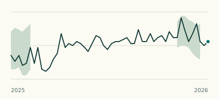 River gauge, United States Is the Schuylkill River unusually low at Philadelphia near 30th Street? Level now, history, the same date in past years and each year's range.
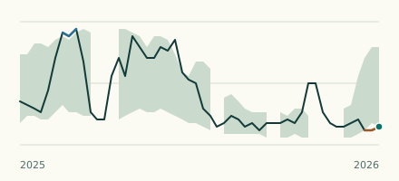 River gauge, United States Is the French Creek unusually low at Union City Lake? Level now, history, the same date in past years and each year's range.