Oregon river levels today
Are the rivers and lakes in Oregon unusually low or high?
We follow 116 water level gauges in Oregon. 1 gauge reads below its normal range for the date and none above it, not counting the 5 tide stations.
How many gauges do we follow in Oregon?
116 gauges of the 7,007 we follow in the United States, as of 21 November 2026.
How many waters in Oregon have a level gauge?
75 waters with a level gauge, of the 3,733 waters we follow in the United States, as of 21 November 2026.
How many gauges read below normal for the date?
1 gauge below its normal range, of the 7 gauges with a current reading and a normal range for the date, not counting the 5 tide stations, as of 21 November 2026.
How many gauges read above normal for the date?
0 gauges above their normal range, of the 7 gauges with a current reading and a normal range for the date, not counting the 5 tide stations, as of 21 November 2026.
How the places stand today
1 place below normal and 0 places above
Which places are furthest below normal?
Which gauges do we follow in Oregon?
| Place | Reading | Against normal for the date | Change in a day |
|---|---|---|---|
| Abernethy Creek | |||
| Mompano Reservoir | 180.06 ft | 0 ft | |
| Alsea River | |||
| Tidewater | 2.07 ft | -0.15 ft | |
| Applegate River | |||
| Applegate | 1.14 ft | -0.01 ft | |
| Wilderville | 2.20 ft | -0.02 ft | |
| Battle Creek (Marion Co., OR) | |||
| Commercial Street in Salem | 4.11 ft | -0.01 ft | |
| Bear Creek | |||
| Medford | 2.53 ft | -0.02 ft | |
| Beaver Creek | |||
| Troutdale | 7.32 ft | -0.11 ft | |
| Beaver Creek (Marion Co., OR) | |||
| Aumsville | 5.16 ft | -0.02 ft | |
| Burnt River | |||
| Unity Reservoir | 2.50 ft | 0 ft | |
| Butte Creek | |||
| Monitor | 5.50 ft | -0.07 ft | |
| Chetco River | |||
| Brookings | 1.62 ft | -0.54 ft | |
| Clackamas River | |||
| Estacada | 11.13 ft | -0.09 ft | |
| Oregon City | 23.33 ft | -0.07 ft | |
| Coast Fork Willamette River | |||
| Goshen | 1.17 ft | -0.10 ft | |
| Columbia River | |||
| Astoria | 0.111 m above the tide table | within the normal range for the date | |
| St. Helens | 3.95 ft | +0.16 ft | |
| Wauna | 5.23 ft | +1.10 ft | |
| Coquille River | |||
| Coquille | 7.84 ft | within the normal range for the date | +0.45 ft |
| Cow Creek | |||
| Azalea | 1.12 ft | 0 ft | |
| Galesville Res | 1,809.61 ft | in the lowest 10 percent for the date | -0.09 ft |
| Glendale | 0.97 ft | -0.04 ft | |
| Riddle | 1.29 ft | -0.13 ft | |
| Deer Creek | |||
| Roseburg | 2.27 ft | -0.06 ft | |
| Deschutes River | |||
| Moody | 2.88 ft | 0 ft | |
| Donner und Blitzen River | |||
| French Glen | 1.82 ft | -0.03 ft | |
| Drift Creek of Lincoln Co. | |||
| Waldport | 0.82 ft | -0.08 ft | |
| Elk creek | |||
| Drain | 0.91 ft | -0.10 ft | |
| Fairview Creek | |||
| Glisan St near Gresham | 4.40 ft | -0.05 ft | |
| Fanno Creek | |||
| 56th Ave - Portland | 8.50 ft | -0.02 ft | |
| Durham | 2.06 ft | -0.06 ft | |
| Gales Creek | |||
| Forest Grove | 3.15 ft | -0.22 ft | |
| Glenn Creek | |||
| Wallace Road | 4.02 ft | -0.04 ft | |
| Grande Ronde River | |||
| Perry | 1.06 ft | 0 ft | |
| Troy | 4.17 ft | 0 ft | |
| Hood River | |||
| Hood River | 2.63 ft | -0.03 ft | |
| Illinois River | |||
| Kerby | 2.70 ft | -0.41 ft | |
| Imnaha River | |||
| Imnaha | 1.80 ft | -0.02 ft | |
| John Day River | |||
| John Day | 3.69 ft | +0.02 ft | |
| Service Creek | 2.26 ft | -0.05 ft | |
| Johnson Creek | |||
| Gresham | 4.52 ft | -0.04 ft | |
| Milwaukie | 23.87 ft | -0.02 ft | |
| Sycamore | 1.36 ft | -0.14 ft | |
| Long Tom River | |||
| Monroe | 4.38 ft | -0.05 ft | |
| Luckiamute River | |||
| Suver | 3.89 ft | -0.31 ft | |
| Malheur River | |||
| Vale | 11.11 ft | -0.17 ft | |
| Marys River | |||
| Philomath | 2.64 ft | -0.16 ft | |
| McKenzie River | |||
| Vida | 0.77 ft | -0.02 ft | |
| Walterville | 1.67 ft | -0.04 ft | |
| Miami River | |||
| Garibaldi | 3.86 ft | -0.09 ft | |
| Mid Fork Willamette River | |||
| Jasper | 3.05 ft | +0.32 ft | |
| Mill Creek (Marion Co., OR) | |||
| North Salem High School at Salem | 5.33 ft | -0.07 ft | |
| Spenner Road near Sublimity | 2.69 ft | -0.03 ft | |
| Turner | 5.13 ft | -0.02 ft | |
| Turner Road near Salem | 6.63 ft | -0.03 ft | |
| Mohawk River | |||
| Springfield | 1.11 ft | -0.06 ft | |
| Molalla River | |||
| Canby | 9.55 ft | -0.10 ft | |
| Wilhoit | 2.13 ft | -0.09 ft | |
| N Santiam River | |||
| Mehama | 3.80 ft | -0.02 ft | |
| Nehalem River | |||
| Foss | 2.76 ft | -0.18 ft | |
| Vernonia | 4.14 ft | -0.04 ft | |
| Nestucca River | |||
| Beaver | 5.27 ft | -0.19 ft | |
| North Fk Coquille River | |||
| Myrtle Point | 4.47 ft | -0.34 ft | |
| North Fork John Day River | |||
| Monument | 2.56 ft | -0.05 ft | |
| North Umpqua River | |||
| Winchester | 2.04 ft | -0.14 ft | |
| Oregon Coast | |||
| Charleston | 0.256 m above the tide table | in the highest 5 percent for the date | |
| Garibaldi | 0.213 m above the tide table | within the normal range for the date | |
| Port Orford | 0.221 m above the tide table | in the highest 10 percent for the date | |
| South Beach | 0.294 m above the tide table | in the highest 10 percent for the date | |
| Powder River | |||
| Baker City | 1.07 ft | -0.04 ft | |
| Pringle Creek | |||
| Salem Hospital | 7.43 ft | -0.03 ft | |
| Pudding River | |||
| Aurora | 6.40 ft | -0.23 ft | |
| Woodburn | 6.03 ft | -0.19 ft | |
| Rock Creek | |||
| Hwy 47 Bridge at Vernonia | 0.88 ft | -0.05 ft | |
| Rogue River | |||
| Agness | 4.12 ft | -0.16 ft | |
| Eagle Point | 3.00 ft | 0 ft | |
| Gold Ray Dam | 0.87 ft | -0.01 ft | |
| Grants Pass | 1.15 ft | -0.03 ft | |
| S. Santiam River | |||
| Waterloo | 3.28 ft | -0.05 ft | |
| Sandy River | |||
| Bull Run | 8.02 ft | -0.02 ft | |
| Marmot | 689.73 ft | -0.02 ft | |
| Santiam River | |||
| Jefferson | 3.37 ft | -0.06 ft | |
| Siletz River | |||
| Siletz | 3.57 ft | -0.17 ft | |
| Silver Creek | |||
| Silverton | 1.35 ft | -0.06 ft | |
| Silvies River | |||
| Burns | 0.82 ft | -0.02 ft | |
| Siuslaw River | |||
| Mapleton | 3.89 ft | -0.18 ft | |
| South Fk Coquille River | |||
| Myrtle Point | 4.97 ft | within the normal range for the date | -0.50 ft |
| Powers | 1.34 ft | -0.42 ft | |
| South Umpqua River | |||
| Tiller | 0.93 ft | -0.15 ft | |
| Winston | 3.84 ft | -0.10 ft | |
| South Yamhill River | |||
| McMinnville | 11.73 ft | -0.43 ft | |
| Sprague River | |||
| Beatty | 2.34 ft | ||
| Steamboat Creek | |||
| Glide | 0.49 ft | -0.15 ft | |
| Thomas Creek | |||
| Scio | 4.77 ft | -0.11 ft | |
| Trask River | |||
| Tillamook | 6.25 ft | -0.10 ft | |
| Tualatin River | |||
| Dilley | 10.14 ft | -0.16 ft | |
| Farmington | 4.67 ft | -0.16 ft | |
| Tualatin | 101.89 ft | -0.03 ft | |
| West Linn | 3.26 ft | -0.05 ft | |
| Umatilla River | |||
| Gibbon | 2.87 ft | 0 ft | |
| Pendleton | 4.46 ft | -0.01 ft | |
| Umpqua River | |||
| Elkton | 3.39 ft | -0.09 ft | |
| Reedsport | 9.08 ft | +0.95 ft | |
| Willamette River | |||
| Albany | 2.80 ft | -0.13 ft | |
| Canby Ferry near Canby | 60.05 ft | ||
| Corvallis | 9.85 ft | -0.11 ft | |
| Eugene | 9.87 ft | within the normal range for the date | +0.21 ft |
| Falls at Oregon City (above) | 56.12 ft | within the normal range for the date | +0.02 ft |
| Falls at Oregon City (below) | 5.84 ft | within the normal range for the date | +0.17 ft |
| Harrisburg | 1.73 ft | +0.11 ft | |
| Portland | 4.05 ft | +0.42 ft | |
| Salem | 5.51 ft | -0.16 ft | |
| Williamson River | |||
| Chiloquin | 3.49 ft | 0 ft | |
| Wilson River | |||
| Sollie Smith Br at Tillamook | 9.79 ft | within the normal range for the date | -0.15 ft |
| Tillamook | 4.36 ft | -0.10 ft | |
| Yachats River | |||
| Yachats | 6.71 ft | -0.07 ft | |
| Yaquina River | |||
| Chitwood | 2.82 ft | -0.03 ft | |
Keep exploring
 Country, United States Are the rivers and lakes in the United States unusually low or high? Every river and lake we follow here, against normal for the date.
 Today's list, United States Which places in the United States are furthest from normal today? The places in the United States furthest below and above normal today.
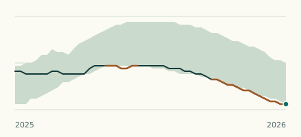 River gauge, United States Is the Cow Creek unusually low at Galesville Res? Level now, history, the same date in past years and each year's range.
 Records, world Which places have set a new record low or high? Record lows and highs in our data, and the newest set.