Oklahoma river levels today
Are the rivers and lakes in Oklahoma unusually low or high?
We follow 84 water level gauges in Oklahoma. 3 gauges read below their normal range for the date and 1 gauge above it.
How many gauges do we follow in Oklahoma?
84 gauges of the 7,007 we follow in the United States, as of 21 November 2026.
How many waters in Oklahoma have a level gauge?
40 waters with a level gauge, of the 3,733 waters we follow in the United States, as of 21 November 2026.
How many gauges read below normal for the date?
3 gauges below their normal range, of the 4 gauges with a current reading and a normal range for the date, as of 21 November 2026.
How many gauges read above normal for the date?
1 gauge above its normal range, of the 4 gauges with a current reading and a normal range for the date, as of 21 November 2026.
How the places stand today
3 places below normal and 1 place above
Which places are furthest below normal?
Which places are furthest above normal?
Which gauges do we follow in Oklahoma?
| Place | Reading | Against normal for the date | Change in a day |
|---|---|---|---|
| Arkansas River | |||
| Haskell | 3.67 ft | +0.11 ft | |
| Muskogee | 18.46 ft | +0.18 ft | |
| Ponca City | 1.13 ft | 0 ft | |
| Ralston | 3.21 ft | -0.04 ft | |
| Tulsa | 4.18 ft | -0.14 ft | |
| Baron Fork | |||
| Eldon | 5.67 ft | +0.01 ft | |
| Beaver Creek | |||
| Waurika | 3.04 ft | -0.14 ft | |
| Beaver River | |||
| Beaver | 2.38 ft | +0.01 ft | |
| Goodwell | 7.01 ft | higher than any day of these dates in 10 years | +0.02 ft |
| Bird Creek | |||
| Avant | 3.49 ft | 0 ft | |
| Owasso | 4.31 ft | +0.01 ft | |
| Sperry | 1.36 ft | 0 ft | |
| Black Bear Creek | |||
| Pawnee | 1.50 ft | -0.01 ft | |
| Blue River | |||
| Blue | 5.51 ft | in the lowest 10 percent for the date | +0.01 ft |
| Canadian River | |||
| Bridgeport | 9.09 ft | +0.01 ft | |
| Calvin | 5.81 ft | -0.09 ft | |
| Mustang | 10.36 ft | -0.07 ft | |
| Norman | 85.43 ft | -0.06 ft | |
| Purcell | 3.19 ft | -0.04 ft | |
| Caney River | |||
| Bartlesville | 2.98 ft | 0 ft | |
| Collinsville | 2.36 ft | +0.05 ft | |
| Ramona | 2.34 ft | -0.05 ft | |
| Chikaskia River | |||
| Blackwell | 2.66 ft | 0 ft | |
| Cimarron River | |||
| Ames | 2.92 ft | 0 ft | |
| Buffalo | 3.43 ft | -0.01 ft | |
| Dover | 9.19 ft | -0.01 ft | |
| Guthrie | 5.96 ft | -0.10 ft | |
| Kenton | 4.61 ft | -0.01 ft | |
| Ripley | 7.70 ft | -0.12 ft | |
| Waynoka | 5.57 ft | 0 ft | |
| Clear Boggy Creek | |||
| Caney Creek near Caney | 9.34 ft | -0.08 ft | |
| Cottonwood Creek | |||
| Seward | 3.24 ft | -0.08 ft | |
| Deep Fork River | |||
| Beggs | -1.15 ft | +0.83 ft | |
| Deep Red Creek | |||
| Randlett | 2.82 ft | -0.19 ft | |
| East Cache Creek | |||
| Walters | 4.66 ft | +0.02 ft | |
| Flint Creek | |||
| Kansas | 5.99 ft | -0.02 ft | |
| Glover River | |||
| Glover | 1.85 ft | 0 ft | |
| Haikey Creek | |||
| Tulsa 12SE / 101st St. Bridge | 4.19 ft | -0.06 ft | |
| Illinois River (AR OK) | |||
| Chewey | 2.48 ft | +0.01 ft | |
| Gore | 6.27 ft | 0 ft | |
| Tahlequah | 4.89 ft | +0.01 ft | |
| Watts | 2.11 ft | 0 ft | |
| Joe Creek | |||
| Tulsa 6SSE / 61st St. | 0.58 ft | +0.01 ft | |
| Kiamichi River | |||
| Antlers | 3.73 ft | +0.41 ft | |
| Clayton | 4.86 ft | -0.01 ft | |
| Little River | |||
| Idabel | 4.61 ft | +0.02 ft | |
| Sasakwa | 2.80 ft | -0.07 ft | |
| Tecumseh | 3.54 ft | -0.08 ft | |
| Little Washita River | |||
| Ninnekah | 6.29 ft | +0.05 ft | |
| Mountain Fork | |||
| Eagletown | 0.80 ft | -0.03 ft | |
| Muddy Boggy Creek | |||
| Farris | 6.80 ft | lower than any day of these dates in 10 years | +0.01 ft |
| Neosho River | |||
| Commerce | 2.84 ft | -0.11 ft | |
| North Canadian River | |||
| Britton Road at Oklahoma City | 5.33 ft | +0.12 ft | |
| El Reno | 3.52 ft | -0.05 ft | |
| Harrah | 4.47 ft | -0.40 ft | |
| NW10th Street at Oklahoma City | 4.94 ft | -0.55 ft | |
| Seiling | 4.04 ft | 0 ft | |
| Watonga | 7.54 ft | -0.01 ft | |
| Wetumka | 7.13 ft | -0.36 ft | |
| Woodward (near) | 2.28 ft | -0.03 ft | |
| Yukon | 1.48 ft | -0.09 ft | |
| North Fork of the Red River | |||
| Carter | 4.93 ft | -0.01 ft | |
| Headrick | 5.83 ft | -0.03 ft | |
| Polecat Creek | |||
| Jenks | 1.39 ft | -0.01 ft | |
| Poteau River | |||
| Panama | 5.61 ft | 0 ft | |
| Poteau | 1.98 ft | 0 ft | |
| Red River | |||
| Arthur City | 5.50 ft | +0.39 ft | |
| Gainesville | 6.76 ft | +0.04 ft | |
| Terral | 5.07 ft | in the lowest 5 percent for the date | -0.29 ft |
| Salt Fork Arkansas River | |||
| Alva | 2.38 ft | +0.02 ft | |
| Tonkawa | 2.76 ft | -0.06 ft | |
| Salt Fork of the Red River | |||
| Mangum | 1.96 ft | -0.01 ft | |
| Spring River | |||
| Quapaw | 4.88 ft | 0 ft | |
| Uncle John Creek | |||
| Kingfisher | 10.20 ft | ||
| Verdigris River | |||
| Claremore | 2.69 ft | 0 ft | |
| Lenapah | 3.43 ft | +0.17 ft | |
| Washita River | |||
| Alex | 0.80 ft | -0.03 ft | |
| Anadarko | 6.98 ft | -0.01 ft | |
| Carnegie | 2.76 ft | -0.04 ft | |
| Cheyenne | 5.57 ft | -0.01 ft | |
| Clinton | 4.58 ft | -0.05 ft | |
| Dickson | 7.94 ft | -0.22 ft | |
| Pauls Valley | 4.06 ft | -0.05 ft | |
| Wildhorse Creek | |||
| Hoover | 10.32 ft | ||
Keep exploring
 Country, United States Are the rivers and lakes in the United States unusually low or high? Every river and lake we follow here, against normal for the date.
 Today's list, United States Which places in the United States are furthest from normal today? The places in the United States furthest below and above normal today.
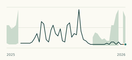 River gauge, United States Is the Muddy Boggy Creek unusually low at Farris? Level now, history, the same date in past years and each year's range.
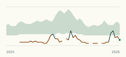 River gauge, United States Is the Red River unusually low at Terral? Level now, history, the same date in past years and each year's range.