River levels in Ohio today
Are the rivers and lakes in Ohio unusually low or high?
We follow 165 water level gauges in Ohio. 1 gauge reads below its normal range for the date and none above it.
How many gauges do we follow in Ohio?
165 gauges of the 7,007 we follow in the United States, as of 21 November 2026.
How many waters in Ohio have a level gauge?
83 waters with a level gauge, of the 3,733 waters we follow in the United States, as of 21 November 2026.
How many gauges read below normal for the date?
1 gauge below its normal range, of the 8 gauges with a current reading and a normal range for the date, as of 21 November 2026.
How many gauges read above normal for the date?
0 gauges above their normal range, of the 8 gauges with a current reading and a normal range for the date, as of 21 November 2026.
How the places stand today
1 place below normal and 0 places above
Which places are furthest below normal?
Which gauges do we follow in Ohio?
| Place | Reading | Against normal for the date | Change in a day |
|---|---|---|---|
| Auglaize River | |||
| Defiance | 5.20 ft | -0.01 ft | |
| Ft. Jennings | 1.98 ft | -0.01 ft | |
| Bean Creek | |||
| Powers | 8.19 ft | +0.01 ft | |
| Big Creek | |||
| Cleveland | 2.09 ft | -0.02 ft | |
| Big Darby Creek | |||
| Darbyville | 2.55 ft | -0.02 ft | |
| Big Walnut Creek | |||
| Central College | 3.76 ft | +0.02 ft | |
| Hoover Pool | 889.47 ft | -0.08 ft | |
| Black Fork Mohican River | |||
| Charles Mills Dam (above) | 994.65 ft | -0.11 ft | |
| Charles Mills Dam (below) | 2.72 ft | -0.01 ft | |
| Loudonville | 3.56 ft | -0.03 ft | |
| Melco | 6.58 ft | 0 ft | |
| Shelby | 5.83 ft | -0.02 ft | |
| Black River | |||
| Elyria | 0.93 ft | -0.06 ft | |
| Blanchard River | |||
| Findlay | 0.87 ft | -0.02 ft | |
| Findlay (above) | 4.96 ft | -0.08 ft | |
| Mt Blanchard | 2.79 ft | -0.01 ft | |
| Ottawa | 4.66 ft | -0.12 ft | |
| Brandywine Creek | |||
| Macedonia | 2.91 ft | 0 ft | |
| Chagrin River | |||
| Willoughby | 3.34 ft | -0.02 ft | |
| Conneaut Creek | |||
| Conneaut | 1.65 ft | -0.03 ft | |
| Crab Creek | |||
| Youngstown | 4.14 ft | 0 ft | |
| Cuyahoga River | |||
| Hiram Rapids | 1.70 ft | -0.04 ft | |
| Independence | 2.86 ft | -0.06 ft | |
| Jaite | 2.42 ft | -0.05 ft | |
| Old Portage | 2.52 ft | -0.10 ft | |
| Duck Creek | |||
| Whipple | 1.79 ft | -0.03 ft | |
| Eagle Creek | |||
| Findlay | 3.27 ft | +0.04 ft | |
| Eagle Creek (Trumbull Co) | |||
| Phalanx Station | 4.24 ft | -0.02 ft | |
| East Branch Nimishillen Creek | |||
| Louisville | 3.79 ft | -0.03 ft | |
| East Fork Duck Creek | |||
| Harriettsville | 3.48 ft | -0.02 ft | |
| East Fork Little Miami River | |||
| Perintown | 2.54 ft | 0 ft | |
| Grand River | |||
| Painesville | 2.06 ft | -0.07 ft | |
| Great Miami River | |||
| Dayton | 23.90 ft | -0.06 ft | |
| Franklin | 0.81 ft | -0.03 ft | |
| Hamilton | 62.89 ft | -0.03 ft | |
| Miamisburg | 3.84 ft | -0.04 ft | |
| Miamitown | 1.01 ft | 0 ft | |
| Middletown | 2.21 ft | -0.02 ft | |
| Piqua | 1.21 ft | -0.03 ft | |
| Sidney | 1.08 ft | -0.01 ft | |
| Taylorsville | 1.70 ft | -0.16 ft | |
| Troy | 2.49 ft | -0.01 ft | |
| Hocking River | |||
| Athens | 3.12 ft | -0.04 ft | |
| Enterprise | 0.98 ft | -0.02 ft | |
| Huron River | |||
| Milan | 6.24 ft | -0.06 ft | |
| Indian Creek | |||
| Macedonia | 0.94 ft | 0 ft | |
| Killbuck Creek | |||
| Killbuck | 6.66 ft | -0.01 ft | |
| Kokosing River | |||
| Mt Vernon | 2.62 ft | -0.04 ft | |
| Lake Erie | |||
| Cleveland | 174.133 m | within the normal range for the date | +0.059 m |
| Fairport | 174.118 m | within the normal range for the date | -0.003 m |
| Marblehead | 174.162 m | within the normal range for the date | +0.16 m |
| Toledo | 174.186 m | within the normal range for the date | +0.232 m |
| Lake Fork Mohican River | |||
| Mohicanville Dam | 4.37 ft | -0.02 ft | |
| Licking River | |||
| Newark (Stadden Bridge) | 3.43 ft | -0.03 ft | |
| Little Miami River | |||
| Milford | 5.29 ft | -0.15 ft | |
| Oldtown | 1.46 ft | 0 ft | |
| South Lebanon | 5.68 ft | +0.05 ft | |
| Little Muskingum | |||
| Bloomfield | 2.98 ft | -0.02 ft | |
| Loramie Creek | |||
| Lockington | 0.39 ft | 0 ft | |
| Lye Creek | |||
| Findlay | 1.00 ft | -0.03 ft | |
| Mad River | |||
| Dayton | 2.67 ft | +0.17 ft | |
| Springfield | 3.29 ft | +0.24 ft | |
| Mahoning River | |||
| Alliance | 3.64 ft | 0 ft | |
| Berlin Dam | 1,016.14 ft | within the normal range for the date | -0.03 ft |
| Berlin Dam (below) | 1.87 ft | -0.05 ft | |
| Lake Milton | 942.02 ft | -0.08 ft | |
| Lake Milton at Pricetown | 2.18 ft | -0.01 ft | |
| Leavittsburg | 2.61 ft | 0 ft | |
| Lowellville | 2.48 ft | 0 ft | |
| Warren | 1.90 ft | -0.38 ft | |
| Youngstown | 3.17 ft | 0 ft | |
| Massies Creek | |||
| Wilberforce | 2.33 ft | +0.02 ft | |
| Maumee River | |||
| Defiance | 1.10 ft | -0.01 ft | |
| Defiance (Independence Dam) | 1.69 ft | -0.01 ft | |
| Grand Rapids | 1.20 ft | ||
| Waterville | 1.79 ft | -0.01 ft | |
| Middle Branch Nimishillen Creek | |||
| Canton | 1.27 ft | -0.01 ft | |
| Mill Creek | |||
| Evendale | 4.85 ft | +0.14 ft | |
| Garfield Parkway | 1.49 ft | 0 ft | |
| Kemper | 3.37 ft | +0.04 ft | |
| Mosquito Creek | |||
| Mosquito Creek Lake | 898.65 ft | 0 ft | |
| Mosquito Creek Lake (below) | 1.17 ft | 0 ft | |
| Muskingum River | |||
| Beverly | 15.71 ft | -0.13 ft | |
| Coshocton | 6.45 ft | -0.24 ft | |
| Dresden | 7.29 ft | -0.06 ft | |
| McConnelsville | 1.55 ft | -0.10 ft | |
| Zanesville | 9.04 ft | -0.09 ft | |
| Nimishillen Creek | |||
| North Industry | 3.83 ft | -0.02 ft | |
| North Fork Licking River | |||
| Newark (Ohio Street) | 3.43 ft | -0.04 ft | |
| Newark Main Street | 2.73 ft | -0.04 ft | |
| Ohio Brush Creek | |||
| West Union | 2.31 ft | -0.01 ft | |
| Ohio River | |||
| Cincinnati | 26.92 ft | within the normal range for the date | +0.68 ft |
| Hannibal Lock and Dam | 12.91 ft | +0.31 ft | |
| Hannibal Lock and Dam (Upper) | 13.49 ft | +0.26 ft | |
| Ironton | 34.19 ft | within the normal range for the date | -0.10 ft |
| Marietta Pumphouse | 16.14 ft | +0.39 ft | |
| Meldahl Dam | 14.14 ft | -0.22 ft | |
| New Cumberland Lock and Dam | 13.27 ft | +0.51 ft | |
| Portsmouth | 15.19 ft | in the lowest 5 percent for the date | -1.73 ft |
| Sardis | 13.01 ft | +0.28 ft | |
| Willow Island Lock | 13.18 ft | +0.08 ft | |
| Olentangy River | |||
| Claridon | 1.93 ft | -0.07 ft | |
| Delaware Lake | 911.29 ft | -0.28 ft | |
| Worthington | 2.19 ft | -0.36 ft | |
| Ottawa River | |||
| Kalida | 4.15 ft | -0.01 ft | |
| University of Toledo | 1.97 ft | 0 ft | |
| Paint Creek | |||
| Bourneville | 2.04 ft | -0.34 ft | |
| Plum Creek | |||
| Olmsted Falls | 1.43 ft | -0.01 ft | |
| Portage River | |||
| Elmore | 2.01 ft | -0.02 ft | |
| Woodville | 1.81 ft | -0.01 ft | |
| Raccoon Creek | |||
| Adamsville | 2.41 ft | -0.01 ft | |
| Granville | 3.10 ft | +0.02 ft | |
| Newark below Wilson St. | 5.17 ft | -0.01 ft | |
| Rocky River | |||
| Berea | 5.43 ft | -0.01 ft | |
| Sandusky River | |||
| Bucyrus | 0.83 ft | -0.03 ft | |
| S Fremont | 1.24 ft | -0.07 ft | |
| Tiffin | 1.71 ft | -0.11 ft | |
| Upper Sandusky | 1.58 ft | -0.04 ft | |
| Sandy Creek | |||
| Waynesburg | 1.39 ft | +0.01 ft | |
| Scioto River | |||
| Chillicothe | 3.23 ft | -0.10 ft | |
| Circleville | 2.47 ft | -0.30 ft | |
| Commercial Point | 9.72 ft | -0.25 ft | |
| Frank Road | 6.29 ft | -0.17 ft | |
| Larue | 1.69 ft | -0.01 ft | |
| Piketon | 2.81 ft | -0.02 ft | |
| Prospect | 1.69 ft | +0.01 ft | |
| Sevenmile Creek | |||
| Camden | 3.33 ft | 0 ft | |
| Shade River | |||
| Chester | 4.87 ft | -0.02 ft | |
| Sharon Creek | |||
| Sharonville | 2.55 ft | +0.51 ft | |
| Short Creek | |||
| Dillonvale | 1.68 ft | 0 ft | |
| South Fork Licking River | |||
| Buckeye Lake near Watkins Island | 891.48 ft | -0.01 ft | |
| Heath | 5.40 ft | -0.02 ft | |
| Hebron | 2.81 ft | -0.03 ft | |
| Interstate 70 near Buckeye Lake | 871.58 ft | -0.03 ft | |
| Kirkersville | 4.69 ft | +0.01 ft | |
| St. Joseph River (OH/IN) | |||
| Montpelier | 4.03 ft | 0 ft | |
| Newville | 3.69 ft | -0.01 ft | |
| St. Marys River | |||
| Rockford | 2.29 ft | -0.03 ft | |
| Stillwater Creek | |||
| Uhrichsville | 6.45 ft | +0.07 ft | |
| Stillwater River | |||
| Englewood | 2.62 ft | +0.02 ft | |
| Sunday Creek | |||
| Glouster | 2.83 ft | -0.01 ft | |
| Symmes Creek | |||
| Aid | 5.67 ft | -0.03 ft | |
| Tiffin River | |||
| Stryker | 3.63 ft | -0.01 ft | |
| Tinkers Creek | |||
| Bedford | 2.30 ft | -0.03 ft | |
| Tuscarawas River | |||
| Barberton | 3.84 ft | -0.22 ft | |
| Clinton | 5.44 ft | -0.13 ft | |
| Dover Dam Tailwater | 2.10 ft | +0.02 ft | |
| Massillon | 7.92 ft | +0.02 ft | |
| New Philadelphia | 1.35 ft | +0.02 ft | |
| Newcomerstown | 1.41 ft | -0.01 ft | |
| Twin Creek | |||
| Germantown | 1.43 ft | -0.01 ft | |
| Tymochtee Creek | |||
| Crawford | 2.17 ft | -0.03 ft | |
| Vermilion River | |||
| Mill Hollow MP | 2.33 ft | -0.05 ft | |
| West Branch Mahoning River | |||
| Kirwan Reservoir | 980.10 ft | -0.01 ft | |
| M J Kirwan Dam | 2.12 ft | 0 ft | |
| West Branch Nimishillen Creek | |||
| North Canton | 3.60 ft | 0 ft | |
| West Branch Rocky River | |||
| West View | 6.56 ft | 0 ft | |
| West Fork Duck Creek | |||
| Macksburg | 7.61 ft | -0.02 ft | |
| Wheeling Creek OH | |||
| Blaine | 1.17 ft | +0.01 ft | |
| Whetstone Creek | |||
| Mt. Gilead | 2.11 ft | -0.04 ft | |
| Wills Creek | |||
| Cambridge | 3.65 ft | -0.02 ft | |
| Derwent | 6.61 ft | -0.06 ft | |
| Wolf Creek (Lucas County) | |||
| Holland | 1.61 ft | 0 ft | |
| Wolf Creek (Summit) | |||
| Outlet O&E Canal | 1.47 ft | 0 ft | |
| Zimber Ditch | |||
| North Canton | 3.97 ft | +0.01 ft | |
Keep exploring
 Country, United States Are the rivers and lakes in the United States unusually low or high? Every river and lake we follow here, against normal for the date.
 Today's list, United States Which places in the United States are furthest from normal today? The places in the United States furthest below and above normal today.
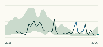 River gauge, United States Is the Ohio River unusually low at Portsmouth? Level now, history, the same date in past years and each year's range.
 Records, world Which places have set a new record low or high? Record lows and highs in our data, and the newest set.