North Carolina river levels today
Are the rivers and lakes in North Carolina unusually low or high?
We follow 402 water level gauges in North Carolina. 85 gauges read below their normal range for the date and 4 gauges above it.
How many gauges do we follow in North Carolina?
402 gauges of the 7,007 we follow in the United States, as of 21 November 2026.
How many waters in North Carolina have a level gauge?
212 waters with a level gauge, of the 3,733 waters we follow in the United States, as of 21 November 2026.
How many gauges read below normal for the date?
85 gauges below their normal range, of the 214 gauges with a current reading and a normal range for the date, not counting the 6 tide stations, as of 21 November 2026.
How many gauges read above normal for the date?
4 gauges above their normal range, of the 214 gauges with a current reading and a normal range for the date, not counting the 6 tide stations, as of 21 November 2026.
How the places stand today
85 places below normal and 4 places above
Which places are furthest below normal?
More places
Which places are furthest above normal?
Which gauges do we follow in North Carolina?
| Place | Reading | Against normal for the date | Change in a day |
|---|---|---|---|
| Abbotts Creek | |||
| Lexington | 3.12 ft | lower than any day of these dates in 29 years | -0.04 ft |
| Aberdeen Cr | |||
| W South St | 2.56 ft | +0.01 ft | |
| Ahoskie Creek | |||
| Ahoskie | 1.42 ft | within the normal range for the date | 0 ft |
| Ararat River | |||
| Ararat | 0.91 ft | in the lowest 5 percent for the date | +0.01 ft |
| Mt Airy | 12.76 ft | 0 ft | |
| Back Creek | |||
| Caldwell Rd near Harrisburg | 2.34 ft | within the normal range for the date | -0.01 ft |
| Bear Creek | |||
| Bear Creek Dam | 95.54 ft | -0.10 ft | |
| Beaver Creek | |||
| Cumberland | 2.51 ft | -0.05 ft | |
| Gruber Road at Fort Bragg | 6.83 ft | 0 ft | |
| Kelly Rd | 1.25 ft | +0.02 ft | |
| Louise St | 0.37 ft | -0.03 ft | |
| Morganton Rd | 8.64 ft | -0.01 ft | |
| Beaverdam Creek | |||
| Creedmore | 251.63 ft | ||
| SR1703 | 3.54 ft | -0.01 ft | |
| Windy Gap Rd | 0.80 ft | within the normal range for the date | +0.22 ft |
| Big Horse Creek | |||
| Lansing | 4.24 ft | -0.01 ft | |
| Big Shoe Heel Creek | |||
| Laurinburg | 0.78 ft | lower than any day of these dates in 38 years | +0.02 ft |
| Big Swamp | |||
| Tarheel | 4.81 ft | lower than any day of these dates in 35 years | +0.01 ft |
| Black River | |||
| Antioch Church Rd | 0.92 ft | 0 ft | |
| Tomahawk | 1.66 ft | in the lowest 5 percent for the date | +0.01 ft |
| Blounts Creek | |||
| Winslow St at Fayetteville | 3.60 ft | 0 ft | |
| Bolin Creek | |||
| Village Drive | 1.00 ft | lower than any day of these dates in 14 years | +0.04 ft |
| Booker Creek | |||
| Chapel Hill | 2.30 ft | +0.01 ft | |
| SR 1751 near Chapel Hill | 3.84 ft | -0.04 ft | |
| Briar Creek | |||
| Colony Road | 2.12 ft | within the normal range for the date | 0 ft |
| Edward's Branch | 1.00 ft | within the normal range for the date | 0 ft |
| Independence Blvd | 0.74 ft | +0.01 ft | |
| Providence road | 1.15 ft | within the normal range for the date | +0.01 ft |
| Shamrock Drive | 1.35 ft | within the normal range for the date | +0.01 ft |
| Broad River | |||
| highway 9 near Chimney Rock | 0.78 ft | +0.01 ft | |
| Sandy Run Ck, 3 SSW Boiling Springs | 1.89 ft | within the normal range for the date | +0.20 ft |
| Broad River in NC/SC | |||
| Lake Lure Dam | 990.00 ft | -0.10 ft | |
| Brush Creek | |||
| Muirfield Rd in Greensboro | 1.74 ft | in the lowest 10 percent for the date | -0.01 ft |
| Brushy Fork | |||
| E 5th St | 2.13 ft | +0.07 ft | |
| S.R. 1311 | 1.05 ft | -0.01 ft | |
| Buckhorn Creek | |||
| Corinth | 1.98 ft | within the normal range for the date | 0 ft |
| Buffalo Creek | |||
| Headwaters | 1.57 ft | 0 ft | |
| Bushy Branch Creek | |||
| Gorman Street at Raleigh | 1.37 ft | 0 ft | |
| Campbell Creek | |||
| Idlewild road | 1.12 ft | within the normal range for the date | -0.02 ft |
| Cane Creek | |||
| Bakersville | 2.58 ft | 0 ft | |
| Carrboro | 0.84 ft | in the lowest 10 percent for the date | 0 ft |
| Cape Fear River | |||
| Elizabethtown | 10.80 ft | +0.08 ft | |
| Fayetteville | 9.43 ft | lower than any day of these dates in 47 years | +0.01 ft |
| Lillington | 1.37 ft | within the normal range for the date | -0.10 ft |
| Lock 1 | 14.56 ft | in the lowest 5 percent for the date | +0.04 ft |
| W.O. Huske Lock | 1.00 ft | in the lowest 5 percent for the date | +0.02 ft |
| Wilmington | 0.008 m below the tide table | within the normal range for the date | |
| Cartoogechaye Creek | |||
| Franklin | 0.20 ft | -0.03 ft | |
| Carvers Creek | |||
| Shawcroft Rd | 1.30 ft | ||
| Cashie River | |||
| Windsor | 4.31 ft | within the normal range for the date | 0 ft |
| Catawba Creek | |||
| E Hudson Blvd 2 SW Gastonia | 1.37 ft | -0.29 ft | |
| Catawba River | |||
| Lake Hickory/Oxford Dam | 98.35 ft | -0.08 ft | |
| Lake James/Linville Dam | 96.69 ft | -0.02 ft | |
| Lake Norman/Cowans Ford Dam | 96.54 ft | +0.02 ft | |
| Lake Rhodhiss Dam | 97.24 ft | -0.04 ft | |
| Lookout Shoals Lake and Dam | 97.42 ft | -0.55 ft | |
| Mountain Island Lake and Dam | 96.86 ft | +0.03 ft | |
| N Main St (US 221 Business) 2 NW Marion | 12.03 ft | -0.02 ft | |
| Pleasant Gardens | 1.62 ft | within the normal range for the date | 0 ft |
| Cheoah river | |||
| Santeetlah Dam | 1,815.73 ft | +0.02 ft | |
| Tapoco | 2.80 ft | within the normal range for the date | 0 ft |
| Chockoyette Creek | |||
| Chockoyette Creek at I-95 | 1.95 ft | -0.01 ft | |
| Clarke Creek NC | |||
| Harrisburg | 3.83 ft | in the highest 10 percent for the date | -0.02 ft |
| Clear Creek | |||
| SR3181 | 1.06 ft | in the lowest 5 percent for the date | +0.01 ft |
| Coddle Creek | |||
| SR 1612 nr Davidson | 2.08 ft | within the normal range for the date | +0.01 ft |
| Coffee Creek | |||
| S Tryon St (NC 49), 3 ENE Steele Creek | 2.10 ft | within the normal range for the date | -0.02 ft |
| Colington Creek | |||
| Colington Cut | 0.00 ft | 0 ft | |
| Contentnea Creek | |||
| Black Creek | 7.32 ft | -0.04 ft | |
| Grifton | 5.53 ft | 0 ft | |
| Hookerton | 4.61 ft | within the normal range for the date | +0.01 ft |
| Lucama | 2.14 ft | within the normal range for the date | 0 ft |
| Sheppard Ferry | 6.20 ft | 0 ft | |
| Snow Hill | 6.16 ft | 0 ft | |
| Speights Bridge | 5.87 ft | +0.02 ft | |
| Stantonsburg | 6.37 ft | +0.01 ft | |
| US 301 | 4.41 ft | 0 ft | |
| Cove Creek | |||
| Highway 64 | 2.07 ft | within the normal range for the date | 0 ft |
| Crabtree Creek | |||
| Anderson Drive | 1.98 ft | lower than any day of these dates in 30 years | -0.01 ft |
| Capitol Blvd (US Rt 1) | -0.31 ft | lower than any day of these dates in 31 years | -0.02 ft |
| Crabtree Creek Greenway at Morrisville | 2.99 ft | +0.10 ft | |
| Ebenezer Church Rd | 3.99 ft | within the normal range for the date | +0.11 ft |
| Glenwood Ave | 4.49 ft | within the normal range for the date | -0.02 ft |
| Old Wake Forest Road | 1.05 ft | in the lowest 5 percent for the date | -0.01 ft |
| Cross Creek | |||
| Langdon St | 3.04 ft | +0.01 ft | |
| Cross Creek NC | |||
| Blue Street at Fayetteville | 4.01 ft | +0.08 ft | |
| Hillsboro St | 1.11 ft | +0.07 ft | |
| Cullasaja River | |||
| Peaceful Cove Rd (above Cullasaja River RV Park), 6 SE Franklin | 2.05 ft | -0.01 ft | |
| Currituck Sound | |||
| Buckskin Creek at NC 168 near Sligo | 0.60 ft | +0.48 ft | |
| Currituck Sound at NC 158 | -0.27 ft | -0.26 ft | |
| Marsh Causeway @ NC 615 | -0.16 ft | -0.19 ft | |
| Outer Bank Center For Wildlife Education in Corolla | 0.40 ft | within the normal range for the date | -0.10 ft |
| Dan River | |||
| Francisco | 1.27 ft | 0 ft | |
| Pine Hall | 1.54 ft | +0.01 ft | |
| Wentworth | 1.11 ft | 0 ft | |
| Davidson River | |||
| hwy 276 near Pisgah Forest | 0.66 ft | within the normal range for the date | -0.01 ft |
| Deep Creek | |||
| Deep Creek road near Bryson City | 2.28 ft | 0 ft | |
| Dickens Rd | 3.04 ft | 0 ft | |
| Deep River | |||
| Moncure | 1.07 ft | in the lowest 10 percent for the date | -0.06 ft |
| Ramseur | 0.81 ft | within the normal range for the date | 0 ft |
| Drowning Creek | |||
| Hoffman | 1.64 ft | in the lowest 5 percent for the date | 0 ft |
| Dutch Creek | |||
| Broadstone Road | 2.83 ft | ||
| East Fork of Deep River | |||
| High Point | 2.07 ft | in the lowest 5 percent for the date | 0 ft |
| East Fork Pigeon River | |||
| Canton | -0.15 ft | in the lowest 5 percent for the date | -0.01 ft |
| East Prong Roaring River | |||
| S.R. 1002 | 4.30 ft | -0.01 ft | |
| Edwards Branch | |||
| Sheffield drive | 0.80 ft | +0.02 ft | |
| EF New River | |||
| Bamboo Road | 1.58 ft | -0.02 ft | |
| Deerfield Road | 1.49 ft | -0.02 ft | |
| Elk Creek | |||
| Elkville | 0.92 ft | within the normal range for the date | -0.01 ft |
| Ellerbe Creek | |||
| Club Blvd in Durham | 1.01 ft | in the highest 5 percent for the date | 0 ft |
| Gorman | 0.75 ft | lower than any day of these dates in 20 years | -0.08 ft |
| Eno River | |||
| Durham | 2.08 ft | within the normal range for the date | +0.02 ft |
| Hillsborough | 1.48 ft | within the normal range for the date | -0.04 ft |
| Huckleberry Springs | 1.97 ft | in the lowest 5 percent for the date | 0 ft |
| First Broad River | |||
| Casar | 0.49 ft | within the normal range for the date | -0.01 ft |
| Lawndale | 0.67 ft | within the normal range for the date | +0.01 ft |
| Fisher River | |||
| S.R. 1100 (Turkey Ford Road) | 1.37 ft | +0.02 ft | |
| Fishing Creek | |||
| Enfield | 2.53 ft | within the normal range for the date | +0.14 ft |
| Flat Creek | |||
| Flat Creek Rd. 1 SW Montreat | 7.39 ft | ||
| Iverness | 0.64 ft | lower than any day of these dates in 30 years | -0.01 ft |
| Flat River | |||
| Bahama | 0.98 ft | within the normal range for the date | 0 ft |
| Lake Mitchie | 1.20 ft | within the normal range for the date | +0.02 ft |
| Fourmile Creek | |||
| Elm Lane | 3.32 ft | within the normal range for the date | +0.06 ft |
| French Broad River | |||
| Grove Bridge Rd, in Blantyre | 5.26 ft | within the normal range for the date | -0.03 ft |
| Old Fanning Bridge Rd, 3 W Fletcher | 4.05 ft | within the normal range for the date | -0.02 ft |
| Pearson Bridge Rd, 2 NW Asheville | 1.11 ft | in the lowest 10 percent for the date | -0.01 ft |
| Rollins Rd, 1 SE Marshall | 1.30 ft | within the normal range for the date | 0 ft |
| Rosman | 2.06 ft | within the normal range for the date | -0.01 ft |
| Silver Mine Ck, in Hot Springs | 2.64 ft | within the normal range for the date | +0.01 ft |
| Gar Creek | |||
| SR 2074 nr Croft #6531 | 1.05 ft | within the normal range for the date | 0 ft |
| Goose Creek | |||
| Hwy 1524 nr Indian Trail | 0.40 ft | within the normal range for the date | -0.01 ft |
| SR1525 nr Indian Trail | 1.03 ft | in the lowest 5 percent for the date | +0.01 ft |
| Grassy Creek | |||
| NC 226 at Grassy Creek | 2.06 ft | 0 ft | |
| Green Mill Run | |||
| 14th St in Greenville | 0.66 ft | 0 ft | |
| Green River | |||
| Lake Summit Dam | 100.45 ft | -0.02 ft | |
| Gum Branch | |||
| Gum Branch road | 1.81 ft | within the normal range for the date | -0.01 ft |
| Haw River | |||
| Bynum | 2.62 ft | lower than any day of these dates in 30 years | 0 ft |
| Haw River | 1.56 ft | lower than any day of these dates in 30 years | +0.01 ft |
| Jordan Lake | 211.86 ft | in the lowest 5 percent for the date | -0.04 ft |
| Moncure | 2.06 ft | in the lowest 10 percent for the date | 0 ft |
| NC-62 | 1.58 ft | -0.04 ft | |
| Hitchcock Creek | |||
| Steele St | 0.12 ft | 0 ft | |
| Hominy Swamp | |||
| Forest Hills Rd near Wilson | 1.96 ft | 0 ft | |
| Wilson | 3.42 ft | -0.01 ft | |
| Horsepen Creek | |||
| US-220 Near Greensboro | 2.04 ft | within the normal range for the date | -0.08 ft |
| Hunting Creek | |||
| E Houstonville Rd. 3 NNE Harmony | 0.26 ft | within the normal range for the date | -0.01 ft |
| Morganton | 1.85 ft | 0 ft | |
| Irvins Creek | |||
| Sam Newell Road | 0.70 ft | lower than any day of these dates in 27 years | 0 ft |
| Irwin Creek | |||
| Charlotte Water Treatment Plant, 1 S Reid Park | 0.40 ft | in the lowest 10 percent for the date | -0.02 ft |
| Statesville Ave, in Lincoln Heights | 1.74 ft | in the lowest 5 percent for the date | 0 ft |
| Ivy River | |||
| Barnardsville | 2.14 ft | 0 ft | |
| Marshall | 1.97 ft | in the lowest 10 percent for the date | 0 ft |
| Jacob Fork | |||
| Old NC 18 in Shoups Ford | 1.69 ft | within the normal range for the date | 0 ft |
| Johns River | |||
| Corpening Bridge Rd, 6 NNW Morganton | 2.14 ft | within the normal range for the date | -0.01 ft |
| Johnsons Mill Run | |||
| Greenville | 6.38 ft | 0 ft | |
| Jonathan Creek | |||
| Maggie Valley | 4.00 ft | 0 ft | |
| Kendrick Creek | |||
| Roper | -0.17 ft | -0.01 ft | |
| Killian Creek | |||
| Mariposa | 3.29 ft | within the normal range for the date | -0.01 ft |
| Knap of the Reeds Creek | |||
| Butner | 2.86 ft | within the normal range for the date | +0.04 ft |
| Leith Creek | |||
| East Church St | 5.33 ft | -0.02 ft | |
| Linville River | |||
| Nebo | 2.00 ft | within the normal range for the date | -0.01 ft |
| Little Alamance Creek | |||
| Graham | 1.85 ft | +0.01 ft | |
| Overbrook Dr | 1.54 ft | 0 ft | |
| Little Buffalo Creek | |||
| Jefferson | 1.67 ft | -0.01 ft | |
| Little Contentnea Creek | |||
| Ayden | 7.22 ft | ||
| Farmville | 5.81 ft | -0.02 ft | |
| Little Fishing Creek | |||
| Ringwood | 1.41 ft | lower than any day of these dates in 31 years | 0 ft |
| Little Hope Creek | |||
| Seneca Pl, in Madison Park | 3.06 ft | within the normal range for the date | +0.04 ft |
| Little Lick Creek | |||
| Oak Grove | 1.33 ft | within the normal range for the date | 0 ft |
| Little River | |||
| Linden | 2.47 ft | +0.02 ft | |
| Manchester | 6.10 ft | within the normal range for the date | +0.12 ft |
| Merrill Ln, 3 S Penrose | 1.05 ft | 0 ft | |
| Mount Pleasant | 2.97 ft | 0 ft | |
| NC18 near Blevins Crossroads | 2.63 ft | 0 ft | |
| Niagara Carthage Rd | 2.47 ft | +0.02 ft | |
| Orange Factory | 0.02 ft | lower than any day of these dates in 38 years | 0 ft |
| Princeton | 0.50 ft | in the lowest 5 percent for the date | +0.01 ft |
| Sparta | 1.67 ft | +0.01 ft | |
| Tributary at Fairntosh | 2.72 ft | within the normal range for the date | +0.01 ft |
| Zebulon | 1.81 ft | within the normal range for the date | +0.01 ft |
| Little River (North Carolina) | |||
| Star/Troy | 1.20 ft | in the lowest 10 percent for the date | -0.01 ft |
| Little Rockfish Creek | |||
| Lakeview Rd near Hope Mills | 2.46 ft | -0.01 ft | |
| Strickland Bridge Rd | 5.25 ft | +0.16 ft | |
| Wallace | 0.89 ft | 0 ft | |
| Little Sugar Creek | |||
| Archdale Dr, 1 ESE Montclaire | 2.20 ft | in the lowest 5 percent for the date | +0.01 ft |
| E 36th St, in North Davidson (NoDa) | 0.40 ft | within the normal range for the date | 0 ft |
| Hillside Ave, in Myers Park | 0.93 ft | within the normal range for the date | 0 ft |
| Medical Center Dr, 1 SSW Cherry | 1.90 ft | within the normal range for the date | 0 ft |
| NC51 Pineville | 1.64 ft | within the normal range for the date | -0.01 ft |
| Little Tennessee River | |||
| Cheoah Dam | 1,150.47 ft | -0.83 ft | |
| Fontana Dam TVA | 1,659.26 ft | -0.16 ft | |
| Lake Emory Dam | 99.55 ft | +0.03 ft | |
| Needmore | 1.95 ft | within the normal range for the date | 0 ft |
| Prentiss | 1.42 ft | within the normal range for the date | -0.01 ft |
| Little Yadkin River | |||
| Dalton | 0.55 ft | in the lowest 5 percent for the date | -0.02 ft |
| Long Creek | |||
| Bessemer City 3 NE | 1.05 ft | within the normal range for the date | +0.01 ft |
| Paw Creek | 1.56 ft | within the normal range for the date | +0.04 ft |
| Rhyne NC | 2.91 ft | within the normal range for the date | -0.05 ft |
| Lower Creek | |||
| Lenoir | 0.25 ft | -0.02 ft | |
| Lower Little River | |||
| Ellendale | 0.57 ft | in the lowest 5 percent for the date | +0.01 ft |
| Lumber River | |||
| Lumberton | 6.92 ft | +0.02 ft | |
| Lumberton West 5th Street | 7.10 ft | in the lowest 5 percent for the date | 0 ft |
| Pembroke | 5.35 ft | +0.01 ft | |
| Lyle Creek | |||
| Section House Rd 2 NW Conover | 0.20 ft | 0 ft | |
| Lynn Branch | |||
| MacDonald Woods Park | 1.83 ft | -0.03 ft | |
| Mallard Creek | |||
| Stony Creek nr Harrisburg | 2.58 ft | lower than any day of these dates in 31 years | +0.01 ft |
| Marsh Creek | |||
| New Hope | 2.82 ft | within the normal range for the date | -0.01 ft |
| Mayo Creek | |||
| Bethel Hill | 1.95 ft | within the normal range for the date | 0 ft |
| Mayo River | |||
| Price | 0.96 ft | in the lowest 5 percent for the date | 0 ft |
| McAlpine Creek | |||
| Colony Rd | 1.73 ft | within the normal range for the date | -0.03 ft |
| Idlewild | 2.00 ft | within the normal range for the date | -0.01 ft |
| Sardis Road | 0.57 ft | in the lowest 10 percent for the date | -0.01 ft |
| Waste Water Treatment Plant | 1.23 ft | within the normal range for the date | +0.02 ft |
| McDowell Creek | |||
| Beatties Ford Rd. | 4.47 ft | within the normal range for the date | +0.07 ft |
| Huntersville | 1.59 ft | within the normal range for the date | +0.10 ft |
| McKee Creek | |||
| Wilgrove | 1.81 ft | within the normal range for the date | +0.01 ft |
| McMullen Creek | |||
| Lincrest Place | 1.05 ft | in the lowest 10 percent for the date | -0.01 ft |
| Sharon View | 0.76 ft | in the lowest 10 percent for the date | -0.01 ft |
| MF New River | |||
| Deerfield Road | 2.35 ft | -0.02 ft | |
| MF SF New River | |||
| U.S. 221/321 | 1.07 ft | -0.02 ft | |
| Middle Creek | |||
| Clayton | 1.58 ft | in the lowest 5 percent for the date | -0.01 ft |
| Mill Creek | |||
| Orchard St, in Old Fort | 0.91 ft | 0 ft | |
| Mill Swamp | |||
| Richlands | 3.54 ft | -0.02 ft | |
| Mills Branch | |||
| Bridgeton | 7.08 ft | -0.02 ft | |
| Mills River | |||
| Mills River | 1.80 ft | within the normal range for the date | -0.01 ft |
| Moravian Creek | |||
| Wilkesboro | 7.99 ft | 0 ft | |
| Morgan Creek | |||
| Chapel Hill | 4.04 ft | within the normal range for the date | -0.10 ft |
| White Cross | 1.92 ft | lower than any day of these dates in 34 years | -0.01 ft |
| Mountain Creek | |||
| SR1617 Nr Bahama | 3.58 ft | ||
| Mud Creek | |||
| N Main St 1 N Hendersonville | 5.56 ft | -0.01 ft | |
| Muddy Creek | |||
| I-40 nr Clemmons | 1.80 ft | 0 ft | |
| Robinhood Rd | 1.70 ft | -0.01 ft | |
| Mulberry Creek | |||
| Collettsville | 2.18 ft | -0.02 ft | |
| N Fork Catawba River | |||
| Highway 221 | 2.75 ft | -0.02 ft | |
| N Second Creek | |||
| Statesville Blvd (US 70) 4 S Woodleaf | 2.41 ft | within the normal range for the date | 0 ft |
| N Toe River | |||
| Highland Ave, in Spruce Pine | 4.04 ft | -0.01 ft | |
| N.E. Cape Fear River | |||
| Beulaville | 6.28 ft | -0.01 ft | |
| Burgaw | 1.12 ft | in the lowest 5 percent for the date | +0.25 ft |
| Chinquapin | 1.65 ft | lower than any day of these dates in 30 years | 0 ft |
| Nahunta Swamp | |||
| Shine | 2.58 ft | within the normal range for the date | 0 ft |
| Nantahala River | |||
| Hewitt | 1.18 ft | within the normal range for the date | 0 ft |
| Nantahala Dam | 82.79 ft | +0.17 ft | |
| Rainbow Springs | 0.94 ft | within the normal range for the date | -0.01 ft |
| Neuse River | |||
| Clayton | 1.17 ft | in the lowest 5 percent for the date | +0.01 ft |
| Falls Dam | 0.93 ft | within the normal range for the date | 0 ft |
| Falls Lake | 244.74 ft | -0.03 ft | |
| Fort Barnwell | 1.97 ft | in the lowest 5 percent for the date | +0.03 ft |
| Goldsboro | 2.35 ft | lower than any day of these dates in 32 years | +0.02 ft |
| Kinston | 2.70 ft | lower than any day of these dates in 29 years | -0.02 ft |
| Main St in Seven Springs | 2.13 ft | +0.01 ft | |
| Smithfield | 4.23 ft | within the normal range for the date | -0.02 ft |
| New Hope Creek | |||
| Blands | 4.54 ft | within the normal range for the date | 0 ft |
| NC-54 | 3.73 ft | -0.01 ft | |
| New River | |||
| Gum Branch | 1.52 ft | lower than any day of these dates in 25 years | -0.03 ft |
| Richlands | 3.14 ft | -0.06 ft | |
| North Buffalo Creek | |||
| Church St in Greensboro | 2.00 ft | within the normal range for the date | -0.03 ft |
| Greensboro | 0.86 ft | lower than any day of these dates in 28 years | -0.04 ft |
| SR2819 near McCleansville | 1.93 ft | lower than any day of these dates in 28 years | -0.08 ft |
| Westover Terrace | 0.59 ft | lower than any day of these dates in 27 years | +0.01 ft |
| North Carolina Coast | |||
| Beaufort, Duke Marine Lab | 0.087 m above the tide table | within the normal range for the date | |
| Duck | 0.09 m above the tide table | within the normal range for the date | |
| Oregon Inlet Marina | 0.041 m above the tide table | within the normal range for the date | |
| USCG Station Hatteras | 0.04 m above the tide table | within the normal range for the date | |
| Wrightsville Beach | 0.159 m above the tide table | within the normal range for the date | |
| North Fork New River | |||
| Ashland | 1.13 ft | 0 ft | |
| Clifton | 1.10 ft | -0.04 ft | |
| North Prong Falling Creek | |||
| Rockingham Rd | 1.51 ft | -0.01 ft | |
| North Toe River | |||
| Newland | 0.65 ft | 0 ft | |
| Northeast Creek | |||
| Genlee | 4.44 ft | within the normal range for the date | -0.01 ft |
| SS1182 near Lowes Grove | 1.07 ft | within the normal range for the date | -0.03 ft |
| Oconaluftee River | |||
| Contesky Dr, in Birdtown | 1.10 ft | within the normal range for the date | -0.01 ft |
| Parker Creek | |||
| Greenville | 5.23 ft | 0 ft | |
| Pasquotank River | |||
| Mariners Wharf Park at Elizabeth City | -0.49 ft | -0.23 ft | |
| Paw Creek | |||
| Wilkinson Blvd | 1.25 ft | within the normal range for the date | +0.01 ft |
| Pee Dee River | |||
| Ansonville | 3.97 ft | +0.04 ft | |
| Blewett Falls Lake | 174.27 ft | -0.52 ft | |
| Lake Tillery | 277.21 ft | -0.04 ft | |
| Rockingham | 2.17 ft | within the normal range for the date | +0.10 ft |
| Pigeon House Creek | |||
| Cameron Village | 1.41 ft | within the normal range for the date | 0 ft |
| Dortch St at Raleigh | 2.19 ft | -0.01 ft | |
| Fenton St | 3.95 ft | +0.01 ft | |
| Pigeon River | |||
| (W Fork) Abv Lake Logan | 0.84 ft | in the lowest 5 percent for the date | -0.01 ft |
| (W Fork) nr Retreat | 1.14 ft | ||
| Jonathans Ck, 4 NW Crabtree | 1.71 ft | within the normal range for the date | -0.02 ft |
| Old River Rd (NC 215), 1 SW Canton | 1.39 ft | in the lowest 10 percent for the date | -0.01 ft |
| Queen Creek | |||
| Queens Creek Dam | 82.18 ft | -0.88 ft | |
| Reddies River | |||
| N. Wilkesboro | 0.98 ft | within the normal range for the date | 0 ft |
| Reedy Creek | |||
| Gibsonville | 0.59 ft | in the lowest 5 percent for the date | +0.03 ft |
| I-485 nr Pine Ridge | 1.64 ft | within the normal range for the date | 0 ft |
| NC2128 Nr Oak Ridge | 3.70 ft | within the normal range for the date | -0.01 ft |
| SR 2803 | 1.52 ft | within the normal range for the date | 0 ft |
| Reedy Fork | |||
| Old NC-87 | 1.49 ft | -0.05 ft | |
| Reedy Patch Creek | |||
| Bat Cave | 1.23 ft | ||
| Richland Creek | |||
| Autumn Care | 3.74 ft | +0.01 ft | |
| Roanoke River | |||
| Halifax | 16.97 ft | lower than any day of these dates in 30 years | +0.05 ft |
| Hamilton | 2.06 ft | in the lowest 5 percent for the date | -0.02 ft |
| Lake Gaston | 199.41 ft | ||
| Roanoke Rapids | 2.91 ft | within the normal range for the date | +0.36 ft |
| Roanoke Rapids Dam | 128.80 ft | -0.70 ft | |
| Scotland Neck | 4.33 ft | in the lowest 5 percent for the date | -0.02 ft |
| Williamston | 4.22 ft | within the normal range for the date | +0.02 ft |
| Roanoke Sound | |||
| Pond Island | 0.13 ft | -0.13 ft | |
| Roaring River | |||
| S.R. 1993 | 2.19 ft | 0 ft | |
| Rockfish Creek | |||
| Raeford | 2.84 ft | in the lowest 5 percent for the date | 0 ft |
| Research Dr near Fayetteville | 1.66 ft | ||
| Rocky Branch | |||
| Pullen Park in Raleigh | 4.84 ft | in the highest 10 percent for the date | +0.01 ft |
| Rocky Broad River | |||
| Bat Cave | 4.45 ft | +0.02 ft | |
| Rocky River | |||
| Siler City | 2.03 ft | in the lowest 5 percent for the date | 0 ft |
| Rocky River NC | |||
| Norwood | 3.90 ft | within the normal range for the date | -0.01 ft |
| Rocky River/ abv Irish Buffalo Ck | 1.12 ft | lower than any day of these dates in 26 years | +0.01 ft |
| SR1300 near Crutchfield | 3.55 ft | higher than any day of these dates in 30 years | -0.01 ft |
| Ryan Creek | |||
| US220 at Greensboro | 1.02 ft | within the normal range for the date | 0 ft |
| S Toe River | |||
| Whiteoak Ck, 2 SSE Celo | 0.76 ft | within the normal range for the date | 0 ft |
| S Yadkin River | |||
| Foster Rd, 6 SW Mocksville | 1.99 ft | within the normal range for the date | -0.01 ft |
| Sandy Creek | |||
| Cornwallis Rd | 2.00 ft | within the normal range for the date | +0.01 ft |
| Scotts Creek | |||
| Beta | 2.54 ft | ||
| Second Broad River | |||
| Logan | 1.62 ft | in the lowest 10 percent for the date | 0 ft |
| SF Catawba River | |||
| George Poston Park, 1 N Lowell | 2.02 ft | within the normal range for the date | +0.01 ft |
| SF New River | |||
| Roby Green Road | 2.11 ft | -0.02 ft | |
| Simmons Branch | |||
| Lail Court near Raleigh | 1.33 ft | 0 ft | |
| Six Mile Creek | |||
| Marvin Rd, 2 NW Marvin | 3.39 ft | within the normal range for the date | 0 ft |
| Six Runs Creek | |||
| US 421 | 1.71 ft | +0.23 ft | |
| Smith River | |||
| Eden | 1.75 ft | in the lowest 5 percent for the date | -0.06 ft |
| South Buffalo Creek | |||
| McConnell Rd Nr Greensboro | 1.17 ft | in the lowest 5 percent for the date | -0.01 ft |
| Pomona | 0.95 ft | within the normal range for the date | +0.01 ft |
| US220 Nr Greensboro | 2.06 ft | within the normal range for the date | 0 ft |
| South Fork Catawba River | |||
| Henry Fork | 1.23 ft | within the normal range for the date | 0 ft |
| Laboratory | 0.91 ft | within the normal range for the date | -0.03 ft |
| South Fork New River | |||
| Jefferson | 1.89 ft | within the normal range for the date | -0.01 ft |
| SR 1100 near Brownwood | 3.58 ft | -0.02 ft | |
| US Hwy 221 | 6.66 ft | -0.02 ft | |
| Steele Creek | |||
| Carowinds Blvd, 2.5 SSE Steele Creek | 1.07 ft | within the normal range for the date | +0.02 ft |
| Stewart Creek | |||
| State St. | 0.90 ft | within the normal range for the date | +0.04 ft |
| W Morehead St (US 29), in Wesley Heights | 1.26 ft | in the lowest 10 percent for the date | +0.03 ft |
| Stony Creek | |||
| Bus US 70 | 3.20 ft | -0.02 ft | |
| Nashville | 2.02 ft | +0.01 ft | |
| Rocky Mount | 3.67 ft | -0.74 ft | |
| Sugar Creek | |||
| Rock Hill-Pineville Rd (NC 51), 1 WNW Pineville | 0.81 ft | in the lowest 5 percent for the date | +0.08 ft |
| W Arrowood Rd, 2 W Starmount | 0.16 ft | in the lowest 5 percent for the date | +0.07 ft |
| Swannanoa River | |||
| Hendersonville Rd (NC 81), in Biltmore Village (2 S Asheville) | 1.31 ft | in the lowest 5 percent for the date | 0 ft |
| Swift Creek | |||
| Apex | 1.82 ft | within the normal range for the date | -0.05 ft |
| McCuller's Crossroads | 1.61 ft | in the lowest 10 percent for the date | +0.01 ft |
| SR1555 Nr Clayton | 1.20 ft | in the lowest 5 percent for the date | +0.01 ft |
| Streets Ferry | 1.90 ft | within the normal range for the date | +0.57 ft |
| Vanceboro | 5.42 ft | +0.30 ft | |
| Symphony Lake | |||
| Cary | 0.35 ft | 0 ft | |
| Taggart Creek | |||
| West Blvd (NC 160), 1 WSW Reid Park | 1.59 ft | within the normal range for the date | +0.02 ft |
| Tanasee Creek | |||
| East Fork Dam | 89.88 ft | -0.42 ft | |
| Tar River | |||
| Greenville | 3.75 ft | within the normal range for the date | +0.22 ft |
| Grimesland | 0.25 ft | +0.26 ft | |
| Langley Crossroads | 0.59 ft | within the normal range for the date | 0 ft |
| Louisburg | 3.23 ft | lower than any day of these dates in 39 years | -0.03 ft |
| NC581 Nr Spring Hope | 1.89 ft | lower than any day of these dates in 14 years | +0.01 ft |
| NC97 In Rocky Mount | 2.96 ft | in the lowest 5 percent for the date | +0.01 ft |
| Rock Springs | 2.15 ft | -0.07 ft | |
| Tar River | 1.20 ft | in the lowest 5 percent for the date | 0 ft |
| Tarboro | 1.18 ft | in the lowest 5 percent for the date | 0 ft |
| US301 Bypass at Rocky Mount | 3.28 ft | +0.16 ft | |
| Third Fork Creek | |||
| ML King Pkwy in Durham | 0.15 ft | 0 ft | |
| Woodcroft Park | 1.31 ft | within the normal range for the date | +0.01 ft |
| Tick Creek | |||
| Mount Vernon Springs | 1.30 ft | in the lowest 10 percent for the date | -0.01 ft |
| Torrence Creek | |||
| Huntersville | 1.24 ft | in the lowest 5 percent for the date | 0 ft |
| Tranters Creek | |||
| Washington | 0.19 ft | +0.28 ft | |
| Trent River | |||
| Pollocksville | 1.53 ft | +0.55 ft | |
| Trenton | 0.34 ft | -0.02 ft | |
| Tuckasegee River | |||
| Barkers creek nr Dillsboro | 3.20 ft | in the lowest 10 percent for the date | +0.05 ft |
| Everett St, in Bryson City | 1.93 ft | within the normal range for the date | +0.02 ft |
| Scott's Creek inflow | 1.45 ft | -0.27 ft | |
| sr1172 nr Cullowhee | 4.29 ft | within the normal range for the date | +0.10 ft |
| Tuckasegee Dam | 99.50 ft | -0.02 ft | |
| Tusquittee Creek | |||
| Hayesville | 2.44 ft | -0.02 ft | |
| UT to Buffalo Creek | |||
| S.R. 1506 | 2.20 ft | -0.01 ft | |
| Valley River | |||
| Tomotla | 1.74 ft | within the normal range for the date | -0.01 ft |
| Waccamaw River | |||
| Freeland | 2.16 ft | within the normal range for the date | +0.02 ft |
| Walnut Creek | |||
| Buck Jones Road | 1.02 ft | +0.01 ft | |
| Byrum St in Cary | 0.33 ft | 0 ft | |
| Downstream Side of E Park | 0.96 ft | 0 ft | |
| East Park St in Cary | 0.70 ft | -0.03 ft | |
| Maynard St in Cary | 1.28 ft | 0 ft | |
| Rose Ln in Raleigh | 5.05 ft | +0.06 ft | |
| S. State St. | 1.62 ft | +0.01 ft | |
| S. Wilmington St. | 0.59 ft | -0.01 ft | |
| Sunnybrook Dr in Raleigh | 2.49 ft | within the normal range for the date | +0.03 ft |
| Trailwood Drive | 3.87 ft | 0 ft | |
| Watauga River | |||
| Aldridge Road | 1.01 ft | ||
| Foscoe | 3.98 ft | 0 ft | |
| Sugar Grove | 1.58 ft | within the normal range for the date | -0.01 ft |
| West Branch Rocky River NC | |||
| mouth of South Prong River | 2.96 ft | within the normal range for the date | 0 ft |
| West Fork Pigeon River | |||
| Bethel | 0.12 ft | lower than any day of these dates in 31 years | 0 ft |
| West Fork Tuckasegee River | |||
| Thorpe Dam | 91.00 ft | -0.06 ft | |
| West Prong Roaring River | |||
| S.R. 1745 | 4.61 ft | ||
| White Oak Creek | |||
| Green Level | 2.36 ft | within the normal range for the date | -0.06 ft |
| Williams Old Mill Branch | |||
| US 421 | 6.20 ft | -0.05 ft | |
| Wilson Creek | |||
| Adako Rd 3 SW Collettsville | 2.99 ft | 0 ft | |
| Winkler Creek | |||
| Meadowview Drive in Boone | 1.87 ft | 0 ft | |
| Wolf Creek | |||
| Wolf Creek Dam | 90.72 ft | -0.21 ft | |
| Yadkin River | |||
| Badin Lake | 540.48 ft | ||
| Elkin | 1.34 ft | within the normal range for the date | 0 ft |
| Enon | 2.66 ft | within the normal range for the date | +0.01 ft |
| High Rock Lake | 647.87 ft | ||
| Patterson | 0.98 ft | within the normal range for the date | 0 ft |
| Wilkesboro | 2.25 ft | within the normal range for the date | -0.01 ft |
| Yadkin College | 0.75 ft | in the lowest 10 percent for the date | -0.04 ft |
Keep exploring
 Country, United States Are the rivers and lakes in the United States unusually low or high? Every river and lake we follow here, against normal for the date.
 Today's list, United States Which places in the United States are furthest from normal today? The places in the United States furthest below and above normal today.
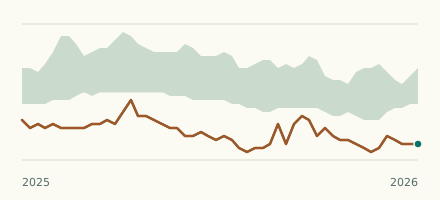 River gauge, United States Is the Bolin Creek unusually low at Village Drive? Level now, history, the same date in past years and each year's range.
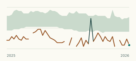 River gauge, United States Is the North Buffalo Creek unusually low at Greensboro? Level now, history, the same date in past years and each year's range.