Nebraska river levels today
Are the rivers and lakes in Nebraska unusually low or high?
We follow 234 water level gauges in Nebraska. 11 gauges read below their normal range for the date and 9 gauges above it.
How many gauges do we follow in Nebraska?
234 gauges of the 7,007 we follow in the United States, as of 21 November 2026.
How many waters in Nebraska have a level gauge?
103 waters with a level gauge, of the 3,733 waters we follow in the United States, as of 21 November 2026.
How many gauges read below normal for the date?
11 gauges below their normal range, of the 94 gauges with a current reading and a normal range for the date, as of 21 November 2026.
How many gauges read above normal for the date?
9 gauges above their normal range, of the 94 gauges with a current reading and a normal range for the date, as of 21 November 2026.
How the places stand today
11 places below normal and 9 places above
Which places are furthest below normal?
More places
Which places are furthest above normal?
8WNW Haigler, NebraskaNorth Fork Republican River
1.70 ft
higher than any day of these dates in 27 years
More places
Which gauges do we follow in Nebraska?
| Place | Reading | Against normal for the date | Change in a day |
|---|---|---|---|
| Antelope Creek | |||
| Lincoln (27th Street) | 3.38 ft | within the normal range for the date | +0.01 ft |
| Arikaree River | |||
| Haigler | 6.21 ft | higher than any day of these dates in 15 years | +0.01 ft |
| Bazile Creek | |||
| Center | 8.99 ft | within the normal range for the date | 0 ft |
| Niobrara | 1.86 ft | in the lowest 10 percent for the date | 0 ft |
| Beaver Creek | |||
| Beaver City | 3.15 ft | within the normal range for the date | +0.01 ft |
| Loretto | 1.99 ft | +0.01 ft | |
| Beaver Creek (Loup River tributary) | |||
| Genoa | 3.37 ft | within the normal range for the date | +0.03 ft |
| Big Blue River | |||
| Barneston | 4.24 ft | within the normal range for the date | -0.01 ft |
| Beatrice | 4.03 ft | -0.02 ft | |
| Crete | 9.11 ft | in the highest 5 percent for the date | -0.06 ft |
| Seward | 1.98 ft | 0 ft | |
| Staplehurst | 4.87 ft | -0.02 ft | |
| Surprise | 1.47 ft | 0 ft | |
| Big Nemaha River | |||
| Falls City | 4.63 ft | within the normal range for the date | -0.01 ft |
| Big Papillion Creek | |||
| Bennington | 5.46 ft | -0.07 ft | |
| Blair | 11.35 ft | ||
| Fort Street at Omaha | 3.31 ft | ||
| Kennard | 7.99 ft | ||
| Pacific Street at Omaha | 10.24 ft | ||
| Q Street at Omaha | 8.24 ft | -0.15 ft | |
| Big Sandy Creek | |||
| Alexandria | 2.64 ft | 0 ft | |
| Birdwood Creek | |||
| Hershey | 0.54 ft | -0.04 ft | |
| Blackbird Creek | |||
| Macy | 5.35 ft | ||
| Blue Creek | |||
| Lewellen | 3.52 ft | -0.04 ft | |
| Bow Creek | |||
| Wynot | 2.30 ft | in the lowest 10 percent for the date | -0.02 ft |
| Buffalo Creek | |||
| Haigler | 0.97 ft | within the normal range for the date | +0.01 ft |
| Overton | 2.32 ft | within the normal range for the date | -0.06 ft |
| Springfield | 9.47 ft | +0.01 ft | |
| Calamus River | |||
| Burwell | 2.70 ft | -0.01 ft | |
| Harrop | 4.24 ft | +0.01 ft | |
| Cedar River | |||
| Fullerton | 2.23 ft | -0.02 ft | |
| Spalding | 2.81 ft | -0.01 ft | |
| Center Creek | |||
| Franklin | 0.89 ft | +0.01 ft | |
| Clear Creek | |||
| Shelby | 4.61 ft | in the highest 10 percent for the date | +0.02 ft |
| Cole Creek | |||
| Blondo Street at Omaha | 5.49 ft | ||
| Davis Creek | |||
| Davis Creek Dam | 2,056.27 ft | +0.01 ft | |
| Deadmans Run | |||
| Lincoln (38th Street) | 8.65 ft | ||
| Dismal River | |||
| Thedford | 1.50 ft | within the normal range for the date | -0.01 ft |
| Driftwood Creek | |||
| McCook | 3.03 ft | within the normal range for the date | +0.02 ft |
| Elkhorn River | |||
| Atkinson | 2.65 ft | +0.01 ft | |
| Ewing | 2.75 ft | within the normal range for the date | +0.02 ft |
| Neligh | 2.79 ft | 0 ft | |
| Norfolk | 3.24 ft | within the normal range for the date | +0.02 ft |
| O'Neill | 1,942.81 ft | -0.02 ft | |
| Pilger | 6.88 ft | 0 ft | |
| Tilden | 7.25 ft | 0 ft | |
| Waterloo | 2.55 ft | within the normal range for the date | -0.02 ft |
| West Point | 4.22 ft | within the normal range for the date | -0.06 ft |
| Winslow | 8.87 ft | -0.02 ft | |
| Elm Creek (trib. to Platte River) | |||
| Elm Creek | 0.88 ft | 0 ft | |
| Elm Creek (trib. to Republican River) | |||
| Amboy | 8.13 ft | 0 ft | |
| Fox Creek | |||
| Curtis | 4.64 ft | 0 ft | |
| Frenchman Creek | |||
| Culbertson | 3.18 ft | within the normal range for the date | 0 ft |
| Palisade | 2.69 ft | within the normal range for the date | -0.02 ft |
| Haines Branch | |||
| Lincoln (SW 56th Street) | 3.08 ft | within the normal range for the date | +0.01 ft |
| Howe Creek | |||
| Walker Draw near Center | 1.75 ft | +0.01 ft | |
| Keya Paha River | |||
| Naper | 5.38 ft | -0.02 ft | |
| Lincoln Creek | |||
| Seward | 4.49 ft | 0 ft | |
| Little Blue River | |||
| Ayr | 0.33 ft | 0 ft | |
| Deshler | 5.80 ft | -0.01 ft | |
| Deweese | 2.78 ft | within the normal range for the date | -0.01 ft |
| Fairbury | 7.43 ft | within the normal range for the date | -0.04 ft |
| Hebron | 2.66 ft | -0.01 ft | |
| Little Nemaha River | |||
| Auburn | 3.23 ft | within the normal range for the date | -0.03 ft |
| Syracuse | 5.27 ft | +0.04 ft | |
| Little Papillion Creek | |||
| Ak-sar-ben at Omaha | 2.51 ft | -0.02 ft | |
| Irvington | 3.57 ft | within the normal range for the date | +0.01 ft |
| Little Salt Creek | |||
| Lincoln (Arbor Road) | 2.46 ft | within the normal range for the date | +0.03 ft |
| Lodgepole Creek | |||
| Bushnell | 3.01 ft | within the normal range for the date | +0.01 ft |
| Logan Creek | |||
| Pender | 2.19 ft | +0.04 ft | |
| Uehling | 3.43 ft | within the normal range for the date | -0.02 ft |
| Wakefield | 7.21 ft | within the normal range for the date | +0.02 ft |
| Long Pine Creek | |||
| Riverview | 1.85 ft | within the normal range for the date | +0.02 ft |
| Loup River | |||
| Columbus | 3.19 ft | 0 ft | |
| Genoa | 3.90 ft | within the normal range for the date | +0.01 ft |
| Loup River Power Canal | |||
| Columbus | 9.82 ft | -0.82 ft | |
| Genoa | 6.32 ft | within the normal range for the date | +0.06 ft |
| Maple Creek | |||
| Nickerson | 2.72 ft | within the normal range for the date | -0.01 ft |
| North Bend | 1,298.00 ft | +0.02 ft | |
| Medicine Creek | |||
| Curtis | 5.55 ft | -0.07 ft | |
| Harry Strunk Reservoir | 2,357.49 ft | +0.12 ft | |
| Somerset | 5.17 ft | -0.09 ft | |
| Middle Branch Big Nemaha River | |||
| Adams | 4.71 ft | ||
| Middle Creek | |||
| Lincoln (SW 63rd Street) | 2.28 ft | in the highest 10 percent for the date | -0.01 ft |
| Middle Loup River | |||
| Dunning | 3.01 ft | within the normal range for the date | +0.01 ft |
| Gates | 4.75 ft | +0.04 ft | |
| Rockville | 5.74 ft | -0.06 ft | |
| St. Paul | 1.96 ft | within the normal range for the date | +0.03 ft |
| Mira Creek | |||
| North Loup | 1.12 ft | -0.01 ft | |
| Missouri River | |||
| Blair | 8.44 ft | -0.09 ft | |
| Brownville | 21.80 ft | -0.01 ft | |
| Gavins Point Dam | 1,207.97 ft | +0.11 ft | |
| Highway 370 at Bellevue | 10.73 ft | -0.12 ft | |
| Highway 92 at Omaha | 9.20 ft | -0.11 ft | |
| Maskell | 18.45 ft | lower than any day of these dates in 18 years | +0.01 ft |
| Nebraska City | 5.90 ft | -0.04 ft | |
| Niobrara | 13.49 ft | in the lowest 5 percent for the date | +0.08 ft |
| Omaha | 8.92 ft | -0.11 ft | |
| Plattsmouth | 11.36 ft | -0.06 ft | |
| Ponca | 6.00 ft | +0.15 ft | |
| Rulo | 5.27 ft | -0.02 ft | |
| Sioux City | 5.51 ft | +0.01 ft | |
| St. James | 29.37 ft | -0.01 ft | |
| Verdel | 17.81 ft | in the lowest 10 percent for the date | +0.03 ft |
| Mud Creek | |||
| Sweetwater | 5.90 ft | -0.01 ft | |
| Muddy Creek | |||
| Arapahoe | 4.50 ft | 0 ft | |
| Furnas-Gosper County Line | 5.83 ft | -0.01 ft | |
| Niobrara River | |||
| Box Butte Reservoir | 3,986.01 ft | +0.04 ft | |
| Butte | 2.14 ft | +0.31 ft | |
| Gordon 11S | 0.44 ft | +0.01 ft | |
| Hay Springs 14S | 2.38 ft | +0.03 ft | |
| Mariaville | 2.93 ft | in the lowest 10 percent for the date | -0.12 ft |
| Nenzel 8S | 0.65 ft | -0.04 ft | |
| Niobrara | 32.02 ft | within the normal range for the date | -0.04 ft |
| Sparks | 2.87 ft | within the normal range for the date | -0.01 ft |
| Spencer | 6.69 ft | -0.18 ft | |
| Verdel | 3.92 ft | within the normal range for the date | +0.06 ft |
| North Blackbird Creek | |||
| Macy | 7.89 ft | -0.07 ft | |
| North Fork Big Nemaha River | |||
| Humboldt | 2.09 ft | +0.01 ft | |
| North Fork Elkhorn River | |||
| Norfolk | 1,491.92 ft | +0.01 ft | |
| Osmond | 1,625.77 ft | -0.02 ft | |
| Pierce | 2.78 ft | within the normal range for the date | +0.01 ft |
| North Fork Republican River | |||
| 8WNW Haigler, Nebraska | 1.70 ft | higher than any day of these dates in 27 years | +0.03 ft |
| North Loup River | |||
| Brewster | 2.86 ft | within the normal range for the date | +0.06 ft |
| Ord | 2.43 ft | 0 ft | |
| St. Paul | 2.63 ft | in the lowest 10 percent for the date | +0.07 ft |
| Taylor | 2.96 ft | in the lowest 5 percent for the date | -0.01 ft |
| North Oak Creek | |||
| Touhy | 3.58 ft | within the normal range for the date | +0.01 ft |
| Valparaiso | 4.65 ft | 0 ft | |
| North Platte River | |||
| Bridgeport | 3.80 ft | +0.01 ft | |
| Keystone | 1.53 ft | 0 ft | |
| Kingsley Dam | 3,205.70 ft | +0.10 ft | |
| Lewellen | 6.07 ft | +0.02 ft | |
| Lisco | 1.21 ft | 0 ft | |
| Minatare | 3.46 ft | +0.02 ft | |
| Mitchell | 3.88 ft | -0.03 ft | |
| North Platte | 4.93 ft | 0 ft | |
| Scottsbluff | 4.10 ft | lower than any day of these dates in 11 years | -0.02 ft |
| Sutherland | 2.92 ft | 0 ft | |
| Oak Creek | |||
| Lincoln (Air Park Road) | 0.82 ft | within the normal range for the date | +0.01 ft |
| Offutt Ditch (Bellevue Drain) | |||
| Offutt AFB | 3.77 ft | -0.03 ft | |
| Omaha Creek | |||
| Homer | 2.28 ft | within the normal range for the date | +0.01 ft |
| Papillion Creek | |||
| Fort Crook | 10.18 ft | within the normal range for the date | -0.09 ft |
| Harlan Lewis Road near La Platte | 10.81 ft | -0.04 ft | |
| Pebble Creek | |||
| Scribner | 2.70 ft | +0.04 ft | |
| Platte River | |||
| Ashland | 14.85 ft | within the normal range for the date | -0.01 ft |
| Brady | 2.09 ft | -0.01 ft | |
| Cozad (North Channel) | 2.81 ft | 0 ft | |
| Cozad (South Channel) | 3.29 ft | 0 ft | |
| Darr | 6.59 ft | +0.02 ft | |
| Duncan | 3.58 ft | within the normal range for the date | -0.06 ft |
| Fremont | 6.85 ft | -0.34 ft | |
| Grand Island | 3.52 ft | within the normal range for the date | -0.04 ft |
| Kearney | 2.65 ft | within the normal range for the date | -0.06 ft |
| La Platte | 10.66 ft | +0.10 ft | |
| Leshara | 4.15 ft | within the normal range for the date | -0.20 ft |
| Louisville | 3.52 ft | within the normal range for the date | +0.11 ft |
| Maxwell | 4.07 ft | +0.01 ft | |
| North Bend | 3.73 ft | within the normal range for the date | -0.03 ft |
| Odessa | 2.94 ft | -0.03 ft | |
| Overton | 2.58 ft | within the normal range for the date | -0.01 ft |
| Schuyler | 6.24 ft | ||
| Shelton | 2.63 ft | +0.01 ft | |
| Venice | 11.74 ft | within the normal range for the date | -0.15 ft |
| Ponca Creek | |||
| Verdel | 5.97 ft | within the normal range for the date | +0.02 ft |
| Prairie Creek | |||
| Silver Creek | 2.24 ft | within the normal range for the date | -0.02 ft |
| Pumpkin Creek | |||
| Bridgeport | 0.92 ft | +0.01 ft | |
| Red Willow Creek | |||
| 4W Indianola, Nebraska | 4.60 ft | within the normal range for the date | +0.01 ft |
| Republican River | |||
| Benkelman | 3.52 ft | within the normal range for the date | +0.04 ft |
| Cambridge | 3.75 ft | 0 ft | |
| Guide Rock | 4.49 ft | in the highest 10 percent for the date | -0.02 ft |
| Harlan Reservoir | 1,932.94 ft | 0 ft | |
| McCook | 3.19 ft | within the normal range for the date | 0 ft |
| Orleans | 0.99 ft | within the normal range for the date | -0.02 ft |
| Riverton | 1.89 ft | 0 ft | |
| Stratton | 5.55 ft | within the normal range for the date | +0.02 ft |
| Rock Creek | |||
| Ceresco | 3.85 ft | within the normal range for the date | 0 ft |
| Parks | 2.71 ft | higher than any day of these dates in 27 years | -0.01 ft |
| Rose Creek | |||
| Fairbury | 4.52 ft | -0.02 ft | |
| S. Fork Republican River | |||
| Benkelman | -0.52 ft | within the normal range for the date | +0.01 ft |
| Salt Creek | |||
| Ashland | 7.00 ft | within the normal range for the date | +0.06 ft |
| Greenwood | 2.13 ft | within the normal range for the date | -0.01 ft |
| Innovation Campus at Lincoln | 8.28 ft | in the lowest 10 percent for the date | -0.03 ft |
| Lincoln (27th Street) | 2.47 ft | within the normal range for the date | -0.04 ft |
| Lincoln (70th Street) | 3.48 ft | -0.02 ft | |
| Lincoln (Pioneers Boulevard) | 5.51 ft | within the normal range for the date | 0 ft |
| Roca | 2.21 ft | within the normal range for the date | -0.01 ft |
| Sappa Creek | |||
| Stamford | 5.98 ft | within the normal range for the date | 0 ft |
| Shell Creek | |||
| Columbus | 10.44 ft | within the normal range for the date | -0.06 ft |
| Silver Creek | |||
| Silver Creek | 4.93 ft | in the highest 5 percent for the date | +0.01 ft |
| Snake River | |||
| Burge | 1.86 ft | +0.01 ft | |
| Doughboy | 2.60 ft | +0.01 ft | |
| Merritt Dam | 2,943.33 ft | +0.40 ft | |
| South Blackbird Creek | |||
| Macy | 5.46 ft | +0.01 ft | |
| South Fork Elkhorn River | |||
| Ewing | 3.33 ft | 0 ft | |
| South Loup River | |||
| Arnold | 4.47 ft | within the normal range for the date | -0.02 ft |
| Pressey | 0.65 ft | 0 ft | |
| St. Michael | 2.52 ft | within the normal range for the date | -0.01 ft |
| South Omaha Creek | |||
| Walthill | 6.58 ft | within the normal range for the date | +0.02 ft |
| South Papillion Creek | |||
| Chalco | 15.97 ft | +0.02 ft | |
| Gretna | 5.49 ft | +0.01 ft | |
| South Platte River | |||
| North Platte | 6.30 ft | 0 ft | |
| Roscoe | 2.15 ft | in the lowest 10 percent for the date | 0 ft |
| Spring Creek | |||
| Overton | 2.70 ft | within the normal range for the date | 0 ft |
| Springfield Creek | |||
| Springfield | 5.45 ft | -0.01 ft | |
| Stevens Creek | |||
| Lincoln | 10.04 ft | in the highest 5 percent for the date | 0 ft |
| Stinking Water Creek | |||
| Palisade | 2.71 ft | 0 ft | |
| Thomas Creek | |||
| Bennington | 2.71 ft | ||
| Thompson Creek | |||
| Riverton | 3.56 ft | -0.01 ft | |
| Turkey Creek | |||
| DeWitt | 10.69 ft | within the normal range for the date | 0 ft |
| Kearney | 0.72 ft | -0.01 ft | |
| Wilber | 2.20 ft | +0.02 ft | |
| Turkey Creek (trib. to Middle Loup) | |||
| Dannebrog | 4.68 ft | -0.02 ft | |
| Turkey Creek (trib. to Republican River) | |||
| Edison | 3.89 ft | 0 ft | |
| Furnas-Gosper County Line | 4.08 ft | +0.01 ft | |
| Naponee | 1.38 ft | 0 ft | |
| Union Creek | |||
| Madison | 7.62 ft | +0.01 ft | |
| Madison (near) | 1,522.34 ft | -0.03 ft | |
| Verdigre Creek | |||
| Verdigre | 3.60 ft | -0.02 ft | |
| Wahoo Creek | |||
| Ashland | 4.92 ft | within the normal range for the date | -0.05 ft |
| Ithaca | 4.61 ft | within the normal range for the date | -0.08 ft |
| Wahoo | 7.43 ft | +0.02 ft | |
| Warm Slough | |||
| Central City | 4.02 ft | +0.05 ft | |
| Weeping Water Creek | |||
| Union | 2.73 ft | within the normal range for the date | +0.03 ft |
| West Fork Big Blue River | |||
| Dorchester | 3.30 ft | within the normal range for the date | -0.02 ft |
| Grafton | 3.60 ft | -0.01 ft | |
| West Papillion Creek | |||
| Elkhorn | 3.28 ft | ||
| Millard | 9.77 ft | ||
| Pacific Street at Omaha | 8.30 ft | ||
| Papillion | 10.48 ft | +0.01 ft | |
| White River | |||
| Crawford | 2.21 ft | +0.01 ft | |
| Willow Creek | |||
| Foster | 3.33 ft | +0.01 ft | |
| Wood River | |||
| Alda | 3.48 ft | +0.04 ft | |
| Grand Island Diversion | 12.44 ft | -0.01 ft | |
Keep exploring
 Country, United States Are the rivers and lakes in the United States unusually low or high? Every river and lake we follow here, against normal for the date.
 Today's list, United States Which places in the United States are furthest from normal today? The places in the United States furthest below and above normal today.
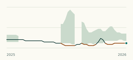 River gauge, United States Is the North Platte River unusually low at Scottsbluff? Level now, history, the same date in past years and each year's range.
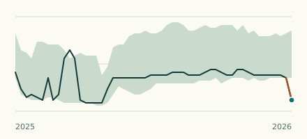 River gauge, United States Is the Missouri River unusually low at Maskell? Level now, history, the same date in past years and each year's range.