Maryland river levels today
Are the rivers and lakes in Maryland unusually low or high?
We follow 124 water level gauges in Maryland. One gauge has a current reading and a normal range for the date, and it reads below that range.
How many gauges do we follow in Maryland?
124 gauges of the 7,007 we follow in the United States, as of 21 November 2026.
How many waters in Maryland have a level gauge?
84 waters with a level gauge, of the 3,733 waters we follow in the United States, as of 21 November 2026.
How many gauges read below normal for the date?
1 gauge below its normal range, the only gauge with a current reading and a normal range for the date, not counting the 8 tide stations, as of 21 November 2026.
How many gauges read above normal for the date?
0 gauges above their normal range, the only gauge with a current reading and a normal range for the date, not counting the 8 tide stations, as of 21 November 2026.
How the places stand today
1 place below normal and 0 places above
Which places are furthest below normal?
Which gauges do we follow in Maryland?
| Place | Reading | Against normal for the date | Change in a day |
|---|---|---|---|
| Antietam Creek | |||
| Sharpsburg | 2.27 ft | 0 ft | |
| Waynesboro | 2.25 ft | +0.08 ft | |
| Baisman Run | |||
| Broadmoor | 1.13 ft | 0 ft | |
| Beaver Run | |||
| Finksburg | 0.51 ft | 0 ft | |
| Beaverdam Run | |||
| Cockeysville | 3.27 ft | -0.10 ft | |
| Beetree Run | |||
| Bentley Springs | 0.62 ft | +0.01 ft | |
| Bennett Creek | |||
| Park Mills | 1.54 ft | 0 ft | |
| Big Elk Creek | |||
| Elk Mills | 3.36 ft | +0.02 ft | |
| Big Pipe Creek | |||
| Bruceville | 0.94 ft | 0 ft | |
| Bynum Run | |||
| Bel Air | 0.65 ft | 0 ft | |
| Cabin Branch | |||
| Upper Marlboro / Ritchie Marlboro Road | 0.92 ft | 0 ft | |
| Casselman River | |||
| Grantsville | 1.01 ft | 0 ft | |
| Catoctin Creek | |||
| Middletown | 1.53 ft | 0 ft | |
| Chesapeake and Delaware Canal | |||
| Chesapeake City | 0.111 m above the tide table | within the normal range for the date | |
| Chesapeake Bay | |||
| Annapolis | 0.141 m above the tide table | within the normal range for the date | |
| Bishops Head | 0.149 m above the tide table | within the normal range for the date | |
| Solomons Island | 0.134 m above the tide table | within the normal range for the date | |
| Tolchester Beach | 0.124 m above the tide table | within the normal range for the date | |
| Choptank River | |||
| Cambridge | 0.108 m above the tide table | within the normal range for the date | |
| Collington Branch | |||
| Mitchellville | 0.92 ft | -0.01 ft | |
| Upper Marlboro / Leeland Road | 1.46 ft | -0.02 ft | |
| Conococheague Creek | |||
| Fairview | 1.41 ft | 0 ft | |
| Cranberry Branch | |||
| Westminster | 1.32 ft | +0.07 ft | |
| Dead Run | |||
| Catonsville | 0.38 ft | ||
| Franklintown | 0.38 ft | 0 ft | |
| Woodlawn | 0.30 ft | ||
| Dead Run Tributary | |||
| Woodlawn | 2.92 ft | ||
| Woodlawn (near) | 0.19 ft | ||
| Deer Creek | |||
| Darlington | 1.12 ft | 0 ft | |
| Rocks State Park | 1.97 ft | 0 ft | |
| East Branch Herbert Run | |||
| Arbutus | 0.86 ft | 0 ft | |
| Foster Branch | |||
| Joppatowne | 1.86 ft | 0 ft | |
| Georges Creek | |||
| Franklin/Westernport | 1.87 ft | 0 ft | |
| Georges Run | |||
| Beckleysville | 0.23 ft | +0.01 ft | |
| Grave Run | |||
| Beckleysville | -0.67 ft | +0.01 ft | |
| Gunpowder Falls | |||
| Glencoe | 0.75 ft | +0.01 ft | |
| Hoffmanville | 1.11 ft | 0 ft | |
| Parkton | 1.39 ft | 0 ft | |
| Gwynns Falls | |||
| Delight | 0.18 ft | 0 ft | |
| Villa Nova | 0.81 ft | 0 ft | |
| Washington Blvd in Baltimore | 2.34 ft | 0 ft | |
| Hawlings River | |||
| Sandy Spring | 0.49 ft | 0 ft | |
| Honeygo Run | |||
| White Marsh | 0.58 ft | 0 ft | |
| Hudson Branch | |||
| Rogers Avenue at Ellicott City | 253.44 ft | 0 ft | |
| James Run | |||
| Belcamp | 2.97 ft | -0.02 ft | |
| Jones Falls | |||
| Sorrento | 7.90 ft | 0 ft | |
| Licking Creek | |||
| Pecktonville | 1.72 ft | -0.01 ft | |
| Little Falls | |||
| Blue Mount | 0.11 ft | 0 ft | |
| Little Gunpowder Falls | |||
| Laurel Brook | 1.03 ft | ||
| Little Patuxent River | |||
| Allview | 271.83 ft | 0 ft | |
| Guilford | 1.97 ft | +0.02 ft | |
| Lake Kittamaqundi | 289.41 ft | +0.01 ft | |
| Savage | 3.00 ft | 0 ft | |
| Little Seneca Creek Tributary | |||
| Brink | 4.75 ft | 0 ft | |
| Clarksburg | 4.37 ft | 0 ft | |
| Germantown | 0.44 ft | 0 ft | |
| Long Green Creek | |||
| Glen Arm | 0.98 ft | +0.01 ft | |
| Long Quarter Branch | |||
| Lutherville | 1.04 ft | +0.01 ft | |
| Marsh Run | |||
| Grimes | 1.02 ft | 0 ft | |
| Maryland Coast | |||
| Ocean City Inlet | 0.134 m above the tide table | within the normal range for the date | |
| Mattawoman Creek | |||
| Pomonkey | 2.11 ft | +0.01 ft | |
| Minebank Run | |||
| Glen Arm | 4.08 ft | -0.01 ft | |
| Monocacy River | |||
| Bridgeport | 2.30 ft | -0.02 ft | |
| Frederick at Interstate 70 | 1.51 ft | 0 ft | |
| Monocacy Blvd. in Frederick | 1.42 ft | -0.01 ft | |
| Morgan Run | |||
| Louisville | 1.37 ft | -0.01 ft | |
| Nassawango Creek | |||
| Snow Hill | 1.86 ft | 0 ft | |
| North Branch Potomac River | |||
| Cumberland | 2.62 ft | 0 ft | |
| Kitzmiller | 2.13 ft | -0.02 ft | |
| Luke | 1.94 ft | 0 ft | |
| Steyer | 2.40 ft | -0.01 ft | |
| Northeast Branch Anacostia River | |||
| Riverdale | 0.42 ft | -0.01 ft | |
| Northwest Branch | |||
| Kemp Mill | 1.44 ft | 0 ft | |
| Northwest Branch Anacostia River | |||
| Brentwood MD | 1.05 ft | +0.01 ft | |
| Paint Branch | |||
| White Oak | 1.49 ft | 0 ft | |
| Paint Branch Tributary | |||
| Colesville | 1.54 ft | 0 ft | |
| Patapsco River | |||
| Baltimore | 0.136 m above the tide table | within the normal range for the date | |
| Catonsville | 10.35 ft | 0 ft | |
| Elkridge at Patapsco Valley State Park | 5.46 ft | -0.01 ft | |
| Elkridge below Patapsco Valley State Park | 7.62 ft | -0.01 ft | |
| Ellicott City | 113.98 ft | 0 ft | |
| Hollofield | 1.61 ft | 0 ft | |
| Patuxent River | |||
| Bowie | 4.28 ft | -0.03 ft | |
| Brighton Dam | 1.25 ft | 0 ft | |
| Duckett Dam near Laurel | 4.36 ft | -0.01 ft | |
| Unity | 2.05 ft | -0.01 ft | |
| Piney Run | |||
| Dover | 1.51 ft | +0.01 ft | |
| Piscataway Creek | |||
| Piscataway | 2.24 ft | +0.01 ft | |
| Plumtree Run | |||
| Bel Air | 1.07 ft | -0.01 ft | |
| Potomac River | |||
| Edwards Ferry | 2.88 ft | in the lowest 5 percent for the date | 0 ft |
| Hancock | 3.06 ft | -0.01 ft | |
| Paw Paw | 3.96 ft | 0 ft | |
| Point of Rocks | 1.06 ft | -0.02 ft | |
| Washington DC (Little Falls) | 2.70 ft | 0 ft | |
| Savage River | |||
| Bloomington | 0.80 ft | 0 ft | |
| Sawmill Creek | |||
| Glen Burnie | 1.88 ft | -0.01 ft | |
| Scotts Level Branch | |||
| Rockdale | 0.81 ft | 0 ft | |
| Seneca Creek | |||
| Dawsonville | 1.98 ft | 0 ft | |
| Sideling Hill Creek | |||
| Bellegrove | 0.34 ft | +0.01 ft | |
| Sligo Creek | |||
| Chillum / Riggs Rd. | 0.22 ft | 0 ft | |
| Takoma Park | 0.56 ft | -0.01 ft | |
| Soper Branch | |||
| Hyattstown | 0.44 ft | 0 ft | |
| Southwest Branch | |||
| Largo / Harry S Truman Dr | 1.90 ft | -0.04 ft | |
| St. Clement Creek | |||
| Clements | -0.18 ft | +0.01 ft | |
| St. Marys River | |||
| Great Mills | 1.41 ft | -0.09 ft | |
| Susquehanna River | |||
| Conowingo Dam | 10.83 ft | -0.83 ft | |
| Swan Creek | |||
| Swan Creek | 2.94 ft | 0 ft | |
| Ten Mile Creek | |||
| Boyds | 2.23 ft | -0.01 ft | |
| Clarksburg | 2.98 ft | 0 ft | |
| Town Creek | |||
| Oldtown | 1.92 ft | +0.01 ft | |
| Tributary to Dead Run Tributary | |||
| Woodlawn | 0.60 ft | ||
| Turkey Branch | |||
| Aspen Hill | 4.35 ft | +0.01 ft | |
| Unnamed Tributary | |||
| Middle River | 6.25 ft | ||
| West Branch Herring Run | |||
| Idlewylde | 0.86 ft | 0 ft | |
| Western Branch | |||
| Upper Marlboro | 1.63 ft | -0.04 ft | |
| Upper Marlboro / Marlboro Country Club | 0.51 ft | -0.04 ft | |
| Woodmore / Lottsford Road | 2.61 ft | -0.03 ft | |
| Western Run | |||
| Western Run | 0.86 ft | 0 ft | |
| Whitemarsh Run | |||
| Fullerton | 1.13 ft | 0 ft | |
| White Marsh | 2.87 ft | -0.01 ft | |
| Wills Creek | |||
| Cumberland | 1.82 ft | -0.01 ft | |
| Winters Run | |||
| Bel Air | 1.31 ft | 0 ft | |
| Benson | 1.31 ft | 0 ft | |
| Zekiah Swamp Run | |||
| Newtown | 0.87 ft | -0.01 ft | |
Keep exploring
 Country, United States Are the rivers and lakes in the United States unusually low or high? Every river and lake we follow here, against normal for the date.
 Today's list, United States Which places in the United States are furthest from normal today? The places in the United States furthest below and above normal today.
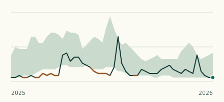 River gauge, United States Is the Potomac River unusually low at Edwards Ferry? Level now, history, the same date in past years and each year's range.
 Records, world Which places have set a new record low or high? Record lows and highs in our data, and the newest set.