Kansas river levels today
Are the rivers and lakes in Kansas unusually low or high?
We follow 166 water level gauges in Kansas. 15 gauges read below their normal range for the date and 7 gauges above it.
How many gauges do we follow in Kansas?
166 gauges of the 7,007 we follow in the United States, as of 21 November 2026.
How many waters in Kansas have a level gauge?
69 waters with a level gauge, of the 3,733 waters we follow in the United States, as of 21 November 2026.
How many gauges read below normal for the date?
15 gauges below their normal range, of the 111 gauges with a current reading and a normal range for the date, as of 21 November 2026.
How many gauges read above normal for the date?
7 gauges above their normal range, of the 111 gauges with a current reading and a normal range for the date, as of 21 November 2026.
How the places stand today
15 places below normal and 7 places above
Which places are furthest below normal?
More places
Which places are furthest above normal?
More places
Which gauges do we follow in Kansas?
| Place | Reading | Against normal for the date | Change in a day |
|---|---|---|---|
| 110 Mile Creek | |||
| Pomona Lake | 975.17 ft | within the normal range for the date | 0 ft |
| Arkansas River | |||
| Arkansas City | 3.31 ft | in the lowest 10 percent for the date | 0 ft |
| Coolidge | 2.95 ft | within the normal range for the date | -0.01 ft |
| Deerfield | 5.95 ft | -0.01 ft | |
| Derby | 0.68 ft | in the lowest 5 percent for the date | -0.04 ft |
| Dodge City | 6.60 ft | within the normal range for the date | 0 ft |
| Garden City | 5.18 ft | within the normal range for the date | 0 ft |
| Great Bend | 0.60 ft | in the lowest 5 percent for the date | +0.02 ft |
| Haven | 1.86 ft | in the lowest 5 percent for the date | +0.01 ft |
| Mulvane | 5.45 ft | -0.01 ft | |
| Oxford | 7.35 ft | -0.02 ft | |
| Syracuse | 4.69 ft | within the normal range for the date | -0.02 ft |
| Beaver Creek | |||
| Cedar Bluffs | 2.99 ft | within the normal range for the date | 0 ft |
| Big Blue River | |||
| Blue Rapids | 17.07 ft | in the highest 5 percent for the date | -0.13 ft |
| Manhattan | 2.84 ft | within the normal range for the date | -0.04 ft |
| Marysville | 14.29 ft | in the highest 5 percent for the date | -0.04 ft |
| Tuttle Creek Lake | 1,079.45 ft | within the normal range for the date | -0.06 ft |
| Big Creek | |||
| Hays | 4.93 ft | within the normal range for the date | -0.01 ft |
| Black Vermillion River | |||
| Frankfort | 3.26 ft | within the normal range for the date | +0.06 ft |
| Blue River | |||
| Stanley | 3.81 ft | within the normal range for the date | +0.03 ft |
| Bow Creek | |||
| Stockton | 4.06 ft | within the normal range for the date | +0.01 ft |
| Chapman Creek | |||
| Chapman | 4.44 ft | within the normal range for the date | 0 ft |
| Chikaskia River | |||
| Corbin | 2.37 ft | within the normal range for the date | -0.01 ft |
| Cimarron River | |||
| Forgan | 2.83 ft | -0.01 ft | |
| Cottonwood River | |||
| Emporia | 2.38 ft | -0.02 ft | |
| Florence | 2.96 ft | +0.01 ft | |
| Plymouth | 3.23 ft | within the normal range for the date | 0 ft |
| Cow Creek | |||
| Hutchinson | 1.67 ft | within the normal range for the date | -0.01 ft |
| Lyons | 3.65 ft | lower than any day of these dates in 37 years | -0.02 ft |
| Cowskin Creek | |||
| Wichita 119th St | 6.68 ft | lower than any day of these dates in 24 years | -0.02 ft |
| Crooked Creek | |||
| Englewood | 2.56 ft | within the normal range for the date | +0.01 ft |
| Cross Creek | |||
| Rossville | 7.65 ft | +0.03 ft | |
| Delaware River | |||
| Muscotah | 2.87 ft | within the normal range for the date | 0 ft |
| Perry Lake | 893.98 ft | within the normal range for the date | -0.01 ft |
| Dragoon Creek | |||
| Burlingame | 8.11 ft | within the normal range for the date | 0 ft |
| Elk River | |||
| Elk Falls | 2.36 ft | within the normal range for the date | 0 ft |
| Emma Creek | |||
| Sedgwick | -1.91 ft | +0.01 ft | |
| Fall River | |||
| Fredonia | 3.06 ft | within the normal range for the date | 0 ft |
| Indian Creek | |||
| Overland Park | 5.57 ft | within the normal range for the date | -0.01 ft |
| State Line Rd. | 10.23 ft | -0.05 ft | |
| Kansas River | |||
| 23rd Street - Kansas City - KS | 9.96 ft | in the lowest 5 percent for the date | -0.36 ft |
| Belvue | 12.11 ft | in the highest 10 percent for the date | +0.01 ft |
| De Soto | 6.56 ft | within the normal range for the date | -0.56 ft |
| Ft. Riley | 6.12 ft | within the normal range for the date | -0.47 ft |
| Lake Quivira | 11.27 ft | -0.15 ft | |
| Lawrence | -9.75 ft | -1.04 ft | |
| Lecompton | 4.24 ft | within the normal range for the date | -0.79 ft |
| Manhattan | 6.58 ft | within the normal range for the date | -0.28 ft |
| Topeka | 7.86 ft | within the normal range for the date | -0.39 ft |
| Wamego | 5.41 ft | within the normal range for the date | -0.05 ft |
| Lightning Creek (SE KS) | |||
| McCune | 0.77 ft | within the normal range for the date | -0.01 ft |
| Little Arkansas River | |||
| Alta Mills | -0.75 ft | in the lowest 5 percent for the date | +0.01 ft |
| Halstead | 5.70 ft | within the normal range for the date | +0.01 ft |
| Sedgwick | 1.78 ft | lower than any day of these dates in 31 years | -0.02 ft |
| Little Blue River | |||
| Barnes | 4.86 ft | in the highest 10 percent for the date | -0.06 ft |
| Hollenberg | 2.40 ft | within the normal range for the date | -0.02 ft |
| Little Osage River | |||
| Fulton | 3.10 ft | within the normal range for the date | -0.03 ft |
| Lyon Creek | |||
| Junction City | 5.84 ft | ||
| Marais Des Cygnes River | |||
| La Cygne | 4.46 ft | within the normal range for the date | -0.01 ft |
| Osawatomie | 13.10 ft | -0.02 ft | |
| Ottawa | 3.90 ft | within the normal range for the date | -0.05 ft |
| Reading | 2.75 ft | within the normal range for the date | -0.01 ft |
| Trading Post | 3.79 ft | within the normal range for the date | +0.18 ft |
| Marmaton River | |||
| Fort Scott | 6.66 ft | -0.03 ft | |
| Uniontown | -0.17 ft | -0.01 ft | |
| Medicine Lodge River | |||
| Kiowa | 0.05 ft | in the lowest 10 percent for the date | 0 ft |
| Mill Creek (PXCK1) | |||
| Paxico | 3.44 ft | within the normal range for the date | -0.01 ft |
| Mill Creek (WSHK1) | |||
| Washington | 2.14 ft | within the normal range for the date | -0.02 ft |
| Missouri River | |||
| Atchison | 5.99 ft | -0.30 ft | |
| Leavenworth | 1.64 ft | -0.20 ft | |
| Mud Creek | |||
| Talmage | 4.03 ft | +0.02 ft | |
| Mulberry Creek | |||
| Salina | 5.73 ft | higher than any day of these dates in 24 years | +0.12 ft |
| N F Solomon River | |||
| Glade | 2.71 ft | within the normal range for the date | +0.02 ft |
| Kirwin Reservoir | 1,704.81 ft | +0.01 ft | |
| Portis | 4.03 ft | within the normal range for the date | +0.01 ft |
| Neosho River | |||
| Americus | 3.24 ft | within the normal range for the date | +0.05 ft |
| Burlington | 6.59 ft | within the normal range for the date | 0 ft |
| Chanute | 8.46 ft | -0.01 ft | |
| Council Grove Lake | 1,274.20 ft | 0 ft | |
| Emporia | 9.30 ft | -0.02 ft | |
| Erie | 11.79 ft | -0.06 ft | |
| Iola | 7.15 ft | within the normal range for the date | -0.01 ft |
| John Redmond Lake | 1,041.37 ft | -0.04 ft | |
| Neosho Rapids | 2.52 ft | -0.11 ft | |
| Oswego | 6.52 ft | -0.10 ft | |
| Oswego (near) | 9.33 ft | -0.36 ft | |
| Parsons | 7.68 ft | within the normal range for the date | -0.19 ft |
| Ninnescah River | |||
| Belle Plaine | 8.57 ft | ||
| Murdock | 3.20 ft | lower than any day of these dates in 35 years | +0.02 ft |
| Peck | 2.38 ft | lower than any day of these dates in 35 years | 0 ft |
| Paradise Creek | |||
| Paradise | 8.43 ft | -0.01 ft | |
| Pawnee River | |||
| Burdett | 2.26 ft | within the normal range for the date | 0 ft |
| Rozel | 7.21 ft | within the normal range for the date | 0 ft |
| Pottawatomie Creek | |||
| Garnett | 3.25 ft | +0.02 ft | |
| Lane | 5.64 ft | -0.01 ft | |
| Prairie Dog Creek | |||
| Clayton 4E | 3.41 ft | within the normal range for the date | +0.01 ft |
| Norton Dam #2-DCP | 2,288.78 ft | 0 ft | |
| Woodruff | 1.53 ft | within the normal range for the date | -0.01 ft |
| Rattlesnake Creek | |||
| Macksville | 2.97 ft | within the normal range for the date | 0 ft |
| Zenith | 11.89 ft | within the normal range for the date | +0.01 ft |
| Republican River | |||
| Clay Center | 7.67 ft | within the normal range for the date | -0.04 ft |
| Concordia | 5.33 ft | within the normal range for the date | -0.03 ft |
| Hardy | 2.23 ft | within the normal range for the date | -0.02 ft |
| Milford Lake | 1,146.19 ft | within the normal range for the date | -0.02 ft |
| Scandia | 1.34 ft | +0.01 ft | |
| S F Solomon River | |||
| Osborne | 3.25 ft | within the normal range for the date | -0.02 ft |
| Webster Reservoir | 1,865.20 ft | 0 ft | |
| Webster Reservoir (above) | 2.24 ft | within the normal range for the date | +0.01 ft |
| Woodston | 4.00 ft | within the normal range for the date | 0 ft |
| Saline River | |||
| Lincoln | 10.68 ft | -0.02 ft | |
| Russell | 4.82 ft | within the normal range for the date | +0.03 ft |
| Tescott | 6.83 ft | within the normal range for the date | +0.02 ft |
| Wakeeney | 2.11 ft | within the normal range for the date | 0 ft |
| Wilson Lake | 1,511.27 ft | within the normal range for the date | +0.01 ft |
| Salt Creek | |||
| Ada | 4.67 ft | within the normal range for the date | +0.05 ft |
| Barnard | 14.85 ft | ||
| Salt Creek (LNDK1) | |||
| Lyndon | 0.75 ft | within the normal range for the date | -0.01 ft |
| Sappa Creek | |||
| Norcatur | 5.25 ft | within the normal range for the date | +0.03 ft |
| Shunganunga Creek | |||
| Topeka | 4.29 ft | within the normal range for the date | +0.02 ft |
| Topeka Gage Blvd | 4.81 ft | +0.01 ft | |
| Slate Creek | |||
| Wellington | 4.15 ft | within the normal range for the date | 0 ft |
| Smoky Hill River | |||
| Arnold | 0.26 ft | within the normal range for the date | +0.01 ft |
| Ellsworth | 1.41 ft | within the normal range for the date | -0.01 ft |
| Enterprise | 8.04 ft | within the normal range for the date | -0.07 ft |
| Kanopolis Lake | 1,465.74 ft | in the highest 10 percent for the date | -0.03 ft |
| Lindsborg | 6.94 ft | -0.01 ft | |
| Mentor | 4.19 ft | within the normal range for the date | 0 ft |
| New Cambria | 5.67 ft | 0 ft | |
| Oakley | 4.79 ft | in the highest 5 percent for the date | +0.06 ft |
| Russell | 4.01 ft | +0.01 ft | |
| Schoenchen | 2.83 ft | within the normal range for the date | +0.01 ft |
| Soldier Creek | |||
| Delia | 5.62 ft | within the normal range for the date | +0.01 ft |
| Topeka | 0.35 ft | within the normal range for the date | +0.01 ft |
| Solomon River | |||
| Beloit | 4.44 ft | -0.54 ft | |
| Glasco | 11.90 ft | ||
| Glen Elder | 7.46 ft | within the normal range for the date | -1.53 ft |
| Glen Elder Reservoir | 1,457.20 ft | -0.01 ft | |
| Minneapolis | 3.32 ft | -0.12 ft | |
| Niles | 6.37 ft | within the normal range for the date | -0.67 ft |
| South Fork Ninnescah River | |||
| Pratt | 2.84 ft | within the normal range for the date | +0.02 ft |
| Spring River | |||
| Baxter Springs | 2.81 ft | -0.01 ft | |
| Stranger Creek | |||
| Easton | 2.86 ft | -0.01 ft | |
| Tonganoxie | 2.64 ft | within the normal range for the date | -0.04 ft |
| Tomahawk Creek | |||
| Roe Avenue | 2.25 ft | +0.03 ft | |
| Turkey Creek | |||
| Seneca | 1.16 ft | within the normal range for the date | -0.01 ft |
| Southwest Boulevard | 0.00 ft | 0 ft | |
| Verdigris River | |||
| Altoona | 3.37 ft | within the normal range for the date | +0.02 ft |
| Coffeyville | 0.30 ft | 0 ft | |
| Independence | 1.31 ft | in the lowest 5 percent for the date | -0.10 ft |
| Vermillion Creek | |||
| Wamego | 3.15 ft | within the normal range for the date | +0.03 ft |
| Wakarusa River | |||
| Clinton Lake | 876.80 ft | within the normal range for the date | +0.01 ft |
| Lawrence | 4.22 ft | within the normal range for the date | +0.07 ft |
| Wakarusa | 2.75 ft | -0.04 ft | |
| Walnut Creek | |||
| Albert | 2.24 ft | within the normal range for the date | 0 ft |
| Nekoma | 7.07 ft | within the normal range for the date | +0.04 ft |
| Walnut River | |||
| Arkansas City | 2.73 ft | within the normal range for the date | +0.02 ft |
| Augusta | 5.52 ft | +0.02 ft | |
| El Dorado | 2.00 ft | +0.01 ft | |
| Winfield | 0.71 ft | in the lowest 5 percent for the date | +0.02 ft |
| West Branch Walnut River | |||
| El Dorado | 5.63 ft | 0 ft | |
| White Rock Creek | |||
| Burr Oak | 1.62 ft | within the normal range for the date | 0 ft |
| Lovewell Reservoir | 1,581.46 ft | 0 ft | |
| Whitewater River | |||
| Augusta | 3.63 ft | in the lowest 5 percent for the date | 0 ft |
| Towanda | 1.74 ft | within the normal range for the date | +0.01 ft |
| Wildcat Creek | |||
| Keats | 8.10 ft | within the normal range for the date | -0.01 ft |
| Manhattan Scenic Drive | 2.94 ft | +0.02 ft | |
Keep exploring
 Country, United States Are the rivers and lakes in the United States unusually low or high? Every river and lake we follow here, against normal for the date.
 Today's list, United States Which places in the United States are furthest from normal today? The places in the United States furthest below and above normal today.
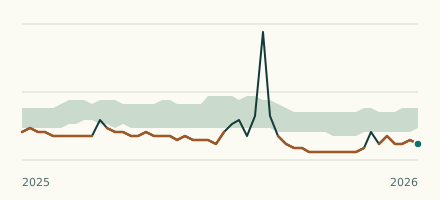 River gauge, United States Is the Ninnescah River unusually low at Murdock? Level now, history, the same date in past years and each year's range.
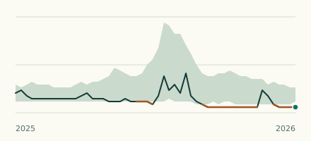 River gauge, United States Is the Little Arkansas River unusually low at Sedgwick? Level now, history, the same date in past years and each year's range.