Indiana river levels today
Are the rivers and lakes in Indiana unusually low or high?
We follow 186 water level gauges in Indiana. 7 gauges read below their normal range for the date and none above it.
How many gauges do we follow in Indiana?
186 gauges of the 7,007 we follow in the United States, as of 21 November 2026.
How many waters in Indiana have a level gauge?
84 waters with a level gauge, of the 3,733 waters we follow in the United States, as of 21 November 2026.
How many gauges read below normal for the date?
7 gauges below their normal range, of the 26 gauges with a current reading and a normal range for the date, as of 21 November 2026.
How many gauges read above normal for the date?
0 gauges above their normal range, of the 26 gauges with a current reading and a normal range for the date, as of 21 November 2026.
How the places stand today
7 places below normal and 0 places above
Which places are furthest below normal?
More places
Which gauges do we follow in Indiana?
| Place | Reading | Against normal for the date | Change in a day |
|---|---|---|---|
| Beaver Creek | |||
| Shoals | 1.61 ft | 0 ft | |
| Bee Hunter Ditch | |||
| Linton | 4.20 ft | -0.01 ft | |
| Big Blue River | |||
| Carthage | 0.64 ft | -0.03 ft | |
| Shelbyville | 4.77 ft | 0 ft | |
| Big Duck Creek | |||
| Elwood | 3.76 ft | within the normal range for the date | -0.01 ft |
| Big Pine Creek | |||
| Pine Village | 3.96 ft | +0.01 ft | |
| Big Raccoon Creek | |||
| Cecil M. Harden Lake | 644.29 ft | -0.25 ft | |
| Coxville | 5.71 ft | -0.24 ft | |
| Fincastle | 2.09 ft | +0.02 ft | |
| Big Walnut Creek | |||
| Reelsville | 0.81 ft | -0.01 ft | |
| Roachdale | 4.69 ft | +0.01 ft | |
| Blue River | |||
| Fredericksburg | 2.66 ft | +0.03 ft | |
| Brandywine Creek in Indiana | |||
| Greenfield | 5.29 ft | +0.04 ft | |
| Brush Creek | |||
| Nebraska | 1.77 ft | 0 ft | |
| Buck Creek | |||
| Acton | 1.70 ft | +0.03 ft | |
| Busseron Creek | |||
| Carlisle | 1.70 ft | 0 ft | |
| Carpenter Creek | |||
| Remington | 3.48 ft | 0 ft | |
| Cedar Creek | |||
| 18th Street Auburn | 2.69 ft | 0 ft | |
| Cedarville | 1.31 ft | 0 ft | |
| Cicero Creek | |||
| Arcadia | 2.67 ft | 0 ft | |
| State Road 19 in Tipton | 2.34 ft | +0.01 ft | |
| Clifty Creek | |||
| Columbus | 4.55 ft | 0 ft | |
| Hartsville | 0.65 ft | 0 ft | |
| Crooked Creek | |||
| Indianapolis | 2.68 ft | +0.01 ft | |
| Deep River | |||
| Hobart | 4.99 ft | -0.10 ft | |
| Liverpool | 6.43 ft | within the normal range for the date | -0.19 ft |
| Merrillville | 3.61 ft | -0.07 ft | |
| Deer Creek | |||
| Delphi | 1.90 ft | -0.01 ft | |
| Driftwood River | |||
| Edinburgh | 1.91 ft | 0 ft | |
| Eagle Creek | |||
| Clermont | 1.40 ft | 0 ft | |
| Eagle Creek Reservoir | 787.99 ft | within the normal range for the date | -0.01 ft |
| Raymond Street in Indianapolis | 1.62 ft | lower than any day of these dates in 12 years | -0.02 ft |
| Speedway | 0.99 ft | -0.01 ft | |
| Traders Point | 4.62 ft | within the normal range for the date | -0.01 ft |
| Zionsville | 1.31 ft | +0.01 ft | |
| East Arm Little Calumet River | |||
| Porter | 3.58 ft | -0.02 ft | |
| East Fork White Lick Creek | |||
| Mooresville | 3.55 ft | +0.01 ft | |
| East Fork White River | |||
| Columbus | -3.45 ft | +0.01 ft | |
| Rivervale | 3.78 ft | -0.01 ft | |
| Seymour | 3.27 ft | -0.02 ft | |
| Shoals | 2.61 ft | 0 ft | |
| Williams | 0.80 ft | ||
| East Fork Whitewater River | |||
| Abington | 4.79 ft | 0 ft | |
| Eel River | |||
| Bowling Green | 2.38 ft | -0.09 ft | |
| Logansport (Adamsboro) | 3.07 ft | -0.01 ft | |
| North Manchester | 2.84 ft | -0.01 ft | |
| Elkhart River | |||
| Goshen | 2.28 ft | -0.01 ft | |
| Fall Creek | |||
| 16th Street in Indianapolis | 6.40 ft | +0.03 ft | |
| Fortville | 1.66 ft | 0 ft | |
| Millersville | 1.78 ft | -0.01 ft | |
| Fish Creek | |||
| Hamilton | 3.19 ft | 0 ft | |
| Flatrock River | |||
| Columbus | 2.92 ft | within the normal range for the date | +0.01 ft |
| Raleigh | 4.06 ft | within the normal range for the date | 0 ft |
| Rushville | 4.44 ft | within the normal range for the date | 0 ft |
| St. Paul | 0.66 ft | 0 ft | |
| Grand Calumet River | |||
| Hammond (Columbia Ave) | 5.46 ft | +0.08 ft | |
| Hart Ditch | |||
| Dyer | 2.66 ft | +0.04 ft | |
| Munster | 0.78 ft | +0.02 ft | |
| Haw Creek | |||
| Clifford | 3.35 ft | 0 ft | |
| East Columbus | 2.65 ft | -0.06 ft | |
| Hope | 2.17 ft | -0.01 ft | |
| Indiana Harbor Canal | |||
| East Chicago (Lake Michigan outlet) | 9.07 ft | +0.03 ft | |
| Iroquois River | |||
| Foresman | 5.18 ft | -0.03 ft | |
| Rensselaer | 4.09 ft | -0.04 ft | |
| Kankakee River | |||
| Davis | 5.92 ft | -0.02 ft | |
| Dunns Bridge | 3.63 ft | -0.05 ft | |
| Kouts | 4.66 ft | -0.05 ft | |
| Shelby | 5.31 ft | -0.16 ft | |
| Lick Creek | |||
| Beech Grove | 1.22 ft | +0.01 ft | |
| Little Blue River | |||
| Walkerville | 4.29 ft | 0 ft | |
| Little Calumet River | |||
| Gary (Burr Street) | 4.62 ft | in the lowest 5 percent for the date | -0.17 ft |
| Gary (Grant St) | 6.39 ft | -0.06 ft | |
| Hammond (Indianapolis Boulevard) | 6.03 ft | 0 ft | |
| Highland (Kennedy Avenue) | 8.03 ft | -0.01 ft | |
| Lake Station | 3.50 ft | within the normal range for the date | -0.10 ft |
| Munster | 5.33 ft | 0 ft | |
| Munster (Northcote Avenue) | 9.90 ft | 0 ft | |
| Little Eagle Creek | |||
| Speedway | 0.13 ft | +0.01 ft | |
| Little River | |||
| Huntington | 1.97 ft | -0.01 ft | |
| Maumee River | |||
| Fort Wayne | 1.49 ft | +0.01 ft | |
| New Haven | 2.84 ft | +0.04 ft | |
| Mill Creek | |||
| Cagles Mill | 7.51 ft | in the lowest 5 percent for the date | 0 ft |
| Cagles Mill Lake | 636.24 ft | -0.04 ft | |
| Cataract | 4.54 ft | -0.01 ft | |
| Mississinewa River | |||
| Marion | 1.12 ft | 0 ft | |
| Peoria | 0.88 ft | in the lowest 5 percent for the date | +0.01 ft |
| Ridgeville | 3.78 ft | +0.02 ft | |
| Mud Creek | |||
| Fishers | 2.83 ft | +0.01 ft | |
| Muscatatuck River | |||
| Deputy | 3.30 ft | 0 ft | |
| North Branch Elkhart River | |||
| Cosperville | 3.51 ft | -0.01 ft | |
| North Fork Salt Creek | |||
| Nashville | 4.92 ft | +0.09 ft | |
| Ohio River | |||
| Cannelton Lock and Dam | 11.10 ft | in the lowest 5 percent for the date | -1.19 ft |
| Clifty Creek | 421.98 ft | +0.18 ft | |
| Evansville | 14.78 ft | within the normal range for the date | -0.42 ft |
| Mount Vernon | 24.50 ft | +0.70 ft | |
| Newburgh Lock and Dam | 14.37 ft | within the normal range for the date | -0.82 ft |
| Patoka River | |||
| Patoka Lake | 536.24 ft | -0.08 ft | |
| Princeton | 5.76 ft | within the normal range for the date | -0.14 ft |
| Pigeon Creek | |||
| Angola | 5.24 ft | -0.01 ft | |
| Pigeon River | |||
| Scott | 3.18 ft | -0.01 ft | |
| Pipe Creek | |||
| Frankton | 3.31 ft | 0 ft | |
| Pleasant Run | |||
| Arlington Avenue in Indianapolis | 3.04 ft | +0.01 ft | |
| Plum Creek | |||
| Groveland | 1.62 ft | -0.01 ft | |
| Pogues Run | |||
| Dam near I-70 in Eastern Marion County | 3.97 ft | -0.04 ft | |
| Vermont Street in Indianapolis | 1.33 ft | 0 ft | |
| Portage-Burns Waterway | |||
| Portage (Lake Michigan outlet) | 4.40 ft | within the normal range for the date | +0.12 ft |
| Praire Creek | |||
| Lebanon | 4.93 ft | -0.05 ft | |
| Salamonie River | |||
| Dora | 3.03 ft | in the lowest 10 percent for the date | 0 ft |
| Portland | 2.49 ft | +0.10 ft | |
| Warren | 6.65 ft | -0.02 ft | |
| Salt Creek | |||
| Harrodsburg | 6.45 ft | within the normal range for the date | -0.02 ft |
| Monroe Lake | 537.30 ft | -0.03 ft | |
| Valparaiso | 3.24 ft | 0 ft | |
| Sand Creek | |||
| Fishers | 1.85 ft | 0 ft | |
| Smothers Creek | |||
| Plainville | 6.36 ft | +0.02 ft | |
| South Fork Wildcat Creek | |||
| Lafayette | 2.67 ft | +0.02 ft | |
| Spy Run Creek | |||
| Ft. Wayne Childrens Zoo | 5.84 ft | 0 ft | |
| St. Joseph River (MI/IN) | |||
| Elkhart | 18.55 ft | +0.02 ft | |
| South Bend | -0.11 ft | -0.12 ft | |
| St. Joseph River (OH/IN) | |||
| Fort Wayne | 0.17 ft | -0.01 ft | |
| St. Marys River | |||
| Decatur | 3.33 ft | -0.03 ft | |
| Fort Wayne | 1.17 ft | +0.01 ft | |
| Stony Creek | |||
| Fishersburg | 3.59 ft | 0 ft | |
| Noblesville | 1.85 ft | 0 ft | |
| Sugar Creek | |||
| Crawfordsville | 3.01 ft | within the normal range for the date | -0.01 ft |
| Sugar Creek (central) | |||
| Edinburgh | 3.75 ft | 0 ft | |
| New Palestine | 2.63 ft | 0 ft | |
| Tippecanoe River | |||
| Delphi | 2.37 ft | 0 ft | |
| North Webster | 3.37 ft | -0.46 ft | |
| Oakdale Dam | 4.69 ft | -0.09 ft | |
| Ora | 5.92 ft | -0.02 ft | |
| Oswego | 5.24 ft | 0 ft | |
| Winamac | 4.36 ft | +0.02 ft | |
| Turkey Creek | |||
| Merrillville | 5.97 ft | -0.07 ft | |
| Schererville | 3.75 ft | -0.01 ft | |
| Vernon Fork Muscatatuck River | |||
| Vernon | 4.29 ft | +0.03 ft | |
| Wabash River | |||
| Bluffton | 1.46 ft | -0.02 ft | |
| Covington | 6.71 ft | -0.40 ft | |
| Huntington | 9.61 ft | within the normal range for the date | +0.25 ft |
| Lafayette | 2.93 ft | -0.35 ft | |
| Linn Grove | 4.41 ft | 0 ft | |
| Logansport | 3.40 ft | -0.50 ft | |
| Montezuma | 5.23 ft | -0.25 ft | |
| New Harmony | 2.31 ft | +0.09 ft | |
| Peru | 5.13 ft | -0.18 ft | |
| Riverton | 5.17 ft | -0.32 ft | |
| Terre Haute...US Hwy 150 Eastbound | 5.68 ft | -0.30 ft | |
| Vincennes | 4.67 ft | -0.17 ft | |
| Wabash | 3.10 ft | +0.09 ft | |
| West Fork Whitewater River | |||
| Alpine | 6.04 ft | 0 ft | |
| Whiskey Run | |||
| Marengo | 1.63 ft | within the normal range for the date | 0 ft |
| White Lick Creek | |||
| Mooresville | 6.73 ft | -0.02 ft | |
| White River | |||
| 146th Street near Noblesville | 3.27 ft | 0 ft | |
| 16th Street in Indianapolis | 7.13 ft | -0.05 ft | |
| 82nd Street Bridge near Nora | 2.03 ft | -0.20 ft | |
| Anderson | 4.19 ft | +0.85 ft | |
| Broad Ripple | 2.93 ft | -0.08 ft | |
| Broad Ripple Dam | 1.20 ft | within the normal range for the date | -0.16 ft |
| Centerton | 0.64 ft | within the normal range for the date | -0.02 ft |
| Edwardsport | 3.89 ft | -0.01 ft | |
| Edwardsport (near) | 4.19 ft | -0.03 ft | |
| Elliston | 7.76 ft | ||
| Indianapolis Museum of Art | 3.08 ft | -0.18 ft | |
| Michigan Street in Indianapolis | 7.16 ft | -0.03 ft | |
| Muncie | 4.04 ft | 0 ft | |
| Newberry | 1.46 ft | -0.02 ft | |
| Noblesville | 3.75 ft | +0.01 ft | |
| Old U.S. Highway 41 located at Hazleton | 1.69 ft | -0.01 ft | |
| Petersburg | 2.42 ft | -0.04 ft | |
| Petersburg (above) | 3.53 ft | 0 ft | |
| Raible Avenue in Anderson | 2.30 ft | -0.01 ft | |
| Ravenswood (near) | 2.57 ft | within the normal range for the date | -0.09 ft |
| Raymond Street in Indianapolis | 2.57 ft | in the lowest 5 percent for the date | -0.03 ft |
| Spencer | 2.13 ft | -0.01 ft | |
| Stout Power Plant | 1.40 ft | -0.02 ft | |
| Strawtown | 3.73 ft | +0.01 ft | |
| Whitewater River | |||
| Brookville | 3.48 ft | -0.21 ft | |
| Wildcat Creek | |||
| Jerome | 1.67 ft | +0.02 ft | |
| Kokomo | 3.01 ft | -0.02 ft | |
| Lafayette | 2.85 ft | +0.03 ft | |
| Owasco | 1.92 ft | 0 ft | |
| William Locke Drain | |||
| Durbin | 5.99 ft | 0 ft | |
| Williams Creek | |||
| 96th Street on the Hamilton-Marion County Line | 3.27 ft | -0.01 ft | |
| Yellow River | |||
| Knox | 5.01 ft | 0 ft | |
| Plymouth | 4.74 ft | -0.01 ft | |
| Youngs Creek | |||
| Amity | 1.52 ft | +0.02 ft | |
Keep exploring
 Country, United States Are the rivers and lakes in the United States unusually low or high? Every river and lake we follow here, against normal for the date.
 Today's list, United States Which places in the United States are furthest from normal today? The places in the United States furthest below and above normal today.
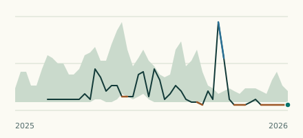 River gauge, United States Is the Eagle Creek unusually low at Raymond Street in Indianapolis? Level now, history, the same date in past years and each year's range.
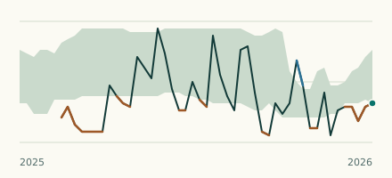 River gauge, United States Is the Mill Creek unusually low at Cagles Mill? Level now, history, the same date in past years and each year's range.