Idaho river levels today
Are the rivers and lakes in Idaho unusually low or high?
We follow 86 water level gauges in Idaho. 1 gauge reads below its normal range for the date and none above it.
How many gauges do we follow in Idaho?
86 gauges of the 7,007 we follow in the United States, as of 21 November 2026.
How many waters in Idaho have a level gauge?
51 waters with a level gauge, of the 3,733 waters we follow in the United States, as of 21 November 2026.
How many gauges read below normal for the date?
1 gauge below its normal range, of the 2 gauges with a current reading and a normal range for the date, as of 21 November 2026.
How many gauges read above normal for the date?
0 gauges above their normal range, of the 2 gauges with a current reading and a normal range for the date, as of 21 November 2026.
How the places stand today
1 place below normal and 0 places above
Which places are furthest below normal?
Which gauges do we follow in Idaho?
| Place | Reading | Against normal for the date | Change in a day |
|---|---|---|---|
| Antelope Creek | |||
| Darlington | 4.61 ft | +0.04 ft | |
| Bear River | |||
| Border | 1.03 ft | +0.03 ft | |
| Idaho-Utah State Line | 9.53 ft | +0.08 ft | |
| Pescadero | 1.95 ft | +0.04 ft | |
| Big Lost River | |||
| Arco | 2.01 ft | 0 ft | |
| Howell Ranch | 1.05 ft | -0.01 ft | |
| Mackay Reservoir | 1.46 ft | -0.02 ft | |
| Big Wood River | |||
| Hailey | 1.69 ft | -0.03 ft | |
| Ketchum | 4.93 ft | -0.01 ft | |
| Magic Dam | 1.81 ft | -0.02 ft | |
| S. Broadford Bridge | 5.82 ft | -0.04 ft | |
| Stanton Crossing | 4.78 ft | -0.05 ft | |
| Blackfoot River | |||
| Blackfoot (Butte Road-Ft. Hall) | 2.83 ft | -0.03 ft | |
| Blackfoot Res nr Henry | 1.71 ft | +0.02 ft | |
| Shelley (Wolverine Canyon) | 5.55 ft | +0.02 ft | |
| Bruneau River | |||
| Hot Springs | 4.56 ft | -0.03 ft | |
| Camas Creek (Eastern ID) | |||
| Camas | 2.72 ft | 0 ft | |
| Clearwater River | |||
| Orofino | 2.89 ft | -0.07 ft | |
| Spalding | 3.52 ft | -0.10 ft | |
| Coeur d'Alene River | |||
| Cataldo | 32.67 ft | -0.03 ft | |
| Enaville | 57.41 ft | -0.04 ft | |
| East Fork Big Wood River | |||
| Gimlet | 5.06 ft | -0.02 ft | |
| Fall River (WY-ID) | |||
| Chester | 2.30 ft | -0.02 ft | |
| Goose Creek | |||
| Oakley | 1.89 ft | +0.04 ft | |
| Henrys Fork | |||
| Rexburg | 3.79 ft | +0.07 ft | |
| St Anthony | 3.49 ft | +0.02 ft | |
| Kootenai River | |||
| Bonners Ferry | 51.59 ft | within the normal range for the date | +0.06 ft |
| Lake Pend Oreille | |||
| Hope | 57.95 ft | ||
| Lemhi River | |||
| Lemhi | 4.00 ft | +0.04 ft | |
| Little Lost River | |||
| Howe | 1.99 ft | -0.01 ft | |
| Wet Creek (Clyde) | 1.25 ft | 0 ft | |
| Little Salmon River | |||
| Riggins | 2.51 ft | -0.03 ft | |
| Little Wood River | |||
| Carey | 0.83 ft | -0.01 ft | |
| High 5 Creek | 1.67 ft | 0 ft | |
| Malad River | |||
| Gooding | -0.06 ft | -0.02 ft | |
| Marsh Creek (Eastern ID) | |||
| McCammon | 2.77 ft | +0.07 ft | |
| Medicine Lodge Creek | |||
| Small | 4.77 ft | -0.01 ft | |
| Middle Fork Payette River | |||
| Crouch | 5.56 ft | -0.03 ft | |
| Mores Creek | |||
| Robie Creek | 2.13 ft | -0.04 ft | |
| Moyie River | |||
| Eastport | 3.36 ft | in the lowest 5 percent for the date | 0 ft |
| North Fork Big Lost River | |||
| Wild Horse | 1.48 ft | -0.01 ft | |
| North Fork Big Wood River | |||
| Ketchum | 4.95 ft | -0.01 ft | |
| North Fork Teton River | |||
| Sugar City | 3.94 ft | +0.03 ft | |
| Paasasikwana Naokwaide | |||
| Bruno Ck | 3.44 ft | 0 ft | |
| Palouse River | |||
| Potlatch | 5.34 ft | -0.05 ft | |
| Paradise Creek | |||
| HWY8 Near Moscow | 46.10 ft | -0.05 ft | |
| Payette River | |||
| Cascade Dam | 8.59 ft | 0 ft | |
| Emmett | 1.68 ft | -0.06 ft | |
| Horseshoe Bend | 2.80 ft | -0.06 ft | |
| Payette | 4.73 ft | 0 ft | |
| Portneuf River | |||
| Pocatello | 4.29 ft | +0.08 ft | |
| Topaz | 2.65 ft | +0.05 ft | |
| Tyhee | 4.46 ft | +0.04 ft | |
| Raft River | |||
| One Mile Creek | 3.93 ft | -0.01 ft | |
| Rock Creek | |||
| Twin Falls | 5.68 ft | -0.02 ft | |
| Salmon River | |||
| Salmon | 2.36 ft | -0.03 ft | |
| White Bird | 12.58 ft | -0.08 ft | |
| Yankee Fork | 2.17 ft | -0.03 ft | |
| Selway River | |||
| Lowell | 3.23 ft | -0.02 ft | |
| Silver Creek | |||
| Picabo | 6.82 ft | +0.03 ft | |
| Snake River | |||
| Blackfoot | 5.24 ft | +0.05 ft | |
| Blackfoot (Tilden Bridge-Ft. Hall) | 2.84 ft | +0.05 ft | |
| Heise | 2.05 ft | +0.06 ft | |
| Idaho Falls | 5.96 ft | +0.03 ft | |
| Irwin | 4.45 ft | 0 ft | |
| Lorenzo | 3.37 ft | +0.02 ft | |
| Menan | 2.17 ft | +0.04 ft | |
| Minidoka Dam (at Howells Ferry) | 2.70 ft | +0.05 ft | |
| Neeley | 2.04 ft | -0.02 ft | |
| Shelley | 5.51 ft | -0.05 ft | |
| Weiser | 3.38 ft | +0.13 ft | |
| South Fork Boise River | |||
| Pine (near Featherville) | 1.73 ft | -0.02 ft | |
| South Fork Clearwater River | |||
| Stites | 2.76 ft | -0.01 ft | |
| South Fork Payette River | |||
| Lowman | 3.28 ft | -0.01 ft | |
| South Fork Teton River | |||
| Rexburg | 5.28 ft | +0.07 ft | |
| St Joe River | |||
| Calder | 5.31 ft | -0.02 ft | |
| Teton River | |||
| Driggs | 1.85 ft | +0.06 ft | |
| St. Anthony | 2.14 ft | +0.08 ft | |
| Thompson Creek | |||
| Clayton | 3.02 ft | -0.01 ft | |
| Trail Creek | |||
| Ketchum | 5.02 ft | 0 ft | |
| Valley Creek | |||
| Stanley | 0.82 ft | -0.01 ft | |
| Weiser River | |||
| Cambridge | 3.15 ft | -0.06 ft | |
| Weiser | 4.22 ft | +0.04 ft | |
| Willow Creek (Eastern ID) | |||
| Ririe Dam near Ririe | 0.84 ft | +0.01 ft | |
| Tex Creek | 2.25 ft | +0.06 ft | |
| Yankee Fork Salmon River | |||
| Clayton | 6.05 ft | -0.01 ft | |
Keep exploring
 Country, United States Are the rivers and lakes in the United States unusually low or high? Every river and lake we follow here, against normal for the date.
 Today's list, United States Which places in the United States are furthest from normal today? The places in the United States furthest below and above normal today.
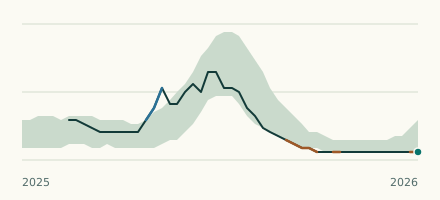 River gauge, United States Is the Moyie River unusually low at Eastport? Level now, history, the same date in past years and each year's range.
 Records, world Which places have set a new record low or high? Record lows and highs in our data, and the newest set.