Hawaii river levels today
Are the rivers and lakes in Hawaii unusually low or high?
We follow 64 water level gauges in Hawaii. 1 gauge reads below its normal range for the date and 1 gauge above it, not counting the 6 tide stations.
How many gauges do we follow in Hawaii?
64 gauges of the 7,007 we follow in the United States, as of 21 November 2026.
How many waters in Hawaii have a level gauge?
57 waters with a level gauge, of the 3,733 waters we follow in the United States, as of 21 November 2026.
How many gauges read below normal for the date?
1 gauge below its normal range, of the 2 gauges with a current reading and a normal range for the date, not counting the 6 tide stations, as of 21 November 2026.
How many gauges read above normal for the date?
1 gauge above its normal range, of the 2 gauges with a current reading and a normal range for the date, not counting the 6 tide stations, as of 21 November 2026.
How the places stand today
1 place below normal and 1 place above
Which places are furthest below normal?
Which places are furthest above normal?
Which gauges do we follow in Hawaii?
| Place | Reading | Against normal for the date | Change in a day |
|---|---|---|---|
| Alakahi Stream | |||
| Kamuela | 2.53 ft | -0.61 ft | |
| Haiku Stream | |||
| Heeia | 1.18 ft | -0.02 ft | |
| Halaulani Stream | |||
| Kilauea | 1.14 ft | +0.03 ft | |
| Halawa Stream | |||
| Halawa | 2.26 ft | -0.16 ft | |
| Halawa Stream (Oahu) | |||
| Honolulu | 6.69 ft | -0.17 ft | |
| Hanalei River | |||
| Hanalei | 0.01 ft | +0.15 ft | |
| Hanalei River Bridge | 6.84 ft | +0.01 ft | |
| Hanapepe River | |||
| Hanapepe | 1.75 ft | -0.10 ft | |
| Hanawi Stream | |||
| Ke anae | 1.07 ft | -1.06 ft | |
| Hawaii Coast | |||
| Hilo | 0.074 m above the tide table | within the normal range for the date | |
| Honolulu | 0.046 m above the tide table | within the normal range for the date | |
| Kahului | 0.089 m above the tide table | within the normal range for the date | |
| Kawaihae | 0.041 m above the tide table | within the normal range for the date | |
| Mokuoloe | 0.057 m above the tide table | within the normal range for the date | |
| Nawiliwili | 0.051 m above the tide table | within the normal range for the date | |
| Honokohau Stream | |||
| Honokohau | 2.23 ft | -1.31 ft | |
| Honolii Stream | |||
| Papaikou | 4.21 ft | +0.73 ft | |
| Honopou Stream | |||
| Huelo | 1.19 ft | -0.48 ft | |
| Kahaluu Stream | |||
| Kaneohe | 1.34 ft | 0 ft | |
| Kahana Stream | |||
| Kahana | 4.65 ft | 0 ft | |
| Kahoma Stream | |||
| Kahoma Stream | 0.59 ft | -1.20 ft | |
| Kalihi Stream | |||
| Honolulu | 2.36 ft | -0.02 ft | |
| Kaluanui Stream | |||
| Punaluu | 3.88 ft | -0.02 ft | |
| Kamananui Stream | |||
| Maunawai | 2.46 ft | +0.11 ft | |
| Kaneohe Stream | |||
| Kaneohe | 15.92 ft | -0.12 ft | |
| Kaukonahua Stream | |||
| North Fork | 1.95 ft | -0.04 ft | |
| Waialua | 17.23 ft | +0.02 ft | |
| Kawa Stream | |||
| Kaneohe | 3.66 ft | -0.01 ft | |
| Kawaikoi Stream | |||
| Waimea | 3.97 ft | +1.50 ft | |
| Kawainui Marsh | |||
| Levee - 15 | 5.76 ft | in the highest 5 percent for the date | -0.01 ft |
| Kawainui Stream | |||
| Kamuela | 2.04 ft | -0.59 ft | |
| Kawela Gulch | |||
| Kawela | 8.66 ft | +0.27 ft | |
| Makaha Stream | |||
| Makaha | 1.27 ft | -0.02 ft | |
| Makawao Stream | |||
| Kailua | 6.95 ft | -0.01 ft | |
| Makiki Stream | |||
| King St. | 3.09 ft | -0.04 ft | |
| Manoa Stream | |||
| Woodlawn Drive | 3.15 ft | -0.12 ft | |
| Moanalua Stream | |||
| Honolulu | 2.36 ft | -0.06 ft | |
| NF Wailua River | |||
| Lihue | 0.23 ft | -0.03 ft | |
| North Halawa Stream | |||
| Quarantine Station | 3.10 ft | -0.15 ft | |
| Oheo Gulch | |||
| Oheo Gulch | 1.13 ft | -1.24 ft | |
| Opaekaa Stream | |||
| Kapaa | 0.99 ft | -0.01 ft | |
| Opaeula Stream | |||
| Wahiawa | 1.96 ft | +0.05 ft | |
| Paauau Gulch | |||
| Pahala | 2.98 ft | 0 ft | |
| Pukele Stream | |||
| Honolulu | 1.05 ft | -0.04 ft | |
| Punaluu Stream | |||
| Punaluu | 3.97 ft | -0.01 ft | |
| South Fork Kaukonahua Stream | |||
| Wahiawa | 1.87 ft | -0.01 ft | |
| Wahiawa Reservoir | |||
| Spillway | 58.29 ft | lower than any day of these dates in 21 years | -0.19 ft |
| Waiaha Stream | |||
| Holualoa | 0.98 ft | +0.01 ft | |
| Waiahole Stream | |||
| Kamehameha Hwy | 7.28 ft | -0.01 ft | |
| Waiakeakua Stream | |||
| Honolulu | 0.61 ft | -0.07 ft | |
| Waialae Stream | |||
| Waimea | 1.12 ft | +0.06 ft | |
| Waihee River | |||
| Dam | 1.94 ft | -0.85 ft | |
| Waihee Stream | |||
| Kahaluu | 2.93 ft | 0 ft | |
| Waihi Stream | |||
| Manoa | 1.91 ft | -0.11 ft | |
| Waikamoi Stream | |||
| Kailua | 0.84 ft | -0.57 ft | |
| Waikane Stream | |||
| Waikane | 2.93 ft | 0 ft | |
| Waikele Stream | |||
| Waipahu | 2.40 ft | +0.10 ft | |
| Wailua River | |||
| Lihue | 7.41 ft | 0 ft | |
| Wailuku River | |||
| Piihonoua | 6.31 ft | +1.65 ft | |
| Wailuku River (Maui) | |||
| Wailuku | 0.93 ft | -0.36 ft | |
| Waimanalo Stream | |||
| Waimanalo | 7.14 ft | -0.01 ft | |
| Waimea River | |||
| Waimea River | 7.28 ft | +0.28 ft | |
| Wainiha River | |||
| Hanalei | 2.00 ft | +0.33 ft | |
| West Wailuaiki Stream | |||
| Hana | 2.13 ft | -2.39 ft | |
Keep exploring
 Country, United States Are the rivers and lakes in the United States unusually low or high? Every river and lake we follow here, against normal for the date.
 Today's list, United States Which places in the United States are furthest from normal today? The places in the United States furthest below and above normal today.
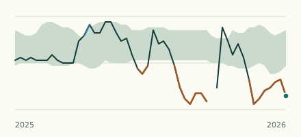 Reservoir gauge, United States Is the Wahiawa Reservoir unusually low at Spillway? Level now, history, the same date in past years and each year's range.
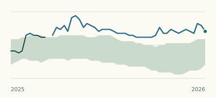 River gauge, United States Is the Kawainui Marsh unusually high at Levee - 15? Level now, history, the same date in past years and each year's range.