Pago Bay water level against the tide table
Is the water at Pago Bay lower than the tide table said?
In the 24 hours to , the water at Pago Bay stood 0.009 m below the tide table on average.
The water now
within the normal range for the date0.009 m below the tide table
Provisional
within the normal range for the date
Table: where the water stands
| Figure | Value |
|---|---|
| Newest figure | 0.009 m below the tide table, |
| Normal range for the date | -0.03 m to 0.21 m |
| Median for the date | 0.10 m |
A gap is the average, over a day, of the water level NOAA measured each hour less the height its tide table predicted for the same hour, both counted from the station's own zero. It leaves the tide out and shows what the table did not foresee: wind, air pressure, river flow, the season and the slow rise or fall of the sea.
The last 12 months, week by week, against the normal range for each week
- Weekly average
- Below the normal range
- Above the normal range
- Normal range for the date
Table: The last 12 months, week by week, against the normal range for each week
| Week starting | Weekly average (m) | Normal range |
|---|---|---|
| 0.120 m | -0.046 m to 0.178 m | |
| 0.178 m | -0.064 m to 0.193 m | |
| 0.235 m | -0.067 m to 0.217 m | |
| 0.196 m | -0.083 m to 0.212 m | |
| 0.202 m | -0.083 m to 0.194 m | |
| 0.294 m | -0.077 m to 0.201 m | |
| 0.214 m | -0.070 m to 0.208 m | |
| 0.256 m | -0.044 m to 0.206 m | |
| 0.239 m | -0.018 m to 0.220 m | |
| 0.231 m | -0.018 m to 0.209 m | |
| 0.203 m | 0.008 m to 0.199 m | |
| 0.190 m | 0.029 m to 0.204 m | |
| 0.194 m | 0.048 m to 0.200 m | |
| 0.155 m | 0.007 m to 0.188 m | |
| 0.163 m | 0.017 m to 0.178 m | |
| 0.169 m | -0.005 m to 0.195 m | |
| 0.177 m | -0.035 m to 0.187 m | |
| 0.090 m | -0.042 m to 0.179 m | |
| 0.158 m | -0.018 m to 0.182 m | |
| 0.186 m | -0.015 m to 0.198 m | |
| 0.144 m | -0.007 m to 0.207 m | |
| 0.202 m | 0.037 m to 0.213 m | |
| 0.165 m | 0.044 m to 0.221 m | |
| 0.116 m | 0.034 m to 0.223 m | |
| 0.104 m | -0.010 m to 0.206 m | |
| 0.108 m | -0.078 m to 0.204 m | |
| 0.063 m | 0.016 m to 0.202 m | |
| 0.200 m | -0.009 m to 0.193 m | |
| 0.182 m | -0.009 m to 0.225 m | |
| -0.069 m | -0.033 m to 0.210 m | |
| 0.005 m | -0.022 m to 0.208 m | |
| 0.145 m | 0.014 m to 0.212 m | |
| 0.146 m | 0.037 m to 0.224 m | |
| 0.171 m | 0.027 m to 0.226 m | |
| 0.129 m | 0.000 m to 0.215 m | |
| 0.059 m | 0.014 m to 0.199 m | |
| 0.086 m | 0.040 m to 0.196 m | |
| 0.120 m | 0.069 m to 0.203 m | |
| 0.117 m | 0.067 m to 0.209 m | |
| 0.127 m | 0.051 m to 0.224 m | |
| 0.104 m | 0.052 m to 0.247 m | |
| -0.032 m | 0.033 m to 0.248 m | |
| 0.027 m | 0.033 m to 0.236 m | |
| -0.004 m | 0.036 m to 0.205 m | |
| -0.101 m | 0.035 m to 0.198 m | |
| -0.103 m | 0.039 m to 0.211 m | |
| 0.011 m | 0.048 m to 0.223 m | |
| -0.007 m | 0.020 m to 0.223 m | |
| -0.066 m | 0.018 m to 0.223 m | |
| -0.071 m | 0.028 m to 0.226 m | |
| -0.051 m | 0.036 m to 0.231 m | |
| -0.085 m | 0.010 m to 0.196 m | |
| -0.116 m | -0.042 m to 0.178 m |
How it compares
That is within the normal range for the date.
Also on this water
About this station
Pago Bay is a tide station on the Guam Coast.
It lies at 13.4283° N, 144.7989° E.
Its figures come from NOAA's Center for Operational Oceanographic Products and Services (CO-OPS): its checked hourly water levels, its predicted tide and, for the newest figure, its preliminary values of the last 24 hours.
NOAA does not publish this average: we work it out from NOAA's hourly water levels and its tide predictions, and it is not an official NOAA product.
The water averaged 0.034 m below NOAA's mean sea level mark (set from 1983 to 2001) over the same 24 hours. That average still holds the tide.
The normal range for a date is made of the same date, and the week either side of it, in up to the last 15 complete years, never the current year: here 14 years between 2011 and 2025. A day counts when at least 20 of its 24 hours have both a height NOAA measured and a predicted tide (an hour NOAA marks inferred is not a measured one).
The newest figure is the average of NOAA's preliminary values of the last 24 hours, which NOAA has not checked yet. The normal range is made of NOAA's checked values of past years.
Keep exploring
 State, United States How is the water in Guam against the tide table? Every tide station we follow in Guam, against the tide table.
 Country, United States Are the rivers and lakes in the United States unusually low or high? Every river and lake we follow here, against normal for the date.
 Today's list, United States Which places in the United States are furthest from normal today? The places in the United States furthest below and above normal today.
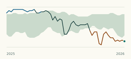 Tide gauge, United States Is the water at Apra Harbor lower than the tide table said? The water now against the tide table and the normal range.