Georgia river levels today
Are the rivers and lakes in Georgia unusually low or high?
We follow 302 water level gauges in Georgia. 104 gauges read below their normal range for the date and 6 gauges above it, not counting the tide station.
How many gauges do we follow in Georgia?
302 gauges of the 7,007 we follow in the United States, as of 21 November 2026.
How many waters in Georgia have a level gauge?
156 waters with a level gauge, of the 3,733 waters we follow in the United States, as of 21 November 2026.
How many gauges read below normal for the date?
104 gauges below their normal range, of the 267 gauges with a current reading and a normal range for the date, not counting the tide station, as of 21 November 2026.
How many gauges read above normal for the date?
6 gauges above their normal range, of the 267 gauges with a current reading and a normal range for the date, not counting the tide station, as of 21 November 2026.
How the places stand today
104 places below normal and 6 places above
Which places are furthest below normal?
More places
US Highway 78 and 278 near MabletonNickajack Creek
1.02 ft
lower than any day of these dates in 27 years
WhitesburgSnake Creek downstream Snake Creek Reservoir
2.88 ft
lower than any day of these dates in 18 years
Which places are furthest above normal?
More places
Which gauges do we follow in Georgia?
| Place | Reading | Against normal for the date | Change in a day |
|---|---|---|---|
| Alabaha River | |||
| GA Highway 203 near Blackshear | 2.86 ft | within the normal range for the date | +0.42 ft |
| Alapaha River | |||
| Alapaha | 2.60 ft | within the normal range for the date | -0.06 ft |
| Irwinville | 1.48 ft | within the normal range for the date | +0.05 ft |
| Statenville | 2.56 ft | within the normal range for the date | +0.01 ft |
| Alcovy River | |||
| Covington (above) | 1.61 ft | within the normal range for the date | +0.03 ft |
| Covington (below) | 1.68 ft | within the normal range for the date | +0.02 ft |
| Lawrenceville | -0.39 ft | within the normal range for the date | 0 ft |
| New Hope Road near Grayson | 2.02 ft | lower than any day of these dates in 23 years | +0.02 ft |
| Allatoona Creek | |||
| Stilesboro Road near Acworth | 4.87 ft | within the normal range for the date | 0 ft |
| Altamaha River | |||
| Baxley | 1.57 ft | within the normal range for the date | +0.01 ft |
| Charlotteville | 0.57 ft | within the normal range for the date | 0 ft |
| Doctortown | 2.39 ft | within the normal range for the date | +0.03 ft |
| Everett City | 6.31 ft | in the lowest 5 percent for the date | -0.06 ft |
| Amicalola Creek | |||
| Dawsonville | 0.41 ft | within the normal range for the date | -0.01 ft |
| Apalachee River | |||
| Bostwick | 1.45 ft | in the lowest 10 percent for the date | +0.01 ft |
| Fence Road near Dacula | 0.34 ft | within the normal range for the date | +0.01 ft |
| Armuchee Creek | |||
| Old Dalton Road near Rome | 3.86 ft | in the lowest 5 percent for the date | +0.02 ft |
| Beaverdam Creek | |||
| Elberton | 1.33 ft | in the lowest 10 percent for the date | +0.01 ft |
| Big Cedar Creek | |||
| Georgia Ave at Cedartown | 2.57 ft | lower than any day of these dates in 16 years | +0.01 ft |
| Big Creek | |||
| Alpharetta | 1.78 ft | within the normal range for the date | -0.09 ft |
| GA 9 near Cumming | -0.29 ft | in the lowest 5 percent for the date | 0 ft |
| Hog Wallow at Roswell | 2.47 ft | within the normal range for the date | 0 ft |
| Big Haynes Creek | |||
| Bald Rock Road near Milstead | -0.37 ft | lower than any day of these dates in 19 years | -0.04 ft |
| Jack Turner Dam near Milstead | 2.26 ft | within the normal range for the date | 0 ft |
| Lenora Road near Snellville | 2.69 ft | in the lowest 10 percent for the date | 0 ft |
| Big Indian Creek | |||
| US 341 near Clinchfield | 14.14 ft | in the lowest 10 percent for the date | +0.01 ft |
| Big Sandy Creek | |||
| US 441 near Irwinton | 2.93 ft | lower than any day of these dates in 17 years | -0.03 ft |
| Black Creek | |||
| Blitchton | 2.29 ft | in the lowest 5 percent for the date | +0.01 ft |
| Brier Creek | |||
| Millhaven | 1.79 ft | within the normal range for the date | +0.01 ft |
| Waynesboro | 4.98 ft | within the normal range for the date | +0.02 ft |
| Broad River | |||
| Washington Hwy (GA 17) 3 S Fortsonia | 3.50 ft | +0.03 ft | |
| Broad River in GA | |||
| Carlton | 0.78 ft | lower than any day of these dates in 29 years | -0.01 ft |
| Brushy Creek | |||
| Campground Road near Wrens | 2.13 ft | within the normal range for the date | +0.02 ft |
| Brushy Fork Creek | |||
| Beaver Road near Loganville | 1.21 ft | in the lowest 5 percent for the date | -0.01 ft |
| Buffalo Creek | |||
| GA 272 near Oconee | 5.88 ft | in the lowest 5 percent for the date | +0.01 ft |
| Burnt Fork Creek | |||
| Millwood Way near Clarkston | 1.16 ft | in the lowest 10 percent for the date | +0.02 ft |
| Montreal Road near Tucker | 1.13 ft | +0.01 ft | |
| Butler Creek | |||
| Mack Dobbs Road near Kennesaw | 2.26 ft | within the normal range for the date | +0.01 ft |
| Cabin Creek | |||
| North Second Street near Griffin | 3.29 ft | 0 ft | |
| Canoochee River | |||
| Claxton | 1.24 ft | within the normal range for the date | +0.02 ft |
| Fort Stewart | 5.66 ft | within the normal range for the date | +0.01 ft |
| Cartecay River | |||
| Ellijay | 1.41 ft | within the normal range for the date | 0 ft |
| Chattahoochee River | |||
| 0.76 mile upstream McGinnis Ferry near Suwanee | 5.22 ft | within the normal range for the date | +2.85 ft |
| 14th Street at Columbus | 16.28 ft | lower than any day of these dates in 13 years | +0.02 ft |
| Atlanta | 2.83 ft | in the lowest 10 percent for the date | -0.01 ft |
| Buford Dam near Buford | -0.55 ft | in the lowest 10 percent for the date | +0.01 ft |
| Cornelia | 0.21 ft | in the lowest 5 percent for the date | 0 ft |
| Fairburn | 0.33 ft | in the lowest 10 percent for the date | -0.02 ft |
| GA 100 at Franklin | 7.84 ft | within the normal range for the date | -0.01 ft |
| GA 280 near Atlanta | 3.96 ft | in the lowest 5 percent for the date | -0.16 ft |
| George W. Andrews Lock and Dam (USACE) | 78.49 ft | within the normal range for the date | +1.84 ft |
| Helen | 0.41 ft | within the normal range for the date | -0.01 ft |
| Highway 141 near Norcross | 3.17 ft | within the normal range for the date | -0.40 ft |
| Lake Sidney Lanier near Buford | 1,061.91 ft | within the normal range for the date | -0.06 ft |
| Morgan Falls Dam near Roswell | 811.00 ft | within the normal range for the date | -0.03 ft |
| Powers Ferry + I-285 near Atlanta | 3.54 ft | -0.02 ft | |
| Roswell | 3.72 ft | within the normal range for the date | +0.50 ft |
| US 41 at Atlanta | 4.22 ft | in the lowest 10 percent for the date | -0.02 ft |
| W.F. George Lock and Dam | 102.23 ft | in the lowest 5 percent for the date | +0.41 ft |
| West Point | 2.38 ft | in the lowest 10 percent for the date | +0.01 ft |
| West Point Lake near West Point | 622.48 ft | in the lowest 10 percent for the date | +0.01 ft |
| Whitesburg | 2.85 ft | in the lowest 10 percent for the date | +0.04 ft |
| Chattanooga Creek | |||
| GA 193 near Flintstone | 2.98 ft | in the lowest 10 percent for the date | +0.03 ft |
| Chattooga River | |||
| Burrells Ford | 0.78 ft | within the normal range for the date | 0 ft |
| Summerville | 1.92 ft | in the lowest 5 percent for the date | +0.01 ft |
| Chestatee River | |||
| Dahlonega | 0.74 ft | within the normal range for the date | 0 ft |
| Chickasawhatchee Creek | |||
| ElModel | -0.09 ft | within the normal range for the date | +0.01 ft |
| Coahulla Creek | |||
| Keiths Mill Road near Dalton | 7.44 ft | in the lowest 10 percent for the date | +0.03 ft |
| Cobbs Creek | |||
| Rainbow Drive near Decatur | 1.62 ft | in the lowest 5 percent for the date | -0.01 ft |
| Comissioner Creek | |||
| US 441 at McIntyre | 7.45 ft | in the lowest 5 percent for the date | +0.02 ft |
| Conasauga River | |||
| GA 286 near Eton | 2.49 ft | within the normal range for the date | -0.01 ft |
| Sloan Bridge below Dalton | -0.37 ft | +0.01 ft | |
| Tilton | 2.41 ft | within the normal range for the date | +0.02 ft |
| Coosa River | |||
| Mayos Bar Lock and Dam near Rome | 10.84 ft | in the lowest 10 percent for the date | +0.02 ft |
| Coosawattee River | |||
| Carters | 4.32 ft | within the normal range for the date | -0.80 ft |
| Carters Lake near Carters | 1,070.96 ft | +0.92 ft | |
| Ellijay | 1.39 ft | within the normal range for the date | -0.01 ft |
| Pine Chapel / Redbud | 5.25 ft | within the normal range for the date | -0.14 ft |
| Pine Chapel Road near Resaca | 2.46 ft | within the normal range for the date | -0.12 ft |
| Cornish Creek | |||
| Hazelbrand Road near Covington | 7.59 ft | higher than any day of these dates in 16 years | 0 ft |
| Lower Jersey Road near Covington | 1.33 ft | within the normal range for the date | +0.03 ft |
| Crooked Creek | |||
| Norcross | 3.58 ft | within the normal range for the date | +0.09 ft |
| Dick Creek | |||
| Old Atlanta Road near Suwanee | 6.36 ft | in the highest 5 percent for the date | -0.08 ft |
| Dog River | |||
| GA 5 near Fairplay | 3.23 ft | within the normal range for the date | -0.01 ft |
| Doolittle Creek | |||
| Flat Shoals Rd near Decatur | 1.14 ft | within the normal range for the date | 0 ft |
| East Bear Creek | |||
| Poplar Road near Mansfield | 0.78 ft | in the lowest 10 percent for the date | 0 ft |
| Ebenezer Creek | |||
| Springfield | 3.57 ft | within the normal range for the date | +0.03 ft |
| Echeconnee Creek | |||
| Houston Road near Byron | 6.03 ft | in the lowest 10 percent for the date | +0.02 ft |
| Etowah River | |||
| Allatoona Dam above Cartersville | 1.19 ft | in the lowest 5 percent for the date | 0 ft |
| Allatoona Lake near Cartersville | 830.21 ft | within the normal range for the date | -0.16 ft |
| Canton | 1.28 ft | in the lowest 5 percent for the date | +0.04 ft |
| Coosa Valley Fairgrounds at Rome | 4.15 ft | +0.02 ft | |
| GA 1 Loop near Rome | 12.68 ft | in the lowest 5 percent for the date | -0.04 ft |
| GA 136 near Landrum | 1.39 ft | in the lowest 10 percent for the date | -0.01 ft |
| GA 61 near Cartersville | 4.86 ft | in the lowest 10 percent for the date | -0.16 ft |
| GA 9 near Dawsonville | 3.56 ft | in the lowest 10 percent for the date | -0.01 ft |
| Kelly Bridge Road near Matt | 1.05 ft | in the lowest 10 percent for the date | -0.01 ft |
| Kingston | 5.20 ft | within the normal range for the date | +0.12 ft |
| Etowah River Downstream I-575 | |||
| Canton | 1.95 ft | within the normal range for the date | +0.06 ft |
| Euharlee Creek | |||
| US 287 at Rockmart | 1.89 ft | lower than any day of these dates in 16 years | +0.01 ft |
| Falling Creek | |||
| Juliette | 1.23 ft | in the lowest 10 percent for the date | +0.08 ft |
| Fausett Creek | |||
| Talking Rock | 1.44 ft | within the normal range for the date | 0 ft |
| Flat Creek | |||
| Lake Kedron Dam | 2.24 ft | in the lowest 10 percent for the date | 0 ft |
| Lake Peachtree Tailrace | 1.94 ft | lower than any day of these dates in 12 years | +0.03 ft |
| Flint River | |||
| Albany | 2.16 ft | in the lowest 10 percent for the date | -0.01 ft |
| Bainbridge (US 27) | 18.64 ft | +0.01 ft | |
| Big Branch near Molena | 4.46 ft | +0.03 ft | |
| Carsonville | 1.40 ft | within the normal range for the date | +0.01 ft |
| GA 26 near Montezuma | 0.56 ft | within the normal range for the date | 0 ft |
| Griffin | 2.27 ft | in the lowest 10 percent for the date | 0 ft |
| Lake Blackshear | 233.48 ft | ||
| Lovejoy | 1.26 ft | in the lowest 5 percent for the date | 0 ft |
| Newton (SR 37) | 3.95 ft | in the lowest 10 percent for the date | +0.01 ft |
| Oakfield (SR 32) | 3.29 ft | within the normal range for the date | +0.01 ft |
| Riverview Plantation | 4.13 ft | within the normal range for the date | 0 ft |
| Thomaston | 2.68 ft | 0 ft | |
| Woolsey Road near Woolsey | 38.60 ft | in the lowest 5 percent for the date | 0 ft |
| Georgia Coast | |||
| Fort Pulaski | 0.378 m above the tide table | in the highest 5 percent for the date | |
| Grove Creek | |||
| US 441 and GA 15 near Commerce | 6.47 ft | within the normal range for the date | 0 ft |
| Hannahatchee Creek | |||
| Union Road at Union | 1.35 ft | lower than any day of these dates in 18 years | +0.01 ft |
| Heath Creek | |||
| Armuchee | 0.98 ft | lower than any day of these dates in 26 years | 0 ft |
| Hickory Log Creek | |||
| Canton | 0.83 ft | in the lowest 5 percent for the date | 0 ft |
| Hillabahatchee Creek | |||
| Thaxton Road near Franklin | 1.89 ft | in the lowest 10 percent for the date | 0 ft |
| Hiwassee River | |||
| Riverside Drive near Hiawassee | 2.48 ft | within the normal range for the date | 0 ft |
| Streak Hill Road near Hiawassee | 1.33 ft | -0.01 ft | |
| Holly Creek | |||
| Chatsworth | 1.19 ft | within the normal range for the date | -0.01 ft |
| Honey Creek | |||
| GA 212 near Conyers | 1.78 ft | within the normal range for the date | 0 ft |
| Horton Creek | |||
| Lake Horton Dam | 773.96 ft | in the lowest 10 percent for the date | -0.05 ft |
| Ichawaynochaway Creek | |||
| ElModel | 4.09 ft | within the normal range for the date | +0.02 ft |
| GA-91 11 miles SW of Newton | 2.57 ft | within the normal range for the date | +0.02 ft |
| Milford | 1.10 ft | within the normal range for the date | +0.02 ft |
| Morgan | 7.11 ft | within the normal range for the date | +0.02 ft |
| Kettle Creek | |||
| Washington | 3.12 ft | in the lowest 5 percent for the date | -0.03 ft |
| Kinchafoonee Creek | |||
| 11 E of Dawson at Pinewood Rd in Lee County | 2.92 ft | within the normal range for the date | -0.01 ft |
| Century Road Bridge | 4.72 ft | +0.01 ft | |
| Preston (SR 41) | 1.65 ft | in the lowest 10 percent for the date | +0.04 ft |
| Kiokee Creek | |||
| Evans | 0.60 ft | within the normal range for the date | +0.01 ft |
| Level Creek | |||
| Suwanee Dam Road near Suwanee | 3.60 ft | within the normal range for the date | 0 ft |
| Line Creek | |||
| GA 54 near Peachtree City | 3.06 ft | within the normal range for the date | +0.02 ft |
| Highway 85 near Senoia | 1.39 ft | within the normal range for the date | 0 ft |
| Lake McIntosh | 1.54 ft | 0 ft | |
| Little Cornish Creek | |||
| County Road 95 near Oxford | 0.93 ft | in the highest 5 percent for the date | +0.01 ft |
| Little Haynes Creek | |||
| Dial Mill Road near Milstead | 3.01 ft | lower than any day of these dates in 23 years | -0.01 ft |
| Little Ocmulgee River | |||
| GA 149 at Scotland | 1.21 ft | within the normal range for the date | -0.05 ft |
| Little River | |||
| Eatonton | 2.54 ft | in the lowest 5 percent for the date | 0 ft |
| GA 5 near Woodstock | 0.38 ft | in the lowest 5 percent for the date | -0.04 ft |
| Newborn Road near Newborn | 3.07 ft | lower than any day of these dates in 16 years | 0 ft |
| Washington | 3.94 ft | in the lowest 10 percent for the date | +0.01 ft |
| Little River (SW Georgia) | |||
| Adel (SR 37) | 2.96 ft | within the normal range for the date | 0 ft |
| Hahira (SR 122) | 4.89 ft | within the normal range for the date | 0 ft |
| Little Satilla River | |||
| Offerman | 2.94 ft | within the normal range for the date | +0.14 ft |
| Little Stone Mountain Creek | |||
| Old Stone Mountain Road near Stone Mountain | 2.28 ft | lower than any day of these dates in 14 years | 0 ft |
| Little Tallapoosa River | |||
| GA 100 near Bowdon | 2.43 ft | in the lowest 10 percent for the date | 0 ft |
| US 27 at Carrollton | 2.17 ft | in the lowest 5 percent for the date | -0.04 ft |
| Lookout Creek | |||
| New England | 3.44 ft | within the normal range for the date | 0 ft |
| Middle Oconee River | |||
| Arcade | 2.18 ft | within the normal range for the date | +0.02 ft |
| US 78 at Athens | 0.80 ft | in the lowest 5 percent for the date | +0.02 ft |
| Mill Creek | |||
| Crandall | 1.21 ft | within the normal range for the date | +0.02 ft |
| Dalton | 4.25 ft | within the normal range for the date | +0.01 ft |
| Mountaintown Creek | |||
| GA 282 near Ellijay | 3.10 ft | within the normal range for the date | -0.01 ft |
| Muckalee Creek | |||
| Forrester Parkway Bridge | 6.23 ft | +0.01 ft | |
| Highway 30 near Americus | 2.38 ft | within the normal range for the date | +0.02 ft |
| Leesburg (SR 195) | 3.87 ft | within the normal range for the date | +0.02 ft |
| Mulberry Creek | |||
| Winder | -1.73 ft | lower than any day of these dates in 19 years | +0.03 ft |
| Murder Creek | |||
| Monticello | 1.35 ft | in the lowest 10 percent for the date | 0 ft |
| Nancy Creek | |||
| Johnson Ferry Road near Chamblee | 3.51 ft | lower than any day of these dates in 14 years | 0 ft |
| Rickenbacker Drive at Atlanta | 1.25 ft | within the normal range for the date | 0 ft |
| West Wesley Road at Atlanta | 1.83 ft | within the normal range for the date | +0.01 ft |
| New River | |||
| GA 100 near Franklin | 2.93 ft | within the normal range for the date | +0.01 ft |
| Nickajack Creek | |||
| US Highway 78 and 278 near Mableton | 1.02 ft | lower than any day of these dates in 27 years | -0.02 ft |
| No Business Creek | |||
| Lee Road near Snellville | 2.80 ft | within the normal range for the date | 0 ft |
| Noonday Creek | |||
| Hawkins Store Road near Blackwells | 0.48 ft | lower than any day of these dates in 26 years | -0.06 ft |
| Shallowford River near Woodstock | 1.27 ft | in the lowest 5 percent for the date | 0 ft |
| Noonday Creek Upstream of Chastain Meadows Parkway | |||
| Kennesaw | 2.02 ft | -0.22 ft | |
| North Fork Peachtree Creek | |||
| Briarwood Road near Atlanta | 2.07 ft | +0.05 ft | |
| Buford Highway at Atlanta | 3.69 ft | within the normal range for the date | +0.07 ft |
| Graves Road near Norcross | 3.64 ft | within the normal range for the date | +0.01 ft |
| North Oconee River | |||
| College Street at Athens | 3.79 ft | in the lowest 10 percent for the date | +0.08 ft |
| Woodbridge Road near Commerce | 1.69 ft | in the lowest 5 percent for the date | +0.02 ft |
| Noses Creek | |||
| Powder Springs Road near Powder Springs | 1.99 ft | within the normal range for the date | 0 ft |
| Ochlockonee River | |||
| Coolidge | 2.21 ft | within the normal range for the date | +0.04 ft |
| Thomasville (US 84) | 2.54 ft | within the normal range for the date | -0.09 ft |
| Ocmulgee River | |||
| 5th Street Bridge at Macon | 5.39 ft | within the normal range for the date | +0.22 ft |
| Abbeville | -0.06 ft | in the lowest 10 percent for the date | 0 ft |
| GA 18 at Dames Ferry | 3.20 ft | within the normal range for the date | +0.06 ft |
| Jackson | 3.95 ft | within the normal range for the date | -0.11 ft |
| Jackson Lake | 528.21 ft | -0.02 ft | |
| Lumber City | 0.35 ft | within the normal range for the date | 0 ft |
| US 341 at Hawkinsville | 0.87 ft | within the normal range for the date | -0.01 ft |
| Oconee River | |||
| Avant Mine near Oconee | 1.37 ft | within the normal range for the date | -0.01 ft |
| Dublin | 1.26 ft | within the normal range for the date | -0.04 ft |
| Highway 280 near Mount Vernon | 0.51 ft | within the normal range for the date | 0 ft |
| Lake Oconee | 433.43 ft | -0.03 ft | |
| Lake Sinclair | 338.13 ft | +0.01 ft | |
| Milledgeville | 7.12 ft | in the lowest 10 percent for the date | 0 ft |
| Oconee | 1.18 ft | within the normal range for the date | +0.02 ft |
| Penfield | 2.73 ft | in the lowest 5 percent for the date | +0.01 ft |
| Ogeechee River | |||
| Eden | 2.17 ft | within the normal range for the date | 0 ft |
| GA 88 near Grange | 6.52 ft | within the normal range for the date | +0.03 ft |
| Midville | 1.43 ft | within the normal range for the date | +0.04 ft |
| Rocky Ford | 2.95 ft | within the normal range for the date | 0 ft |
| Ohoopee River | |||
| GA 297 near Swainsboro | 7.44 ft | within the normal range for the date | +0.01 ft |
| Reidsville | 1.50 ft | within the normal range for the date | +0.03 ft |
| Olley Creek | |||
| Clay Road near Austell | 2.91 ft | within the normal range for the date | -0.04 ft |
| Oostanaula River | |||
| Calhoun | 3.77 ft | -0.01 ft | |
| Resaca | 3.08 ft | within the normal range for the date | -0.03 ft |
| Rome | 5.31 ft | within the normal range for the date | +0.17 ft |
| US 27 at Rome | 2.98 ft | within the normal range for the date | +0.04 ft |
| Oothkalooga Creek | |||
| GA 53 Spur at Calhoun | 7.83 ft | in the highest 10 percent for the date | +0.02 ft |
| Pachitla Creek | |||
| Edison | 2.59 ft | within the normal range for the date | +0.01 ft |
| Parks Creek | |||
| Lyle Field Road near Jefferson | 3.39 ft | within the normal range for the date | -0.01 ft |
| Pates Creek | |||
| Flippen | 2.06 ft | in the highest 10 percent for the date | -0.03 ft |
| Peachtree Creek | |||
| Atlanta | 2.06 ft | in the lowest 5 percent for the date | +0.03 ft |
| Pew Creek | |||
| Patterson Road near Lawrenceville | 3.08 ft | in the lowest 10 percent for the date | -0.01 ft |
| Pole Bridge Creek | |||
| Evans Mill Road near Lithonia | 1.05 ft | within the normal range for the date | 0 ft |
| Potato Creek | |||
| County Line Road near Orchard Hill | 6.53 ft | within the normal range for the date | +0.07 ft |
| Powder Springs Creek | |||
| Powder Springs | 1.58 ft | within the normal range for the date | +0.10 ft |
| Proctor Creek | |||
| Atlanta | 8.38 ft | ||
| Jackson Parkway at Atlanta | 3.08 ft | within the normal range for the date | -0.17 ft |
| Richland Creek | |||
| Old Dallas Road near Dallas | 0.92 ft | 0 ft | |
| Suwanee Dam Road near Buford | 0.55 ft | within the normal range for the date | +0.01 ft |
| Rottenwood Creek | |||
| Interstate North Parkway near Smyrna | 2.30 ft | within the normal range for the date | +0.02 ft |
| Russell Creek | |||
| 0.3 miles downstream of Head Lake near Dawsonville | 0.54 ft | 0 ft | |
| Satilla River | |||
| Atkinson | 4.93 ft | within the normal range for the date | +0.06 ft |
| GA-158 above Millwood | 4.57 ft | within the normal range for the date | -0.02 ft |
| Waycross | 6.81 ft | within the normal range for the date | +0.47 ft |
| Savannah River | |||
| Augusta | 96.54 ft | within the normal range for the date | -0.08 ft |
| Burton's Ferry | 3.61 ft | in the lowest 10 percent for the date | +0.02 ft |
| Clyo | 2.57 ft | in the lowest 10 percent for the date | 0 ft |
| Hartwell Dam | 647.27 ft | +0.01 ft | |
| Settingdown Creek | |||
| Ball Ground | 0.39 ft | lower than any day of these dates in 21 years | 0 ft |
| Sewell Mill Creek | |||
| GA 120 near Marietta | 1.00 ft | lower than any day of these dates in 18 years | -0.01 ft |
| Sharp Mountain Creek | |||
| Old GA 5 below Ball Ground | 2.80 ft | in the lowest 10 percent for the date | 0 ft |
| Shoal Creek | |||
| Columbia Drive near Atlanta | 3.49 ft | within the normal range for the date | -0.01 ft |
| GA 108 near Waleska | 2.18 ft | in the lowest 5 percent for the date | 0 ft |
| GA 54 near Sharpsburg | 2.47 ft | within the normal range for the date | -0.01 ft |
| Paper Mill Rd near Lawrenceville | 1.09 ft | lower than any day of these dates in 17 years | 0 ft |
| Shoal Creek Road near Griffin | 0.63 ft | within the normal range for the date | 0 ft |
| Snake Creek | |||
| Whitesburg | 1.80 ft | within the normal range for the date | +0.04 ft |
| Snake Creek downstream Snake Creek Reservoir | |||
| Whitesburg | 2.88 ft | lower than any day of these dates in 18 years | 0 ft |
| Snapfinger Creek | |||
| Redan Road near Glen Haven | 2.49 ft | in the lowest 5 percent for the date | 0 ft |
| Thompson Mill Road near Lithonia | 3.28 ft | within the normal range for the date | 0 ft |
| Sope Creek | |||
| Lower Roswell Road near Marietta | 0.88 ft | in the lowest 5 percent for the date | 0 ft |
| Soque River | |||
| GA 197 NR Clarkesville | 3.61 ft | within the normal range for the date | -0.04 ft |
| South Chickamauga Creek | |||
| Ringgold | 3.71 ft | within the normal range for the date | -0.01 ft |
| South Fork Peachtree Creek | |||
| Casa Drive at Clarkston | 3.48 ft | in the highest 10 percent for the date | 0 ft |
| Johnson Road near Atlanta | 3.33 ft | in the lowest 10 percent for the date | +0.01 ft |
| South River | |||
| Bouldercrest Road at Atlanta | 2.32 ft | 0 ft | |
| Flakes Mill Road near Snapfinger | 1.99 ft | within the normal range for the date | -0.01 ft |
| Forrest Park Road at Atlanta | 2.88 ft | within the normal range for the date | 0 ft |
| GA 81 at Snapping Shoals | 6.85 ft | within the normal range for the date | -0.02 ft |
| Klondike Road near Lithonia | 5.01 ft | within the normal range for the date | -0.01 ft |
| Springdale Road near East Point | 2.21 ft | lower than any day of these dates in 16 years | 0 ft |
| Spirit Creek | |||
| U.S. Hwy 1 near Augusta | 2.75 ft | in the lowest 5 percent for the date | +0.01 ft |
| Spring Creek | |||
| Colquitt | 3.25 ft | within the normal range for the date | +0.02 ft |
| Iron City (CR 16) | 2.52 ft | within the normal range for the date | 0 ft |
| St. Marys River | |||
| Traders Hill | 2.40 ft | +1.04 ft | |
| Stone Mountain Creek | |||
| GA 124 near Lithonia | 3.47 ft | lower than any day of these dates in 13 years | +0.05 ft |
| Silver Hill Road near Stone Mountain | 1.86 ft | lower than any day of these dates in 13 years | 0 ft |
| Suwanee Creek | |||
| Suwanee | -0.46 ft | lower than any day of these dates in 26 years | 0 ft |
| Suwannee River | |||
| Fargo | 2.57 ft | within the normal range for the date | +0.48 ft |
| Sweetwater Creek | |||
| Austell (below) | 0.87 ft | within the normal range for the date | -0.11 ft |
| Austell (near) | 0.91 ft | within the normal range for the date | -0.01 ft |
| Brownsville Road near Powder Springs | 3.11 ft | within the normal range for the date | +0.01 ft |
| Northwest Austell | 5.29 ft | within the normal range for the date | 0 ft |
| Sweetwater Creek (E ATL) | |||
| Club Drive near Lilburn | 2.83 ft | within the normal range for the date | 0 ft |
| Swift Creek | |||
| Rock Chapel Road near Lithonia | 1.59 ft | in the lowest 5 percent for the date | 0 ft |
| Talking Rock Creek | |||
| Hinton | 0.83 ft | within the normal range for the date | -0.01 ft |
| Tallapoosa River | |||
| US 78 near Tallapoosa | 1.16 ft | within the normal range for the date | -0.02 ft |
| Tallulah River | |||
| Burton Dam | 1,864.57 ft | -0.05 ft | |
| Mathis-Terrora Dam | 1,688.07 ft | +0.41 ft | |
| Nacoochee Dam | 1,751.03 ft | -0.01 ft | |
| Plum Orchard Rd 6 NW Tiger | 1.78 ft | within the normal range for the date | -0.01 ft |
| Tallulah Falls Dam | 1,499.10 ft | +0.17 ft | |
| Tallulah Falls Pwr House | 5.18 ft | within the normal range for the date | +0.01 ft |
| Tugalo Dam | 890.04 ft | +0.02 ft | |
| Tobesofkee Creek | |||
| Macon | 1.72 ft | within the normal range for the date | -0.01 ft |
| Toccoa River | |||
| Blue Ridge Dam | 1,668.68 ft | +0.01 ft | |
| Dial | 0.91 ft | in the lowest 10 percent for the date | -0.01 ft |
| Towaliga River | |||
| GA 83 near Juliette | 1.23 ft | in the lowest 5 percent for the date | -0.05 ft |
| Tucsawhatchee Creek | |||
| Hawkinsville | 1.29 ft | within the normal range for the date | +0.02 ft |
| Tugalo River | |||
| Yonah Dam | 743.65 ft | -0.02 ft | |
| Turkey Creek | |||
| Byromville | 5.00 ft | within the normal range for the date | +0.01 ft |
| Turnpike Creek | |||
| McRae | 5.10 ft | within the normal range for the date | +0.02 ft |
| Two Run Creek | |||
| Kingston | 1.17 ft | in the lowest 10 percent for the date | -0.01 ft |
| Upatoi Creek | |||
| Columbus | 3.84 ft | within the normal range for the date | 0 ft |
| Utoy Creek | |||
| Great Southwest Parkway near Atlanta | 2.53 ft | lower than any day of these dates in 27 years | 0 ft |
| West Chickamauga Creek | |||
| GA 146 near Lakeview | 0.77 ft | within the normal range for the date | 0 ft |
| Wheeler Creek | |||
| Bill Cheek Road near Auburn | 1.33 ft | within the normal range for the date | 0 ft |
| Willeo Creek | |||
| GA 120 near Roswell | 0.89 ft | within the normal range for the date | 0 ft |
| Williamson Swamp Creek | |||
| Davisboro | 2.41 ft | in the lowest 5 percent for the date | +0.01 ft |
| Withlacoochee River | |||
| Quitman (US 84) | 2.22 ft | within the normal range for the date | 0 ft |
| Valdosta (Skipper Bridge Rd) | 3.02 ft | within the normal range for the date | +0.06 ft |
| Valdosta at US 41 | 4.47 ft | within the normal range for the date | +0.29 ft |
| Woodall Creek | |||
| Defoors Ferry Road at Atlanta | 0.80 ft | within the normal range for the date | +0.01 ft |
| Yellow Jacket Creek | |||
| Hammett Road below Hogansville | 1.11 ft | within the normal range for the date | -0.04 ft |
| Yellow River | |||
| GA 124 near Lithonia | 2.83 ft | within the normal range for the date | +0.05 ft |
| Gees Mill Road near Milstead | 1.21 ft | lower than any day of these dates in 24 years | -0.06 ft |
| Milstead | 5.40 ft | within the normal range for the date | +0.02 ft |
| Pleasant Hill Road near Lithonia | 1.12 ft | lower than any day of these dates in 22 years | +0.04 ft |
| Rocky Plains Road near Rocky Plains | 3.90 ft | within the normal range for the date | 0 ft |
| Snellville | 5.42 ft | within the normal range for the date | +0.03 ft |
Keep exploring
 Country, United States Are the rivers and lakes in the United States unusually low or high? Every river and lake we follow here, against normal for the date.
 Today's list, United States Which places in the United States are furthest from normal today? The places in the United States furthest below and above normal today.
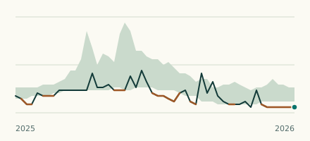 River gauge, United States Is the Big Cedar Creek unusually low at Georgia Ave at Cedartown? Level now, history, the same date in past years and each year's range.
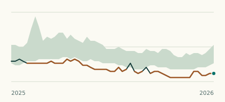 River gauge, United States Is the Little River unusually low at Newborn Road near Newborn? Level now, history, the same date in past years and each year's range.