Arkansas river levels today
Are the rivers and lakes in Arkansas unusually low or high?
We follow 54 water level gauges in Arkansas. 3 gauges read below their normal range for the date and none above it.
How many gauges do we follow in Arkansas?
54 gauges of the 7,007 we follow in the United States, as of 21 November 2026.
How many waters in Arkansas have a level gauge?
23 waters with a level gauge, of the 3,733 waters we follow in the United States, as of 21 November 2026.
How many gauges read below normal for the date?
3 gauges below their normal range, of the 9 gauges with a current reading and a normal range for the date, as of 21 November 2026.
How many gauges read above normal for the date?
0 gauges above their normal range, of the 9 gauges with a current reading and a normal range for the date, as of 21 November 2026.
How the places stand today
3 places below normal and 0 places above
Which places are furthest below normal?
Which gauges do we follow in Arkansas?
| Place | Reading | Against normal for the date | Change in a day |
|---|---|---|---|
| Arkansas River | |||
| Dardanelle | 4.75 ft | -0.14 ft | |
| Little Rock | 7.47 ft | -0.07 ft | |
| Morrilton | 9.70 ft | +0.09 ft | |
| Ozark L/D Tailwater | 337.45 ft | -0.17 ft | |
| Pendleton | 26.27 ft | +0.02 ft | |
| Pine Bluff | 31.29 ft | within the normal range for the date | +0.43 ft |
| Toad Suck Lock and Dam | 248.85 ft | -0.16 ft | |
| Van Buren | 19.16 ft | +0.12 ft | |
| Black River | |||
| Black Rock | 0.71 ft | -0.01 ft | |
| Corning | 0.74 ft | +0.01 ft | |
| Pocahontas | 0.07 ft | -0.02 ft | |
| Buffalo River | |||
| St Joe | 2.95 ft | -0.01 ft | |
| Cossatot River | |||
| DeQueen | 2.68 ft | -0.01 ft | |
| Eleven Point River | |||
| Ravenden Springs | 2.44 ft | 0 ft | |
| Fourche LaFave River | |||
| Gravelly | 1.05 ft | -0.01 ft | |
| Houston | 9.15 ft | +0.09 ft | |
| Kings River | |||
| Berryville | 2.75 ft | within the normal range for the date | -0.01 ft |
| L'Anguille River | |||
| Palestine | 13.93 ft | -0.01 ft | |
| Lee Creek | |||
| Van Buren LCR | 4.89 ft | -0.08 ft | |
| Little Missouri River | |||
| Boughton | 0.15 ft | 0 ft | |
| Little Red River | |||
| Judsonia | 1.37 ft | lower than any day of these dates in 36 years | -0.35 ft |
| Little River | |||
| Horatio | 4.45 ft | -0.05 ft | |
| Mississippi River | |||
| Arkansas City | 4.59 ft | -0.43 ft | |
| Helena | 6.23 ft | -0.55 ft | |
| Osceola | -1.29 ft | -0.76 ft | |
| Mulberry River | |||
| Mulberry | 0.99 ft | -0.01 ft | |
| Ouachita River | |||
| Arkadelphia | 4.08 ft | -0.01 ft | |
| Camden | 5.78 ft | 0 ft | |
| Felsenthal Lock and Dam | 65.28 ft | +0.02 ft | |
| Moro Bay State Park | 64.80 ft | ||
| Remmel Dam above Jones Mill | 2.70 ft | within the normal range for the date | 0 ft |
| Thatcher L&D | 77.16 ft | +0.02 ft | |
| Petit Jean River | |||
| Danville | 9.54 ft | +0.01 ft | |
| Red River | |||
| Fulton | -3.20 ft | 0 ft | |
| Index | -0.13 ft | 0 ft | |
| Spring Bank Ferry | 9.64 ft | lower than any day of these dates in 31 years | -0.02 ft |
| Right Hand Chute Little River | |||
| Rivervale | 1.53 ft | -0.04 ft | |
| Rolling Fork | |||
| DeQueen | 1.70 ft | within the normal range for the date | +0.01 ft |
| Saline River | |||
| Benton | 3.29 ft | -0.05 ft | |
| Dierks | 3.54 ft | 0 ft | |
| Lockesburg | 2.72 ft | -0.01 ft | |
| Rye | 4.04 ft | +0.01 ft | |
| Spring River | |||
| Hardy | 2.86 ft | 0 ft | |
| Imboden | 2.76 ft | +0.01 ft | |
| St. Francis River | |||
| Lake City | -0.39 ft | -0.08 ft | |
| Madison | 0.54 ft | +0.04 ft | |
| St. Francis | 5.16 ft | +0.02 ft | |
| White River | |||
| Augusta | 12.35 ft | within the normal range for the date | -0.77 ft |
| Batesville | 5.57 ft | in the lowest 5 percent for the date | -1.53 ft |
| Calico Rock | 4.06 ft | +0.50 ft | |
| Clarendon | 9.00 ft | +0.31 ft | |
| Des Arc | 3.65 ft | +0.51 ft | |
| Georgetown | 0.17 ft | +0.13 ft | |
| Newport | 2.11 ft | within the normal range for the date | +0.42 ft |
Keep exploring
 Country, United States Are the rivers and lakes in the United States unusually low or high? Every river and lake we follow here, against normal for the date.
 Today's list, United States Which places in the United States are furthest from normal today? The places in the United States furthest below and above normal today.
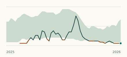 River gauge, United States Is the Red River unusually low at Spring Bank Ferry? Level now, history, the same date in past years and each year's range.
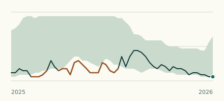 River gauge, United States Is the Little Red River unusually low at Judsonia? Level now, history, the same date in past years and each year's range.