Alaska river levels today
Are the rivers and lakes in Alaska unusually low or high?
We follow 131 water level gauges in Alaska. 1 gauge reads below its normal range for the date and none above it, not counting the 26 tide stations.
How many gauges do we follow in Alaska?
131 gauges of the 7,007 we follow in the United States, as of 21 November 2026.
How many waters in Alaska have a level gauge?
85 waters with a level gauge, of the 3,733 waters we follow in the United States, as of 21 November 2026.
How many gauges read below normal for the date?
1 gauge below its normal range, of the 2 gauges with a current reading and a normal range for the date, not counting the 26 tide stations, as of 21 November 2026.
How many gauges read above normal for the date?
0 gauges above their normal range, of the 2 gauges with a current reading and a normal range for the date, not counting the 26 tide stations, as of 21 November 2026.
How the places stand today
1 place below normal and 0 places above
Which places are furthest below normal?
Which gauges do we follow in Alaska?
| Place | Reading | Against normal for the date | Change in a day |
|---|---|---|---|
| Alaska Coast | |||
| Adak Island | 0.037 m above the tide table | within the normal range for the date | |
| Alitak | 0.044 m above the tide table | within the normal range for the date | |
| Anchorage | 0.21 m above the tide table | in the highest 5 percent for the date | |
| Atka | 0.049 m above the tide table | within the normal range for the date | |
| Cordova | 0.053 m above the tide table | within the normal range for the date | |
| Elfin Cove | 0.133 m below the tide table | within the normal range for the date | |
| Juneau | 0.05 m below the tide table | within the normal range for the date | |
| Ketchikan | 0.135 m above the tide table | within the normal range for the date | |
| King Cove | 0.164 m above the tide table | within the normal range for the date | |
| Kodiak Island | 0.06 m below the tide table | within the normal range for the date | |
| Nikiski | 0.056 m above the tide table | within the normal range for the date | |
| Nikolski | 0.071 m above the tide table | within the normal range for the date | |
| Nome | 0.465 m above the tide table | within the normal range for the date | |
| Port Alexander | 0.057 m above the tide table | within the normal range for the date | |
| Port Moller | 0.172 m above the tide table | within the normal range for the date | |
| Prudhoe Bay | 0.419 m above the tide table | in the highest 10 percent for the date | |
| Red Dog Dock | 0.466 m above the tide table | in the highest 10 percent for the date | |
| Sand Point | 0.212 m above the tide table | within the normal range for the date | |
| Seldovia | 0.035 m above the tide table | within the normal range for the date | |
| Seward | 0.029 m below the tide table | within the normal range for the date | |
| Sitka | 0.069 m above the tide table | in the highest 10 percent for the date | |
| Skagway | 0.016 m below the tide table | within the normal range for the date | |
| Unalaska | 0.054 m above the tide table | within the normal range for the date | |
| Valdez | 0.189 m below the tide table | within the normal range for the date | |
| Village Cove, St Paul Island | 0.218 m above the tide table | in the highest 5 percent for the date | |
| Yakutat | 0.126 m below the tide table | within the normal range for the date | |
| Alsek River | |||
| Bates River-Yukon Territory | 24.27 ft | +0.02 ft | |
| Anchor River | |||
| Anchor Point | 12.05 ft | -0.69 ft | |
| Anchor Point (near) | 1.51 ft | -0.67 ft | |
| Antler River | |||
| Antler Lake near Auke Bay | 30.49 ft | -0.14 ft | |
| Campbell Creek | |||
| Spenard | 17.57 ft | -0.28 ft | |
| Carlanna Lake | |||
| Carlanna Lake Dam near Ketchikan | 520.01 ft | -0.04 ft | |
| Chatanika River | |||
| Steese Hwy Bridge near Chatanika | 15.25 ft | ||
| Chena River | |||
| Fairbanks | 1.22 ft | +0.34 ft | |
| Hunts Creek near Two Rivers | 11.51 ft | ||
| Moose Creek Dam near Fairbanks | 18.11 ft | +0.01 ft | |
| Two Rivers | 16.61 ft | +0.09 ft | |
| Chester Creek | |||
| Arctic Blvd at Anchorage | 2.89 ft | -0.02 ft | |
| Chester Lake | |||
| Chester Lake Dam near Metlakatla | 853.61 ft | -0.19 ft | |
| Chisana River | |||
| Northway Road Bridge | 6.52 ft | 0 ft | |
| Cooper Creek | |||
| Mouth near Cooper Landing | 10.08 ft | -0.04 ft | |
| Eklutna Lake | |||
| Palmer | 846.36 ft | in the lowest 5 percent for the date | -0.08 ft |
| Eyak River | |||
| Copper River Hwy near Cordova | 18.93 ft | 0 ft | |
| Falls Creek | |||
| Petersburg | 17.32 ft | -0.06 ft | |
| Fish Creek | |||
| Ketchikan | 1.73 ft | -0.12 ft | |
| Gakona River | |||
| Gakona | 2.07 ft | +0.03 ft | |
| Glacier Creek | |||
| Alyeska Highway at Girdwood | 26.58 ft | -0.36 ft | |
| Goldstream Creek | |||
| Fairbanks | 10.12 ft | +0.03 ft | |
| Grouse Creek | |||
| Grouse Lake Outlet near Seward | 5.51 ft | -0.38 ft | |
| Gulkana River | |||
| the Richardson Highway near Gulkana | 5.72 ft | -0.04 ft | |
| Iliamna River | |||
| Pedro Bay | 56.99 ft | ||
| Iskut River | |||
| Johnson River-British Columbia | 2.12 ft | -0.21 ft | |
| Jordan Creek | |||
| Juneau | 7.45 ft | -0.02 ft | |
| Kasilof River | |||
| Kasilof | 37.31 ft | -0.05 ft | |
| Kenai River | |||
| Cooper Landing | 8.00 ft | -0.05 ft | |
| Kenai Keys near Sterling | 5.98 ft | -0.15 ft | |
| Skilak Lake Outlet near Sterling | 7.62 ft | +0.01 ft | |
| Soldotna | 6.65 ft | -0.02 ft | |
| Ketchikan Creek | |||
| Ketchikan Powerhouse near Ketchikan | 60.29 ft | 0 ft | |
| Klondike River | |||
| Bonanza Creek-Yukon Territory | 3.14 ft | +0.02 ft | |
| Klutina River | |||
| Copper Center | 7.78 ft | -0.02 ft | |
| Kobuk River | |||
| Kiana | 48.42 ft | -0.13 ft | |
| Koyukuk River | |||
| Hughes | 51.90 ft | +0.08 ft | |
| Kuskokwim River | |||
| Bethel | 2.21 ft | -0.93 ft | |
| McGrath | 8.47 ft | +0.05 ft | |
| Little Chena River | |||
| Fairbanks | 15.60 ft | +0.12 ft | |
| Little Susitna River | |||
| Palmer | 2.12 ft | -0.15 ft | |
| Parks Hwy Bridge near Houston | 4.51 ft | +0.06 ft | |
| Lowe River | |||
| Horsetail Falls near Valdez | 2.02 ft | -0.10 ft | |
| Lower Ketchikan Lake | |||
| Ketchikan Lake Dam near Ketchikan | 343.51 ft | -0.50 ft | |
| Maclaren River | |||
| Paxson | 2.41 ft | -0.13 ft | |
| Matanuska River | |||
| Matanuska Glacier near Chickaloon | 2.76 ft | +0.11 ft | |
| Mendenhall River | |||
| Auke Bay | 1.01 ft | -0.17 ft | |
| Middle Fork Koyukuk River | |||
| Wiseman | 18.07 ft | ||
| Montana Creek | |||
| Mendenhall Loop Road Bridge near Auke Bay | 10.71 ft | 0 ft | |
| Moose Creek | |||
| Oilwell Road near Trapper Creek | 11.45 ft | -0.20 ft | |
| Palmer | 15.10 ft | -0.12 ft | |
| Mosquito Fork of the Fortymile River | |||
| Chicken | 11.79 ft | +0.02 ft | |
| Nenana River | |||
| Healy | 8.93 ft | +0.13 ft | |
| Ninilchik River | |||
| Ninilchik | 5.09 ft | ||
| Nisling River | |||
| Onion Creek-Yukon Territory | 47.92 ft | 0 ft | |
| North Fork Flathead River | |||
| Canadian Border | 4.32 ft | -0.03 ft | |
| Nuyakuk River | |||
| Dillingham | 4.87 ft | -0.12 ft | |
| Old Crow River | |||
| the Mouth-Yukon Territory | 78.38 ft | -0.05 ft | |
| Pelly River | |||
| Pelly Crossing-Yukon Territory | 4.07 ft | -0.34 ft | |
| Porcupine River | |||
| International Boundary near Old Crow-Yukon Territory | 25.69 ft | -0.03 ft | |
| Old Crow River-Yukon Territory | 33.71 ft | -0.03 ft | |
| Resurrection River | |||
| Exit Glacier Road near Seward | 11.11 ft | ||
| Russell Creek | |||
| Cold Bay | 26.72 ft | within the normal range for the date | +0.44 ft |
| Sagavanirktok River | |||
| Pump Station 3 | 16.70 ft | +0.03 ft | |
| Salcha River | |||
| Salchaket | 6.22 ft | -0.04 ft | |
| Salmon Creek | |||
| Nash Road near Seward | 7.58 ft | -0.36 ft | |
| Salmon River | |||
| Gustavus | 9.71 ft | ||
| Ship Creek | |||
| Anchorage | 4.75 ft | -0.03 ft | |
| Situk River | |||
| Yakutat | 66.55 ft | +0.05 ft | |
| Sixmile Creek | |||
| Hope | 8.73 ft | -0.24 ft | |
| Skagway River | |||
| Skagway | 16.92 ft | 0 ft | |
| Skwentna River | |||
| Skwentna | 36.00 ft | ||
| Snow River | |||
| Seward | 6.61 ft | -0.40 ft | |
| South Fork of the Fortymile River | |||
| Chicken | 80.76 ft | -0.04 ft | |
| Staney Creek | |||
| Klawock | 7.53 ft | -0.11 ft | |
| Stewart River | |||
| the Mouth-Yukon Territory | 84.65 ft | +0.12 ft | |
| Stikine River | |||
| Telegraph Creek-British Columbia | 3.17 ft | +0.01 ft | |
| Wrangell | 6.78 ft | -0.53 ft | |
| Susitna River | |||
| Sunshine | 12.32 ft | +0.15 ft | |
| Taiya River | |||
| Skagway | 11.92 ft | +0.15 ft | |
| Taku River | |||
| Juneau | 30.20 ft | -0.10 ft | |
| Talkeetna River | |||
| Alaska Railroad Bridge 227.1 at Talkeetna | 3.62 ft | -0.14 ft | |
| Talkeetna | 2.97 ft | -0.18 ft | |
| Tanana River | |||
| Fairbanks | 17.22 ft | -0.10 ft | |
| Manley Hot Springs | 9.38 ft | -0.11 ft | |
| Nenana | 3.92 ft | +0.39 ft | |
| Tatshenshini River | |||
| Dalton Post-Yukon Territory | 15.15 ft | -0.01 ft | |
| Terror River | |||
| Mouth near Kodiak | 0.93 ft | -0.01 ft | |
| Tonsina River | |||
| the Richardson Hwy near Tonsina | 7.72 ft | -0.04 ft | |
| Trail River | |||
| Lawing | 4.00 ft | ||
| Walker Fork of the Fortymile River | |||
| Chicken | 8.33 ft | -0.09 ft | |
| Ward Creek | |||
| Lake Connell Dam near Ketchikan | 249.50 ft | ||
| West Creek | |||
| Skagway | 14.30 ft | +0.08 ft | |
| West Fork Dennison Fork | |||
| Chicken | 4.60 ft | ||
| White River | |||
| kilometer 1881.6 Alaska Hwy near Beaver Creek-Yukon Territory | 68.83 ft | -0.36 ft | |
| Whitman Creek | |||
| Whitman Lake Dam near Ketchikan | 376.40 ft | -0.34 ft | |
| Willow Creek | |||
| Parks Highway near Willow | 6.29 ft | -0.21 ft | |
| Yentna River | |||
| Lake Creek | 15.55 ft | -1.88 ft | |
| Yentna Station | 10.41 ft | ||
| Yukon River | |||
| Dawson-Yukon Territory | 1.67 ft | -1.05 ft | |
| Fort Yukon | 20.75 ft | ||
| Galena | 64.35 ft | -0.33 ft | |
| Pilot Station | 17.52 ft | ||
| Tanana | 69.68 ft | ||
| White River-Yukon Territory | 28.24 ft | -0.02 ft | |
Keep exploring
 Country, United States Are the rivers and lakes in the United States unusually low or high? Every river and lake we follow here, against normal for the date.
 Today's list, United States Which places in the United States are furthest from normal today? The places in the United States furthest below and above normal today.
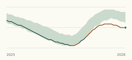 Lake gauge, United States Is the Eklutna Lake unusually low at Palmer? Level now, history, the same date in past years and each year's range.
 Records, world Which places have set a new record low or high? Record lows and highs in our data, and the newest set.