Ribble Douglas and Crossens catchment river levels today
Are the rivers and lakes in the Ribble Douglas and Crossens catchment unusually low or high?
We follow 56 water level gauges in the Ribble Douglas and Crossens catchment. 2 gauges read below their normal range for the date and none above it.
How many gauges do we follow in the Ribble Douglas and Crossens catchment?
56 gauges of the 2,378 we follow in the United Kingdom, as of 21 November 2026.
How many waters in the Ribble Douglas and Crossens catchment have a level gauge?
28 waters with a level gauge, of the 1,152 waters we follow in the United Kingdom, as of 21 November 2026.
How many gauges read below normal for the date?
2 gauges below their normal range, of the 30 gauges with a current reading and a normal range for the date, as of 21 November 2026.
How many gauges read above normal for the date?
0 gauges above their normal range, of the 30 gauges with a current reading and a normal range for the date, as of 21 November 2026.
How the places stand today
2 places below normal and 0 places above
Which places are furthest below normal?
Which gauges do we follow in Ribble Douglas and Crossens?
| Place | Reading | Against normal for the date | Change in a day |
|---|---|---|---|
| Black Brook (Chorley) | |||
| Chorley Haworth Road | 0.205 m | -0.006 m | |
| Boyces Brook | |||
| Ribchester Sarmatian Bridge | 0.089 m | -0.004 m | |
| Colne Water | |||
| Carry Bridge | 0.175 m | within the normal range for the date | -0.047 m |
| Ewood Mill Race | |||
| Ewood Ashville Terrace North | 0.096 m | +0.009 m | |
| Ewood Ashville Terrace South | -0.021 m | -0.008 m | |
| Hellifield Beck | |||
| Hellifield | 0.29 m | within the normal range for the date | +0.007 m |
| Hey | |||
| Chatburn Pendle Avenue | 0.065 m | -0.004 m | |
| Kirk Beck | |||
| Bolton by Bowland Hellifield rd | 0.084 m | +0.026 m | |
| Mearley Brook | |||
| Waterloo Road | 0.174 m | within the normal range for the date | -0.008 m |
| Pearl Brook | |||
| Horwich Pearl Brook | 0.296 m | within the normal range for the date | -0.007 m |
| Pendle Water | |||
| Barden Lane | 0.291 m | within the normal range for the date | -0.042 m |
| Lomeshaye | 0.281 m | within the normal range for the date | -0.035 m |
| Reedyford | 0.426 m | within the normal range for the date | -0.052 m |
| Pimlico Brook | |||
| Pimlico Brook | 0.201 m | within the normal range for the date | +0.045 m |
| River Blakewater | |||
| Gorse Street | 0.054 m | -0.011 m | |
| Harrison Street | 0.432 m | within the normal range for the date | -0.022 m |
| River Brun | |||
| Thompson Park | 0.351 m | within the normal range for the date | -0.02 m |
| River Calder (Lancashire) | |||
| Active Way | 0.657 m | within the normal range for the date | -0.029 m |
| Oxford Road | 0.258 m | in the lowest 5 percent for the date | -0.023 m |
| Padiham Town Centre | 0.326 m | in the lowest 10 percent for the date | -0.056 m |
| Whalley Weir | 0.49 m | within the normal range for the date | -0.081 m |
| River Darwen | |||
| Blackburn Waterfall | 0.477 m | -0.05 m | |
| Blue Bridge | 0.32 m | -0.069 m | |
| Darwen Clough Street Overflow | 0.507 m | -0.007 m | |
| Ewood | 0.341 m | within the normal range for the date | -0.041 m |
| Hardman Way | 0.064 m | within the normal range for the date | -0.016 m |
| River Douglas | |||
| Appley Bridge | 0.57 m | within the normal range for the date | -0.055 m |
| Parbold | 0.227 m | within the normal range for the date | -0.078 m |
| Red Rock | 0.142 m | -0.032 m | |
| Wanes Blades | 0.405 m | within the normal range for the date | -0.131 m |
| Wigan | 0.164 m | within the normal range for the date | -0.027 m |
| River Dunsop | |||
| Footholme Flume | 0.468 m | -0.028 m | |
| River Hodder | |||
| Hodder Place | 0.458 m | within the normal range for the date | -0.069 m |
| River Hyndburn | |||
| Milnshaw | 0.271 m | within the normal range for the date | 0 m |
| River Lostock | |||
| Bamber Bridge | 0.192 m | -0.029 m | |
| Littlewood Bridge | 0.57 m | within the normal range for the date | -0.157 m |
| River Ribble | |||
| Arnford Weir | 0.435 m | -0.08 m | |
| Henthorn | 0.576 m | within the normal range for the date | -0.102 m |
| Locks Weir | 0.208 m | -0.052 m | |
| Low Moor | 0.599 m | within the normal range for the date | -0.165 m |
| New Jumbles Rock | 0.463 m | within the normal range for the date | -0.099 m |
| Penny Bridge | 0.461 m | within the normal range for the date | -0.10 m |
| Penwortham | 2.163 m | +0.238 m | |
| Ribchester School | 0.284 m | -0.175 m | |
| Samlesbury | 1.216 m | -0.191 m | |
| Walton-Le-Dale | 0.303 m | -0.173 m | |
| River Yarrow | |||
| Castle Bridge Croston | 0.587 m | -0.101 m | |
| Croston | 0.313 m | within the normal range for the date | -0.046 m |
| Croston Dam | 0.573 m | -0.067 m | |
| Pincock Brow | 0.123 m | -0.027 m | |
| Sabden Brook | |||
| Sabden Bridge | 0.239 m | -0.022 m | |
| Sandy Brook | |||
| Dyers lane | 0.106 m | -0.01 m | |
| Shaw Brook Tributary | |||
| Dryden Street | 0.236 m | within the normal range for the date | -0.027 m |
| Syd Brook | |||
| Eccleston Heskin Bridge | 0.581 m | -0.024 m | |
| The Sluice | |||
| Crossens Pumping Station | 1.19 m | -0.066 m | |
| Trawden Brook | |||
| Trawden Brook | 0.09 m | within the normal range for the date | -0.018 m |
Keep exploring
 Country, United Kingdom Are the rivers and lakes in the United Kingdom unusually low or high? Every river and lake we follow here, against normal for the date.
 Today's list, United Kingdom Which places in the United Kingdom are furthest from normal today? The places in the United Kingdom furthest below and above normal today.
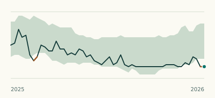 River gauge, United Kingdom Is the River Calder (Lancashire) unusually low at Oxford Road? Level now, history, the same date in past years and each year's range.
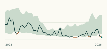 River gauge, United Kingdom Is the River Calder (Lancashire) unusually low at Padiham Town Centre? Level now, history, the same date in past years and each year's range.