Eden and Esk catchment river levels today
Are the rivers and lakes in the Eden and Esk catchment unusually low or high?
We follow 44 water level places in the Eden and Esk catchment. 6 places read below their normal range for the date and none above it.
How many places do we follow in the Eden and Esk catchment?
44 places of the 2,378 we follow in the United Kingdom, as of 21 November 2026.
How many waters in the Eden and Esk catchment have a level gauge?
25 waters with a level gauge, of the 1,152 waters we follow in the United Kingdom, as of 21 November 2026.
How many places read below normal for the date?
6 places below their normal range, of the 29 places with a current reading and a normal range for the date, as of 21 November 2026.
How many places read above normal for the date?
0 places above their normal range, of the 29 places with a current reading and a normal range for the date, as of 21 November 2026.
How the places stand today
6 places below normal and 0 places above
Which places are furthest below normal?
More places
Which gauges do we follow in Eden and Esk?
| Place | Reading | Against normal for the date | Change in a day |
|---|---|---|---|
| Brampton Beck | |||
| Brampton Moat Side | 0.066 m | -0.005 m | |
| Coal Burn | |||
| Coalburn Beck | 0.179 m | within the normal range for the date | -0.068 m |
| Dacre Beck | |||
| Dacre Bridge | 0.315 m | within the normal range for the date | -0.031 m |
| Durranhill Beck | |||
| Durranhill Pumping Station | 0.807 m | -0.009 m | |
| Gill Beck | |||
| Caldbeck Gill Beck Bridge | 0.317 m | -0.01 m | |
| Glenridding Beck | |||
| Glenridding Village | 0.203 m | -0.026 m | |
| Haweswater Beck | |||
| Burnbanks | 0.087 m | within the normal range for the date | -0.001 m |
| Haweswater Reservoir | |||
| Haweswater Reservoir | 19.62 m | in the lowest 5 percent for the date | -0.081 m |
| Little Caldew | |||
| Little Caldew Maltings | 0.347 m | -0.001 m | |
| Lochinvar Beck | |||
| Lochinvar storage basin, Longtown | 0.142 m | within the normal range for the date | -0.032 m |
| Parham Beck | |||
| Carlisle Raffles Avenue | 0.07 m | -0.005 m | |
| River Caldew | |||
| Cummersdale | 0.452 m | within the normal range for the date | -0.058 m |
| Denton Holme | 0.32 m | within the normal range for the date | -0.071 m |
| Sebergham | 0.502 m | within the normal range for the date | -0.045 m |
| Skew Bridge | 0.482 m | -0.067 m | |
| River Eamont | |||
| Eamont Bridge Farm | 0.398 m | in the lowest 10 percent for the date | -0.015 m |
| Pooley Bridge | 0.406 m | within the normal range for the date | -0.006 m |
| Udford New | 0.439 m | -0.042 m | |
| River Eden | |||
| Appleby | 0.289 m | in the lowest 10 percent for the date | -0.154 m |
| Great Corby | 0.788 m | within the normal range for the date | -0.141 m |
| Great Musgrave Bridge | 0.323 m | -0.079 m | |
| Kirkby Stephen | 0.296 m | within the normal range for the date | -0.116 m |
| Linstock | 0.427 m | -0.201 m | |
| Sands Centre, Carlisle | 0.517 m | ||
| Sheepmount | 0.993 m | within the normal range for the date | -0.264 m |
| Temple Sowerby | 0.552 m | within the normal range for the date | -0.198 m |
| River Ellen | |||
| Blennerhasset Bridge | 0.688 m | -0.018 m | |
| River Esk (Dumfries and Galloway) | |||
| Canonbie | 0.42 m | in the lowest 10 percent for the date | -0.062 m |
| River Gelt | |||
| Hynam Bridge | 0.374 m | within the normal range for the date | -0.084 m |
| River Irthing | |||
| Greenholme | 0.368 m | within the normal range for the date | -0.11 m |
| River Lowther | |||
| Bampton Grange | 0.429 m | within the normal range for the date | -0.043 m |
| Eamont Bridge | 0.517 m | within the normal range for the date | -0.049 m |
| River Petteril | |||
| Botcherby Bridge, Carlisle | 0.68 m | within the normal range for the date | -0.073 m |
| Harraby Green Business Park | 0.319 m | in the lowest 5 percent for the date | -0.065 m |
| Newbiggin Bridge | 0.549 m | -0.078 m | |
| Roe Beck | |||
| Stockdalewath | 0.302 m | within the normal range for the date | -0.041 m |
| Thacka Beck | |||
| Thacka Beck Reservoir | 0.056 m | within the normal range for the date | -0.019 m |
| Watson Terrace | 0.151 m | within the normal range for the date | +0.064 m |
| White House Gardens, Penrith | 0.353 m | within the normal range for the date | -0.024 m |
| Trout Beck (Carlisle) | |||
| Warwick Bridge | 0.028 m | -0.015 m | |
| Ullswater | |||
| Glenridding Steamer Pier | 0.703 m | +0.002 m | |
| Pooley Bridge Steamer Pier | 1.417 m | in the lowest 10 percent for the date | -0.014 m |
| Wiza Beck | |||
| Station Road, Wigton | 0.286 m | within the normal range for the date | -0.027 m |
| Wiza Beck Storage Basin, Wigton | 0.141 m | within the normal range for the date | -0.042 m |
Keep exploring
 Country, United Kingdom Are the rivers and lakes in the United Kingdom unusually low or high? Every river and lake we follow here, against normal for the date.
 Today's list, United Kingdom Which places in the United Kingdom are furthest from normal today? The places in the United Kingdom furthest below and above normal today.
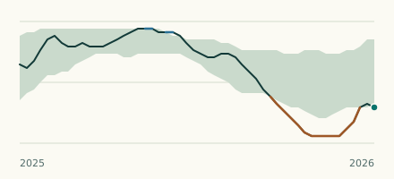 Reservoir, United Kingdom Is Haweswater Reservoir unusually low? Level now, history, the same date in past years and each year's range.
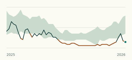 River gauge, United Kingdom Is the River Petteril unusually low at Harraby Green Business Park? Level now, history, the same date in past years and each year's range.