Derwent West Cumbria and Duddon catchment river levels today
Are the rivers and lakes in the Derwent West Cumbria and Duddon catchment unusually low or high?
We follow 25 water level places in the Derwent West Cumbria and Duddon catchment. 4 places read below their normal range for the date and none above it.
How many places do we follow in the Derwent West Cumbria and Duddon catchment?
25 places of the 2,378 we follow in the United Kingdom, as of 21 November 2026.
How many waters in the Derwent West Cumbria and Duddon catchment have a level gauge?
16 waters with a level gauge, of the 1,152 waters we follow in the United Kingdom, as of 21 November 2026.
How many places read below normal for the date?
4 places below their normal range, of the 19 places with a current reading and a normal range for the date, as of 21 November 2026.
How many places read above normal for the date?
0 places above their normal range, of the 19 places with a current reading and a normal range for the date, as of 21 November 2026.
How the places stand today
4 places below normal and 0 places above
Which places are furthest below normal?
Which gauges do we follow in Derwent West Cumbria and Duddon?
| Place | Reading | Against normal for the date | Change in a day |
|---|---|---|---|
| Bassenthwaite Lake | |||
| Bassenthwaite Lake | 1.051 m | within the normal range for the date | -0.02 m |
| Derwentwater | |||
| Derwentwater | 0.851 m | within the normal range for the date | -0.005 m |
| River Calder (Cumbria) | |||
| Calder Hall | 0.223 m | in the lowest 10 percent for the date | -0.014 m |
| River Cocker | |||
| Scalehill Upper Lorton Valley | 0.51 m | within the normal range for the date | -0.01 m |
| South Street Footbridge | 0.994 m | -0.012 m | |
| Southwaite Bridge | 0.43 m | in the lowest 10 percent for the date | -0.01 m |
| River Derwent (Cumbria) | |||
| Kingfisher, Cockermouth | 0.781 m | within the normal range for the date | -0.019 m |
| Ouse Bridge | 0.865 m | within the normal range for the date | -0.02 m |
| Portinscale | 0.559 m | within the normal range for the date | -0.043 m |
| Seaton Mill, Barepot, Workington | 0.592 m | within the normal range for the date | -0.011 m |
| River Ehen | |||
| Bleach Green Weir | 0.309 m | within the normal range for the date | 0 m |
| Braystones | 0.433 m | within the normal range for the date | -0.016 m |
| Egremont | 0.459 m | in the lowest 5 percent for the date | -0.017 m |
| River Ellen | |||
| Bull Gill | 0.504 m | within the normal range for the date | -0.04 m |
| River Esk (Cumbria) | |||
| Cropple How | 0.475 m | within the normal range for the date | -0.035 m |
| River Glenderamackin | |||
| Threlkeld | 0.568 m | -0.043 m | |
| River Greta | |||
| Greta Bridge | 1.105 m | -0.039 m | |
| Keswick Campsite | 0.566 m | -0.049 m | |
| Riddings Wood | 1.266 m | -0.041 m | |
| River Irt | |||
| Galesyke | 0.347 m | in the lowest 5 percent for the date | -0.006 m |
| River Keekle | |||
| St Leonards | 0.49 m | within the normal range for the date | -0.025 m |
| Skirting Beck | |||
| Church View | 0.329 m | within the normal range for the date | -0.006 m |
| St Johns Beck | |||
| Thirlmere | 0.16 m | within the normal range for the date | -0.005 m |
| Thirlmere Reservoir | |||
| Thirlmere Reservoir | 11.119 m | within the normal range for the date | -0.071 m |
| Wyre River | |||
| Harrington Eadie Street | 0.265 m | -0.022 m | |
Keep exploring
 Country, United Kingdom Are the rivers and lakes in the United Kingdom unusually low or high? Every river and lake we follow here, against normal for the date.
 Today's list, United Kingdom Which places in the United Kingdom are furthest from normal today? The places in the United Kingdom furthest below and above normal today.
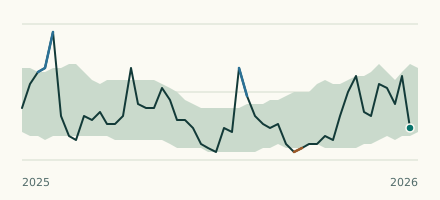 River gauge, United Kingdom Is the River Irt unusually low at Galesyke? Level now, history, the same date in past years and each year's range.
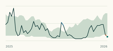 River gauge, United Kingdom Is the River Ehen unusually low at Egremont? Level now, history, the same date in past years and each year's range.