Var département river levels today
Are the rivers and lakes in Var unusually low or high?
We follow 55 water level gauges in Var. None read below their normal range for the date and none above it.
How many gauges do we follow in Var?
55 gauges of the 3,078 we follow in France, as of 26 October 2026.
How many waters in Var have a level gauge?
33 waters with a level gauge, of the 1,509 waters we follow in France, as of 26 October 2026.
How many gauges read below normal for the date?
0 gauges below their normal range, of the 33 gauges with a current reading and a normal range for the date, as of 26 October 2026.
How many gauges read above normal for the date?
0 gauges above their normal range, of the 33 gauges with a current reading and a normal range for the date, as of 26 October 2026.
How the places stand today
0 places below normal and 0 places above
Which gauges do we follow in Var?
| Place | Reading | Against normal for the date | Change in a day |
|---|---|---|---|
| Agay | |||
| Saint-Raphaël | 0.646 m | within the normal range for the date | -0.014 m |
| Aille | |||
| Vidauban | 1.78 m | -0.031 m | |
| Argens | |||
| Carcès | 0.312 m | within the normal range for the date | -0.036 m |
| Châteauvert | 0.63 m | within the normal range for the date | -0.008 m |
| Les Arcs | 0.90 m | within the normal range for the date | -0.035 m |
| Roquebrune-sur-Argens | 1.201 m | within the normal range for the date | -0.005 m |
| Seillons-Source-d'Argens | 0.383 m | within the normal range for the date | -0.002 m |
| Artuby | |||
| La Bastide | 0.20 m | within the normal range for the date | -0.01 m |
| Bourrian | |||
| Gassin | 0.244 m | within the normal range for the date | -0.01 m |
| Bresque | |||
| Entrecasteaux | 0.297 m | ||
| Salernes | 0.857 m | within the normal range for the date | -0.002 m |
| Caramy | |||
| Brignoles | 0.624 m | ||
| Brignoles (Pont de la D5, La Celle DREAL PACA) | 0.687 m | -0.024 m | |
| Carcès | 0.536 m | -0.023 m | |
| Mazaugues | 0.058 m | within the normal range for the date | -0.004 m |
| Vins-sur-Caramy | 0.664 m | within the normal range for the date | -0.012 m |
| Cassole | |||
| Cotignac | 0.387 m | ||
| Cauron | |||
| Bras | 0.181 m | within the normal range for the date | -0.002 m |
| Eau Salée | |||
| Barjols | 0.70 m | ||
| Endre | |||
| Le Muy | 0.628 m | within the normal range for the date | -0.015 m |
| Gapeau | |||
| Hyères | 0.428 m | within the normal range for the date | -0.017 m |
| La Crau | 0.372 m | within the normal range for the date | -0.012 m |
| Signes | 0.20 m | within the normal range for the date | -0.006 m |
| Solliès-Pont | 0.551 m | within the normal range for the date | -0.021 m |
| Garde | |||
| Grimaud | -0.237 m | -0.02 m | |
| Garonnette | |||
| Roquebrune-sur-Argens | 0.161 m | -0.013 m | |
| Giscle | |||
| Cogolin | 0.275 m | within the normal range for the date | -0.031 m |
| Cogolin (Les Ajusts) | 0.988 m | within the normal range for the date | -0.042 m |
| Grimaud | 0.397 m | within the normal range for the date | -0.024 m |
| Huveaune | |||
| Saint-Zacharie | 0.078 m | within the normal range for the date | +0.004 m |
| Issole (Var) | |||
| Cabasse | 0.157 m | within the normal range for the date | -0.007 m |
| Forcalqueiret | 0.339 m | ||
| Forcalqueiret (Pont de la D43) | 0.383 m | -0.012 m | |
| Jabron (Var) | |||
| Comps-sur-Artuby | 0.385 m | within the normal range for the date | -0.009 m |
| Môle | |||
| La Môle | -0.077 m | -0.031 m | |
| Le Lavandou | 0.328 m | within the normal range for the date | -0.026 m |
| Nartuby | |||
| Draguignan | 0.017 m | -0.012 m | |
| Trans-en-Provence | 0.525 m | 0 m | |
| Préconil | |||
| Le Plan-de-la-Tour | 0.057 m | within the normal range for the date | -0.015 m |
| Sainte-Maxime (Virgiles, Pont Virgiles) | 0.527 m | within the normal range for the date | -0.017 m |
| Sainte-Maxime (ZA Camp ferrat) | 0.218 m | +0.005 m | |
| Reppe | |||
| Ollioules | 0.541 m | within the normal range for the date | -0.007 m |
| Reyran | |||
| Fréjus | 0.022 m | -0.006 m | |
| Ruisseau de Grenouille | |||
| Cogolin | 0.183 m | -0.02 m | |
| Ruisseau Florièye | |||
| Lorgues | 0.666 m | ||
| Réal Collobrier | |||
| Pierrefeu-du-Var | 0.385 m | within the normal range for the date | -0.014 m |
| Réal Martin | |||
| La Crau | 0.634 m | within the normal range for the date | -0.017 m |
| Pierrefeu-du-Var | 0.451 m | within the normal range for the date | -0.004 m |
| Siagne | |||
| Callian | 0.745 m | within the normal range for the date | -0.068 m |
| Montauroux | 0.097 m | ||
| Siagnole | |||
| Mons | 0.137 m | within the normal range for the date | -0.022 m |
| Vallon de Bouillonnet | |||
| Sainte-Maxime | 0.014 m | within the normal range for the date | 0 m |
| Vallon de Font Taillade | |||
| Brue-Auriac | 0.467 m | ||
| Vallon du Couloubrier | |||
| Sainte-Maxime | 0.317 m | -0.014 m | |
| Verdon | |||
| Vinon-sur-Verdon | 0.72 m | -0.001 m | |
Keep exploring
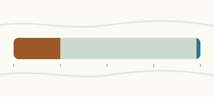 Country, France Are the rivers and lakes in France unusually low or high? Every river and lake we follow in France, against normal for the date.
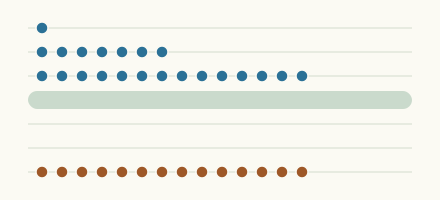 Today's list, France Which places in France are furthest from normal today? The places in France furthest below and above normal today.
 Records, world Which places have set a new record low or high? Record lows and highs in our data, and the newest set.
 Today's list, world Which places are furthest from normal today? The places furthest below and above normal today.
Sources
- Source : Hub'Eau / SCV, données PHyC (Licence Ouverte Etalab) (source). Licence: Licence Ouverte / Open Licence version 2.0