Saskatchewan river levels today
Are the rivers and lakes in Saskatchewan unusually low or high?
We follow 150 water level places in Saskatchewan. 7 places read below their normal range for the date and 12 places above it.
How many places do we follow in Saskatchewan?
150 Water Survey of Canada level gauges of the 2,148 we follow in Canada, as of 26 October 2026.
How many waters in Saskatchewan have a level gauge?
126 waters with a level gauge, of the 1,635 waters we follow in Canada, as of 26 October 2026.
How many places read below normal for the date?
7 places below their normal range, of the 103 places with a current reading and a normal range for the date, as of 26 October 2026.
How many places read above normal for the date?
12 places above their normal range, of the 103 places with a current reading and a normal range for the date, as of 26 October 2026.
How the places stand today
7 places below normal and 12 places above
Which places are furthest below normal?
Cypress Lake West Inflow Canal DrainCypress Lake West Inflow Canal Drain
0.346 m
lower than any day of these dates in 13 years
Cypress Lake West Outflow CanalCypress Lake West Outflow Canal
0.263 m
in the lowest 10 percent for the date
More places
Which places are furthest above normal?
More places
Which gauges do we follow in Saskatchewan?
| Place | Reading | Against normal for the date | Change in a day |
|---|---|---|---|
| Abitau River | |||
| Cuming Lake (upstream) | 5.44 m | in the highest 10 percent for the date | -0.008 m |
| Adams Lake (Saskatchewan) | |||
| Adams Lake (Saskatchewan) | 1,185.596 m | within the normal range for the date | +0.037 m |
| Altawan Reservoir | |||
| Govenlock | 897.789 m | within the normal range for the date | -0.003 m |
| Antelope Creek | |||
| Cabri | 0.369 m | -0.002 m | |
| Antler River | |||
| Wauchope | 603.431 m | -0.004 m | |
| Assiniboine River | |||
| Kamsack | 3.372 m | within the normal range for the date | +0.002 m |
| Sturgis | 1.127 m | within the normal range for the date | -0.014 m |
| Battle Creek | |||
| Consul | 0.948 m | within the normal range for the date | +0.005 m |
| International Boundary | 1.171 m | within the normal range for the date | -0.003 m |
| Nashlyn Project (downstream) | 1.186 m | within the normal range for the date | +0.003 m |
| Wilson's Weir (downstream) | 1.093 m | higher than any day of these dates in 15 years | +0.004 m |
| Bear Creek (Saskatchewan) | |||
| Piapot | 1.908 m | within the normal range for the date | -0.003 m |
| Belanger Creek Diversion to Cypress Lake | |||
| Belanger Creek Diversion to Cypress Lake | 0.027 m | 0 m | |
| Big Quill Lake | |||
| Kandahar | 520.349 m | within the normal range for the date | +0.013 m |
| Birch Creek | |||
| Elfros | 540.473 m | lower than any day of these dates in 10 years | -0.005 m |
| Boggy Creek | |||
| Lumsden | 1.759 m | within the normal range for the date | +0.001 m |
| Boundary Reservoir Diversion Canal | |||
| Estevan | 1.212 m | -0.007 m | |
| Boxelder Creek | |||
| Hargrave's Ranch | 0.252 m | ||
| Brightwater Creek | |||
| Kenaston | 0.747 m | -0.002 m | |
| Butala Coulee | |||
| Willow Creek | -0.07 m | 0 m | |
| Canoe River (Saskatchewan) | |||
| Beauval | 2.082 m | within the normal range for the date | -0.088 m |
| Carrot River | |||
| Turnberry | 261.537 m | within the normal range for the date | -0.088 m |
| Charlot River | |||
| Outlet of Webb Lake | 6.879 m | within the normal range for the date | 0 m |
| Churchill River (Saskatchewan and Manitoba) | |||
| Otter Rapids (upstream) | 1.801 m | within the normal range for the date | +0.001 m |
| Patuanak | 420.051 m | within the normal range for the date | -0.087 m |
| Sandy Bay | 4.924 m | within the normal range for the date | +0.008 m |
| Wintego Rapids (upstream) | 9.233 m | within the normal range for the date | +0.025 m |
| Cold River | |||
| Outlet of Cold Lake | 534.95 m | within the normal range for the date | -0.001 m |
| Cooke Creek | |||
| Goodwater | 0.457 m | ||
| Cottonwood Creek (Saskatchewan) | |||
| Lumsden | 1.346 m | -0.009 m | |
| Cutarm Creek | |||
| Spy Hill | 1.18 m | within the normal range for the date | -0.025 m |
| Cypress Lake | |||
| Cypress Lake | 974.067 m | within the normal range for the date | -0.026 m |
| Cypress Lake East Outflow Canal | |||
| Cypress Lake East Outflow Canal | 1.201 m | within the normal range for the date | +0.003 m |
| Cypress Lake West Inflow Canal | |||
| Cypress Lake West Inflow Canal | 0.191 m | 0 m | |
| Cypress Lake West Inflow Canal Drain | |||
| Cypress Lake West Inflow Canal Drain | 0.346 m | lower than any day of these dates in 13 years | 0 m |
| Cypress Lake West Outflow Canal | |||
| Cypress Lake West Outflow Canal | 0.263 m | in the lowest 10 percent for the date | +0.005 m |
| Denniel Creek | |||
| Val Marie | 1.242 m | within the normal range for the date | -0.016 m |
| Dore River (Saskatchewan) | |||
| Mouth | 1.283 m | within the normal range for the date | -0.004 m |
| Douglas River | |||
| Cluff Lake | 1.977 m | in the highest 10 percent for the date | +0.001 m |
| Eastend Canal | |||
| Eastend | 914.198 m | 0 m | |
| Eastend Reservoir | |||
| Eastend Reservoir | 917.37 m | within the normal range for the date | -0.031 m |
| Ekapo Creek | |||
| Marieval | 1.741 m | within the normal range for the date | -0.025 m |
| Elbow Diversion Canal | |||
| Drop Structure | 1.286 m | within the normal range for the date | 0 m |
| Fahlman Creek | |||
| Davin | 0.728 m | -0.003 m | |
| Fond Du Lac River | |||
| Outlet of Black Lake | 1.44 m | within the normal range for the date | +0.01 m |
| Frenchman River | |||
| Ravenscrag | 948.961 m | within the normal range for the date | -0.004 m |
| Gaff Ditch | |||
| Merryflat | 0.49 m | within the normal range for the date | +0.001 m |
| Geikie River | |||
| Wheeler River (downstream) | 1.324 m | within the normal range for the date | +0.012 m |
| Gibson Creek | |||
| Radville | 0.808 m | +0.001 m | |
| Grant Devine Lake | |||
| Alameda | 561.547 m | within the normal range for the date | -0.01 m |
| Haultain River | |||
| Norbert River (upstream) | 0.984 m | within the normal range for the date | -0.007 m |
| Huff Lake | |||
| Huff Lake | 815.536 m | in the highest 10 percent for the date | -0.006 m |
| Huff Lake Pumping Canal | |||
| Huff Lake Pumping Canal | 824.358 m | 0 m | |
| Illerbrun Creek | |||
| Simmie | 2.576 m | -0.001 m | |
| Inverness Creek | |||
| Broderick | 0.552 m | -0.002 m | |
| Ironspring Creek | |||
| Watson | 1.068 m | within the normal range for the date | -0.004 m |
| Jewel Creek | |||
| Goodwater | 1.384 m | -0.002 m | |
| Jumping Deer Creek | |||
| Lipton | 3.132 m | -0.004 m | |
| Lac La Ronge | |||
| La Ronge | 364.116 m | within the normal range for the date | +0.003 m |
| Lake Athabasca | |||
| Crackingstone Point | 209.223 m | within the normal range for the date | +0.031 m |
| Lake Diefenbaker | |||
| Gardiner Dam | 555.432 m | within the normal range for the date | +0.007 m |
| Lake of the Prairies | |||
| Togo | 94.625 m | -0.009 m | |
| Lanigan Creek | |||
| Boulder Lake (upstream) | 0.21 m | -0.065 m | |
| Larsen Reservoir | |||
| Radville | 631.044 m | in the highest 5 percent for the date | -0.002 m |
| Last Mountain Lake | |||
| Rowan's Ravine | 490.126 m | within the normal range for the date | -0.006 m |
| Lightning Creek | |||
| Carnduff | 1.643 m | higher than any day of these dates in 12 years | +0.002 m |
| Lilian River | |||
| Lady Lake | 0.419 m | within the normal range for the date | +0.002 m |
| Little Quill Lake | |||
| Wynyard | 520.411 m | within the normal range for the date | -0.033 m |
| Lodge Creek | |||
| Alberta Boundary | 0.575 m | within the normal range for the date | -0.003 m |
| McRae Creek at International Boundary (downstream) | 0.292 m | within the normal range for the date | 0 m |
| Long Creek | |||
| Estevan | 536.679 m | in the highest 5 percent for the date | -0.002 m |
| Western Crossing of International Boundary | 0.627 m | in the highest 5 percent for the date | -0.004 m |
| Lyons Creek | |||
| International Boundary | 9.898 m | -0.001 m | |
| Macfarlane River | |||
| Outlet of Davy Lake | 3.803 m | within the normal range for the date | +0.011 m |
| Magnusson Creek | |||
| Wynyard | 1.774 m | -0.004 m | |
| McDonald Creek | |||
| McCord | 0.854 m | in the lowest 5 percent for the date | +0.002 m |
| McKinnon Ditch | |||
| Consul | 0.525 m | 0 m | |
| Middle Creek | |||
| Govenlock | 1.288 m | in the highest 10 percent for the date | -0.002 m |
| Lodge Creek (upstream) | 0.805 m | -0.006 m | |
| Middle Creek Reservoir (downstream) | 0.603 m | 0 m | |
| Moose Jaw River | |||
| Burdick | 528.196 m | within the normal range for the date | +0.023 m |
| Moose Mountain Creek | |||
| Grant Devine Lake (downstream) | 8.392 m | within the normal range for the date | -0.005 m |
| Grant Devine Lake (upstream) | 2.195 m | within the normal range for the date | +0.014 m |
| Moose Mountain Lake (Reservoir) | |||
| Corning | 620.202 m | within the normal range for the date | -0.022 m |
| Moosomin Lake | |||
| Moosomin | 543.961 m | within the normal range for the date | -0.007 m |
| Moseley Creek | |||
| Halbrite | 0.772 m | -0.003 m | |
| Mosquito Creek (Saskatchewan) | |||
| Pambrun | 9.777 m | 0 m | |
| Nashlyn Canal | |||
| Consul | 0.634 m | +0.001 m | |
| Newton Lake | |||
| Newton Lake | 802.661 m | within the normal range for the date | +0.003 m |
| Newton Lake Main Canal | |||
| Newton Lake Main Canal | 799.537 m | +0.001 m | |
| Nickle Lake | |||
| Weyburn | 562.962 m | within the normal range for the date | -0.002 m |
| North Saskatchewan River | |||
| Borden | 442.512 m | +0.002 m | |
| Deer Creek | 1.349 m | within the normal range for the date | +0.026 m |
| Prince Albert | 1.606 m | within the normal range for the date | -0.006 m |
| Notukeu Creek | |||
| Admiral Reservoir (upstream) | 0.685 m | -0.001 m | |
| Vanguard | 0.983 m | within the normal range for the date | 0 m |
| Pheasant Creek | |||
| Abernethy | 1.49 m | +0.002 m | |
| Pipestone Creek (Saskatchewan and Manitoba) | |||
| Moosomin Lake (upstream) | 100.214 m | within the normal range for the date | -0.016 m |
| Qu'appelle River | |||
| Buffalo Pound Lake (upstream) | 5.522 m | within the normal range for the date | -0.01 m |
| Craven Dam (downstream) | 1.498 m | within the normal range for the date | -0.032 m |
| Loon Creek (downstream) | 1.016 m | within the normal range for the date | -0.057 m |
| Lumsden | 491.191 m | within the normal range for the date | +0.023 m |
| Welby | 2.584 m | within the normal range for the date | -0.001 m |
| Quill Creek | |||
| Quill Lake | 2.84 m | -0.004 m | |
| Rafferty Reservoir | |||
| Estevan | 549.705 m | within the normal range for the date | -0.034 m |
| Ranch Creek | |||
| Ranch Lake (upstream) | 0.403 m | -0.003 m | |
| Rapid River | |||
| Outlet of Lac La Ronge | 6.585 m | within the normal range for the date | -0.001 m |
| Red Deer River (Manitoba) | |||
| Erwood | 1.22 m | ||
| Reindeer Lake | |||
| Southend | 336.639 m | -0.041 m | |
| Reindeer River | |||
| Devil Rapids (upstream) | 7.394 m | within the normal range for the date | -0.034 m |
| Richardson Ditch | |||
| Consul | 0.677 m | 0 m | |
| Ridge Creek | |||
| Bridgeford | 99.878 m | in the lowest 10 percent for the date | -0.013 m |
| Romance Creek | |||
| Watson | 0.367 m | -0.002 m | |
| Roughbark Creek | |||
| Rafferty Reservoir (upstream) | 0.373 m | ||
| Roughbark Reservoir | |||
| Weyburn | 566.004 m | within the normal range for the date | -0.006 m |
| Rushlake Creek | |||
| Highfield Reservoir (upstream) | 1.676 m | within the normal range for the date | +0.003 m |
| Saline Creek | |||
| Nokomis | 0.993 m | within the normal range for the date | -0.003 m |
| Saskatchewan River | |||
| Forks (downstream) | 377.332 m | within the normal range for the date | -0.022 m |
| Old Channel | 1.143 m | -0.359 m | |
| Tobin Lake (downstream) | 2.396 m | within the normal range for the date | +0.267 m |
| Shepherd Creek | |||
| Alameda | 1.244 m | -0.007 m | |
| Short Creek | |||
| Roche Percee | 1.133 m | within the normal range for the date | -0.008 m |
| Six Mile Creek | |||
| Glentworth | 6.381 m | +0.001 m | |
| Smith Creek | |||
| Marchwell | 0.718 m | within the normal range for the date | +0.011 m |
| Souris River | |||
| Rafferty Reservoir (downstream) | 2.741 m | higher than any day of these dates in 15 years | -0.002 m |
| Ralph | 0.30 m | in the lowest 10 percent for the date | +0.017 m |
| South Saskatchewan River | |||
| Saskatoon | 2.228 m | within the normal range for the date | +0.024 m |
| Spangler Ditch | |||
| Govenlock | 0.27 m | 0 m | |
| Stony Creek (Saskatchewan) | |||
| Kamsack | 0.865 m | within the normal range for the date | -0.021 m |
| Swift Current Creek | |||
| Leinan | 1.159 m | within the normal range for the date | +0.009 m |
| Rock Creek (downstream) | 1.811 m | in the lowest 5 percent for the date | +0.002 m |
| Tatagwa Lake Drain | |||
| Weyburn | 0.138 m | -0.007 m | |
| Tazin Lake | |||
| Outlet | 345.66 m | in the highest 5 percent for the date | +0.008 m |
| Tazin River | |||
| Tazin Lake (upstream) | 6.633 m | in the highest 10 percent for the date | -0.001 m |
| Tobin Lake | |||
| Spillway | 313.585 m | within the normal range for the date | +0.019 m |
| Val Marie Pump No. 1 | |||
| Val Marie Pump No. 1 | 0.111 m | +0.001 m | |
| Vidora Ditch | |||
| Consul | 0.335 m | 0 m | |
| Wapiskau River | |||
| White Lake (upstream) | 7.976 m | within the normal range for the date | +0.014 m |
| Wascana Creek | |||
| Lumsden | 1.761 m | within the normal range for the date | +0.028 m |
| Waskesiu Lake | |||
| Waskesiu Lake | 532.265 m | within the normal range for the date | -0.015 m |
| Waterfound River | |||
| Theriau Lake (downstream) | 2.248 m | within the normal range for the date | -0.003 m |
| Wathaman River | |||
| Wathaman Lake (downstream) | 1.367 m | within the normal range for the date | +0.03 m |
| Wheeler River | |||
| Russell Lake (downstream) | 1.715 m | within the normal range for the date | +0.046 m |
| White Gull Creek | |||
| Highway No. 106 | 2.462 m | within the normal range for the date | -0.049 m |
| Whitesand River (Saskatchewan) | |||
| Canora | 469.426 m | within the normal range for the date | +0.004 m |
| Wollaston Lake | |||
| Ross Channel | 391.515 m | within the normal range for the date | +0.028 m |
| Wood River | |||
| Lafleche | 0.723 m | within the normal range for the date | -0.001 m |
| McCord | 5.592 m | within the normal range for the date | -0.005 m |
| Yellow Grass Ditch | |||
| Yellow Grass | 0.75 m | +0.004 m | |
| Yorkton Creek | |||
| Ebenezer | 0.326 m | within the normal range for the date | +0.049 m |
Keep exploring
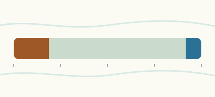 Country, Canada Are the rivers and lakes in Canada unusually low or high? Every river and lake we follow in Canada, against normal for the date.
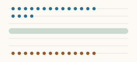 Today's list, Canada Which places in Canada are furthest from normal today? The places in Canada furthest below and above normal today.
 River gauge, Canada Is the Birch Creek unusually low at Elfros? Level now, history, the same date in past years and each year's range.
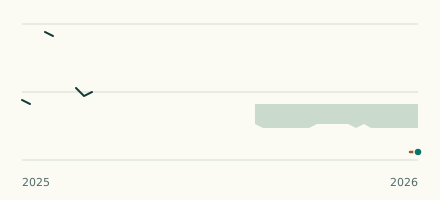 Canal gauge, Canada Is the Cypress Lake West Inflow Canal Drain unusually low at Cypress Lake West Inflow Canal Drain? Level now, history, the same date in past years and each year's range.
Sources
- Data Source: Environment and Climate Change Canada (Water Survey of Canada) (source). Licence: ECCC Data Services End-use Licence v2.1.1