Queensland river levels today
Are the rivers and lakes in Queensland unusually low or high?
We follow 348 water level gauges in Queensland. 8 gauges read below their normal range for the date and 86 gauges above it.
How many gauges do we follow in Queensland?
348 gauges of the 640 we follow in Australia, as of 20 November 2026.
How many waters in Queensland have a level gauge?
230 waters with a level gauge, of the 398 waters we follow in Australia, as of 20 November 2026.
How many gauges read below normal for the date?
8 gauges below their normal range, of the 295 gauges with a current reading and a normal range for the date, as of 20 November 2026.
How many gauges read above normal for the date?
86 gauges above their normal range, of the 295 gauges with a current reading and a normal range for the date, as of 20 November 2026.
How the places stand today
8 places below normal and 86 places above
Which places are furthest below normal?
More places
Which places are furthest above normal?
More places
Which gauges do we follow in Queensland?
| Place | Reading | Against normal for the date | Change in a day |
|---|---|---|---|
| Accomodation Creek | |||
| Wallaces Dump | 0.531 m | within the normal range for the date | -0.024 m |
| Albert River | |||
| Bromfleet | 0.40 m | within the normal range for the date | -0.101 m |
| Lumeah Number 2 | 0.849 m | within the normal range for the date | -0.01 m |
| Alice River | |||
| Barcaldine | 4.598 m | within the normal range for the date | -0.011 m |
| Amamoor Creek | |||
| Zachariah | 1.42 m | within the normal range for the date | -0.027 m |
| Andromache River | |||
| Jochheims | 1.773 m | in the highest 5 percent for the date | +0.169 m |
| Annan River | |||
| Beesbike | 2.658 m | ||
| Archer River | |||
| Telegraph Crossing | 2.533 m | within the normal range for the date | -0.006 m |
| Auburn River | |||
| Dykehead | 1.40 m | within the normal range for the date | -0.183 m |
| Babinda Creek | |||
| The Boulders | 1.048 m | in the highest 10 percent for the date | +0.118 m |
| Back Creek | |||
| Beechmont | 0.235 m | in the highest 5 percent for the date | 0 m |
| Ballandool River | |||
| Hebel Bollon Road | 2.126 m | within the normal range for the date | -0.051 m |
| Balonne River | |||
| St George | 3.135 m | +0.194 m | |
| Surat | 3.886 m | in the highest 10 percent for the date | -0.417 m |
| Weribone | 5.302 m | in the highest 10 percent for the date | -0.313 m |
| Balonne-minor River | |||
| Hastings | 3.312 m | +0.277 m | |
| Barambah Creek | |||
| Ban Ban | 1.272 m | within the normal range for the date | -0.104 m |
| Litzows | 1.322 m | in the highest 10 percent for the date | -0.123 m |
| West Barambah | 1.38 m | in the highest 10 percent for the date | -0.144 m |
| Barcoo River | |||
| Blackall | 1.995 m | within the normal range for the date | -0.408 m |
| Retreat | 1.638 m | within the normal range for the date | -0.074 m |
| Barker Creek | |||
| Glenmore | 1.227 m | within the normal range for the date | -0.317 m |
| Barkers Creek | |||
| Brooklands | 0.639 m | within the normal range for the date | -0.016 m |
| Barratta Creek | |||
| Northcote | 1.224 m | within the normal range for the date | +0.019 m |
| Barron River | |||
| Bilwon | 1.582 m | in the highest 10 percent for the date | -0.004 m |
| Goonara Creek | 1.272 m | within the normal range for the date | +0.009 m |
| Mareeba | 1.689 m | within the normal range for the date | -0.002 m |
| Myola | 0.625 m | within the normal range for the date | +0.002 m |
| Picnic Crossing | 0.76 m | within the normal range for the date | 0 m |
| Basalt River | |||
| Bluff Downs | 0.768 m | within the normal range for the date | +0.006 m |
| Bell Creek | |||
| Craiglands | 0.857 m | within the normal range for the date | -0.011 m |
| Belyando River | |||
| Gregory Development Road | 1.03 m | within the normal range for the date | -0.031 m |
| Black River | |||
| Bruce Highway | 0.761 m | within the normal range for the date | +0.024 m |
| Blacks Creek | |||
| Whitefords | 1.106 m | within the normal range for the date | +0.309 m |
| Blencoe Creek | |||
| Blencoe Falls | 1.187 m | within the normal range for the date | +0.024 m |
| Bloomfield River | |||
| China Camp | 1.237 m | within the normal range for the date | +0.137 m |
| Bluewater Creek | |||
| Bluewater | 0.357 m | within the normal range for the date | +0.071 m |
| Bokhara River | |||
| Hebel | 1.836 m | in the highest 10 percent for the date | -0.012 m |
| Boonara Creek | |||
| Ettiewyn | 1.681 m | -0.095 m | |
| Bowen River | |||
| Jacks Creek | 1.251 m | within the normal range for the date | +0.052 m |
| Myuna | 0.622 m | within the normal range for the date | +0.004 m |
| Boyne River | |||
| Carters | 0.553 m | within the normal range for the date | -0.033 m |
| Cooranga | 1.753 m | in the highest 10 percent for the date | -0.097 m |
| Bremer River | |||
| Adams Bridge | 0.91 m | within the normal range for the date | -0.042 m |
| Walloon | 1.934 m | in the highest 10 percent for the date | -0.264 m |
| Briarie Creek | |||
| Woolerbilla-Hebel Road | 0.891 m | within the normal range for the date | +0.002 m |
| Brisbane River | |||
| Gregors Creek | 1.54 m | in the highest 5 percent for the date | -0.138 m |
| Linville | 0.675 m | within the normal range for the date | -0.16 m |
| Savages Crossing | 1.465 m | within the normal range for the date | -0.129 m |
| Broadwater Creek | |||
| Barkers | 0.292 m | within the normal range for the date | -0.024 m |
| Broken River | |||
| Old Racecourse | 0.917 m | in the highest 5 percent for the date | +0.204 m |
| Urannah | 1.50 m | in the highest 5 percent for the date | +0.546 m |
| Brown River (Queensland) | |||
| Lake Brown | 0.786 m | in the highest 10 percent for the date | -0.029 m |
| Brush Creek | |||
| Beebo | 1.329 m | within the normal range for the date | -0.009 m |
| Bulloo River | |||
| Autumnvale | 2.249 m | within the normal range for the date | +0.50 m |
| Quilpie | 2.095 m | in the highest 10 percent for the date | +0.107 m |
| Bungil Creek | |||
| Tabers | 0.721 m | within the normal range for the date | -0.028 m |
| Burdekin River | |||
| Blue Range | 0.636 m | +0.004 m | |
| Clare | 1.612 m | within the normal range for the date | +0.002 m |
| Gainsford | 1.991 m | within the normal range for the date | -0.052 m |
| Hydro Site | 1.913 m | within the normal range for the date | +0.019 m |
| Mount Fullstop | 1.774 m | within the normal range for the date | +0.003 m |
| Sellheim | 1.27 m | +0.032 m | |
| Valley of Lagoons | 0.61 m | within the normal range for the date | +0.012 m |
| Burke River | |||
| Boulia | 0.868 m | within the normal range for the date | -0.011 m |
| Burnett Creek | |||
| Upstream Maroon Dam | 1.124 m | within the normal range for the date | -0.008 m |
| Burnett River | |||
| Ceratodus | 1.625 m | -0.031 m | |
| Eidsvold | 0.754 m | within the normal range for the date | +0.021 m |
| Figtree Creek | 2.122 m | in the highest 5 percent for the date | -0.365 m |
| Gayndah Flume | 0.516 m | within the normal range for the date | -0.339 m |
| Jones Weir Headwater | 110.095 m | within the normal range for the date | -0.045 m |
| Jones Weir Tailwater | 0.806 m | within the normal range for the date | -0.107 m |
| Mount Lawless | 1.343 m | in the highest 10 percent for the date | -0.199 m |
| Yarrol | 0.689 m | within the normal range for the date | 0 m |
| Caboolture River | |||
| Upper Caboolture | 0.785 m | within the normal range for the date | -0.039 m |
| Cadarga Creek | |||
| Brovinia Station | 0.942 m | within the normal range for the date | -0.057 m |
| Cainbable Creek | |||
| The Gorge | 0.777 m | in the highest 10 percent for the date | -0.03 m |
| Callandoon Creek | |||
| Carana Weir | 1.971 m | within the normal range for the date | -0.018 m |
| Oonavale | 0.641 m | -0.018 m | |
| Callide Creek | |||
| Goovigen | 0.492 m | within the normal range for the date | 0 m |
| Cameron Creek | |||
| 8.7 km | 0.529 m | within the normal range for the date | -0.003 m |
| Canal Creek | |||
| Leyburn | 0.831 m | in the highest 10 percent for the date | -0.087 m |
| Canungra Creek | |||
| Main Road Bridge | 0.372 m | within the normal range for the date | -0.014 m |
| Cape River | |||
| Pentland | 1.464 m | within the normal range for the date | -0.011 m |
| Taemas | 0.795 m | within the normal range for the date | -0.008 m |
| Carmila Creek | |||
| Carmila | 1.11 m | in the highest 10 percent for the date | +0.019 m |
| Carnarvon Creek | |||
| Rewan | 0.727 m | within the normal range for the date | -0.242 m |
| Cattle Creek | |||
| Gargett | 1.903 m | in the highest 5 percent for the date | +0.419 m |
| Higham's Bridge | 1.535 m | in the highest 5 percent for the date | +0.111 m |
| Charleys Creek | |||
| Chinchilla | 5.233 m | -0.084 m | |
| Christmas Creek (Queensland) | |||
| Tramway Lane | 1.058 m | within the normal range for the date | -0.018 m |
| Cloncurry River | |||
| Canobie | 0.054 m | 0 m | |
| Hensley Drive | 0.926 m | in the highest 5 percent for the date | -0.656 m |
| Coen River | |||
| Racecourse | 1.034 m | within the normal range for the date | -0.02 m |
| Comet River | |||
| Comet Weir | 1.46 m | in the highest 10 percent for the date | +0.202 m |
| Springsure Creek Junction | 2.72 m | in the highest 5 percent for the date | -0.136 m |
| The Lake | 3.255 m | in the highest 5 percent for the date | +1.54 m |
| Condamine River | |||
| Bedarra | 5.178 m | -0.058 m | |
| Brigalow | 6.251 m | in the highest 5 percent for the date | +0.29 m |
| Brosnans Barn | 0.587 m | in the highest 10 percent for the date | -0.021 m |
| Cecil Weir | 4.568 m | in the highest 5 percent for the date | -0.538 m |
| Chinchilla | 4.407 m | in the highest 5 percent for the date | -0.212 m |
| Cotswold | 5.76 m | in the highest 5 percent for the date | +0.614 m |
| Elbow Valley | 0.814 m | within the normal range for the date | -0.04 m |
| Loudouns Bridge | 3.232 m | in the highest 5 percent for the date | -0.361 m |
| Talgai Tailwater | 9.678 m | -0.653 m | |
| Tummaville | 1.899 m | in the highest 10 percent for the date | -0.21 m |
| Warwick | 1.034 m | in the highest 10 percent for the date | -0.071 m |
| Connors River | |||
| Mount Bridget | 0.898 m | within the normal range for the date | -0.001 m |
| Pink Lagoon | 0.753 m | within the normal range for the date | -0.008 m |
| Coomera River | |||
| Army Camp | 0.862 m | within the normal range for the date | -0.015 m |
| Cooper Creek | |||
| Nappa Merrie | 1.044 m | within the normal range for the date | +0.342 m |
| Cooyar Creek | |||
| Taromeo Creek | 1.151 m | in the highest 5 percent for the date | -0.041 m |
| Copperfield River | |||
| Spanner Waterhole | 1.771 m | within the normal range for the date | -0.045 m |
| Cornish Creek | |||
| Bowen Downs | 1.351 m | -0.037 m | |
| Cressbrook Creek | |||
| Rosentreters Crossing | 1.16 m | within the normal range for the date | 0 m |
| Culgoa River | |||
| Whyenbah | 3.35 m | in the highest 10 percent for the date | +0.277 m |
| Woolerbilla Road | 2.508 m | -0.041 m | |
| Currumbin Creek | |||
| Nicolls Bridge | 0.621 m | within the normal range for the date | -0.004 m |
| Dalrymple Creek | |||
| Allora | 0.944 m | -0.058 m | |
| Darr River | |||
| Darr | 2.237 m | within the normal range for the date | +0.419 m |
| Dawson River | |||
| Beckers | 1.041 m | within the normal range for the date | +0.06 m |
| Bindaree | 3.079 m | +0.563 m | |
| Taroom | 4.032 m | in the highest 5 percent for the date | +0.313 m |
| Utopia Downs | 2.454 m | -1.368 m | |
| Woodleigh | 2.807 m | in the highest 10 percent for the date | -0.126 m |
| Dee River | |||
| Wura | 1.067 m | -0.002 m | |
| Degilbo Creek | |||
| Coringa | 1.482 m | -0.074 m | |
| Denison Creek | |||
| Braeside | 0.415 m | within the normal range for the date | +0.162 m |
| Diamantina River | |||
| Diamantina Lakes | 0.427 m | within the normal range for the date | +0.095 m |
| Dogwood Creek | |||
| Gilweir | 7.751 m | within the normal range for the date | +0.005 m |
| Don River (Don) | |||
| Ida Creek | 0.682 m | within the normal range for the date | +0.041 m |
| Reeves | 1.089 m | within the normal range for the date | +0.012 m |
| Don River (Fitzroy) | |||
| Kingsborough | -0.064 m | in the lowest 10 percent for the date | 0 m |
| Rannes Recorder | 1.824 m | within the normal range for the date | -0.014 m |
| Dugald River | |||
| Railway Crossing | 0.02 m | within the normal range for the date | 0 m |
| Dulhunty River | |||
| Dougs Pad | 0.851 m | within the normal range for the date | -0.002 m |
| Dumaresq River | |||
| Farnbro | 1.243 m | -0.091 m | |
| East Normanby River | |||
| Mulligan Highway | 1.289 m | within the normal range for the date | +0.003 m |
| Eastern Creek | |||
| Lands End | 1.635 m | within the normal range for the date | -0.014 m |
| Einasleigh River | |||
| Einasleigh | 1.25 m | within the normal range for the date | -0.003 m |
| Minnies Dip | 1.533 m | within the normal range for the date | -0.001 m |
| Elizabeth Creek | |||
| Mount Surprise | 1.66 m | ||
| Emu Creek (Balonne-Condamine) | |||
| Emu Vale | 1.80 m | in the highest 5 percent for the date | -0.047 m |
| Emu Creek (Brisbane) | |||
| Boat Mountain | 0.80 m | within the normal range for the date | -0.129 m |
| Endeavour River | |||
| Flaggy | 1.447 m | within the normal range for the date | +0.007 m |
| Esk Creek | |||
| Falls Road | 1.399 m | within the normal range for the date | -0.026 m |
| Etheridge River | |||
| Roseglen | 1.164 m | within the normal range for the date | +0.001 m |
| Eurombah Creek | |||
| Brookfield | 0.733 m | within the normal range for the date | -0.031 m |
| Finch Hatton Creek | |||
| Gorge Road | 1.623 m | in the highest 5 percent for the date | +0.031 m |
| Fishers Creek | |||
| Nerada | 1.169 m | in the highest 10 percent for the date | +0.014 m |
| Fitzroy River | |||
| Hanrahan's Crossing | 1.821 m | +0.003 m | |
| Riverslea | 12.796 m | +0.001 m | |
| The Gap | 5.794 m | within the normal range for the date | -0.014 m |
| Flaggy Creek | |||
| Cattle Yards | 0.822 m | within the normal range for the date | +0.002 m |
| Flagstone Creek | |||
| Brown-Zirbels Road | 0.998 m | within the normal range for the date | 0 m |
| Flinders River | |||
| Etta Plains | 0.205 m | -0.026 m | |
| Glendower Crossing | 0.294 m | in the highest 10 percent for the date | -0.021 m |
| Punchbowl | 1.64 m | in the highest 5 percent for the date | +0.004 m |
| Richmond | 1.653 m | +0.005 m | |
| Freshwater Creek (Queensland) | |||
| Redlynch Estate | 1.701 m | within the normal range for the date | 0 m |
| Funnel Creek | |||
| Main Road | 1.132 m | within the normal range for the date | +0.141 m |
| Georgina River | |||
| Roxborough Downs | 1.683 m | within the normal range for the date | +0.026 m |
| Gilbert River | |||
| Burke Development Road | 1.449 m | ||
| Rockfields | 2.251 m | within the normal range for the date | -0.006 m |
| Gilliat River | |||
| Wills Developmental Road | 1.51 m | within the normal range for the date | -0.001 m |
| Gin Gin Creek | |||
| Brushy Creek | 0.748 m | within the normal range for the date | -0.031 m |
| Glastonbury Creek | |||
| Glastonbury | 0.748 m | within the normal range for the date | -0.013 m |
| Glengallan Creek | |||
| Rocky Ridge | 0.583 m | -0.087 m | |
| Gowrie Creek (Balonne-Condamine) | |||
| Cranley | 0.478 m | within the normal range for the date | -0.006 m |
| Gowrie Creek (Herbert) | |||
| Abergowrie | 0.791 m | within the normal range for the date | +0.01 m |
| Gregory River (Burrum) | |||
| Isis Highway | 2.154 m | in the highest 5 percent for the date | -0.221 m |
| Leesons | 2.427 m | in the highest 5 percent for the date | -0.183 m |
| Gregory River (Nicholson) | |||
| Gregory Downs | 1.125 m | within the normal range for the date | +0.005 m |
| Riversleigh Number 2 | 1.539 m | within the normal range for the date | -0.004 m |
| Gregory River (Proserpine) | |||
| Lower Gregory | 0.574 m | within the normal range for the date | +0.014 m |
| Grevillea Creek | |||
| Folding Hills | 0.315 m | in the lowest 5 percent for the date | 0 m |
| Gunpowder Creek | |||
| Gunpowder | 0.213 m | within the normal range for the date | -0.001 m |
| Hann River | |||
| Sandy Creek | 1.082 m | within the normal range for the date | -0.005 m |
| Haughton River | |||
| Glendale | -0.426 m | in the lowest 10 percent for the date | -0.001 m |
| Powerline | 0.931 m | in the highest 5 percent for the date | +0.004 m |
| Herbert River | |||
| Abergowrie | 1.11 m | within the normal range for the date | +0.005 m |
| Glen Eagle | 1.036 m | within the normal range for the date | +0.004 m |
| Hodgson Creek | |||
| Balgownie | 0.849 m | in the highest 10 percent for the date | -0.115 m |
| Isaac River | |||
| Deverill | 0.702 m | within the normal range for the date | +0.012 m |
| Yatton | 1.699 m | -0.009 m | |
| Isis River | |||
| Bruce Highway | 1.444 m | in the highest 5 percent for the date | -0.043 m |
| Jolimont Creek | |||
| Mount Roy | 1.674 m | in the highest 5 percent for the date | +0.10 m |
| Juandah Creek | |||
| Windamere | 0.798 m | within the normal range for the date | -0.023 m |
| Julia Creek | |||
| Julia Creek | 0.106 m | within the normal range for the date | 0 m |
| Kandanga Creek | |||
| Hygait | 0.488 m | within the normal range for the date | -0.024 m |
| Keelbottom Creek | |||
| Keelbottom | 0.526 m | within the normal range for the date | 0 m |
| Kilcoy Creek | |||
| Downstream of Kilcoy Weir | 0.778 m | within the normal range for the date | -0.009 m |
| Kings Creek | |||
| Aides Bridge | 0.745 m | within the normal range for the date | -0.067 m |
| Kolan River | |||
| Springfield | 1.355 m | within the normal range for the date | -0.003 m |
| Laidley Creek | |||
| Mulgowie | 2.281 m | in the highest 10 percent for the date | -0.045 m |
| Warrego Highway | 1.036 m | -0.081 m | |
| Laura River | |||
| Coal Seam Creek | 1.516 m | within the normal range for the date | -0.013 m |
| Leichhardt River | |||
| Doughboy Creek | 0.701 m | within the normal range for the date | -0.016 m |
| Floraville Homestead | 1.322 m | within the normal range for the date | -0.013 m |
| Miranda Creek | 0.943 m | within the normal range for the date | 0 m |
| Liverpool Creek | |||
| Upper Japoonvale | 1.582 m | within the normal range for the date | +0.034 m |
| Lockyer Creek | |||
| Clarendon | 0.918 m | -0.17 m | |
| Helidon Number 3 | 0.62 m | within the normal range for the date | -0.021 m |
| Rifle Range Road | 1.142 m | -0.417 m | |
| Logan River (Queensland) | |||
| Forest Home | 0.80 m | within the normal range for the date | -0.031 m |
| Rathdowney | 0.881 m | within the normal range for the date | -0.103 m |
| Round Mtn | 2.51 m | within the normal range for the date | -0.052 m |
| Yarrahappini | 1.768 m | -0.601 m | |
| Ma Ma Creek | |||
| Harms | 1.485 m | -0.063 m | |
| Macintyre Brook | |||
| Booba Sands | 2.064 m | in the highest 5 percent for the date | -0.103 m |
| Inglewood | 2.133 m | in the highest 5 percent for the date | -0.239 m |
| Macintyre River | |||
| Goondiwindi | 2.125 m | -0.309 m | |
| Goondiwindi Weir | 2.074 m | -0.263 m | |
| Mackenzie River (Queensland) | |||
| Bingegang | 7.506 m | within the normal range for the date | -0.013 m |
| Coolmaringa | 0.925 m | -0.074 m | |
| Rileys Crossing | 1.52 m | within the normal range for the date | +0.091 m |
| Major Creek | |||
| Rocky Waterhole | 0.886 m | within the normal range for the date | -0.002 m |
| Maranoa River | |||
| Cashmere | 4.578 m | +0.374 m | |
| Mitchell | 1.263 m | in the highest 5 percent for the date | +0.051 m |
| Marlborough Creek | |||
| Slopeaway | 1.46 m | within the normal range for the date | -0.194 m |
| Maronghi Creek | |||
| Glendale | 1.057 m | within the normal range for the date | -0.021 m |
| Mary River | |||
| Bellbird Creek | 0.542 m | within the normal range for the date | -0.025 m |
| Fishermans Pocket | 2.499 m | -0.177 m | |
| Miva | 2.789 m | -0.349 m | |
| Moy Pocket | 1.014 m | within the normal range for the date | -0.059 m |
| Mazlin Creek | |||
| Railway Bridge | 1.312 m | within the normal range for the date | +0.033 m |
| McLeod River (Queensland) | |||
| Mulligan Highway | 1.49 m | in the highest 10 percent for the date | +0.012 m |
| Mills Creek | |||
| Oondooroo | 0.839 m | within the normal range for the date | 0 m |
| Mimosa Creek | |||
| Redcliffe | 0.034 m | within the normal range for the date | 0 m |
| Mistake Creek | |||
| Twin Hills | 0.759 m | within the normal range for the date | +0.011 m |
| Mitchell River | |||
| Cooktown Crossing | 0.732 m | within the normal range for the date | -0.002 m |
| Dunbar | 2.238 m | within the normal range for the date | +0.001 m |
| Gamboola | 1.021 m | within the normal range for the date | -0.002 m |
| O.K. Bridge | 2.165 m | within the normal range for the date | +0.008 m |
| Moggill Creek | |||
| Upper Brookfield | 0.565 m | within the normal range for the date | -0.002 m |
| Monal Creek | |||
| Upper Monal | 0.188 m | in the lowest 5 percent for the date | 0 m |
| Mooloolah River | |||
| Mooloolah | 0.42 m | within the normal range for the date | -0.027 m |
| Moonie River | |||
| Fenton | 1.194 m | within the normal range for the date | -0.013 m |
| Flinton | 1.819 m | within the normal range for the date | +0.194 m |
| Nindigully | 1.023 m | within the normal range for the date | +0.185 m |
| Mulgrave River | |||
| Peets Bridge | 1.842 m | within the normal range for the date | +0.031 m |
| The Fisheries | 0.851 m | within the normal range for the date | +0.012 m |
| Munna Creek | |||
| Marodian | 1.385 m | in the highest 5 percent for the date | -0.06 m |
| Murphys Creek | |||
| Spring Bluff | 1.056 m | in the lowest 10 percent for the date | 0 m |
| Murray River (Queensland) | |||
| Upper Murray | 2.303 m | within the normal range for the date | +0.041 m |
| Narran River | |||
| Dirranbandi-Hebel Road | 2.354 m | in the highest 5 percent for the date | +0.038 m |
| Native Companion Creek | |||
| Violet Grove | 2.322 m | in the highest 5 percent for the date | -0.053 m |
| Nebine Creek | |||
| Roseleigh Crossing | 0.608 m | within the normal range for the date | -0.005 m |
| Nerang River | |||
| Numinbah | 0.521 m | within the normal range for the date | -0.008 m |
| Nogoa River | |||
| Craigmore | 2.23 m | in the highest 10 percent for the date | -0.208 m |
| Duck Ponds | 1.241 m | within the normal range for the date | -0.144 m |
| Normanby River | |||
| Battle Camp | 2.238 m | within the normal range for the date | -0.001 m |
| Kalpowar Crossing | 1.66 m | in the highest 5 percent for the date | -0.001 m |
| North Condamine River | |||
| Lone Pine | 1.981 m | +0.032 m | |
| Pampas | 1.005 m | within the normal range for the date | -0.046 m |
| North Maroochy River | |||
| Eumundi | 0.301 m | within the normal range for the date | -0.07 m |
| O'Connell River | |||
| Forbes Road | 2.313 m | in the highest 5 percent for the date | +0.474 m |
| Stafford's Crossing | 1.606 m | in the highest 5 percent for the date | +0.748 m |
| Oakey Creek | |||
| Bowenville Reserve | 0.758 m | -0.168 m | |
| Dalmeny | 0.593 m | within the normal range for the date | -0.045 m |
| Fairview | 0.633 m | within the normal range for the date | -0.032 m |
| Oaky Creek | |||
| Texas | 0.302 m | within the normal range for the date | -0.003 m |
| Obi Obi Creek | |||
| Gardners Falls | 0.249 m | within the normal range for the date | -0.005 m |
| Oxley Creek | |||
| New Beith | 1.214 m | in the highest 10 percent for the date | -0.043 m |
| Palen Creek | |||
| Ward Road | 1.144 m | within the normal range for the date | -0.003 m |
| Palm Tree Creek | |||
| La Palma | 0.311 m | within the normal range for the date | -0.048 m |
| Palmer River | |||
| Drumduff | 0.843 m | within the normal range for the date | -0.008 m |
| Goldfields | 1.288 m | within the normal range for the date | +0.018 m |
| Paroo River | |||
| Caiwarro | 1.167 m | within the normal range for the date | +0.014 m |
| Pascoe River | |||
| Fall Creek | 1.197 m | within the normal range for the date | -0.007 m |
| Garraway Creek | 1.685 m | within the normal range for the date | -0.002 m |
| Pike Creek | |||
| Glenlyon Dam Headwater | 404.538 m | within the normal range for the date | +0.023 m |
| Glenlyon Dam Tailwater | 0.329 m | within the normal range for the date | -0.003 m |
| Pioneer River | |||
| Dumbleton Weir Headwater | 14.71 m | in the highest 10 percent for the date | +0.529 m |
| Mirani Weir Tailwater | 2.089 m | in the highest 5 percent for the date | +0.539 m |
| Sarich's | 1.883 m | in the highest 5 percent for the date | +0.421 m |
| Porcupine Creek | |||
| Mount Emu Plains | 1.418 m | in the highest 10 percent for the date | +0.006 m |
| Prospect Creek | |||
| Red Hill | 0.749 m | within the normal range for the date | 0 m |
| Purga Creek | |||
| Loamside | 1.31 m | -0.155 m | |
| Quart Pot Creek | |||
| Stanthorpe | 0.713 m | in the highest 10 percent for the date | -0.043 m |
| Raglan Creek | |||
| Old Station | 0.986 m | within the normal range for the date | -0.001 m |
| Rankin Creek | |||
| Ross | 0.805 m | within the normal range for the date | +0.026 m |
| Reedy Creek | |||
| Mount Byron | 0.287 m | within the normal range for the date | -0.031 m |
| Reid Creek | |||
| Mungy | 0.726 m | within the normal range for the date | -0.009 m |
| Rifle Creek | |||
| Font Hill | 1.513 m | within the normal range for the date | +0.014 m |
| Robinson Creek | |||
| Broadmere | 2.014 m | within the normal range for the date | -0.034 m |
| Rocky Creek | |||
| Channel Road | 0.898 m | in the lowest 5 percent for the date | -0.016 m |
| Roundstone Creek | |||
| Dawson Highway | 0.842 m | -0.007 m | |
| Rudd Creek | |||
| Gunnawarra | 2.73 m | in the highest 10 percent for the date | +0.133 m |
| Running Creek | |||
| Dieckmans Bridge | 0.533 m | within the normal range for the date | -0.009 m |
| Running River | |||
| Mount Bradley | 0.685 m | within the normal range for the date | +0.008 m |
| Sandy Creek (Fitzroy) | |||
| Clermont | 0.431 m | in the highest 10 percent for the date | +0.03 m |
| Sandy Creek (Plane) | |||
| Homebush | 1.631 m | in the highest 5 percent for the date | +0.954 m |
| Saxby River | |||
| Punchbowl Road | 0.595 m | lower than any day of these dates in 12 years | +0.001 m |
| Severn River | |||
| Ballandean | 0.906 m | -0.113 m | |
| Six Mile Creek (Queensland) | |||
| Cooran | 2.389 m | in the highest 5 percent for the date | -0.125 m |
| South Kariboe Creek | |||
| Pump Station | 0.962 m | in the highest 5 percent for the date | 0 m |
| South Maroochy River | |||
| Kiamba | 0.875 m | in the highest 10 percent for the date | -0.051 m |
| Yandina | 0.73 m | in the highest 10 percent for the date | -0.098 m |
| South Pine River | |||
| Drapers Crossing | 0.727 m | within the normal range for the date | -0.032 m |
| Splinter Creek | |||
| Dakiel | 0.719 m | within the normal range for the date | 0 m |
| St Helens Creek | |||
| Calen | 2.022 m | in the highest 5 percent for the date | +0.198 m |
| Staaten River | |||
| Dorunda | 0.884 m | within the normal range for the date | -0.006 m |
| Stanley River | |||
| Peachester | 0.516 m | within the normal range for the date | -0.024 m |
| Woodford | 1.946 m | in the highest 10 percent for the date | -0.05 m |
| Star River | |||
| Laroona | 0.728 m | within the normal range for the date | +0.003 m |
| Stewart River (Queensland) | |||
| Telegraph Road | 1.019 m | within the normal range for the date | -0.002 m |
| Stone River | |||
| Running Creek | 1.399 m | within the normal range for the date | +0.004 m |
| Venables Crossing | 0.337 m | +0.001 m | |
| Stuart River (Queensland) | |||
| Proston Rifle Range | 1.669 m | in the highest 10 percent for the date | -0.036 m |
| Weens Bridge | 1.355 m | in the highest 10 percent for the date | -0.118 m |
| Suttor River | |||
| Eaglefield | 1.396 m | in the lowest 5 percent for the date | +0.001 m |
| St Anns | 1.143 m | within the normal range for the date | +0.106 m |
| Swan Creek | |||
| Swanfels | 0.458 m | within the normal range for the date | -0.016 m |
| Tallebudgera Creek | |||
| Tallebudgera Creek Road | 0.951 m | within the normal range for the date | -0.007 m |
| Tenthill Creek | |||
| Tenthill | 1.472 m | -0.093 m | |
| Teviot Brook | |||
| Coulson | 1.54 m | in the highest 10 percent for the date | -0.279 m |
| Croftby | 0.814 m | within the normal range for the date | -0.017 m |
| Theresa Creek | |||
| Gregory Highway | 0.51 m | within the normal range for the date | -0.059 m |
| Valeria | 1.165 m | within the normal range for the date | -0.009 m |
| Thomson River | |||
| Longreach | 1.929 m | in the highest 10 percent for the date | +0.261 m |
| Stonehenge | 1.392 m | within the normal range for the date | -0.153 m |
| Three Moon Creek | |||
| Abercorn | 1.594 m | within the normal range for the date | -0.013 m |
| Tinana Creek | |||
| Bauple East | 1.616 m | in the highest 5 percent for the date | +0.21 m |
| Tagigan Road | 0.994 m | within the normal range for the date | -0.072 m |
| Tully River | |||
| Tully Gorge National Park | 0.914 m | within the normal range for the date | +0.013 m |
| Wallam Creek | |||
| Cardiff | 0.668 m | +0.003 m | |
| Walsh River | |||
| Flatrock | 1.947 m | within the normal range for the date | -0.045 m |
| Nullinga | 0.849 m | +0.004 m | |
| Rookwood | 1.869 m | within the normal range for the date | -0.009 m |
| Trimbles Crossing | 0.774 m | within the normal range for the date | +0.003 m |
| Ward River | |||
| Binnowee | 1.945 m | in the highest 10 percent for the date | +0.371 m |
| Warrego River | |||
| Augathella | 1.338 m | within the normal range for the date | +0.058 m |
| Cunnamulla Weir | 5.766 m | in the highest 10 percent for the date | -0.004 m |
| Wallen | 0.892 m | within the normal range for the date | -0.032 m |
| Wyandra | 2.267 m | in the highest 10 percent for the date | -0.003 m |
| Warrill Creek | |||
| Amberley | 2.446 m | in the highest 10 percent for the date | -0.337 m |
| Weir River (Queensland) | |||
| Gunn Bridge | 0.418 m | within the normal range for the date | -0.012 m |
| Jericho | 1.109 m | -0.02 m | |
| Mascot | 1.413 m | within the normal range for the date | -0.018 m |
| Talwood | 0.734 m | within the normal range for the date | -0.007 m |
| Wenlock River | |||
| Moreton | 2.38 m | ||
| Western Creek | |||
| Kuss Road | 0.227 m | -0.05 m | |
| Wide Bay Creek | |||
| Brooyar | 1.728 m | -0.021 m | |
| Kilkivan | 0.097 m | within the normal range for the date | -0.022 m |
| Williams River | |||
| Landsborough Highway | 0.357 m | -0.089 m | |
| Yuleba Creek | |||
| Forestry Station | 1.105 m | within the normal range for the date | -0.014 m |
Keep exploring
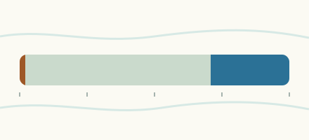 Country, Australia Are the rivers and lakes in Australia unusually low or high? Every river and lake we follow in Australia, against normal for the date.
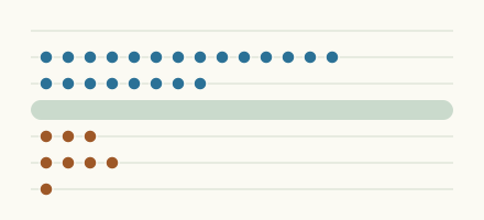 Today's list, Australia Which places in Australia are furthest from normal today? The places in Australia furthest below and above normal today.
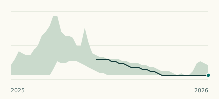 River gauge, Australia Is the Saxby River unusually low at Punchbowl Road? Level now, history, the same date in past years and each year's range.
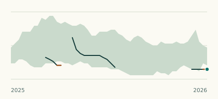 River gauge, Australia Is the Monal Creek unusually low at Upper Monal? Level now, history, the same date in past years and each year's range.