Taw and North Devon Streams catchment river levels today
Are the rivers and lakes in the Taw and North Devon Streams catchment unusually low or high?
We follow 28 water level gauges in the Taw and North Devon Streams catchment. None read below their normal range for the date and 7 gauges above it.
How many gauges do we follow in the Taw and North Devon Streams catchment?
28 gauges of the 2,378 we follow in the United Kingdom, as of 21 November 2026.
How many waters in the Taw and North Devon Streams catchment have a level gauge?
17 waters with a level gauge, of the 1,152 waters we follow in the United Kingdom, as of 21 November 2026.
How many gauges read below normal for the date?
0 gauges below their normal range, of the 14 gauges with a current reading and a normal range for the date, as of 21 November 2026.
How many gauges read above normal for the date?
7 gauges above their normal range, of the 14 gauges with a current reading and a normal range for the date, as of 21 November 2026.
How the places stand today
0 places below normal and 7 places above
Which places are furthest above normal?
More places
Which gauges do we follow in Taw and North Devon Streams?
| Place | Reading | Against normal for the date | Change in a day |
|---|---|---|---|
| Bradiford Water | |||
| Plaistow Mill | 0.642 m | in the highest 5 percent for the date | -0.152 m |
| Coney Gut | |||
| Coney Gut | 0.759 m | -0.102 m | |
| Portmarsh Lane | 0.41 m | -0.065 m | |
| East Lyn River | |||
| Brendon | 1.468 m | ||
| East Wilder Brook | |||
| Ilfracombe Lambda | 0.215 m | -0.012 m | |
| Halford Stream | |||
| Landkey Newland Tanners Road | 0.463 m | -0.149 m | |
| Hele Stream | |||
| Ilfracombe Hele Witheridge Place | 0.609 m | -0.001 m | |
| Landkey Brook | |||
| Swimbridge | 0.367 m | -0.072 m | |
| Little Dart River | |||
| Chulmleigh | 0.836 m | within the normal range for the date | -0.424 m |
| River Bray | |||
| Leehamford | 0.47 m | within the normal range for the date | -0.104 m |
| Newtown Bridge | 0.735 m | within the normal range for the date | -0.216 m |
| River Caen | |||
| Braunton | 2.731 m | -0.018 m | |
| Braunton Butts Bridge | 0.957 m | in the highest 5 percent for the date | -0.003 m |
| Stoneybridge | 0.224 m | +0.027 m | |
| River Mole (Devon) | |||
| Mole Mills | 0.439 m | in the highest 5 percent for the date | -0.114 m |
| North Molton | 0.594 m | in the highest 10 percent for the date | -0.084 m |
| Woodleigh | 1.38 m | in the highest 10 percent for the date | -0.597 m |
| River Taw | |||
| Barnstaple | 1.50 m | -0.245 m | |
| Newnham Bridge | 1.232 m | within the normal range for the date | -0.882 m |
| Sticklepath | 0.362 m | -0.155 m | |
| Sticklepath GS | 0.312 m | -0.257 m | |
| Taw Bridge | 0.328 m | within the normal range for the date | -0.152 m |
| Umberleigh | 1.407 m | within the normal range for the date | -0.664 m |
| River Umber | |||
| Combe Martin Bowling Green Lane | 0.322 m | in the highest 10 percent for the date | -0.009 m |
| River Yeo (Barnstaple) | |||
| Collard Bridge | 0.942 m | in the highest 5 percent for the date | -0.154 m |
| River Yeo (Lapford) | |||
| Lapford | 0.838 m | within the normal range for the date | -0.539 m |
| West Lyn River | |||
| Barbrook Bridge | 0.331 m | -0.033 m | |
| West Wilder Brook | |||
| Ilfracombe Saltmer Close | 0.084 m | -0.009 m | |
Keep exploring
 Country, United Kingdom Are the rivers and lakes in the United Kingdom unusually low or high? Every river and lake we follow here, against normal for the date.
 Today's list, United Kingdom Which places in the United Kingdom are furthest from normal today? The places in the United Kingdom furthest below and above normal today.
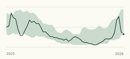 River gauge, United Kingdom Is the Bradiford Water unusually high at Plaistow Mill? Level now, history, the same date in past years and each year's range.
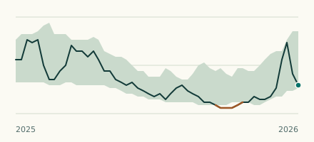 River gauge, United Kingdom Is the River Yeo (Barnstaple) unusually high at Collard Bridge? Level now, history, the same date in past years and each year's range.