Severn Vale catchment river levels today
Are the rivers and lakes in the Severn Vale catchment unusually low or high?
We follow 54 water level gauges in the Severn Vale catchment. 6 gauges read below their normal range for the date and 1 gauge above it.
How many gauges do we follow in the Severn Vale catchment?
54 gauges of the 2,378 we follow in the United Kingdom, as of 21 November 2026.
How many waters in the Severn Vale catchment have a level gauge?
19 waters with a level gauge, of the 1,152 waters we follow in the United Kingdom, as of 21 November 2026.
How many gauges read below normal for the date?
6 gauges below their normal range, of the 21 gauges with a current reading and a normal range for the date, as of 21 November 2026.
How many gauges read above normal for the date?
1 gauge above its normal range, of the 21 gauges with a current reading and a normal range for the date, as of 21 November 2026.
How the places stand today
6 places below normal and 1 place above
Which places are furthest below normal?
More places
Which places are furthest above normal?
Which gauges do we follow in Severn Vale?
| Place | Reading | Against normal for the date | Change in a day |
|---|---|---|---|
| Daniels Brook | |||
| Bodiam Avenue | 0.255 m | in the highest 5 percent for the date | -0.01 m |
| Bodiam Avenue Relief Channel | 0.537 m | -0.212 m | |
| Dimore Brook | |||
| Field Court Drive | 0.11 m | -0.038 m | |
| The Causeway | 0.389 m | within the normal range for the date | -0.049 m |
| Hatherley Brook | |||
| Merestones Road | 0.053 m | lower than any day of these dates in 13 years | -0.02 m |
| Sandhurst | 1.559 m | within the normal range for the date | 0 m |
| Horsbere Brook | |||
| Clomoney Way | 0.329 m | -0.039 m | |
| Hucclecote | 0.104 m | -0.018 m | |
| Witcombe | 0.003 m | in the lowest 10 percent for the date | 0 m |
| Zoons Court | 0.218 m | lower than any day of these dates in 13 years | -0.015 m |
| Zoons Court Flood Storage | 0.054 m | in the lowest 5 percent for the date | 0 m |
| Leigh Brook | |||
| Leigh Court | 0.602 m | -0.09 m | |
| Lilley Brook | |||
| Moorend Road | 0.354 m | within the normal range for the date | -0.011 m |
| Nailsworth Stream | |||
| Egypt Mill | 0.37 m | +0.005 m | |
| River Cam (Gloucestershire) | |||
| Cam | 0.903 m | ||
| Cambridge | 0.201 m | -0.052 m | |
| River Chelt | |||
| Arle | 0.447 m | -0.016 m | |
| Charlton Kings | 0.335 m | within the normal range for the date | -0.011 m |
| College Road | 0.194 m | -0.013 m | |
| Cox's Flume | 0.321 m | -0.014 m | |
| Cox's Meadow Storage Area | -0.049 m | -0.007 m | |
| River Frome (Severn) | |||
| Brimscombe | 0.675 m | +0.001 m | |
| Chalford | 0.046 m | 0 m | |
| Eastington | 0.414 m | -0.053 m | |
| Ebley Mill | 0.227 m | -0.008 m | |
| River Leadon | |||
| Bosbury | 0.025 m | within the normal range for the date | -0.016 m |
| Wedderburn Bridge | 0.711 m | within the normal range for the date | -0.467 m |
| River Lyd (Gloucestershire) | |||
| Lydney | 0.205 m | -0.025 m | |
| Parkend | 0.082 m | within the normal range for the date | -0.025 m |
| River Severn | |||
| Ashleworth | 2.12 m | +0.022 m | |
| Deerhurst | 0.00 m | ||
| Deerhurst Flood Plain Level | 2.518 m | 0 m | |
| Epney | 3.11 m | -0.001 m | |
| Gloucester | 1.003 m | +0.036 m | |
| Haw Bridge | 2.474 m | +0.002 m | |
| Kempsey Yacht Club | 2.638 m | within the normal range for the date | +0.002 m |
| Minsterworth | 1.788 m | within the normal range for the date | +0.075 m |
| Mythe Bridge | 1.375 m | -0.01 m | |
| Sandhurst | 1.583 m | within the normal range for the date | +0.012 m |
| Saxons Lode | 1.672 m | 0 m | |
| Sharpness | 0.786 m | -6.748 m | |
| River Twyver | |||
| Abbeymead Avenue | 0.051 m | in the lowest 5 percent for the date | -0.01 m |
| Bondend Road | 0.31 m | -0.008 m | |
| India Road | 0.155 m | lower than any day of these dates in 11 years | -0.015 m |
| Saintbridge | 0.00 m | within the normal range for the date | +0.001 m |
| River Worfe | |||
| Burlington | 0.149 m | -0.02 m | |
| Slad Brook | |||
| Merrywalks | 0.191 m | -0.027 m | |
| Slad Road | 0.074 m | 0 m | |
| Slad Steanbridge Lane | 0.167 m | -0.011 m | |
| Sud Brook | |||
| Cheyney Close | 0.00 m | -0.043 m | |
| Matson Place | 0.198 m | -0.018 m | |
| Whaddon Brook (Gloucester) | |||
| Shepherd Road | 0.032 m | within the normal range for the date | -0.008 m |
| Wotton Brook (Gloucester) | |||
| Armscroft Place | 0.064 m | within the normal range for the date | -0.088 m |
| Kingscroft Road | 0.365 m | within the normal range for the date | -0.017 m |
Keep exploring
 Country, United Kingdom Are the rivers and lakes in the United Kingdom unusually low or high? Every river and lake we follow here, against normal for the date.
 Today's list, United Kingdom Which places in the United Kingdom are furthest from normal today? The places in the United Kingdom furthest below and above normal today.
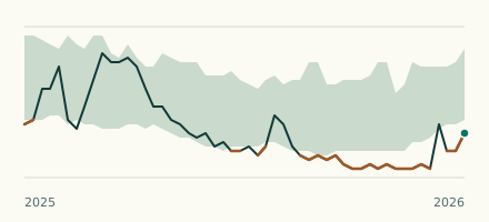 River gauge, United Kingdom Is the Hatherley Brook unusually low at Merestones Road? Level now, history, the same date in past years and each year's range.
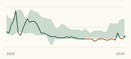 River gauge, United Kingdom Is the Horsbere Brook unusually low at Zoons Court? Level now, history, the same date in past years and each year's range.