Pinn catchment river levels today
Are the rivers and lakes in the Pinn catchment unusually low or high?
We follow 11 water level gauges in the Pinn catchment. 2 gauges read below their normal range for the date and none above it.
How many gauges do we follow in the Pinn catchment?
11 gauges of the 2,378 we follow in the United Kingdom, as of 21 November 2026.
How many waters in the Pinn catchment have a level gauge?
2 waters with a level gauge, of the 1,152 waters we follow in the United Kingdom, as of 21 November 2026.
How many gauges read below normal for the date?
2 gauges below their normal range, of the 7 gauges with a current reading and a normal range for the date, as of 21 November 2026.
How many gauges read above normal for the date?
0 gauges above their normal range, of the 7 gauges with a current reading and a normal range for the date, as of 21 November 2026.
How the places stand today
2 places below normal and 0 places above
Which places are furthest below normal?
Which gauges do we follow in Pinn?
| Place | Reading | Against normal for the date | Change in a day |
|---|---|---|---|
| Cannon Brook | |||
| Howletts Lane, Ruislip | 0.139 m | -0.017 m | |
| River Pinn | |||
| Ickenham, Swakeleys Road | 0.578 m | in the lowest 10 percent for the date | -0.027 m |
| Pinner, Avenue Road | 0.149 m | -0.024 m | |
| Pinner, Eastcote Road | 0.383 m | -0.029 m | |
| Pinner, Moss Close | 0.136 m | lower than any day of these dates in 29 years | -0.001 m |
| Ruislip | 0.183 m | within the normal range for the date | -0.027 m |
| Uxbridge | 0.064 m | within the normal range for the date | -0.041 m |
| Uxbridge, Hercies Road | 0.758 m | within the normal range for the date | -0.019 m |
| Uxbridge, Philpots Bridge | 0.97 m | within the normal range for the date | -0.064 m |
| Waxwell Lane | 0.197 m | within the normal range for the date | -0.073 m |
| Woodhall Avenue | 0.193 m | -0.018 m | |
Keep exploring
 Country, United Kingdom Are the rivers and lakes in the United Kingdom unusually low or high? Every river and lake we follow here, against normal for the date.
 Today's list, United Kingdom Which places in the United Kingdom are furthest from normal today? The places in the United Kingdom furthest below and above normal today.
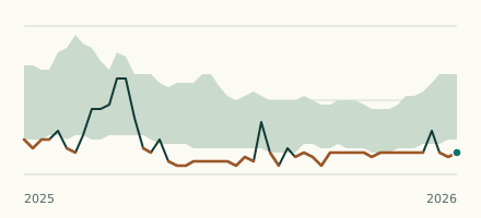 River gauge, United Kingdom Is the River Pinn unusually low at Pinner, Moss Close? Level now, history, the same date in past years and each year's range.
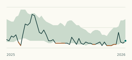 River gauge, United Kingdom Is the River Pinn unusually low at Ickenham, Swakeleys Road? Level now, history, the same date in past years and each year's range.