Hull and East Riding catchment river levels today
Are the rivers and lakes in the Hull and East Riding catchment unusually low or high?
We follow 47 water level gauges in the Hull and East Riding catchment. 8 gauges read below their normal range for the date and 2 gauges above it.
How many gauges do we follow in the Hull and East Riding catchment?
47 gauges of the 2,378 we follow in the United Kingdom, as of 21 November 2026.
How many waters in the Hull and East Riding catchment have a level gauge?
32 waters with a level gauge, of the 1,152 waters we follow in the United Kingdom, as of 21 November 2026.
How many gauges read below normal for the date?
8 gauges below their normal range, of the 34 gauges with a current reading and a normal range for the date, as of 21 November 2026.
How many gauges read above normal for the date?
2 gauges above their normal range, of the 34 gauges with a current reading and a normal range for the date, as of 21 November 2026.
How the places stand today
8 places below normal and 2 places above
Which places are furthest below normal?
More places
Which places are furthest above normal?
Which gauges do we follow in Hull and East Riding?
| Place | Reading | Against normal for the date | Change in a day |
|---|---|---|---|
| Back Delfin | |||
| Wholsea Grange | 0.115 m | in the lowest 10 percent for the date | -0.005 m |
| Barmston Main Drain | |||
| Lissett New Bridge | 1.80 m | within the normal range for the date | -0.097 m |
| Beverley and Barmston Drain | |||
| Beverley Waterside Pumping Station | -0.448 m | within the normal range for the date | -0.055 m |
| Wilfholme PS | -0.543 m | +0.172 m | |
| Broadlane Beck | |||
| Cottingham Hallgate | 0.082 m | -0.002 m | |
| Brough Clough | |||
| Brough | 1.056 m | -0.018 m | |
| Burstwick Drain | |||
| Burstwick Hall Road Bridge | 0.769 m | within the normal range for the date | -0.215 m |
| Hedon Thorn Road Bridge | 0.766 m | within the normal range for the date | -0.19 m |
| Salt end | 0.808 m | within the normal range for the date | -0.177 m |
| Driffield Trout Stream | |||
| Driffield | 0.157 m | -0.002 m | |
| Fleet Drain | |||
| Hessle | 0.856 m | -0.007 m | |
| Frodingham Beck | |||
| Frodingham Bridge | 0.443 m | within the normal range for the date | -0.01 m |
| Gypsey Race | |||
| Boynton | 0.04 m | within the normal range for the date | +0.03 m |
| Holderness Drain | |||
| Bransholme Great Culvert Pumping Station | -2.321 m | within the normal range for the date | -0.022 m |
| East Hull Hedon Road | -1.929 m | in the lowest 5 percent for the date | -0.822 m |
| Tickton PS | -1.885 m | within the normal range for the date | -0.035 m |
| Ings Beck (South Newbald) | |||
| South Newbald | 0.073 m | -0.001 m | |
| Keyingham Drain | |||
| Stone Creek | 0.252 m | within the normal range for the date | -0.024 m |
| Market Weighton Canal | |||
| North America | 0.496 m | -0.003 m | |
| Mickley Dyke | |||
| Hempholme Pumping Station | 1.641 m | within the normal range for the date | -0.004 m |
| Mill Beck (Market Weighton) | |||
| Market Weighton | 0.028 m | ||
| Mires Beck | |||
| North Cave | 0.117 m | within the normal range for the date | -0.006 m |
| Monk Dyke | |||
| Riston Pumping Station | 0.503 m | within the normal range for the date | -0.215 m |
| River Foulness | |||
| Holme House Farm | 0.109 m | in the lowest 5 percent for the date | -0.002 m |
| Welham Bridge | 0.468 m | within the normal range for the date | 0 m |
| River Hull | |||
| Beverley Shipyard | 1.655 m | within the normal range for the date | -0.039 m |
| Hempholme Weir | 3.089 m | -0.009 m | |
| Hull Barrier Victoria Pier | -0.729 m | lower than any day of these dates in 30 years | +0.003 m |
| Hull High Flaggs, Lincoln Street | -1.345 m | -0.471 m | |
| Scurf Dyke | 3.203 m | within the normal range for the date | -0.006 m |
| Stoneferry Bridge | 0.424 m | lower than any day of these dates in 24 years | -0.006 m |
| Wilfholme PS | 1.786 m | -0.032 m | |
| River Ouse (Yorkshire) | |||
| Blacktoft | -0.842 m | lower than any day of these dates in 29 years | +0.103 m |
| Roam Drain | |||
| Hempholme PS | -0.41 m | within the normal range for the date | +0.017 m |
| Scurf Dyke | |||
| Scurf Dyke | 3.159 m | within the normal range for the date | -0.007 m |
| Setting Dyke | |||
| North Hull Birdsall Avenue | 0.116 m | within the normal range for the date | -0.017 m |
| North Hull National Avenue | 0.298 m | within the normal range for the date | -0.013 m |
| Skeffling Drain | |||
| Skeffling Pumping Station | 0.637 m | within the normal range for the date | -0.049 m |
| South Cave Beck | |||
| South Cave Beverley Road | 0.239 m | -0.002 m | |
| Thorngumbald Drain | |||
| Thorngumbald Pumping Station | 0.43 m | within the normal range for the date | +0.071 m |
| Weighton Lock | |||
| Broomfleet Weighton Lock | 0.365 m | in the highest 5 percent for the date | +0.006 m |
| West Beck (Driffield) | |||
| Wansford Snakeholm Lock | 0.404 m | within the normal range for the date | -0.001 m |
| West Clough | |||
| Brough West Clough | 1.657 m | in the lowest 5 percent for the date | -0.003 m |
| Western Drain | |||
| Hessle Western Drain | 0.092 m | within the normal range for the date | +0.04 m |
| Hull Hessle Astral Close | 0.327 m | -0.016 m | |
| Winestead Drain | |||
| Patrington Haven Outstrays | 0.748 m | in the highest 5 percent for the date | +0.04 m |
| Winestead Booster Pumping Station | -0.308 m | in the lowest 10 percent for the date | -0.173 m |
Keep exploring
 Country, United Kingdom Are the rivers and lakes in the United Kingdom unusually low or high? Every river and lake we follow here, against normal for the date.
 Today's list, United Kingdom Which places in the United Kingdom are furthest from normal today? The places in the United Kingdom furthest below and above normal today.
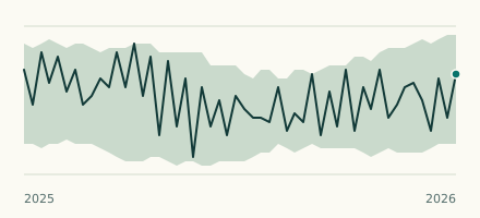 River gauge, United Kingdom Is the River Ouse (Yorkshire) unusually low at Blacktoft? Level now, history, the same date in past years and each year's range.
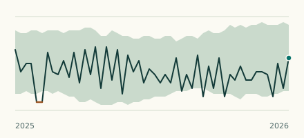 River gauge, United Kingdom Is the River Hull unusually low at Hull Barrier Victoria Pier? Level now, history, the same date in past years and each year's range.