Don and Rother catchment river levels today
Are the rivers and lakes in the Don and Rother catchment unusually low or high?
We follow 74 water level gauges in the Don and Rother catchment. 6 gauges read below their normal range for the date and none above it.
How many gauges do we follow in the Don and Rother catchment?
74 gauges of the 2,378 we follow in the United Kingdom, as of 21 November 2026.
How many waters in the Don and Rother catchment have a level gauge?
32 waters with a level gauge, of the 1,152 waters we follow in the United Kingdom, as of 21 November 2026.
How many gauges read below normal for the date?
6 gauges below their normal range, of the 54 gauges with a current reading and a normal range for the date, as of 21 November 2026.
How many gauges read above normal for the date?
0 gauges above their normal range, of the 54 gauges with a current reading and a normal range for the date, as of 21 November 2026.
How the places stand today
6 places below normal and 0 places above
Which places are furthest below normal?
Mexborough Pasture Road Pumping StationDearne Washlands
0.896 m
lower than any day of these dates in 28 years
More places
Which gauges do we follow in Don and Rother?
| Place | Reading | Against normal for the date | Change in a day |
|---|---|---|---|
| Bagley Dike | |||
| Grimesthorpe | 0.002 m | within the normal range for the date | -0.361 m |
| Baildon Dyke | |||
| Skelmanthorpe Park Gate | 0.043 m | -0.027 m | |
| Blackburn Brook | |||
| Sheffield Blackburn | 0.032 m | within the normal range for the date | -0.029 m |
| Sheffield Wincobank | 0.195 m | -0.133 m | |
| Brook Dike | |||
| Wath upon Dearne | 0.119 m | lower than any day of these dates in 18 years | -0.021 m |
| Calow Brook | |||
| Chesterfield Calow Lane | 0.164 m | within the normal range for the date | -0.096 m |
| Catcliffe Drain | |||
| Catcliffe Drain | 25.69 m | within the normal range for the date | -0.424 m |
| Charlton Brook | |||
| High Green | -0.014 m | lower than any day of these dates in 18 years | -0.006 m |
| Dearne Washlands | |||
| Mexborough Dearne Mouth | 9.96 m | within the normal range for the date | -0.441 m |
| Mexborough Pasture Road Pumping Station | 0.896 m | lower than any day of these dates in 28 years | +0.032 m |
| Dun Navigation Canal | |||
| Doncaster Strawberry Island Temp | 7.594 m | -0.041 m | |
| Ea Beck | |||
| Adwick le Street White Cross Bridge | 0.266 m | within the normal range for the date | -0.112 m |
| Norwood | 0.456 m | within the normal range for the date | -0.247 m |
| South Elmsall | 0.134 m | within the normal range for the date | -0.029 m |
| Fowler Bridge Drain | |||
| Bentley Ings Screen | 2.365 m | lower than any day of these dates in 17 years | -0.063 m |
| Green Dyke | |||
| Fishlake Woodhouse Ings (Temporary) | 0.946 m | -0.005 m | |
| Kearsley Brook | |||
| Conisbrough | 0.059 m | -0.007 m | |
| Knoll Beck | |||
| Manvers Old Moor Lane | 0.389 m | -0.088 m | |
| Meers Brook | |||
| Sheffield Meersbrook | 0.53 m | -0.02 m | |
| Porter Brook | |||
| Sheffield Oakbrook Road | 0.042 m | within the normal range for the date | -0.004 m |
| Sheffield Station | 0.089 m | -0.021 m | |
| River Dearne | |||
| Adwick | 0.285 m | within the normal range for the date | -0.125 m |
| Barnsley | 0.249 m | -0.067 m | |
| Bolton Bridge | 0.396 m | within the normal range for the date | -0.089 m |
| Cundy Cross | 0.133 m | within the normal range for the date | -0.086 m |
| Darfield Bridge | 0.276 m | in the lowest 10 percent for the date | -0.082 m |
| Darton | 0.304 m | within the normal range for the date | -0.05 m |
| Denby Dale Norman Road | 0.293 m | within the normal range for the date | -0.018 m |
| Houghton | 0.177 m | within the normal range for the date | -0.076 m |
| River Doe Lea | |||
| Staveley | 0.277 m | within the normal range for the date | -0.207 m |
| River Don | |||
| Doncaster | 0.548 m | within the normal range for the date | -0.34 m |
| Fishlake | 2.294 m | within the normal range for the date | -0.20 m |
| Hadfields | 0.392 m | within the normal range for the date | -0.054 m |
| Kilnhurst Lower | 0.785 m | -0.561 m | |
| Kirk Bramwith | 2.778 m | within the normal range for the date | -0.355 m |
| Mexborough Lock | 0.775 m | within the normal range for the date | -0.234 m |
| Oxspring Bower Hill | 0.077 m | within the normal range for the date | -0.066 m |
| Penistone | 0.407 m | within the normal range for the date | -0.06 m |
| Rotherham | 0.121 m | within the normal range for the date | -0.176 m |
| Rotherham Forge Island | 0.296 m | within the normal range for the date | -0.142 m |
| Sheffield Lady's Bridge | 0.51 m | within the normal range for the date | -0.092 m |
| Sprotbrough | 0.642 m | within the normal range for the date | -0.205 m |
| Wharncliffe Side | 0.881 m | -0.105 m | |
| River Dove (South Yorkshire) | |||
| Stonyford Bridge | 0.133 m | -0.067 m | |
| Worsbrough | 0.075 m | -0.044 m | |
| River Drone | |||
| Dronfield | 0.002 m | within the normal range for the date | -0.03 m |
| Dronfield Dam | 0.374 m | within the normal range for the date | -0.056 m |
| River Hipper | |||
| Chesterfield | 0.423 m | within the normal range for the date | -0.056 m |
| Chesterfield Park Road Bridge | 0.046 m | within the normal range for the date | -0.064 m |
| Holymoorside | 0.074 m | within the normal range for the date | -0.059 m |
| River Loxley | |||
| Loxley Rowell Bridge | 0.099 m | within the normal range for the date | -0.006 m |
| Malinbridge | 0.262 m | -0.026 m | |
| River Ouse (Yorkshire) | |||
| Goole | -0.369 m | lower than any day of these dates in 19 years | +0.166 m |
| River Rother | |||
| Canklow Regulator | 24.219 m | within the normal range for the date | -0.476 m |
| Catcliffe | 25.659 m | within the normal range for the date | -0.429 m |
| Chesterfield Avenue Washlands | 0.442 m | -0.27 m | |
| Chesterfield Tapton Bridge | 0.181 m | within the normal range for the date | -0.148 m |
| Hady Hill | 0.718 m | within the normal range for the date | -0.173 m |
| Killamarsh | 0.147 m | within the normal range for the date | -0.201 m |
| Meadowgate Regulator | 35.35 m | -0.192 m | |
| Whittington | 0.412 m | within the normal range for the date | -0.159 m |
| Woodhouse Mill Regulator | 0.437 m | within the normal range for the date | -0.271 m |
| River Sheaf | |||
| Dore Twenty Well Lane | 0.423 m | within the normal range for the date | -0.049 m |
| Highfield | 0.275 m | within the normal range for the date | -0.07 m |
| Sheffield Centenary Works | 0.02 m | within the normal range for the date | -0.052 m |
| River Went | |||
| Topham Ferry Bridge | 0.88 m | +0.058 m | |
| Walden Stubbs | 0.197 m | within the normal range for the date | -0.018 m |
| Went Bridge | 0.521 m | -0.075 m | |
| Went Outfall | 1.674 m | within the normal range for the date | +0.061 m |
| River Whitting | |||
| Sheepbridge | 0.146 m | within the normal range for the date | -0.082 m |
| The Moss | |||
| Eckington Rotherham Road | 0.282 m | -0.041 m | |
| The Porter River | |||
| Stocksbridge Steelworks | 0.238 m | +0.002 m | |
| Ulley Brook | |||
| Canklow Washlands | 0.318 m | within the normal range for the date | -0.163 m |
| Whitley Brook | |||
| Ecclesfield Morrisons | 0.037 m | within the normal range for the date | -0.034 m |
Keep exploring
 Country, United Kingdom Are the rivers and lakes in the United Kingdom unusually low or high? Every river and lake we follow here, against normal for the date.
 Today's list, United Kingdom Which places in the United Kingdom are furthest from normal today? The places in the United Kingdom furthest below and above normal today.
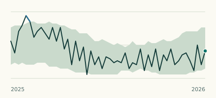 River gauge, United Kingdom Is the River Ouse (Yorkshire) unusually low at Goole? Level now, history, the same date in past years and each year's range.
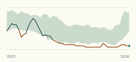 River gauge, United Kingdom Is the Brook Dike unusually low at Wath upon Dearne? Level now, history, the same date in past years and each year's range.