Arun and Western Streams catchment river levels today
Are the rivers and lakes in the Arun and Western Streams catchment unusually low or high?
We follow 20 water level gauges in the Arun and Western Streams catchment. 3 gauges read below their normal range for the date and none above it.
How many gauges do we follow in the Arun and Western Streams catchment?
20 gauges of the 2,378 we follow in the United Kingdom, as of 21 November 2026.
How many waters in the Arun and Western Streams catchment have a level gauge?
9 waters with a level gauge, of the 1,152 waters we follow in the United Kingdom, as of 21 November 2026.
How many gauges read below normal for the date?
3 gauges below their normal range, of the 9 gauges with a current reading and a normal range for the date, as of 21 November 2026.
How many gauges read above normal for the date?
0 gauges above their normal range, of the 9 gauges with a current reading and a normal range for the date, as of 21 November 2026.
How the places stand today
3 places below normal and 0 places above
Which places are furthest below normal?
Which gauges do we follow in Arun and Western Streams?
| Place | Reading | Against normal for the date | Change in a day |
|---|---|---|---|
| Aldingbourne Rife | |||
| Bognor | 0.16 m | within the normal range for the date | -0.056 m |
| Barnham Rife | |||
| Barnham | 1.604 m | lower than any day of these dates in 21 years | -0.024 m |
| Bosham Stream | |||
| Bosham Moreton Road | 0.204 m | -0.006 m | |
| River Arun | |||
| Alfoldean | 0.192 m | -0.121 m | |
| Arundel | 1.693 m | +0.362 m | |
| Ferring Outfall | -3.42 m | -0.027 m | |
| Houghton Bridge | 1.976 m | +0.105 m | |
| Littlehampton | 1.483 m | +0.557 m | |
| New Bridge | 7.402 m | -0.589 m | |
| Provender Mill | 35.322 m | -0.111 m | |
| Pulborough Swan Bridge | 1.509 m | +0.001 m | |
| Tanbridge | 32.325 m | within the normal range for the date | +0.015 m |
| River Ems | |||
| Westbourne | 0.062 m | in the lowest 10 percent for the date | -0.012 m |
| River Lavant (West Sussex) | |||
| Chichester Tozer Way | 12.632 m | lower than any day of these dates in 13 years | -0.021 m |
| Graylingwell | -0.009 m | within the normal range for the date | -0.014 m |
| River Lod | |||
| Halfway Bridge | 0.074 m | within the normal range for the date | -0.023 m |
| River Lox | |||
| Drungewick | 0.205 m | -0.091 m | |
| River Rother (West Sussex) | |||
| Hardham | 0.332 m | within the normal range for the date | -0.055 m |
| Lodsbridge | 0.786 m | -0.161 m | |
| Princes Marsh | 0.094 m | within the normal range for the date | -0.018 m |
Keep exploring
 Country, United Kingdom Are the rivers and lakes in the United Kingdom unusually low or high? Every river and lake we follow here, against normal for the date.
 Today's list, United Kingdom Which places in the United Kingdom are furthest from normal today? The places in the United Kingdom furthest below and above normal today.
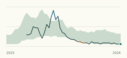 River gauge, United Kingdom Is the Barnham Rife unusually low at Barnham? Level now, history, the same date in past years and each year's range.
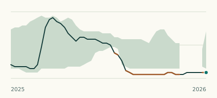 River gauge, United Kingdom Is the River Lavant (West Sussex) unusually low at Chichester Tozer Way? Level now, history, the same date in past years and each year's range.