Tönning waterway office river levels today
Are the rivers and lakes in the Tönning waterway office unusually low or high?
We follow 18 water level gauges in the Tönning waterway office. None read below their normal range for the date and 13 gauges above it.
How many gauges do we follow in the Tönning waterway office?
18 gauges of the 1,158 we follow in Germany, as of 21 November 2026.
How many waters in the Tönning waterway office have a level gauge?
3 waters with a level gauge, of the 363 waters we follow in Germany, as of 21 November 2026.
How many gauges read below normal for the date?
0 gauges below their normal range, of the 18 gauges with a current reading and a normal range for the date, as of 21 November 2026.
How many gauges read above normal for the date?
13 gauges above their normal range, of the 18 gauges with a current reading and a normal range for the date, as of 21 November 2026.
How the places stand today
0 places below normal and 13 places above
Which places are furthest above normal?
More places
Which gauges do we follow in Tönning?
| Place | Reading | Against normal for the date | Change in a day |
|---|---|---|---|
| Eider | |||
| Eider-Sperrwerk BPkm 110.1 | 667 cm | higher than any day of these dates in 26 years | +14 cm |
| Friedrichstadt Strassenbrückekm 83.14 | 684 cm | higher than any day of these dates in 26 years | -2 cm |
| Lexfähre Oberwasserkm 26.09 | 465 cm | within the normal range for the date | -8 cm |
| Lexfähre Unterwasserkm 26.09 | 485 cm | in the highest 10 percent for the date | 0 cm |
| Nordfeld Oberwasserkm 78.19 | 478 cm | within the normal range for the date | -15 cm |
| Nordfeld Unterwasserkm 78.312 | 685 cm | higher than any day of these dates in 25 years | -6 cm |
| Tönningkm 99.8 | 678 cm | higher than any day of these dates in 26 years | +15 cm |
| North Sea | |||
| Büsum | 645 cm | in the highest 5 percent for the date | +56 cm |
| Dagebüll | 670 cm | higher than any day of these dates in 26 years | +35 cm |
| Eider-Sperrwerk AP | 654 cm | in the highest 5 percent for the date | +34 cm |
| Helgoland Binnenhafen | 555 cm | within the normal range for the date | +38 cm |
| Helgoland Südhafen | 557 cm | within the normal range for the date | +40 cm |
| Husum | 680 cm | higher than any day of these dates in 26 years | +48 cm |
| Hörnum | 626 cm | in the highest 5 percent for the date | +29 cm |
| List auf Sylt | 612 cm | in the highest 5 percent for the date | +2 cm |
| Pellworm Anleger | 651 cm | higher than any day of these dates in 26 years | +47 cm |
| Wittdün | 631 cm | in the highest 5 percent for the date | +38 cm |
| Treene | |||
| Friedrichstadt Treenekm 0 | 478 cm | within the normal range for the date | -6 cm |
Keep exploring
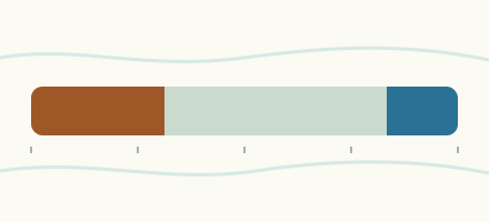 Country, Germany Are the rivers and lakes in Germany unusually low or high? Every river and lake we follow in Germany, against normal for the date.
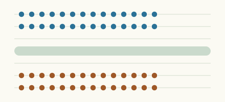 Today's list, Germany Which places in Germany are furthest from normal today? The places in Germany furthest below and above normal today.
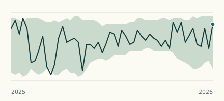 River gauge, Germany Is the Eider unusually high at Nordfeld Unterwasser? Level now, history, the same date in past years and each year's range.
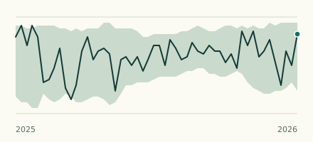 River gauge, Germany Is the Eider unusually high at Friedrichstadt Strassenbrücke? Level now, history, the same date in past years and each year's range.