LKN Kiel river levels today
Are the rivers and lakes in the LKN Kiel unusually low or high?
We follow 104 water level places in the LKN Kiel. None read below their normal range for the date and none above it.
Last updated . This page normally updates every day; the latest update is late.
How many places do we follow in the LKN Kiel?
104 places of the 1,158 we follow in Germany, as of 17 November 2026.
How many waters in the LKN Kiel have a level gauge?
83 waters with a level gauge, of the 363 waters we follow in Germany, as of 17 November 2026.
How many places read below normal for the date?
0 places below their normal range, of the 48 places with a current reading and a normal range for the date, as of 17 November 2026.
How many places read above normal for the date?
0 places above their normal range, of the 48 places with a current reading and a normal range for the date, as of 17 November 2026.
How the places stand today
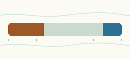
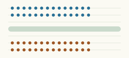
0 places below normal and 0 places above
Which gauges do we follow in LKN Kiel?
| Place | Reading | Against normal for the date | Change in a day |
|---|---|---|---|
| Barkauer See | |||
| Barkauer See | 171 cm | ||
| Behler Au | |||
| Behl | 2,265 cm | ||
| Behler See | |||
| Behler See | 2,226 cm | ||
| Belauer See | |||
| Belauer See | 2,934 cm | ||
| Bienebek | |||
| Sensby | 121 cm | ||
| Bille | |||
| Hamfelde | 2,430 cm | within the normal range for the date | +4 cm |
| Bistensee | |||
| Bistensee | 1,204 cm | ||
| Bokeler Au | |||
| Bokel-Dorf | 1,374 cm | ||
| Bokel/Bokeler Au | 1,035 cm | ||
| Bordesholmer See | |||
| Bordesholmer See | 2,547 cm | ||
| Buckener Au | |||
| Innien | 1,100 cm | within the normal range for the date | +10 cm |
| Bültsee | |||
| Bültsee | 886 cm | ||
| Bünzau | |||
| Bargfeld | 636 cm | ||
| Bünzen | 154 cm | ||
| Innien-Mitte | 141 cm | ||
| Sarlhusen | 472 cm | within the normal range for the date | +14 cm |
| Curau | |||
| Malkendorf | 54 cm | within the normal range for the date | +9 cm |
| Dieksee | |||
| Dieksee | 2,231 cm | ||
| Dobersdorfer See | |||
| Dobersdorfer See | 1,876 cm | ||
| Dosenbek | |||
| Tungendorf | 147 cm | within the normal range for the date | +2 cm |
| Drögeneider | |||
| Hochmutskate | 2,355 cm | ||
| Eider | |||
| Achterwehr | 650 cm | ||
| Eiderheim | 1,397 cm | ||
| Eiderkaten | 131 cm | within the normal range for the date | +2 cm |
| Flintbek | 1,356 cm | ||
| Hammer | 123 cm | within the normal range for the date | +1 cm |
| Schmalstede-Neu | 168 cm | within the normal range for the date | +2 cm |
| Voorde | 1,203 cm | within the normal range for the date | +2 cm |
| Einfelder See | |||
| Einfelder See | 2,633 cm | ||
| Fuhlenau | |||
| Böken/Fuhlenau | 1,077 cm | within the normal range for the date | +16 cm |
| Füsinger Au | |||
| Füsing | 520 cm | within the normal range for the date | +18 cm |
| Godderstorfer Au | |||
| Löhrstorf | 141 cm | within the normal range for the date | 0 cm |
| Grimsau | |||
| Stutebüll | 278 cm | ||
| Grinau | |||
| Ziegelhof | 479 cm | ||
| Großer Binnensee | |||
| Großer Binnensee | 484 cm | ||
| Großer Eutiner See | |||
| Großer Eutiner See | 2,673 cm | within the normal range for the date | +1 cm |
| Großer Plöner See | |||
| Großer Plöner See | 2,091 cm | within the normal range for the date | 0 cm |
| Großer Pönitzer See | |||
| Großer Pönitzer See | 139 cm | ||
| Grönau | |||
| Grönauer Mühle | 119 cm | ||
| Heilsau | |||
| Zarpen | 936 cm | within the normal range for the date | +9 cm |
| Hemmelsdorfer See | |||
| Hemmelsdorfer See | 492 cm | ||
| Hohner See | |||
| Hohner See | 160 cm | ||
| Höllenau | |||
| Böken/Höllenau | 147 cm | within the normal range for the date | +3 cm |
| Jevenau | |||
| Jevenstedt | 141 cm | within the normal range for the date | +5 cm |
| Johannisbek | |||
| Sipsdorf | 223 cm | ||
| Kellersee | |||
| Kellersee | 2,428 cm | within the normal range for the date | 0 cm |
| Kleiner Eutiner See | |||
| Kleiner Eutiner See | 2,842 cm | ||
| Koseler Au | |||
| Kosel | 120 cm | within the normal range for the date | 0 cm |
| Kossau | |||
| Rantzau | 2,193 cm | within the normal range for the date | 0 cm |
| Schönweide | 2,458 cm | ||
| Kremper Au | |||
| Hasselburger Mühle | 290 cm | within the normal range for the date | +1 cm |
| Lachsbach | |||
| Stolpe | 104 cm | within the normal range for the date | +1 cm |
| Langballigau | |||
| Langballig | 181 cm | ||
| Lanker See | |||
| Lanker See | 1,926 cm | ||
| Linau | |||
| Lütau | 1,775 cm | ||
| Witzeeze | 111 cm | within the normal range for the date | +1 cm |
| Lippingau | |||
| Niesgrau | 72 cm | ||
| Loiter Au | |||
| Westerakeby | 506 cm | within the normal range for the date | +1 cm |
| Malenter Au | |||
| Sieversdorf | 2,581 cm | within the normal range for the date | 0 cm |
| Oldenburger Graben | |||
| Grube | 149 cm | within the normal range for the date | +2 cm |
| Oxbek | |||
| Billwatt | 25 cm | within the normal range for the date | 0 cm |
| Passader See | |||
| Passader See | 1,875 cm | ||
| Postsee | |||
| Postsee | 2,082 cm | within the normal range for the date | 0 cm |
| Priesterbach | |||
| Breitenfelde | 2,427 cm | ||
| Salzau | |||
| Fargau | 3,693 cm | ||
| Gut Salzau | 3,668 cm | ||
| Schirnau | |||
| Bünsdorf | 128 cm | within the normal range for the date | 0 cm |
| Schluensee | |||
| Schluensee | 2,279 cm | ||
| Schmarkau (Grebin) | |||
| Grebin | 2,231 cm | ||
| Schulensee | |||
| Schulensee | 1,144 cm | within the normal range for the date | +2 cm |
| Schwale | |||
| Brachenfeld | 57 cm | within the normal range for the date | +3 cm |
| Schwartau | |||
| Bad Schwartau | 149 cm | within the normal range for the date | +17 cm |
| Hobbersdorfer Mühle | 616 cm | within the normal range for the date | +2 cm |
| Hobbersdorfer Mühle Unterlauf | 340 cm | within the normal range for the date | +11 cm |
| Kesdorf | 148 cm | ||
| Schulendorf | 52 cm | within the normal range for the date | +3 cm |
| Schwennau | |||
| Glücksburg | 72 cm | ||
| Schwentine | |||
| Eutin Neumühle | 125 cm | ||
| Kiel-Oppendorf | 175 cm | within the normal range for the date | 0 cm |
| Plön | 161 cm | within the normal range for the date | +1 cm |
| Preetz | 1,919 cm | within the normal range for the date | 0 cm |
| Schöhsee | |||
| Schöhsee | 125 cm | ||
| Sehlendorfer See | |||
| Sehlendorfer See | 556 cm | ||
| Selenter See | |||
| Selenter See | 3,700 cm | within the normal range for the date | 0 cm |
| Sorge | |||
| Sorgbrück | 532 cm | within the normal range for the date | 0 cm |
| Steinau | |||
| Nusse | 3,111 cm | within the normal range for the date | +3 cm |
| Pötrau | 1,328 cm | within the normal range for the date | +4 cm |
| Stendorfer See | |||
| Stendorfer See | 107 cm | ||
| Stolper See | |||
| Stolper See | 2,739 cm | ||
| Stör | |||
| Padenstedt | 36 cm | within the normal range for the date | +4 cm |
| Suhrer See | |||
| Suhrer See | 2,203 cm | ||
| Tensfelder Au | |||
| Nehmten | 2,161 cm | within the normal range for the date | +1 cm |
| Todenbütteler Au | |||
| Todenbüttel | 155 cm | within the normal range for the date | +15 cm |
| Trammer See | |||
| Trammer See | 110 cm | ||
| Trave | |||
| Hamberge | 523 cm | within the normal range for the date | +19 cm |
| Tresdorfer See | |||
| Tresdorfer See | 122 cm | ||
| Trittauer Mühlenbach | |||
| Trittau | 2,431 cm | within the normal range for the date | +2 cm |
| Ukleisee | |||
| Ukleisee | 435 cm | ||
| Vollstedter See | |||
| Vollstedter See | 139 cm | ||
| Wardersee | |||
| Wardersee | 1,924 cm | ||
| Wehrau | |||
| Osterrönfeld/Wehrau | 333 cm | within the normal range for the date | 0 cm |
| Wennebek | |||
| Borgdorfer See | 2,068 cm | ||
| Westensee | |||
| Westensee | 655 cm | ||
| Wittensee | |||
| Wittensee | 378 cm | ||
Keep exploring
 Country, Germany Are the rivers and lakes in Germany unusually low or high? Every river and lake we follow in Germany, against normal for the date.
 Today's list, Germany Which places in Germany are furthest from normal today? The places in Germany furthest below and above normal today.
 Records, world Which places have set a new record low or high? Record lows and highs in our data, and the newest set.
 Today's list, world Which places are furthest from normal today? The places furthest below and above normal today.
Sources
- Landesamt für Landwirtschaft, Umwelt und ländliche Räume Schleswig-Holstein (LLUR-SH), names and waters edited (source). Licence: Data licence Germany, attribution, version 2.0