Jade water level at Jade-Weser-Port today
How high is the Jade at Jade-Weser-Port today?
The Jade at Jade-Weser-Port read 536 cm at .
Level now
536 cm
Provisional
Where the water stands
Table: where the water stands
| Level | Value |
|---|---|
| Newest reading | 536 cm, |
| Mean low tide level | 316 cm |
| Mean high tide level | 671 cm |
| Highest in our series | 659.8 cm |
| Lowest in our series | 342.7 cm |
- Past day
- +65 cm
- Past week
- -15 cm
The gauge reads the height of the water above a fixed zero, not the depth of the river. Its zero lies at -5.02 m above NHN (the German sea-level datum), valid from 1 November 2019.
The last 12 months, week by week
- Level
Table: The last 12 months, week by week
| Week starting | Weekly average (cm) |
|---|---|
| 517.6 cm | |
| 528.4 cm | |
| 502.6 cm | |
| 531.8 cm | |
| 521.0 cm | |
| 468.2 cm | |
| 555.3 cm | |
| 474.6 cm | |
| 507.4 cm | |
| 444.9 cm | |
| 460.7 cm | |
| 440.0 cm | |
| 495.1 cm | |
| 492.3 cm | |
| 516.5 cm | |
| 490.3 cm | |
| 519.5 cm | |
| 495.6 cm | |
| 531.6 cm | |
| 513.8 cm | |
| 499.1 cm | |
| 495.1 cm | |
| 496.7 cm | |
| 476.9 cm | |
| 497.8 cm | |
| 519.7 cm | |
| 498.4 cm | |
| 493.8 cm | |
| 513.3 cm | |
| 523.1 cm | |
| 504.2 cm | |
| 498.1 cm | |
| 514.9 cm | |
| 514.8 cm | |
| 504.6 cm | |
| 522.2 cm | |
| 511.0 cm | |
| 509.6 cm | |
| 501.1 cm | |
| 519.6 cm | |
| 500.4 cm | |
| 533.2 cm | |
| 521.5 cm | |
| 537.4 cm | |
| 515.2 cm | |
| 508.1 cm | |
| 534.7 cm | |
| 510.3 cm | |
| 513.9 cm | |
| 521.7 cm | |
| 484.8 cm | |
| 531.6 cm | |
| 543.7 cm |
Official levels
- Mean low tide level (MTnw): 316 cm, over 2010 to 2020. (Mittlerer Tideniedrigwasserstand) The newest reading is 220 cm above it.Published by PEGELONLINE REST API v2 (WSV, operated by ITZBund).
- Mean high tide level (MThw): 671 cm, over 2010 to 2020. (Mittlerer Tidehochwasserstand) The newest reading is 135 cm below it.Published by PEGELONLINE REST API v2 (WSV, operated by ITZBund).
Records
- Highest reading in our series since 24 August 2017: 920 cm at 07:30 CET on 22 December 2023. Provisional data.
- Lowest reading in our series since 24 August 2017: 181 cm at 10:04 CEST on 20 October 2023. Provisional data.
- Highest daily average in our series since 24 August 2017: 659.8 cm on 5 October 2025. Provisional data.
- Lowest daily average in our series since 24 August 2017: 342.7 cm on 1 March 2018. Provisional data.
As the source publishes them
- Lowest low tide in the period (NTnw): 188 cm, on 1 March 2018, over 2010 to 2020. (Niedrigster Tideniedrigwasserstand)Published by PEGELONLINE REST API v2 (WSV, operated by ITZBund).
- Highest high tide in the period (HThw): 871 cm, on 12 February 2020, over 2010 to 2020. (Höchster Tidehochwasserstand)Published by PEGELONLINE REST API v2 (WSV, operated by ITZBund).
Next gauges
The next gauges on this water by river kilometre.
| Gauge | River kilometre | Reading |
|---|---|---|
| WHV Alter Vorhafen | km 1.565 | 554 cm |
| WHV Neuer Vorhafen | km 4.053 | 542 cm |
| Jade at Jade-Weser-Port | This gauge | |
| Hooksielplate | km 18.098 | 531 cm |
| Schillig | km 24.137 | 517 cm |
Also on this water
About this gauge
Jade-Weser-Port is a gauge on the Jade in Germany, at river kilometre 11.6.
It lies at 53.6020° N, 8.1491° E.
Its readings come from the Federal Waterways and Shipping Administration (WSV), through PEGELONLINE.
PEGELONLINE publishes its readings as unchecked raw data.
The newest reading is provisional: the source may still correct it.
We show no forecast values for German gauges: the forecasts PEGELONLINE relays come from the Federal Institute of Hydrology (BfG), whose terms allow only private and own use. ELWIS and the BfG publish them.
Keep exploring
 Waterway office, Germany Are the rivers and lakes in the Wilhelmshaven waterway office unusually low or high? Every river and lake we follow here, against normal for the date.
 Country, Germany Are the rivers and lakes in Germany unusually low or high? Every river and lake we follow in Germany, against normal for the date.
 Today's list, Germany Which places in Germany are furthest from normal today? The places in Germany furthest below and above normal today.
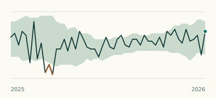 Waterway gauge, Germany Is the Jade at Hooksielplate within its normal range for the date? Level now, history, the same date in past years and each year's range.