Berlin waterway office river levels today
Are the rivers and lakes in the Berlin waterway office unusually low or high?
We follow 38 water level gauges in the Berlin waterway office. 1 gauge reads below its normal range for the date and 5 gauges above it.
How many gauges do we follow in the Berlin waterway office?
38 gauges of the 1,158 we follow in Germany, as of 21 November 2026.
How many waters in the Berlin waterway office have a level gauge?
10 waters with a level gauge, of the 363 waters we follow in Germany, as of 21 November 2026.
How many gauges read below normal for the date?
1 gauge below its normal range, of the 37 gauges with a current reading and a normal range for the date, as of 21 November 2026.
How many gauges read above normal for the date?
5 gauges above their normal range, of the 37 gauges with a current reading and a normal range for the date, as of 21 November 2026.
How the places stand today
1 place below normal and 5 places above
Which places are furthest below normal?
Which places are furthest above normal?
Which gauges do we follow in Berlin?
| Place | Reading | Against normal for the date | Change in a day |
|---|---|---|---|
| Berlin-Spandau Ship Canal | |||
| Berlin-Plötzensee OPkm 7.4 | 346 cm | within the normal range for the date | -2 cm |
| Berlin-Plötzensee UPkm 7.5 | 274 cm | within the normal range for the date | +1 cm |
| Dahme Waterway | |||
| Berlin-Schmöckwitzkm 0.3 | 39 cm | within the normal range for the date | -1 cm |
| Neue Mühle Schleuse OPkm 9.56 | 265 cm | within the normal range for the date | -1 cm |
| Neue Mühle Schleuse UPkm 9.4 | 123 cm | within the normal range for the date | -2 cm |
| Havel-Oder Waterway | |||
| Berlin-Spandau OPkm 0.76 | 351 cm | within the normal range for the date | -2 cm |
| Berlin-Spandau UPkm 0.55 | 143 cm | within the normal range for the date | +1 cm |
| Landwehr Canal | |||
| Berlin-Oberschleuse OPkm 10.62 | 438 cm | in the highest 10 percent for the date | +1 cm |
| Berlin-Oberschleuse UPkm 10.51 | 404 cm | within the normal range for the date | 0 cm |
| Berlin-Unterschleuse OPkm 1.71 | 403 cm | within the normal range for the date | 0 cm |
| Berlin-Unterschleuse UPkm 1.61 | 276 cm | ||
| Müggelspree | |||
| Grosse Tränke Wehr OPkm 45.03 | 217 cm | in the highest 10 percent for the date | 0 cm |
| Grosse Tränke Wehr UPkm 44.91 | 150 cm | within the normal range for the date | 0 cm |
| Neuhauser Speisekanal | |||
| Neuhaus OPkm 2.7 | 213 cm | within the normal range for the date | -4 cm |
| Neuhaus UPkm 2.77 | 99 cm | within the normal range for the date | +3 cm |
| Rüdersdorfer Gewässer | |||
| Woltersdorf OPkm 3.89 | 306 cm | within the normal range for the date | -1 cm |
| Woltersdorf UPkm 3.71 | 92 cm | within the normal range for the date | 0 cm |
| Spree-Oder Waterway | |||
| Berlin-Charlottenburg OPkm 6.44 | 276 cm | within the normal range for the date | +2 cm |
| Berlin-Charlottenburg UPkm 6.24 | 140 cm | within the normal range for the date | +1 cm |
| Berlin-Köpenickkm 35.02 | 87 cm | within the normal range for the date | -1 cm |
| Berlin-Mühlendamm OPkm 17.9 | 434 cm | within the normal range for the date | -1 cm |
| Berlin-Mühlendamm UPkm 17.7 | 274 cm | within the normal range for the date | +1 cm |
| Eisenhüttenstadt Schl. OPkm 127.2 | 214 cm | within the normal range for the date | -1 cm |
| Eisenhüttenstadt Schl. UPkm 127.5 | 194 cm | within the normal range for the date | +8 cm |
| Fürstenwalde OPkm 74.8 | 170 cm | in the highest 5 percent for the date | +1 cm |
| Fürstenwalde UPkm 74.7 | 60 cm | in the highest 10 percent for the date | +1 cm |
| Kersdorf OPkm 89.86 | 211 cm | within the normal range for the date | -3 cm |
| Kersdorf UPkm 89.66 | 228 cm | within the normal range for the date | 0 cm |
| Wernsdorf OPkm 47.74 | 667 cm | higher than any day of these dates in 26 years | -1 cm |
| Wernsdorf UPkm 47.46 | 208 cm | within the normal range for the date | -1 cm |
| Storkower Gewässer | |||
| Kummersdorf OPkm 10.4 | 260 cm | within the normal range for the date | 0 cm |
| Kummersdorf UPkm 10.21 | 153 cm | within the normal range for the date | -1 cm |
| Storkow OPkm 15.56 | 451 cm | within the normal range for the date | -1 cm |
| Storkow UPkm 15.39 | 257 cm | within the normal range for the date | 0 cm |
| Wendisch Rietz OPkm 22.77 | 595 cm | within the normal range for the date | 0 cm |
| Wendisch Rietz UPkm 22.71 | 450 cm | in the lowest 10 percent for the date | 0 cm |
| Teltow Canal | |||
| Kleinmachnow OPkm 8.42 | 207 cm | within the normal range for the date | -1 cm |
| Kleinmachnow UPkm 8.28 | 244 cm | within the normal range for the date | -1 cm |
Keep exploring
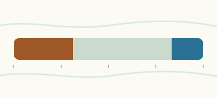 Country, Germany Are the rivers and lakes in Germany unusually low or high? Every river and lake we follow in Germany, against normal for the date.
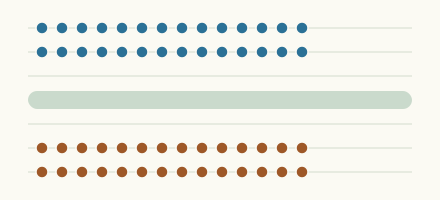 Today's list, Germany Which places in Germany are furthest from normal today? The places in Germany furthest below and above normal today.
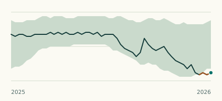 Waterway gauge, Germany Is the Storkower Gewässer unusually low at Wendisch Rietz UP? Level now, history, the same date in past years and each year's range.
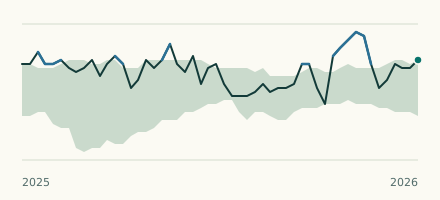 Waterway gauge, Germany Is the Spree-Oder Waterway unusually high at Wernsdorf OP? Level now, history, the same date in past years and each year's range.