Pas-de-Calais département river levels today
Are the rivers and lakes in Pas-de-Calais unusually low or high?
We follow 42 water level gauges in Pas-de-Calais. 1 gauge reads below its normal range for the date and 6 gauges above it.
How many gauges do we follow in Pas-de-Calais?
42 gauges of the 3,038 we follow in France, as of 21 November 2026.
How many waters in Pas-de-Calais have a level gauge?
21 waters with a level gauge, of the 1,483 waters we follow in France, as of 21 November 2026.
How many gauges read below normal for the date?
1 gauge below its normal range, of the 23 gauges with a current reading and a normal range for the date, as of 21 November 2026.
How many gauges read above normal for the date?
6 gauges above their normal range, of the 23 gauges with a current reading and a normal range for the date, as of 21 November 2026.
How the places stand today
1 place below normal and 6 places above
Which places are furthest below normal?
Which places are furthest above normal?
More places
Which gauges do we follow in Pas-de-Calais?
| Place | Reading | Against normal for the date | Change in a day |
|---|---|---|---|
| Blequin | |||
| Lumbres | 0.099 m | in the lowest 5 percent for the date | -0.04 m |
| Canche | |||
| Beutin | 1.91 m | +0.02 m | |
| Brimeux | 2.074 m | higher than any day of these dates in 56 years | +0.041 m |
| Ligny-sur-Canche | 1.725 m | +0.204 m | |
| Étaples | 1.841 m | +0.091 m | |
| Clarence | |||
| Marles-les-Mines | 0.974 m | within the normal range for the date | -0.946 m |
| Robecq | 0.866 m | within the normal range for the date | -0.532 m |
| Course ou Canche | |||
| Estrée | 0.342 m | within the normal range for the date | -0.373 m |
| Fleuve l'aa | |||
| Arques | 2.246 m | within the normal range for the date | -0.164 m |
| Gironde | |||
| Saint-Léonard | 0.402 m | -0.297 m | |
| Saint-Venant | 1.14 m | in the highest 5 percent for the date | +0.07 m |
| Laque Bras Est | |||
| Aire-sur-la-Lys | 1.275 m | +0.035 m | |
| Laquette | |||
| Witternesse | 0.344 m | within the normal range for the date | -1.517 m |
| Lawe | |||
| Bruay-la-Buissière | 1.42 m | within the normal range for the date | -0.726 m |
| Béthune | 0.451 m | within the normal range for the date | -0.848 m |
| Houdain | -0.034 m | within the normal range for the date | -0.638 m |
| Liane | |||
| Isques | 1.032 m | within the normal range for the date | -0.746 m |
| Selles | 0.641 m | ||
| Wirwignes | 0.647 m | within the normal range for the date | -0.352 m |
| Lys | |||
| Aire-sur-la-Lys | 0.423 m | in the highest 5 percent for the date | +0.138 m |
| Aire-sur-la-Lys (upstream) | 1.90 m | +0.041 m | |
| Delettes | 0.728 m | in the highest 10 percent for the date | -1.285 m |
| Lisbourg | 0.25 m | ||
| Lugy | 0.266 m | -1.897 m | |
| Rivière Aa | |||
| Blendecques | 0.69 m | ||
| Elnes | 0.768 m | within the normal range for the date | -0.475 m |
| Fauquembergues | 0.653 m | within the normal range for the date | -0.647 m |
| Wizernes | 0.748 m | -0.465 m | |
| Rivière la hem | |||
| Recques-sur-Hem | 0.843 m | within the normal range for the date | -0.08 m |
| Tournehem-sur-la-Hem | 0.232 m | within the normal range for the date | -0.152 m |
| Rivière Scarpe | |||
| Anzin-Saint-Aubin | 0.874 m | +0.084 m | |
| Scarpe | |||
| Brebières | 0.018 m | +0.006 m | |
| Sensée | |||
| Étaing | 0.544 m | in the highest 5 percent for the date | +0.082 m |
| Slack | |||
| Ambleteuse | 1.584 m | ||
| Rinxent | 0.541 m | within the normal range for the date | -0.23 m |
| Souchez | |||
| Angres | 0.369 m | -0.29 m | |
| Courrières | 0.018 m | 0 m | |
| Surgeon | |||
| Cambrin | 0.188 m | -0.345 m | |
| Ternoise | |||
| Hesdin | 1.862 m | higher than any day of these dates in 41 years | -0.059 m |
| Teneur | 0.266 m | ||
| Wimereux | |||
| Pittefaux | 0.482 m | ||
| Wimille | -0.119 m | within the normal range for the date | -0.20 m |
Keep exploring
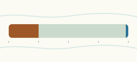 Country, France Are the rivers and lakes in France unusually low or high? Every river and lake we follow in France, against normal for the date.
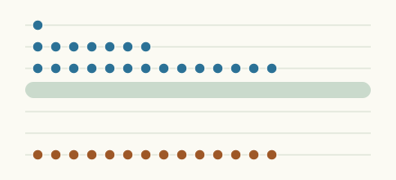 Today's list, France Which places in France are furthest from normal today? The places in France furthest below and above normal today.
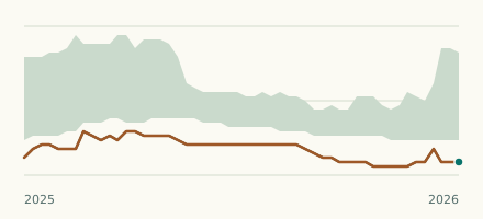 River gauge, France Is the Blequin unusually low at Lumbres? Level now, history, the same date in past years and each year's range.
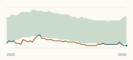 River gauge, France Is the Ternoise unusually high at Hesdin? Level now, history, the same date in past years and each year's range.
Sources
- Source : Hub'Eau / SCV, données PHyC (Licence Ouverte Etalab) (source). Licence: Licence Ouverte / Open Licence version 2.0