Naturstyrelsen river levels today
Are the rivers and lakes in the Naturstyrelsen rising or falling?
We follow 37 water level gauges in the Naturstyrelsen. No gauge has a current reading and a normal range for the date yet.
Are the rivers and lakes in the Naturstyrelsen rising or falling?
In the last 24 hours, 10 gauges rose, 21 gauges fell and 3 gauges stayed level; the biggest rise was the Agger Tange at Agger Tange, +6.4 cm, and the biggest fall was the Skåningedam at Skåningedam, -6.8 cm. 34 gauges with a 24-hour change, of the 37 gauges we follow in the Naturstyrelsen, as of 21 November 2026.
How many gauges do we follow in the Naturstyrelsen?
37 gauges of the 580 we follow in Denmark, as of 21 November 2026.
How many waters in the Naturstyrelsen have a level gauge?
37 waters with a level gauge, of the 467 waters we follow in Denmark, as of 21 November 2026.
How many gauges read below or above normal for the date?
No normal range yet for any of the 37 gauges we follow in the Naturstyrelsen, as of 21 November 2026.
Which gauges do we follow in Naturstyrelsen?
| Place | Reading | Change in a day |
|---|---|---|
| Agger Tange | ||
| Agger Tange | 21.3 cm | +6.4 cm |
| Bagdam | ||
| Bagdam | 632 cm | -1.9 cm |
| Bondedam | ||
| Bondedam | 2,060.7 cm | +0.2 cm |
| Bøgeholm Sø | ||
| Bøgeholm Sø | 2,510 cm | +0.2 cm |
| Esrum kanal | ||
| Midtstation | 893.5 cm | +2.2 cm |
| Esrum Møllekanal | ||
| Ved indløb til møllen | 898.7 cm | +2.7 cm |
| Esrum sø indløb | ||
| Ved bro | 907.7 cm | -0.5 cm |
| Flade Sø | ||
| Flade Sø | 16.1 cm | -0.9 cm |
| Fordam | ||
| Fordam | 679.3 cm | -0.4 cm |
| Gurre sø | ||
| Indløb til Gurre Å | 2,592.7 cm | -0.5 cm |
| Hammerdam | ||
| Hammerdam | 1,436.7 cm | +0.6 cm |
| Havmølle Å | ||
| Havmølle Å | 131.6 cm | -0.5 cm |
| Holløse Bredning | ||
| Indløb til Ramløse Å | 425.7 cm | -0.9 cm |
| Jens Butiks Hul | ||
| Jens Butiks Hul | 1,567 cm | 0 cm |
| Klaresø | ||
| Klaresø | 2,696 cm | -0.1 cm |
| Kobberdam | ||
| Kobberdam | 2,057.4 cm | 0 cm |
| Lerkenfeld Å | ||
| Udløb projektområde | 78.8 cm | -2.8 cm |
| Nellerødvej | ||
| Dæmning | 1,367.4 cm | -0.8 cm |
| NNP Læsø Grøft | ||
| NNP Læsø Grøft | 782.5 cm | |
| Nors sø | ||
| Nors sø | 1,356.5 cm | -0.6 cm |
| Nors Å øst | ||
| Nors Å øst | 1,378.1 cm | -2.1 cm |
| NST Randers tegl 4 | ||
| NST Randers tegl 4 | 324.9 cm | |
| Nydam | ||
| Nydam | 2,121.3 cm | +0.2 cm |
| Ramløse Å | ||
| Gl. dæmning | 398.8 cm | -0.9 cm |
| Rødepæledam | ||
| Rødepæledam | 3,062.6 cm | +1.5 cm |
| Skidendam | ||
| Skidendam | 2,636 cm | +0.2 cm |
| Skiverdam | ||
| Skiverdam | 1,198.3 cm | -0.3 cm |
| Skåningedam | ||
| Skåningedam | 1,219.1 cm | -6.8 cm |
| Sortesø | ||
| Sortesø | 2,882.5 cm | -0.2 cm |
| St.Å Thy 103 | ||
| St.Å Thy 103 | -91.9 cm | -0.9 cm |
| St.Å Thy 104 | ||
| St.Å Thy 104 | -57.9 cm | -0.3 cm |
| St.Å Thy 106 | ||
| St.Å Thy 106 | 123.6 cm | -0.5 cm |
| Stråsø Syd 3 | ||
| Stråsø Syd 3 | 3,516.1 cm | 0 cm |
| Tissing Vig | ||
| Tissing Vig | 9.1 cm | +1.3 cm |
| Tranum7 | ||
| Tranum7 | 671.1 cm | -3.7 cm |
| Tranum9 | ||
| Tranum9 | 885.6 cm | |
| Våsen | ||
| Vasebæk | 155.9 cm | -1.4 cm |
Keep exploring
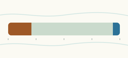 Country, Denmark Are the rivers and lakes in Denmark unusually low or high? Every river and lake we follow in Denmark, against normal for the date.
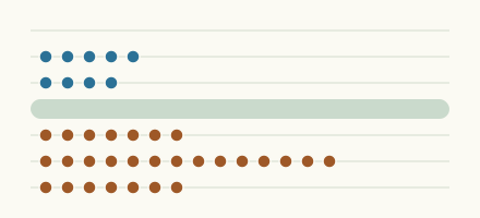 Today's list, Denmark Which places in Denmark are furthest from normal today? The places in Denmark furthest below and above normal today.
 Records, world Which places have set a new record low or high? Record lows and highs in our data, and the newest set.
 Today's list, world Which places are furthest from normal today? The places furthest below and above normal today.
Sources
- Danmarks Miljøportal (VanDa): Indeholder data, som benyttes i henhold til vilkår for brug af danske offentlige data (source). Licence: Danmarks Miljøportal terms for the use of Danish public data: free reuse, credit text required