Yukon river levels today
Are the rivers and lakes in Yukon unusually low or high?
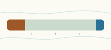
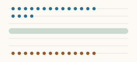
We follow 70 water level places in Yukon. 7 places read below their normal range for the date and 3 places above it.
How many places do we follow in Yukon?
70 Water Survey of Canada level gauges of the 2,148 we follow in Canada, as of 26 October 2026.
How many waters in Yukon have a level gauge?
59 waters with a level gauge, of the 1,635 waters we follow in Canada, as of 26 October 2026.
How many places read below normal for the date?
7 places below their normal range, of the 53 places with a current reading and a normal range for the date, as of 26 October 2026.
How many places read above normal for the date?
3 places above their normal range, of the 53 places with a current reading and a normal range for the date, as of 26 October 2026.
How the places stand today
7 places below normal and 3 places above
Which places are furthest below normal?
More places
Which places are furthest above normal?
Which gauges do we follow in Yukon?
| Place | Reading | Against normal for the date | Change in a day |
|---|---|---|---|
| Aishihik Lake | |||
| Aishihik | 3.815 m | within the normal range for the date | +0.002 m |
| Whitehorse | 3.325 m | within the normal range for the date | -0.038 m |
| Aishihik River | |||
| Aishihik Lake (downstream) | 3.058 m | lower than any day of these dates in 13 years | 0 m |
| Alsek River | |||
| Bates River (upstream) | 7.515 m | within the normal range for the date | -0.031 m |
| Babbage River | |||
| Caribou Creek (downstream) | 3.737 m | +0.018 m | |
| Beaver River (Yukon) | |||
| Matson Creek (downstream) | 6.104 m | within the normal range for the date | +0.054 m |
| Bennett Lake | |||
| Carcross | 2.013 m | within the normal range for the date | +0.002 m |
| Big Creek (Yukon) | |||
| Km 1084.8 Alaska Highway | 3.398 m | in the lowest 5 percent for the date | +0.079 m |
| Mouth | 6.195 m | within the normal range for the date | +0.094 m |
| Big Salmon River | |||
| Carmacks | 0.931 m | +0.03 m | |
| Blackstone River (Yukon) | |||
| Chapman Lake Airstrip | 4.146 m | within the normal range for the date | +0.186 m |
| Bonnet Plume River | |||
| Gillespie Creek (upstream) | 5.787 m | -0.006 m | |
| Caribou Creek (Yukon) | |||
| Babbage River (upstream) | 2.506 m | +0.001 m | |
| Dezadeash River | |||
| Haines Junction | 3.05 m | within the normal range for the date | -0.076 m |
| Drury Creek | |||
| Km 469 Robert Campbell Highway | 7.327 m | within the normal range for the date | +0.004 m |
| Duke River | |||
| Mouth | 5.349 m | within the normal range for the date | +0.008 m |
| Eagle River (Yukon) | |||
| Dempster Highway Bridge | 2.91 m | within the normal range for the date | +0.025 m |
| Firth River | |||
| Mouth | 4.195 m | within the normal range for the date | -0.04 m |
| Fishing Branch | |||
| Chii Ch'a'an Mountain | 2.992 m | +0.048 m | |
| Frances River | |||
| Watson Lake | 1.436 m | within the normal range for the date | -0.024 m |
| Giltana Creek | |||
| Mouth | 0.649 m | within the normal range for the date | -0.007 m |
| Hess River | |||
| Emerald Creek (upstream) | 13.929 m | within the normal range for the date | +0.016 m |
| Hyland River | |||
| Kilometre 108.5 Nahanni Range Road | 0.343 m | within the normal range for the date | +0.016 m |
| Ibex River | |||
| Whitehorse | 4.11 m | in the highest 5 percent for the date | -0.022 m |
| Indian River (Yukon) | |||
| Mouth (upstream) | 1.728 m | within the normal range for the date | +0.053 m |
| Klondike River | |||
| Bonanza Creek (upstream) | 0.997 m | within the normal range for the date | +0.059 m |
| Kluane Lake | |||
| Burwash Landing | 1.72 m | in the lowest 5 percent for the date | +0.001 m |
| Kluane River | |||
| Outlet of Kluane Lake | 25.498 m | +0.007 m | |
| Lake Laberge | |||
| Whitehorse | 7.073 m | within the normal range for the date | -0.034 m |
| Liard River | |||
| Scurvy Creek (downstream) | 6.577 m | -0.024 m | |
| Upper Crossing | 2.177 m | within the normal range for the date | -0.03 m |
| Little South Klondike River | |||
| Ross Creek (downstream) | 4.031 m | within the normal range for the date | -0.142 m |
| Marsh Lake | |||
| Whitehorse | 2.714 m | within the normal range for the date | +0.004 m |
| Mayo Lake | |||
| Mayo Lake | 3.442 m | within the normal range for the date | -0.008 m |
| Mayo River | |||
| Highway No. 11 | 6.731 m | +0.002 m | |
| Mayo Lake (downstream) | 8.304 m | +0.011 m | |
| McQuesten River | |||
| Mouth | 3.703 m | within the normal range for the date | -0.025 m |
| Morley River | |||
| Km 1251 Alaska Highway | 3.746 m | within the normal range for the date | -0.031 m |
| Nisling River | |||
| Onion Creek (downstream) | 13.925 m | within the normal range for the date | +0.08 m |
| Nordenskiold River | |||
| Rowlinson Creek (downstream) | 2.865 m | in the lowest 10 percent for the date | +0.07 m |
| North Klondike River | |||
| Mouth | 1.78 m | within the normal range for the date | +0.002 m |
| Ogilvie River | |||
| Kilometre 197.9 Dempster Highway | 6.766 m | +0.061 m | |
| Old Crow River | |||
| Mouth | 24.737 m | in the highest 10 percent for the date | -0.022 m |
| Peel River | |||
| Canyon Creek (upstream) | 1.166 m | +0.15 m | |
| Pelly River | |||
| Pelly Crossing | 1.794 m | within the normal range for the date | -0.024 m |
| Ross River | 0.98 m | -0.012 m | |
| Vangorda Creek (downstream) | 4.494 m | within the normal range for the date | -0.034 m |
| Porcupine River | |||
| Bell River (downstream) | 23.438 m | -0.411 m | |
| International Boundary | 7.958 m | in the highest 5 percent for the date | -0.098 m |
| Rancheria River | |||
| Mouth | 8.251 m | in the lowest 5 percent for the date | -0.02 m |
| Ross River | |||
| Ross River | 9.745 m | within the normal range for the date | -0.017 m |
| Sekulmun Lake | |||
| Whitehorse | 2.265 m | within the normal range for the date | -0.006 m |
| Sidney Creek | |||
| Kilometre 46 South Canol Road | 27.224 m | -0.027 m | |
| Sixty Mile River | |||
| Mouth | 6.225 m | within the normal range for the date | +0.02 m |
| South Macmillan River | |||
| Kilometre 407 Canol Road | 1.455 m | within the normal range for the date | +0.056 m |
| Stewart River | |||
| Mayo | 3.968 m | within the normal range for the date | -0.122 m |
| Mouth | 26.473 m | within the normal range for the date | -0.002 m |
| Tagish Lake | |||
| 10 Mile Road | 6.926 m | within the normal range for the date | -0.002 m |
| Takhanne River | |||
| Km 167 Haines Highway | 28.992 m | within the normal range for the date | -0.05 m |
| Takhini River | |||
| Whitehorse | 3.03 m | within the normal range for the date | 0 m |
| Tatshenshini River | |||
| Dalton Post | 4.765 m | within the normal range for the date | +0.029 m |
| Teslin Lake | |||
| Teslin | 4.26 m | within the normal range for the date | -0.008 m |
| West Aishihik River | |||
| Mouth | 7.036 m | +0.186 m | |
| Wheaton River | |||
| Carcross | 1.687 m | within the normal range for the date | +0.016 m |
| White River (Yukon) | |||
| Kilometre 1881.6 Alaska Highway | 20.334 m | in the lowest 10 percent for the date | +0.033 m |
| Whitestone River | |||
| Mouth | 1.436 m | +0.06 m | |
| Yukon River | |||
| Carmacks | 2.712 m | -0.049 m | |
| Dawson | 1.039 m | within the normal range for the date | -0.062 m |
| White River (upstream) | 8.691 m | within the normal range for the date | -0.047 m |
| Whitehorse | 29.264 m | in the lowest 5 percent for the date | -0.005 m |
Keep exploring
 Country, Canada Are the rivers and lakes in Canada unusually low or high? Every river and lake we follow in Canada, against normal for the date.
 Today's list, Canada Which places in Canada are furthest from normal today? The places in Canada furthest below and above normal today.
 River gauge, Canada Is the Aishihik River unusually low at Aishihik Lake (downstream)? Level now, history, the same date in past years and each year's range.
 River gauge, Canada Is the Rancheria River unusually low at Mouth? Level now, history, the same date in past years and each year's range.
Sources
- Data Source: Environment and Climate Change Canada (Water Survey of Canada) (source). Licence: ECCC Data Services End-use Licence v2.1.1