Ontario river levels today
Are the rivers and lakes in Ontario unusually low or high?
We follow 524 water level gauges in Ontario. 116 gauges read below their normal range for the date and 6 gauges above it.
How many gauges do we follow in Ontario?
524 Water Survey of Canada level gauges of the 2,148 we follow in Canada, as of 26 October 2026.
How many waters in Ontario have a level gauge?
377 waters with a level gauge, of the 1,635 waters we follow in Canada, as of 26 October 2026.
How many gauges read below normal for the date?
116 gauges below their normal range, of the 481 gauges with a current reading and a normal range for the date, as of 26 October 2026.
How many gauges read above normal for the date?
6 gauges above their normal range, of the 481 gauges with a current reading and a normal range for the date, as of 26 October 2026.
How the places stand today
116 places below normal and 6 places above
Which places are furthest below normal?
Otoskwin-Attawapiskat River Provincial ParkMuketei River
12.271 m
lower than any day of these dates in 11 years
More places
Which places are furthest above normal?
More places
Which gauges do we follow in Ontario?
| Place | Reading | Against normal for the date | Change in a day |
|---|---|---|---|
| Abitibi River | |||
| Onakawana | 2.881 m | within the normal range for the date | -0.032 m |
| Ahmic Lake | |||
| Ahmic Harbour | 8.347 m | in the lowest 10 percent for the date | -0.008 m |
| Albany River | |||
| Achapi Lake (downstream) | 26.34 m | in the lowest 10 percent for the date | -0.047 m |
| Fishing Creek Island (upstream) | 5.613 m | within the normal range for the date | -0.02 m |
| Hat Island | 1.794 m | in the lowest 10 percent for the date | -0.019 m |
| Nottik Island (upstream) | 23.506 m | within the normal range for the date | +0.033 m |
| Alder Creek | |||
| New Dundee | 12.881 m | within the normal range for the date | 0 m |
| Ancaster Creek | |||
| Ancaster | 0.12 m | within the normal range for the date | -0.001 m |
| Asheweig River | |||
| Straight Lake | 13.232 m | in the lowest 10 percent for the date | -0.005 m |
| Atikokan River | |||
| Atikokan | 386.205 m | within the normal range for the date | -0.008 m |
| Attawapiskat River | |||
| Attawapiskat Lake (downstream) | 28.163 m | in the lowest 10 percent for the date | -0.008 m |
| Lawashi Channel (upstream) | 5.615 m | within the normal range for the date | -0.002 m |
| Muketei River (downstream) | 22.779 m | lower than any day of these dates in 26 years | -0.019 m |
| Aubinadong River | |||
| Sesabic Creek (upstream) | 1.671 m | in the lowest 5 percent for the date | -0.001 m |
| Aumond Creek | |||
| Mattawa | 3.573 m | in the lowest 5 percent for the date | -0.003 m |
| Ausable River | |||
| Exeter | 3.308 m | within the normal range for the date | -0.001 m |
| Parkhill | 1.692 m | within the normal range for the date | +0.127 m |
| Springbank | 1.624 m | within the normal range for the date | -0.013 m |
| Aux Sables River | |||
| Massey | 3.683 m | in the lowest 10 percent for the date | 0 m |
| Avon River | |||
| Stratford (downstream) | 6.312 m | within the normal range for the date | +0.006 m |
| Stratford (upstream) | 6.22 m | within the normal range for the date | +0.005 m |
| Bala Bay | |||
| Bala | 225.175 m | within the normal range for the date | -0.006 m |
| Baltimore Creek | |||
| Baltimore | 1.338 m | lower than any day of these dates in 20 years | +0.001 m |
| Batchawana River | |||
| Batchawana | 2.118 m | in the lowest 5 percent for the date | +0.003 m |
| Baxter Creek | |||
| Millbrook | 2.419 m | within the normal range for the date | +0.001 m |
| Bay Lake | |||
| Latchford | 6.802 m | in the lowest 10 percent for the date | +0.002 m |
| Bayfield River | |||
| Varna | 0.761 m | within the normal range for the date | +0.001 m |
| Bear Brook | |||
| Bourget | 7.701 m | within the normal range for the date | +0.013 m |
| Bear Creek (Ontario) | |||
| Brigden (downstream) | 3.927 m | within the normal range for the date | +0.001 m |
| Petrolia | 4.118 m | within the normal range for the date | +0.002 m |
| Beatty Saugeen River | |||
| Holstein | 1.696 m | within the normal range for the date | +0.003 m |
| Beaver Creek (Ontario) | |||
| Marmora | 9.147 m | within the normal range for the date | -0.003 m |
| Beaver River (Beaverton) | |||
| Beaverton | 7.839 m | within the normal range for the date | -0.002 m |
| Beaver River (Clarksburg) | |||
| Clarksburg | 0.547 m | in the lowest 10 percent for the date | -0.001 m |
| Vandeleur | 7.126 m | in the lowest 5 percent for the date | -0.002 m |
| Becketts Creek | |||
| Cumberland Estates | 6.664 m | -0.001 m | |
| Beeton Creek | |||
| Tottenham | 5.683 m | within the normal range for the date | +0.005 m |
| Berens River | |||
| Berens Lake (upstream) | 25.438 m | within the normal range for the date | -0.008 m |
| Bernard Lake | |||
| Sundridge | 8.267 m | in the lowest 10 percent for the date | -0.004 m |
| Big Carp River | |||
| Sault Ste. Marie | 2.49 m | within the normal range for the date | +0.013 m |
| Big Creek (Ontario) | |||
| Delhi | 4.916 m | in the lowest 5 percent for the date | -0.001 m |
| Kelvin | 6.039 m | within the normal range for the date | -0.003 m |
| Walsingham | 4.096 m | within the normal range for the date | -0.026 m |
| Big East River | |||
| Huntsville | 5.117 m | in the lowest 5 percent for the date | -0.004 m |
| Big Otter Creek | |||
| Calton | 9.784 m | within the normal range for the date | +0.002 m |
| Otterville (upstream) | 3.871 m | within the normal range for the date | +0.013 m |
| Tillsonburg | 2.929 m | within the normal range for the date | -0.003 m |
| Bighead River | |||
| Meaford | 10.296 m | lower than any day of these dates in 22 years | -0.006 m |
| Strathavon | 7.148 m | within the normal range for the date | 0 m |
| Black Creek (Bradshaw) | |||
| Bradshaw | 6.355 m | within the normal range for the date | +0.002 m |
| Black Creek (Hensall) | |||
| Hensall | 5.347 m | within the normal range for the date | 0 m |
| Black Creek (Limehouse) | |||
| Limehouse | 8.135 m | +0.005 m | |
| Black Creek (Milford) | |||
| Milford | 1.157 m | within the normal range for the date | -0.001 m |
| Black Creek (Weston) | |||
| Weston | 0.314 m | within the normal range for the date | 0 m |
| Black River (Actinolite) | |||
| Actinolite | 12.054 m | within the normal range for the date | +0.002 m |
| Black River (Washago) | |||
| Baldwin | 8.44 m | within the normal range for the date | +0.038 m |
| Vankoughnet | 8.775 m | within the normal range for the date | -0.004 m |
| Washago | 7.296 m | within the normal range for the date | -0.02 m |
| Black Sturgeon River | |||
| Highway No. 17 | 186.429 m | in the lowest 5 percent for the date | -0.005 m |
| Blackstock Creek | |||
| Blackstock | 2.912 m | in the lowest 10 percent for the date | +0.016 m |
| Blackwater River | |||
| Beardmore | 300.799 m | in the lowest 5 percent for the date | +0.002 m |
| Blanche River | |||
| Englehart (upstream) | 25.425 m | in the lowest 5 percent for the date | -0.013 m |
| Blue Jay Creek | |||
| Tehkummah | 7.941 m | within the normal range for the date | -0.002 m |
| Blue Springs Creek | |||
| Eden Mills | 1.749 m | within the normal range for the date | -0.001 m |
| Blyth Brook | |||
| Blyth (downstream) | 4.083 m | within the normal range for the date | -0.005 m |
| Bonnechere River | |||
| Castleford | 5.914 m | within the normal range for the date | -0.031 m |
| Bowmanville Creek | |||
| Bowmanville | 0.669 m | in the lowest 10 percent for the date | +0.002 m |
| Boyle Drain | |||
| Atwood | 3.123 m | within the normal range for the date | 0 m |
| Boyne River (Ontario) | |||
| Earl Rowe Park | 2.866 m | within the normal range for the date | +0.006 m |
| Brightsand River | |||
| Moberley | 26.951 m | within the normal range for the date | -0.011 m |
| Bronte Creek | |||
| Carlisle | 2.48 m | within the normal range for the date | -0.002 m |
| Zimmerman | 5.831 m | within the normal range for the date | -0.003 m |
| Buckshot Creek | |||
| Plevna | 1.382 m | in the lowest 5 percent for the date | +0.004 m |
| Buells Creek | |||
| Brockville | 0.793 m | within the normal range for the date | -0.002 m |
| Burnley Creek | |||
| Warkworth (upstream) | 2.515 m | within the normal range for the date | +0.001 m |
| Burnt River | |||
| Burnt River | 2.984 m | within the normal range for the date | -0.01 m |
| Three Brothers Falls | 6.972 m | -0.004 m | |
| Camp Creek (Ontario) | |||
| Allan Park | 3.772 m | in the lowest 10 percent for the date | +0.002 m |
| Canagagigue Creek | |||
| Elmira | 9.707 m | within the normal range for the date | +0.004 m |
| Canard River | |||
| Lukerville | 1.517 m | within the normal range for the date | -0.006 m |
| Carp River | |||
| Kinburn | 4.824 m | within the normal range for the date | -0.009 m |
| Carrick Creek | |||
| Carlsruhe | 1.671 m | within the normal range for the date | +0.005 m |
| Castor River | |||
| Russell | 3.207 m | within the normal range for the date | -0.006 m |
| Cat River | |||
| Wesleyan Lake (downstream) | 29.234 m | within the normal range for the date | -0.005 m |
| Catfish Creek | |||
| Aylmer | 2.871 m | within the normal range for the date | -0.031 m |
| Sparta | 0.314 m | within the normal range for the date | -0.002 m |
| Cecebe Lake | |||
| Magnetawan | 18.774 m | in the lowest 10 percent for the date | -0.008 m |
| Cedar Creek (Hemlo) | |||
| Hemlo | 7.142 m | in the lowest 10 percent for the date | -0.007 m |
| Cedar Creek (Woodstock) | |||
| Woodstock | 3.816 m | within the normal range for the date | +0.005 m |
| Cedar River | |||
| Wabaskang Lake (downstream) | 28.198 m | within the normal range for the date | -0.006 m |
| Centreville Creek | |||
| Albion Hills | 0.528 m | +0.017 m | |
| Chippewa Creek | |||
| North Bay | 13.187 m | within the normal range for the date | -0.001 m |
| Chukuni River | |||
| Ear Falls | 4.334 m | within the normal range for the date | +0.016 m |
| Clare River | |||
| Bogart | 1.68 m | within the normal range for the date | +0.01 m |
| Clyde River | |||
| Gordon Rapids | 2.981 m | within the normal range for the date | -0.005 m |
| Lanark | 8.098 m | within the normal range for the date | -0.008 m |
| Cobourg Brook | |||
| Cobourg | 6.426 m | within the normal range for the date | +0.01 m |
| Precious Corners | 2.305 m | higher than any day of these dates in 21 years | +0.046 m |
| Cold Creek (Bolton) | |||
| Bolton | 4.972 m | in the lowest 5 percent for the date | 0 m |
| Cold Creek (Orland) | |||
| Orland | 2.58 m | in the lowest 10 percent for the date | 0 m |
| Coldwater River (Ontario) | |||
| Coldwater | 1.184 m | in the lowest 10 percent for the date | +0.01 m |
| Collins Creek | |||
| Kingston | 11.954 m | within the normal range for the date | -0.005 m |
| Commanda Creek | |||
| Commanda | 1.019 m | in the lowest 5 percent for the date | -0.004 m |
| Conestogo River | |||
| Bosworth | 4.088 m | -0.005 m | |
| Glen Allan | 0.679 m | within the normal range for the date | -0.004 m |
| St. Jacobs | 0.284 m | within the normal range for the date | 0 m |
| Coniston Creek | |||
| Wanapitei River (upstream) | 1.025 m | within the normal range for the date | -0.021 m |
| Consecon Creek | |||
| Allisonville | 1.052 m | within the normal range for the date | +0.004 m |
| Cooksville Creek | |||
| Cooksville | 1.901 m | in the lowest 10 percent for the date | +0.001 m |
| Corbett Creek | |||
| Murillo | 5.791 m | within the normal range for the date | -0.009 m |
| Credit River | |||
| Boston Mills | 3.786 m | in the lowest 10 percent for the date | +0.003 m |
| Cataract | 1.338 m | within the normal range for the date | +0.005 m |
| Norval | 2.562 m | in the lowest 10 percent for the date | +0.008 m |
| Orangeville | 11.186 m | within the normal range for the date | 0 m |
| Streetsville | 4.407 m | within the normal range for the date | 0 m |
| Credit River Erin Branch | |||
| Erin (upstream) | 2.036 m | within the normal range for the date | -0.001 m |
| Hillsburgh | 1.92 m | within the normal range for the date | +0.003 m |
| Credit River West Branch | |||
| Norval | 2.162 m | within the normal range for the date | +0.008 m |
| Crowe River | |||
| Glen Alda | 12.288 m | within the normal range for the date | -0.001 m |
| Marmora | 10.122 m | within the normal range for the date | -0.001 m |
| Current River | |||
| Stepstone | 1.866 m | within the normal range for the date | -0.003 m |
| Depot Creek | |||
| Bellrock | 6.677 m | within the normal range for the date | -0.009 m |
| Dingman Creek | |||
| Lambeth (downstream) | 4.809 m | in the lowest 5 percent for the date | -0.001 m |
| Dodd Creek | |||
| Paynes Mills (downstream) | 1.446 m | within the normal range for the date | -0.002 m |
| Doe Lake | |||
| Katrine | 7.042 m | within the normal range for the date | -0.01 m |
| Dollars Lake | |||
| S Narrows (downstream) | 7.591 m | lower than any day of these dates in 20 years | 0 m |
| Don River | |||
| Todmorden | 12.114 m | within the normal range for the date | 0 m |
| Don River East Branch | |||
| Thornhill | 2.018 m | within the normal range for the date | +0.001 m |
| Don River West Branch | |||
| York Mills | 0.534 m | within the normal range for the date | +0.004 m |
| Driftwood River (Ontario) | |||
| Monteith | 260.987 m | within the normal range for the date | -0.02 m |
| Duffins Creek | |||
| Ajax | 0.763 m | within the normal range for the date | +0.002 m |
| East Humber River | |||
| King Creek | 1.276 m | in the lowest 10 percent for the date | -0.002 m |
| Pine Grove | 2.054 m | within the normal range for the date | +0.002 m |
| East Sixteen Mile Creek | |||
| Omagh | 1.455 m | within the normal range for the date | 0 m |
| Ekwan River | |||
| North Washagami River (downstream) | 22.587 m | within the normal range for the date | -0.024 m |
| English River | |||
| Umfreville | 393.85 m | within the normal range for the date | -0.009 m |
| Eramosa River | |||
| Guelph (upstream) | 8.555 m | within the normal range for the date | -0.029 m |
| Etobicoke Creek | |||
| Queen Elizabeth Highway (downstream) | 3.468 m | in the lowest 10 percent for the date | +0.007 m |
| Fairchild Creek | |||
| Brantford | 1.458 m | ||
| Onondaga (upstream) | 6.812 m | -0.002 m | |
| Fairy Lake | |||
| Huntsville | 6.247 m | within the normal range for the date | -0.001 m |
| Fall River | |||
| Outlet of Bennett Lake | 1.005 m | within the normal range for the date | -0.005 m |
| Fish Creek (Ontario) | |||
| Prospect Hill | 3.292 m | within the normal range for the date | +0.058 m |
| Flanagan River | |||
| Outlet of North Spirit Lake | 28.164 m | within the normal range for the date | +0.038 m |
| Forest Lake (Canyon Lake) | |||
| Canyon Lake (upstream) | 1.889 m | in the lowest 10 percent for the date | -0.01 m |
| Forest Lake (South River) | |||
| South River | 8.836 m | within the normal range for the date | -0.071 m |
| Four Mile Creek | |||
| Virgil | 7.73 m | in the highest 10 percent for the date | +0.013 m |
| Fourteen Mile Creek | |||
| Oakville | 1.259 m | in the lowest 5 percent for the date | -0.002 m |
| French River | |||
| Chaudiere Dam | 189.189 m | within the normal range for the date | -0.001 m |
| Dry Pine Bay | 1.189 m | within the normal range for the date | +0.007 m |
| Hartley Bay | 177.921 m | within the normal range for the date | +0.028 m |
| Portage Dam (downstream) | 188.004 m | within the normal range for the date | +0.103 m |
| Wolseley Bay | 186.844 m | within the normal range for the date | +0.007 m |
| Frood Lake | |||
| Whitefish Falls | 1.70 m | lower than any day of these dates in 20 years | +0.004 m |
| Ganaraska River | |||
| Dale (upstream) | 0.95 m | in the lowest 10 percent for the date | +0.002 m |
| Osaca | 0.367 m | in the lowest 10 percent for the date | +0.002 m |
| Garry River | |||
| Alexandria | 81.506 m | within the normal range for the date | +0.001 m |
| Go Home Lake | |||
| Potters Landing | 185.22 m | within the normal range for the date | +0.006 m |
| Golden Creek | |||
| Red Lake | 29.699 m | within the normal range for the date | -0.011 m |
| Goshawk Lake | |||
| Kahkagopkung Onigum | 318.093 m | +0.03 m | |
| Goulais River | |||
| Kirby's Corner | 2.886 m | in the lowest 5 percent for the date | -0.002 m |
| Searchmont | 7.298 m | in the lowest 5 percent for the date | +0.004 m |
| Graham Creek (Ontario) | |||
| Nepean | 0.836 m | within the normal range for the date | +0.01 m |
| Grand River | |||
| Brantford | 0.236 m | within the normal range for the date | -0.008 m |
| Doon | 4.026 m | within the normal range for the date | -0.005 m |
| Dundalk | 1.287 m | within the normal range for the date | +0.003 m |
| Galt | 0.694 m | within the normal range for the date | +0.002 m |
| Marsville | 3.301 m | within the normal range for the date | +0.006 m |
| Shand Dam (downstream) | 1.545 m | within the normal range for the date | 0 m |
| West Montrose | 11.095 m | within the normal range for the date | +0.001 m |
| Grassy Narrows Lake | |||
| Grassy Narrows | 318.735 m | within the normal range for the date | -0.008 m |
| Gravel River | |||
| Cavers | 3.197 m | within the normal range for the date | -0.006 m |
| Grindstone Creek | |||
| Hidden Valley Park | 8.323 m | -0.005 m | |
| Millgrove | 2.328 m | within the normal range for the date | +0.007 m |
| Groundhog River | |||
| Fauquier | 29.349 m | within the normal range for the date | -0.03 m |
| Gull River | |||
| Norland | 3.661 m | within the normal range for the date | -0.001 m |
| Hawkestone Creek | |||
| Hawkestone | 2.143 m | in the lowest 10 percent for the date | +0.007 m |
| Head River | |||
| Sebright | 8.929 m | within the normal range for the date | -0.01 m |
| Highland Creek | |||
| West Hill | 5.968 m | in the lowest 10 percent for the date | +0.001 m |
| Hoards Creek | |||
| Wellman | 3.169 m | within the normal range for the date | +0.01 m |
| Hogg Creek | |||
| Victoria Harbour | 0.485 m | within the normal range for the date | -0.001 m |
| Holland River East Branch | |||
| Holland Landing | 7.479 m | within the normal range for the date | +0.002 m |
| Horner Creek | |||
| Princeton | 3.24 m | within the normal range for the date | 0 m |
| Humber River (Ontario) | |||
| Elder Mills | 5.464 m | in the lowest 10 percent for the date | +0.002 m |
| Highway No. 9 | 2.217 m | +0.002 m | |
| Palgrave | 8.206 m | within the normal range for the date | +0.006 m |
| Weston | 2.179 m | within the normal range for the date | 0 m |
| Hunsburger Creek | |||
| Wilmot Centre | 0.881 m | in the lowest 10 percent for the date | +0.002 m |
| Indian River (Blakeney) | |||
| Blakeney | 8.56 m | within the normal range for the date | -0.001 m |
| Indian River (Hope Mill Dam) | |||
| Hope Mill Dam (downstream) | 7.28 m | -0.01 m | |
| Hope Mill Dam (upstream) | 9.359 m | -0.003 m | |
| Indian River (Pembroke) | |||
| Pembroke | 2.697 m | within the normal range for the date | +0.024 m |
| Innisfil Creek | |||
| Alliston | 1.915 m | within the normal range for the date | +0.002 m |
| Irvine River | |||
| Salem | 1.694 m | in the lowest 10 percent for the date | -0.004 m |
| Ivanhoe Lake | |||
| Foleyet | 340.984 m | lower than any day of these dates in 24 years | -0.017 m |
| Ivanhoe River | |||
| Foleyet | 318.596 m | within the normal range for the date | -0.031 m |
| Jackson Creek | |||
| Jackson Heights | 2.925 m | within the normal range for the date | -0.007 m |
| Peterborough | 1.515 m | within the normal range for the date | -0.004 m |
| Jock River | |||
| Richmond | 6.325 m | within the normal range for the date | -0.015 m |
| Junction Creek | |||
| Kelley Lake (downstream) | 2.756 m | within the normal range for the date | +0.012 m |
| Sudbury | 0.941 m | within the normal range for the date | +0.015 m |
| Kaministiquia River | |||
| Kaministiquia | 301.752 m | in the lowest 10 percent for the date | -0.008 m |
| West Fort William | 183.06 m | within the normal range for the date | -0.063 m |
| Kamiskotia River | |||
| Enid Creek (upstream) | 6.189 m | within the normal range for the date | -0.005 m |
| Kapuskasing River | |||
| Kapuskasing | 4.246 m | in the lowest 10 percent for the date | -0.322 m |
| Kawagama Lake | |||
| Russell Landing | 8.741 m | within the normal range for the date | +0.001 m |
| Kawinogans River | |||
| Pickle Crow | 330.143 m | in the lowest 10 percent for the date | -0.01 m |
| Kemptville Creek | |||
| Kemptville | 5.936 m | within the normal range for the date | -0.022 m |
| Kenogami River | |||
| Mammamattawa | 20.133 m | within the normal range for the date | -0.005 m |
| Kenogamisis Lake | |||
| Geraldton | 329.377 m | in the lowest 5 percent for the date | +0.003 m |
| Kettle Creek | |||
| St. Thomas | 6.031 m | within the normal range for the date | -0.004 m |
| St. Thomas (upstream) | 5.577 m | within the normal range for the date | 0 m |
| Kwetabohigan River | |||
| Mouth | 10.169 m | lower than any day of these dates in 24 years | -0.011 m |
| La Vallee River | |||
| Burriss | 12.235 m | higher than any day of these dates in 18 years | +0.006 m |
| La Vase River | |||
| North Bay | 10.875 m | within the normal range for the date | +0.112 m |
| Lac Seul | |||
| Goldpines | 356.309 m | within the normal range for the date | +0.086 m |
| Hudson | 356.345 m | within the normal range for the date | +0.009 m |
| Lac Seul | 356.284 m | within the normal range for the date | -0.043 m |
| Lake Muskoka | |||
| Beaumaris | 9.306 m | within the normal range for the date | -0.009 m |
| Lake Nipissing | |||
| French River Outlet | 195.561 m | within the normal range for the date | +0.004 m |
| North Bay | 5.576 m | within the normal range for the date | -0.01 m |
| West Bay | 5.544 m | +0.01 m | |
| Lake of Bays | |||
| Baysville | 10.218 m | within the normal range for the date | +0.009 m |
| Lake of the Woods | |||
| Clearwater Bay | 322.586 m | within the normal range for the date | -0.037 m |
| Cyclone Island | 322.691 m | within the normal range for the date | +0.006 m |
| Hanson Bay | 322.724 m | within the normal range for the date | -0.065 m |
| Keewatin | 322.595 m | within the normal range for the date | -0.048 m |
| Lake of the Woods Eastern Outlet | |||
| Kenora Powerhouse | 322.563 m | within the normal range for the date | -0.045 m |
| Lake of the Woods Western Outlet | |||
| Norman Dam and Powerhouse Site No.1 (upstream) | 322.571 m | -0.045 m | |
| Norman Dam and Powerhouse Site No.2 (upstream) | 322.569 m | within the normal range for the date | -0.041 m |
| Norman Dam and Powerhouse Site No.3 (upstream) | 322.576 m | within the normal range for the date | -0.051 m |
| Lake Rosseau | |||
| Port Carling | 8.782 m | within the normal range for the date | +0.017 m |
| Lake Scugog | |||
| Scugog Island Marina | 9.002 m | -0.007 m | |
| Lake Timiskaming | |||
| Haileybury | 4.58 m | within the normal range for the date | -0.036 m |
| Lakelet Creek | |||
| Gorrie | 7.14 m | in the lowest 10 percent for the date | -0.002 m |
| Laurel Creek | |||
| Waterloo | 2.995 m | within the normal range for the date | -0.005 m |
| Little Ausable River | |||
| Lucan Crossing | 2.443 m | within the normal range for the date | -0.003 m |
| Little Current River | |||
| Percy Lake | 27.404 m | within the normal range for the date | -0.02 m |
| Little French River | |||
| Okikendawt Island | 193.071 m | within the normal range for the date | -0.005 m |
| Little Maitland River | |||
| Bluevale | 6.664 m | within the normal range for the date | +0.013 m |
| Little Pic River | |||
| Coldwell | 2.172 m | in the lowest 5 percent for the date | -0.003 m |
| Little River | |||
| Windsor | 1.185 m | in the lowest 5 percent for the date | -0.002 m |
| Little Rouge Creek | |||
| Dicksons Hill | 5.166 m | within the normal range for the date | +0.004 m |
| Locust Hill | 10.211 m | within the normal range for the date | -0.002 m |
| Little Sturgeon River | |||
| Booth Lake (downstream) | 2.429 m | in the lowest 5 percent for the date | -0.009 m |
| Little White River | |||
| Bellingham | 2.749 m | in the lowest 10 percent for the date | -0.036 m |
| Boland River (downstream) | 1.658 m | in the lowest 10 percent for the date | -0.025 m |
| Long-Legged River | |||
| Long-Legged Lake (downstream) | 28.468 m | within the normal range for the date | -0.009 m |
| Lucknow River | |||
| Lucknow | 6.408 m | within the normal range for the date | +0.003 m |
| Lyn Creek | |||
| Lyn | 7.898 m | within the normal range for the date | -0.011 m |
| Lynde Creek | |||
| Brooklin | 4.793 m | in the lowest 10 percent for the date | +0.001 m |
| Whitby | 8.066 m | within the normal range for the date | 0 m |
| Lynde Creek Tributary | |||
| Kinsale | 3.766 m | within the normal range for the date | +0.002 m |
| Lyndhurst Creek | |||
| Lyndhurst | 16.546 m | within the normal range for the date | -0.008 m |
| Lynn River | |||
| Simcoe | 1.23 m | within the normal range for the date | +0.011 m |
| Mackie Creek | |||
| Hampton | 2.826 m | in the lowest 5 percent for the date | -0.002 m |
| Mad River | |||
| Avening | 1.016 m | within the normal range for the date | -0.001 m |
| Madawaska River | |||
| Palmer Rapids | 1.398 m | within the normal range for the date | -0.006 m |
| Magnetawan River | |||
| Britt | 25.268 m | within the normal range for the date | +0.036 m |
| Emsdale | 7.469 m | within the normal range for the date | -0.005 m |
| Magpie River | |||
| Esnagi Lake | 3.403 m | within the normal range for the date | +0.011 m |
| Maitland River | |||
| Benmiller | 1.891 m | in the lowest 10 percent for the date | +0.002 m |
| Harriston | 2.229 m | within the normal range for the date | 0 m |
| Wingham (downstream) | 0.793 m | within the normal range for the date | +0.002 m |
| Wingham (upstream) | 9.827 m | lower than any day of these dates in 22 years | -0.003 m |
| Mariposa Brook | |||
| Little Britain | 2.276 m | within the normal range for the date | -0.001 m |
| Mary Lake | |||
| Port Sydney | 8.468 m | within the normal range for the date | -0.001 m |
| Mattagami River | |||
| Timmins | 2.26 m | within the normal range for the date | +0.037 m |
| Mattawa River | |||
| Bouillon Lake (downstream) | 8.797 m | -0.062 m | |
| Mattawishkwia River | |||
| Hearst | 4.917 m | within the normal range for the date | +0.001 m |
| Mayhew Creek | |||
| Trenton | 1.901 m | within the normal range for the date | +0.005 m |
| McGregor Creek | |||
| Chatham | 1.055 m | within the normal range for the date | +0.001 m |
| McIntyre River | |||
| Thunder Bay (upstream) | 307.671 m | in the lowest 10 percent for the date | +0.002 m |
| McKenzie Creek | |||
| Caledonia | 1.212 m | ||
| McVicar Creek | |||
| Thunder Bay | 4.962 m | in the lowest 10 percent for the date | +0.002 m |
| Medway River | |||
| London | 3.529 m | within the normal range for the date | -0.004 m |
| Middle Maitland River | |||
| Belgrave | 9.976 m | in the lowest 5 percent for the date | 0 m |
| Ethel (upstream) | 4.238 m | within the normal range for the date | +0.001 m |
| Listowel | 6.79 m | within the normal range for the date | +0.052 m |
| Middle Thames River | |||
| Thamesford | 8.82 m | within the normal range for the date | -0.018 m |
| Mill Creek (Ontario) | |||
| Red Wing | 5.806 m | in the lowest 5 percent for the date | +0.002 m |
| Millhaven Creek | |||
| Millhaven | 2.067 m | within the normal range for the date | +0.021 m |
| Sydenham | 126.287 m | within the normal range for the date | -0.008 m |
| Mimico Creek | |||
| Islington | 5.567 m | within the normal range for the date | -0.001 m |
| Mindemoya Lake | |||
| Mindemoya | 6.375 m | within the normal range for the date | +0.003 m |
| Minisinakwa River | |||
| Gogama | 348.684 m | within the normal range for the date | -0.005 m |
| Ministic Creek | |||
| Agnew Lake (upstream) | 3.022 m | within the normal range for the date | +0.001 m |
| Missinaibi River | |||
| Mattice | 0.32 m | within the normal range for the date | -0.018 m |
| Waboose River (downstream) | 24.604 m | within the normal range for the date | -0.017 m |
| Mississagi River | |||
| Mississagi Chute | 9.50 m | lower than any day of these dates in 14 years | -0.005 m |
| Mississippi River (Ontario) | |||
| Appleton | 1.708 m | within the normal range for the date | -0.005 m |
| Fergusons Falls | 3.02 m | within the normal range for the date | -0.006 m |
| Marble Lake (downstream) | 8.586 m | within the normal range for the date | -0.009 m |
| Outlet of Dalhousie Lake | 6.221 m | within the normal range for the date | -0.002 m |
| Moira River | |||
| Deloro | 1.32 m | within the normal range for the date | -0.02 m |
| Foxboro | 7.147 m | within the normal range for the date | -0.01 m |
| Tweed | 4.288 m | within the normal range for the date | -0.012 m |
| Mollie River | |||
| Highway No. 144 | 8.826 m | within the normal range for the date | +0.001 m |
| Montreal River | |||
| Latchford | 4.711 m | 0 m | |
| Mountain Chutes | 2.488 m | +0.003 m | |
| Mowat Landing | 98.077 m | -0.01 m | |
| Moon River | |||
| Highway No. 400 | 0.973 m | in the lowest 10 percent for the date | -0.016 m |
| Moorefield Creek | |||
| Rothsay | 1.131 m | in the lowest 5 percent for the date | 0 m |
| Moose Creek | |||
| Levack | 1.049 m | within the normal range for the date | +0.002 m |
| Moose River | |||
| Moose River (upstream) | 87.567 m | in the lowest 10 percent for the date | -0.102 m |
| Mountjoy River | |||
| Timmins | 93.794 m | within the normal range for the date | -0.002 m |
| Mountsberg Creek | |||
| Carlisle | 2.693 m | within the normal range for the date | -0.001 m |
| Mountsberg Reservoir (downstream) | 1.148 m | within the normal range for the date | 0 m |
| Muketei River | |||
| Otoskwin-Attawapiskat River Provincial Park | 12.271 m | lower than any day of these dates in 11 years | -0.005 m |
| Muskrat River | |||
| Pembroke | 3.74 m | in the highest 10 percent for the date | -0.001 m |
| Musquash River | |||
| Highway No. 400 | 9.232 m | within the normal range for the date | +0.411 m |
| Nagagami River | |||
| Highway No. 11 | 1.38 m | within the normal range for the date | +0.001 m |
| Namakan Lake | |||
| Squirrel Island | 340.106 m | within the normal range for the date | -0.025 m |
| Namakan River | |||
| Outlet of Lac La Croix | 360.316 m | within the normal range for the date | -0.005 m |
| Nanticoke Creek | |||
| Nanticoke | 12.249 m | within the normal range for the date | +0.001 m |
| Napanee River | |||
| Camden East | 12.401 m | within the normal range for the date | -0.004 m |
| Neebing River | |||
| Intola | 27.163 m | within the normal range for the date | +0.002 m |
| Thunder Bay | 184.408 m | within the normal range for the date | -0.003 m |
| Nemegosenda River | |||
| Chapleau | 14.523 m | in the lowest 5 percent for the date | +0.002 m |
| Niagara River | |||
| Fort Erie | 172.352 m | within the normal range for the date | +0.016 m |
| Nipigon River | |||
| Alexander Generating Station (downstream) | 26.638 m | within the normal range for the date | +0.006 m |
| Polly Lake (downstream) | 183.664 m | -0.004 m | |
| Nith River | |||
| Canning | 3.162 m | within the normal range for the date | -0.01 m |
| New Hamburg | 1.598 m | within the normal range for the date | -0.004 m |
| Nithburg (upstream) | 9.902 m | within the normal range for the date | +0.006 m |
| North Branch Muskoka River | |||
| Port Sydney | 0.734 m | within the normal range for the date | 0 m |
| North Branch South Nation River | |||
| Heckston | 0.793 m | within the normal range for the date | -0.006 m |
| North Current River | |||
| Thunder Bay | 27.875 m | in the lowest 10 percent for the date | +0.002 m |
| North French River | |||
| Mouth | 24.044 m | within the normal range for the date | -0.012 m |
| North Magnetawan River | |||
| Burk's Falls | 8.51 m | within the normal range for the date | -0.001 m |
| Pickerel Lake (upstream) | 1.359 m | in the lowest 5 percent for the date | -0.002 m |
| North Penetangore River | |||
| Kincardine | 1.281 m | within the normal range for the date | +0.001 m |
| North River (Ontario) | |||
| Falls | 0.778 m | within the normal range for the date | +0.003 m |
| North Thames River | |||
| Fanshawe Dam (downstream) | 6.199 m | within the normal range for the date | -0.001 m |
| Mitchell | 3.613 m | within the normal range for the date | +0.01 m |
| St. Marys | 2.917 m | within the normal range for the date | -0.002 m |
| Thorndale | 1.488 m | ||
| North West Ganaraska River | |||
| Osaca | 2.475 m | within the normal range for the date | -0.001 m |
| Nottawasaga River | |||
| Alliston | 6.729 m | within the normal range for the date | +0.001 m |
| Baxter | 5.43 m | within the normal range for the date | +0.006 m |
| Edenvale | 4.34 m | within the normal range for the date | -0.008 m |
| Hockley | 0.672 m | within the normal range for the date | +0.001 m |
| Ogoki River | |||
| Whiteclay Lake (upstream) | 1.808 m | within the normal range for the date | -0.035 m |
| Onaping River | |||
| Levack | 1.08 m | within the normal range for the date | -0.012 m |
| Oshawa Creek | |||
| Oshawa | 2.304 m | within the normal range for the date | -0.008 m |
| Oswego Creek | |||
| Canborough | 2.148 m | within the normal range for the date | +0.004 m |
| Otonabee River | |||
| Robinsons Island | 7.274 m | -0.037 m | |
| Otoskwin River | |||
| Badesdawa Lake (downstream) | 327.988 m | in the lowest 10 percent for the date | -0.098 m |
| Ottawa River | |||
| Britannia | 57.817 m | within the normal range for the date | -0.013 m |
| Mattawa | 52.428 m | within the normal range for the date | +0.137 m |
| Thorne | 9.52 m | -0.002 m | |
| Ouse River | |||
| Norwood | 6.897 m | -0.004 m | |
| Westwood | 12.467 m | within the normal range for the date | -0.003 m |
| Oxbow Creek | |||
| Kilworth | 4.667 m | within the normal range for the date | 0 m |
| Oxtongue River | |||
| Dwight | 3.142 m | within the normal range for the date | +0.015 m |
| Pagwachuan River | |||
| Highway No. 11 | 9.529 m | in the lowest 10 percent for the date | +0.002 m |
| Pakwash Lake | |||
| Snake Falls (downstream) | 346.171 m | within the normal range for the date | -0.001 m |
| Panache Lake | |||
| Jackson's Point | 30.956 m | within the normal range for the date | -0.007 m |
| Parkhill Creek | |||
| Parkhill Reservoir (upstream) | 11.001 m | within the normal range for the date | +0.001 m |
| Pashkokogan River | |||
| Outlet of Pashkokogan Lake | 27.195 m | within the normal range for the date | -0.074 m |
| Payne River | |||
| Berwick | 6.175 m | within the normal range for the date | -0.004 m |
| Pefferlaw Brook | |||
| Udora | 1.122 m | within the normal range for the date | 0 m |
| Pelican Lake (Ontario) | |||
| Sioux Lookout | 356.704 m | within the normal range for the date | +0.002 m |
| Perch Creek | |||
| Sarnia | 2.494 m | within the normal range for the date | +0.005 m |
| Petawawa River | |||
| Petawawa | 2.341 m | within the normal range for the date | -0.002 m |
| Pic River | |||
| Marathon | 1.733 m | in the lowest 5 percent for the date | -0.005 m |
| Pickerel River | |||
| Cantin Lake (upstream) | 16.615 m | -0.007 m | |
| Pigeon River | |||
| Lotus | 2.667 m | in the lowest 10 percent for the date | 0 m |
| Omemee | 248.055 m | in the lowest 10 percent for the date | 0 m |
| Pine River (Ontario) | |||
| Everett | -0.03 m | in the lowest 5 percent for the date | -0.01 m |
| Pineimuta River | |||
| Eyes Lake | 12.374 m | in the lowest 5 percent for the date | -0.023 m |
| Pinewood River | |||
| Highway No. 617 | 10.512 m | within the normal range for the date | +0.006 m |
| Pipestone River (Ontario) | |||
| Karl Lake | 12.52 m | lower than any day of these dates in 26 years | +0.04 m |
| Porcupine Lake | |||
| Porcupine | 97.573 m | within the normal range for the date | -0.007 m |
| Pretty River | |||
| Collingwood | 1.865 m | in the lowest 5 percent for the date | +0.002 m |
| Proctors Creek | |||
| Brighton | 1.072 m | in the lowest 10 percent for the date | +0.001 m |
| Pukaskwa River | |||
| Fox River (downstream) | 3.884 m | in the lowest 10 percent for the date | +0.01 m |
| Rainy Lake | |||
| Bear Pass | 337.363 m | within the normal range for the date | -0.012 m |
| Fort Frances | 337.359 m | within the normal range for the date | +0.005 m |
| Northwest Bay | 8.449 m | within the normal range for the date | -0.006 m |
| Rainy River | |||
| Lake of the Woods (upstream) | 97.308 m | -0.005 m | |
| Point Park Site No.1 | 337.346 m | within the normal range for the date | +0.012 m |
| Point Park Site No.2 | 337.336 m | within the normal range for the date | +0.016 m |
| Rainy River | 322.801 m | within the normal range for the date | -0.008 m |
| Raisin River | |||
| Black River | 4.552 m | within the normal range for the date | -0.006 m |
| Williamstown | 9.263 m | within the normal range for the date | -0.02 m |
| Rawdon Creek | |||
| West Huntingdon | 1.28 m | within the normal range for the date | -0.001 m |
| Red Lake | |||
| Forestry Point | 355.641 m | within the normal range for the date | -0.005 m |
| Reynolds Creek | |||
| Putnam | 8.647 m | higher than any day of these dates in 24 years | +0.037 m |
| Rideau River | |||
| Manotick (downstream) | 3.832 m | -0.273 m | |
| Merrickville (downstream) | 4.564 m | -0.058 m | |
| Ottawa | 2.967 m | within the normal range for the date | -0.104 m |
| Rideau Falls (upstream) | 4.956 m | within the normal range for the date | -0.01 m |
| Rigaud River | |||
| St. Eugene | 1.619 m | within the normal range for the date | -0.008 m |
| Riviere Beaudette | |||
| Glen Nevis | 8.385 m | within the normal range for the date | -0.007 m |
| Riviere Delisle | |||
| Alexandria | 1.669 m | within the normal range for the date | -0.001 m |
| Glen Norman | 1.488 m | within the normal range for the date | -0.008 m |
| Roseberry River | |||
| Roseberry Lakes (upstream) | 29.829 m | within the normal range for the date | +0.001 m |
| Rouge River | |||
| Markham | 3.30 m | in the lowest 10 percent for the date | -0.002 m |
| Ruscom River | |||
| Ruscom Station | 3.788 m | within the normal range for the date | +0.012 m |
| Salmon River (Ontario) | |||
| Shannonville | 0.847 m | within the normal range for the date | -0.004 m |
| Tamworth | 4.558 m | within the normal range for the date | -0.001 m |
| Salt Creek (Ontario) | |||
| Codrington | 1.695 m | within the normal range for the date | -0.006 m |
| Sauble River | |||
| Allenford | 4.684 m | within the normal range for the date | -0.002 m |
| Sauble Falls | 0.879 m | within the normal range for the date | -0.005 m |
| Saugeen River | |||
| Durham (upstream) | 1.157 m | in the lowest 10 percent for the date | -0.004 m |
| Port Elgin | 7.512 m | within the normal range for the date | -0.001 m |
| Walkerton | 9.35 m | within the normal range for the date | +0.017 m |
| Schomberg River | |||
| Schomberg | 1.319 m | within the normal range for the date | 0 m |
| Serpent River | |||
| Highway No. 17 | 7.53 m | within the normal range for the date | -0.001 m |
| Quirke Lake (upstream) | 5.962 m | in the lowest 5 percent for the date | -0.003 m |
| Severn River (Deer Lake) | |||
| Outlet of Deer Lake | 28.367 m | within the normal range for the date | -0.026 m |
| Outlet of Muskrat Dam Lake | 27.257 m | within the normal range for the date | -0.228 m |
| Severn River (Wasdell Falls) | |||
| Mill Island | 6.874 m | -0.014 m | |
| Wasdell Falls (upstream) | 7.131 m | within the normal range for the date | -0.008 m |
| Shamattawa River | |||
| Outlet of Shamattawa Lake | 27.287 m | within the normal range for the date | -0.037 m |
| Sharbot Lake | |||
| Outlet of Sharbot Lake | 1.087 m | within the normal range for the date | 0 m |
| Shawanaga River | |||
| Shawanaga Lake (downstream) | 5.615 m | lower than any day of these dates in 19 years | +0.002 m |
| Shelter Valley Brook | |||
| Grafton | 0.743 m | within the normal range for the date | +0.001 m |
| Silver Creek (Grovesend) | |||
| Grovesend | 4.287 m | within the normal range for the date | +0.001 m |
| Silver Creek (Orillia) | |||
| Orillia | 7.049 m | in the lowest 10 percent for the date | +0.002 m |
| Silver Creek (Seaforth) | |||
| Seaforth | 5.728 m | within the normal range for the date | -0.001 m |
| Sixteen Mile Creek | |||
| Milton | 1.136 m | within the normal range for the date | -0.002 m |
| Skootamatta River | |||
| Actinolite | 3.065 m | within the normal range for the date | -0.012 m |
| Slate River | |||
| Thunder Bay | 25.528 m | within the normal range for the date | -0.005 m |
| Smoke Lake | |||
| Algonquin Provincial Park | 9.128 m | within the normal range for the date | -0.012 m |
| South Branch Muskoka River | |||
| Baysville | 7.422 m | in the lowest 10 percent for the date | +0.001 m |
| South Branch South Nation River | |||
| Winchester Springs | 7.233 m | within the normal range for the date | -0.021 m |
| South Castor River | |||
| Kenmore | 1.334 m | within the normal range for the date | -0.007 m |
| South Maitland River | |||
| Roxboro | 3.971 m | in the lowest 10 percent for the date | +0.001 m |
| Summerhill | 9.127 m | in the lowest 10 percent for the date | -0.002 m |
| South Nation River | |||
| Chesterville | 5.597 m | -0.018 m | |
| Plantagenet Springs | 0.858 m | within the normal range for the date | -0.014 m |
| Spencerville | 11.016 m | within the normal range for the date | -0.006 m |
| South Parkhill Creek | |||
| Parkhill | 1.777 m | within the normal range for the date | -0.013 m |
| South Saugeen River | |||
| Hanover | 1.469 m | within the normal range for the date | 0 m |
| Speed River | |||
| Armstrong Mills | 1.037 m | within the normal range for the date | +0.001 m |
| Cambridge | 0.648 m | within the normal range for the date | +0.001 m |
| Guelph (downstream) | 0.602 m | within the normal range for the date | -0.001 m |
| Spencer Creek | |||
| Dundas | 6.076 m | within the normal range for the date | -0.002 m |
| Highway No. 5 | 0.518 m | within the normal range for the date | -0.002 m |
| Westover | 13.825 m | in the highest 5 percent for the date | +0.042 m |
| St. Marys River | |||
| Garden River | 23.918 m | within the normal range for the date | -0.102 m |
| Steel River | |||
| Santoy Lake (downstream) | 6.835 m | within the normal range for the date | +0.001 m |
| Stokes River | |||
| Ferndale | 1.236 m | in the lowest 10 percent for the date | +0.002 m |
| Stoney Creek | |||
| London | 7.038 m | within the normal range for the date | +0.003 m |
| Stooping River | |||
| Mouth (upstream) | 1.722 m | -0.001 m | |
| Sturgeon Lake (Ontario) | |||
| Fenelon Falls | 7.096 m | -0.012 m | |
| Sturgeon River (Glen Afton) | |||
| Glen Afton | 93.156 m | within the normal range for the date | -0.006 m |
| Upper Goose Falls | 4.497 m | in the lowest 10 percent for the date | -0.003 m |
| Sturgeon River (McDougall Mills) | |||
| McDougall Mills | 28.756 m | within the normal range for the date | +0.015 m |
| Sturgeon River (Salvesen Lake) | |||
| Outlet of Salvesen Lake | 0.334 m | within the normal range for the date | +0.002 m |
| Sydenham River (Alvinston) | |||
| Alvinston | 10.505 m | within the normal range for the date | -0.001 m |
| Florence | 3.062 m | within the normal range for the date | 0 m |
| Strathroy | 1.819 m | in the lowest 5 percent for the date | +0.005 m |
| Wallaceburg | 5.172 m | within the normal range for the date | +0.002 m |
| Sydenham River (Owen Sound) | |||
| Owen Sound | 4.87 m | in the lowest 5 percent for the date | -0.002 m |
| Tatachikapika River | |||
| Timmins | 94.081 m | within the normal range for the date | -0.009 m |
| Tay River | |||
| Bolingbroke | 8.228 m | -0.008 m | |
| Perth | 7.241 m | within the normal range for the date | -0.001 m |
| Teeswater River | |||
| Paisley | 11.347 m | in the lowest 10 percent for the date | -0.023 m |
| Teeswater | 1.078 m | within the normal range for the date | 0 m |
| Thames River | |||
| Byron | 1.714 m | within the normal range for the date | +0.005 m |
| Chatham | 1.529 m | within the normal range for the date | -0.018 m |
| Dutton | 3.57 m | within the normal range for the date | -0.012 m |
| Ealing | 0.408 m | within the normal range for the date | +0.002 m |
| Ingersoll | 1.242 m | in the lowest 10 percent for the date | 0 m |
| Innerkip | 7.282 m | in the lowest 10 percent for the date | +0.005 m |
| Thamesville | 10.716 m | within the normal range for the date | -0.012 m |
| Thessalon River | |||
| Poplar Dale | 1.819 m | in the lowest 5 percent for the date | -0.006 m |
| Trent River | |||
| Lower Glen Ross | 4.496 m | -0.015 m | |
| Trenton | 8.507 m | within the normal range for the date | -0.062 m |
| Upper Glen Ross | 4.418 m | -0.002 m | |
| Tricks Creek | |||
| Clinton | 6.312 m | within the normal range for the date | +0.002 m |
| Trout Creek (Campbellford) | |||
| Campbellford | 2.032 m | in the lowest 5 percent for the date | -0.004 m |
| Trout Creek (St. Marys) | |||
| Fairview | 11.36 m | within the normal range for the date | 0 m |
| St. Marys | 5.732 m | within the normal range for the date | -0.002 m |
| Troutlake River | |||
| Woman River (downstream) | 32.75 m | -0.006 m | |
| Turkey Creek | |||
| South Windsor | 4.022 m | lower than any day of these dates in 10 years | -0.004 m |
| Turtle River (Ontario) | |||
| Mine Centre | 0.688 m | within the normal range for the date | -0.004 m |
| Twelve Mile Creek (Ontario) | |||
| Power Glen | 5.09 m | within the normal range for the date | -0.001 m |
| Twenty Mile Creek | |||
| Balls Falls | 5.536 m | within the normal range for the date | +0.001 m |
| Smithville (upstream) | 2.868 m | in the lowest 5 percent for the date | -0.001 m |
| Uxbridge Brook | |||
| Uxbridge | 2.783 m | within the normal range for the date | 0 m |
| Venison Creek | |||
| Walsingham | 6.701 m | in the lowest 5 percent for the date | +0.001 m |
| Vermilion River (Ontario) | |||
| Milnet | 3.569 m | lower than any day of these dates in 19 years | 0 m |
| Val Caron | 2.833 m | within the normal range for the date | -0.006 m |
| Veuve River | |||
| Verner | 0.368 m | in the lowest 5 percent for the date | +0.008 m |
| Wabigoon River | |||
| Quibell | 336.978 m | within the normal range for the date | +0.006 m |
| Wanapitei River | |||
| Highway 637 | 15.866 m | +0.01 m | |
| Wanup | 1.62 m | within the normal range for the date | -0.057 m |
| Wasi River | |||
| Astorville | 7.962 m | in the lowest 5 percent for the date | +0.003 m |
| Watabeag Lake | |||
| Watabeag Lake Dam | 316.921 m | within the normal range for the date | -0.012 m |
| Welland River | |||
| Caistor Corners (downstream) | 0.872 m | within the normal range for the date | -0.019 m |
| West Branch Little Cataraqui Creek | |||
| Kingston | 10.002 m | in the lowest 10 percent for the date | +0.001 m |
| West Duffins Creek | |||
| Green River (upstream) | 2.182 m | within the normal range for the date | +0.001 m |
| West Highland Creek | |||
| Scarborough Village | 2.393 m | within the normal range for the date | +0.001 m |
| West Humber River | |||
| Highway No. 7 | 2.662 m | in the lowest 10 percent for the date | +0.002 m |
| White Lake | |||
| White Lake Provincial Park | 7.024 m | within the normal range for the date | +0.016 m |
| White River (Ontario) | |||
| Oskabukuta River (upstream) | 26.99 m | +0.055 m | |
| Whitefish River (Ontario) | |||
| Nolalu | 0.497 m | within the normal range for the date | -0.002 m |
| Stanley | 4.031 m | -0.006 m | |
| Whitemans Creek | |||
| Mount Vernon | 1.107 m | in the lowest 10 percent for the date | -0.002 m |
| Whitesand River (Ontario) | |||
| Schreiber at Minova Mine (upstream) | 3.07 m | in the lowest 5 percent for the date | -0.009 m |
| Whitson River | |||
| Chelmsford | 8.734 m | within the normal range for the date | 0 m |
| Val Caron | 7.313 m | within the normal range for the date | -0.01 m |
| Willow Creek (Ontario) | |||
| Minesing | 3.841 m | within the normal range for the date | -0.011 m |
| Wilmot Creek | |||
| Leskard | 1.146 m | within the normal range for the date | -0.003 m |
| Newcastle | 3.516 m | within the normal range for the date | 0 m |
| Wilton Creek | |||
| Napanee | 6.228 m | within the normal range for the date | -0.008 m |
| Windigo River | |||
| Muskrat Dam Lake (upstream) | 27.858 m | within the normal range for the date | -0.116 m |
| Winisk River | |||
| Asheweig River Tributary (downstream) | 21.778 m | within the normal range for the date | -0.013 m |
| Kanuchuan Rapids | 28.143 m | ||
| Winnipeg River | |||
| Boundary Falls (upstream) | 299.62 m | within the normal range for the date | -0.008 m |
| Darlington Bay | 316.181 m | +0.009 m | |
| Kenora Powerhouse (downstream) | 316.203 m | within the normal range for the date | +0.004 m |
| Manito Sipi | 299.41 m | -0.01 m | |
| Minaki | 316.024 m | within the normal range for the date | -0.007 m |
| Norman Dam and Powerhouse (downstream) | 316.172 m | within the normal range for the date | +0.008 m |
| Winnipeg River Western Channel | |||
| Tunnel Island | 1.335 m | within the normal range for the date | +0.01 m |
| Wolf River (Ontario) | |||
| Highway No. 17 | 189.885 m | within the normal range for the date | -0.009 m |
| Wye River | |||
| Wyevale | 1.144 m | within the normal range for the date | -0.003 m |
| York River | |||
| Bancroft | 7.65 m | within the normal range for the date | +0.004 m |
| Young Creek (Ontario) | |||
| Vittoria | 11.699 m | within the normal range for the date | +0.001 m |
Keep exploring
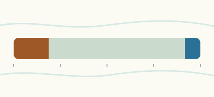 Country, Canada Are the rivers and lakes in Canada unusually low or high? Every river and lake we follow in Canada, against normal for the date.
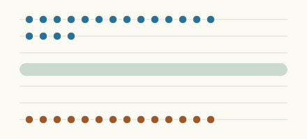 Today's list, Canada Which places in Canada are furthest from normal today? The places in Canada furthest below and above normal today.
 Lake gauge, Canada Is the Frood Lake unusually low at Whitefish Falls? Level now, history, the same date in past years and each year's range.
 Lake gauge, Canada Is the Dollars Lake unusually low at S Narrows (downstream)? Level now, history, the same date in past years and each year's range.
Sources
- Data Source: Environment and Climate Change Canada (Water Survey of Canada) (source). Licence: ECCC Data Services End-use Licence v2.1.1