Nunavut river levels today
Are the rivers and lakes in Nunavut unusually low or high?
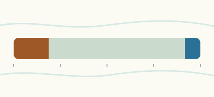
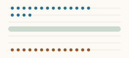
We follow 23 water level gauges in Nunavut. 1 gauge reads below its normal range for the date and 5 gauges above it.
How many gauges do we follow in Nunavut?
23 Water Survey of Canada level gauges of the 2,148 we follow in Canada, as of 26 October 2026.
How many waters in Nunavut have a level gauge?
20 waters with a level gauge, of the 1,635 waters we follow in Canada, as of 26 October 2026.
How many gauges read below normal for the date?
1 gauge below its normal range, of the 20 gauges with a current reading and a normal range for the date, as of 26 October 2026.
How many gauges read above normal for the date?
5 gauges above their normal range, of the 20 gauges with a current reading and a normal range for the date, as of 26 October 2026.
How the places stand today
1 place below normal and 5 places above
Which places are furthest below normal?
Which places are furthest above normal?
Which gauges do we follow in Nunavut?
| Place | Reading | Against normal for the date | Change in a day |
|---|---|---|---|
| Apex River | |||
| Apex | 7.877 m | higher than any day of these dates in 15 years | +0.151 m |
| Bridge to Nowhere (1 km upstream) | 6.491 m | +0.002 m | |
| Bridge to Nowhere (2 km upstream) | 9.348 m | +0.004 m | |
| Back River | |||
| Beechy Lake (downstream) | 1.69 m | within the normal range for the date | -0.012 m |
| Hermann River (upstream) | 2.635 m | within the normal range for the date | -0.024 m |
| Baillie River | |||
| Mouth | 4.365 m | within the normal range for the date | -0.085 m |
| Brown River | |||
| Outlet of Brown Lake | 5.976 m | within the normal range for the date | -0.018 m |
| Burnside River | |||
| Mouth | 4.318 m | within the normal range for the date | -0.068 m |
| Contwoyto Lake | |||
| Lupin Mine | 443.278 m | within the normal range for the date | +0.01 m |
| Coppermine River | |||
| Copper Creek (upstream) | 17.251 m | -0.007 m | |
| Dubawnt River | |||
| Outlet of Marjorie Lake | 14.464 m | in the highest 10 percent for the date | +0.041 m |
| Ennadai Lake | |||
| Ennadai | 312.659 m | in the highest 10 percent for the date | +0.052 m |
| Fairy Lake River | |||
| Outlet of Napaktulik Lake | 7.823 m | within the normal range for the date | +0.013 m |
| Freshwater Creek | |||
| Cambridge Bay | 2.951 m | in the lowest 10 percent for the date | 0 m |
| Inflow to Lake Geraldine | |||
| Iqaluit | 9.731 m | within the normal range for the date | 0 m |
| Kazan River | |||
| Kazan Falls (upstream) | 75.144 m | in the highest 10 percent for the date | +0.064 m |
| Kuunajuk River | |||
| Mouth | 3.57 m | within the normal range for the date | -0.035 m |
| Lake Geraldine | |||
| Iqaluit | 111.283 m | in the highest 10 percent for the date | -0.013 m |
| Meadowbank River | |||
| Nanau Lake (upstream) | 8.481 m | within the normal range for the date | +0.003 m |
| Sylvia Grinnell River | |||
| Iqaluit | 3.242 m | within the normal range for the date | -0.003 m |
| Thelon River | |||
| Outlet of Schultz Lake (downstream) | 25.256 m | within the normal range for the date | -0.002 m |
| Thlewiaza River | |||
| Outlet Sealhole Lake (upstream) | 25.93 m | within the normal range for the date | +0.005 m |
| Tree River | |||
| Mouth | 2.086 m | within the normal range for the date | -0.137 m |
Keep exploring
 Country, Canada Are the rivers and lakes in Canada unusually low or high? Every river and lake we follow in Canada, against normal for the date.
 Today's list, Canada Which places in Canada are furthest from normal today? The places in Canada furthest below and above normal today.
 River gauge, Canada Is the Freshwater Creek unusually low at Cambridge Bay? Level now, history, the same date in past years and each year's range.
 River gauge, Canada Is the Apex River unusually high at Apex? Level now, history, the same date in past years and each year's range.
Sources
- Data Source: Environment and Climate Change Canada (Water Survey of Canada) (source). Licence: ECCC Data Services End-use Licence v2.1.1