Nova Scotia river levels today
Are the rivers and lakes in Nova Scotia unusually low or high?
We follow 39 water level gauges in Nova Scotia. 4 gauges read below their normal range for the date and none above it.
How many gauges do we follow in Nova Scotia?
39 Water Survey of Canada level gauges of the 2,148 we follow in Canada, as of 26 October 2026.
How many waters in Nova Scotia have a level gauge?
36 waters with a level gauge, of the 1,635 waters we follow in Canada, as of 26 October 2026.
How many gauges read below normal for the date?
4 gauges below their normal range, of the 28 gauges with a current reading and a normal range for the date, as of 26 October 2026.
How many gauges read above normal for the date?
0 gauges above their normal range, of the 28 gauges with a current reading and a normal range for the date, as of 26 October 2026.
How the places stand today
4 places below normal and 0 places above
Which places are furthest below normal?
Which gauges do we follow in Nova Scotia?
| Place | Reading | Against normal for the date | Change in a day |
|---|---|---|---|
| Annapolis River | |||
| Lawrencetown | 0.797 m | lower than any day of these dates in 15 years | 0 m |
| Wilmot | 0.885 m | within the normal range for the date | -0.002 m |
| Beaverbank River | |||
| Kinsac | 0.523 m | within the normal range for the date | -0.029 m |
| Bennery Lake Outlet | |||
| Enfield | 98.351 m | -0.001 m | |
| Cheticamp River | |||
| Robert Brook (upstream) | 1.026 m | within the normal range for the date | -0.033 m |
| Cornwallis River | |||
| Cambridge Station | 0.721 m | lower than any day of these dates in 14 years | -0.001 m |
| Great Village River | |||
| Scrabble Hill | 1.181 m | within the normal range for the date | -0.007 m |
| Indian Brook | |||
| Indian Brook | 0.664 m | within the normal range for the date | -0.047 m |
| Ingram Brook | |||
| Rivulet | 96.255 m | -0.012 m | |
| Kelley River (Mill Creek) | |||
| Eight Mile Ford | 0.844 m | in the lowest 10 percent for the date | -0.002 m |
| Lahave River | |||
| West Northfield | 1.88 m | within the normal range for the date | -0.02 m |
| Little Sackville River | |||
| Middle Sackville | 1.548 m | within the normal range for the date | -0.012 m |
| Macaskills Brook | |||
| Birch Grove | 1.037 m | within the normal range for the date | -0.13 m |
| Macintosh Brook | |||
| Pleasant Bay | 97.971 m | -0.008 m | |
| McClures Brook | |||
| Cobequid Trail | 0.983 m | -0.011 m | |
| Mersey River | |||
| George Lake (downstream) | 1.182 m | within the normal range for the date | +0.001 m |
| Mill Falls (downstream) | 0.761 m | within the normal range for the date | -0.003 m |
| Middle River (Nova Scotia) | |||
| Maclennans Cross | 1.165 m | within the normal range for the date | -0.011 m |
| Middle River of Pictou | |||
| Rocklin | 0.581 m | within the normal range for the date | -0.036 m |
| Moose Pit Brook | |||
| Tupper Lake | 0.998 m | within the normal range for the date | -0.018 m |
| North Brook | |||
| Sheffield Mills | 0.443 m | in the lowest 5 percent for the date | 0 m |
| North River (Nova Scotia) | |||
| North River | 1.994 m | -0.021 m | |
| Northeast Margaree River | |||
| Margaree Valley | 0.386 m | within the normal range for the date | -0.029 m |
| River Denys | |||
| Big Marsh | 1.869 m | within the normal range for the date | -0.026 m |
| River Inhabitants | |||
| Glenora | 0.959 m | within the normal range for the date | -0.144 m |
| Roseway River | |||
| Lower Ohio | 1.943 m | within the normal range for the date | -0.014 m |
| Sackville River | |||
| Bedford | 0.853 m | within the normal range for the date | -0.02 m |
| Salmon River (Nova Scotia) | |||
| Murray | 1.144 m | -0.035 m | |
| Shelburne River | |||
| Pollard's Falls Bridge | 0.667 m | within the normal range for the date | -0.004 m |
| South River | |||
| St. Andrews | 1.333 m | within the normal range for the date | -0.061 m |
| Southwest Margaree River | |||
| Upper Margaree | 0.95 m | within the normal range for the date | +0.001 m |
| St Andrews River | |||
| Stewiacke | 1.565 m | within the normal range for the date | -0.034 m |
| St. Marys River (Nova Scotia) | |||
| Stillwater | 2.773 m | within the normal range for the date | -0.18 m |
| Tomahawk Lake | |||
| Hammonds Plains | 99.263 m | -0.01 m | |
| Tomahawk Lake Outlet | |||
| Hammonds Plains | 98.657 m | -0.006 m | |
| Tusket River | |||
| Wilson's Bridge | 0.845 m | within the normal range for the date | -0.017 m |
| Wallace River | |||
| Wentworth Centre | 93.19 m | -0.006 m | |
| West River Sheet Harbour | |||
| Beaver Dam Mines Road | 98.771 m | -0.018 m | |
| Marinette | 97.881 m | -0.058 m | |
Keep exploring
 Country, Canada Are the rivers and lakes in Canada unusually low or high? Every river and lake we follow in Canada, against normal for the date.
 Today's list, Canada Which places in Canada are furthest from normal today? The places in Canada furthest below and above normal today.
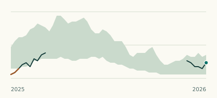 River gauge, Canada Is the Annapolis River unusually low at Lawrencetown? Level now, history, the same date in past years and each year's range.
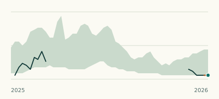 River gauge, Canada Is the Cornwallis River unusually low at Cambridge Station? Level now, history, the same date in past years and each year's range.
Sources
- Data Source: Environment and Climate Change Canada (Water Survey of Canada) (source). Licence: ECCC Data Services End-use Licence v2.1.1